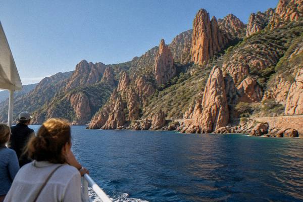
Are The Calanques De Piana Worth Visiting?
Whether the Calanques de Piana in Corsica are worth visiting, what the red granite cliffs are, how boat trips from Porto and Cargèse cover them, and what the UNESCO listing covers.
The Calanques de Piana are a run of red granite cliffs and coves on the west coast of Corsica, the French Mediterranean island, between the village of Piana and the Golfe de Porto. They form one of the three named parts of a UNESCO World Heritage property, and they are one of the few Corsican sights that can be read from a car window, from a walking path above the water, and from a small boat at cliff level. This page sets out what the listing actually covers, what a visit involves, and where the answer to the question in the title comes out.
What Are The Calanques De Piana In Corsica?
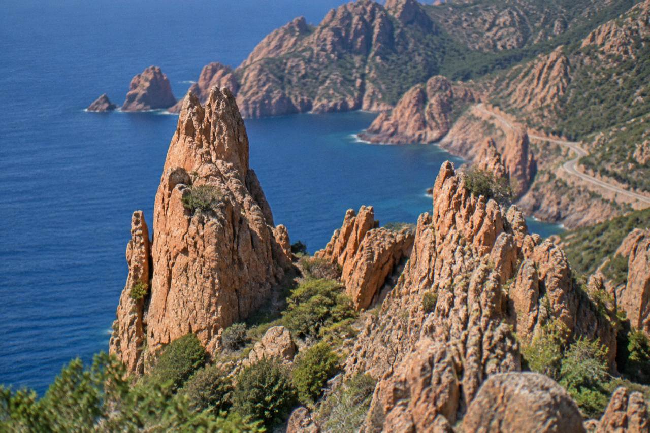
The Calanques de Piana are a stretch of red granite cliffs on Corsica's west coast, listed since 1983 as part of the UNESCO World Heritage property "Gulf of Porto: Calanche of Piana, Gulf of Girolata, Scandola Reserve", which covers 11,800 hectares in total. The granite formations rise straight out of the sea between the village of Piana and the Golfe de Porto, inside the Parc naturel régional de Corse.
That property, dossier 258 on the UNESCO list, was inscribed in 1983 on natural criteria (vii), (viii) and (x). It binds three neighbours into one protected stretch of coast: the Calanche of Piana itself, the Gulf of Girolata with its hamlet reachable mainly by sea and footpath, and the Scandola Reserve further north. The park that manages much of this coast, the Parc naturel régional de Corse, was created in 1972 and today covers 4,484 km2, including a western sea front that runs 80 km from Capu Rossu to Capu Cavallu.
Scandola deserves its own precision here, because the three names are often blurred together. Scandola is the first nature reserve created in Corsica, by ministerial order of 9 December 1975, with 1,000 ha of sea, 919 ha of land and a 70 ha integral reserve, in the commune of Osani. Its land area is closed to the public: visits are by boat only, with no landing in the integral reserve, and that rule is reported on the official reserve pages. The Calanques de Piana carry no such landing ban, which is part of why they work for walkers and drivers as well as boaters. The full detail sits on the Calanques de Piana attraction page.
Are The Calanques De Piana Worth Visiting?
Yes: the Calanques de Piana are worth visiting, because they combine a UNESCO-inscribed landscape with three genuinely different ways to see it, by road, on foot and by boat, all within a short drive of Porto and Piana. The cliffs are the southern third of a World Heritage property that also holds Girolata and Scandola, so a single day here can absorb one of the densest protected coastlines in the Mediterranean.
The case for the visit rests on facts, not adjectives. This is one of only a handful of natural World Heritage properties on a Mediterranean island, inscribed on three natural criteria at once. The coast it belongs to is part of an island with more than 1,000 km of shoreline, yet this specific 11,800 ha block is the part international protection landed on in 1983. The red granite itself is the signature: the Calanche of Piana is named for the rock, not for a beach or a town, and the formation runs down into the water in a way that a viewpoint above and a boat below read as two different landscapes.
What "worth it" means in practice depends on how you go. The road between Piana and Porto threads the upper edge of the calanques and costs nothing but the drive. The footpaths out of Piana drop toward the water and need only shoes and water. The boat trips out of Porto, Cargèse and Sagone put you at the foot of the cliffs and into the sea caves, and several of them continue north into Scandola, where the boat is the only legal way in. A traveller based anywhere from Ajaccio to Calvi can reach this coast on a day trip, and the Calanques de Piana day trip guide lays out the options.
The April 2026 road map matters to visitors even though it sounds administrative. Voluntary operator labelling and a QR-code trial for private boats are the current tools steering traffic around the osprey zones, and the quiet zones were renewed. Nothing in that package closes the calanques; it shapes how the marine traffic behaves, and it is the reason booking a labelled boat operator is the low-friction choice.
How Do You See The Calanques De Piana Without A Boat?
You can see the Calanques de Piana without a boat in two main ways: the D-road between Piana and Porto runs along the top of the formation with pull-in viewpoints, and marked paths out of Piana descend on foot toward the granite and the water. The village of Piana itself sits above the calanques and works as the walking base, with the whole section reachable by car from Porto in a short drive.
The land-based visit is the free and flexible half of the answer. Piana is the anchor village, and the road that drops from it toward the Golfe de Porto is the viewing corridor. Walkers get the closer read: paths out of the village reach the rock itself, and the terrain is the same red granite that the boats look up at. What land access cannot give you is the vertical face of the cliffs, the sea caves at water level, or any continuation into Scandola, whose land is closed to the public and whose marine part is the only part a boat may enter.
That split, free views above and paid access below, is why the boat question decides the shape of a day here. The published product set makes the division plain:
| Way in | What it gives you | What it cannot give you |
|---|---|---|
| Road between Piana and Porto | The upper panorama of the red granite, free, on your own schedule | The cliff face at water level and the caves |
| Footpaths from Piana | Close contact with the rock, no ticket | Scandola, which is boat-only, and the sea caves |
| Boat trip from Porto, Cargèse or Sagone | The cliffs from below, the caves, and on some trips Scandola and a Girolata stop | Time walking inside Piana village itself |
Which Boat Trip Covers The Calanques De Piana?
Boat trips out of the Golfe de Porto, out of Cargèse and out of Sagone all cover the Calanques de Piana, with Porto as the closest base and the shortest crossings, and several departures add Scandola or a stop at Girolata to the same sail. From Ajaccio, full-day departures run up to the same coast, and from Calvi a dedicated boat tour reaches Scandola in a longer day.
The closest departure points win on time in the rocks. Porto sits at the mouth of the gulf, minutes from the calanques by sea, and it hosts the densest mix of trips, from short calanques-and-caves runs to half-day cruises that take in Scandola as well. Cargèse and Sagone, south along the coast, offer their own departures, several of them small-group sails with a stop at Girolata, the hamlet inside the World Heritage property that is best known for its sea-and-footpath access.
It belongs to the shortest end of the local product range, which suits a day that pairs a morning on the water with an afternoon on the Piana paths.
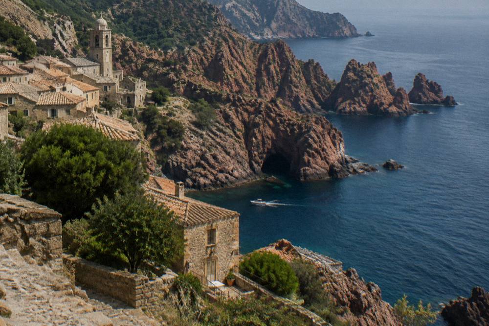
One practical note belongs here. From 15 June to 30 September it is forbidden to light a fire or smoke in forests, maquis and massifs across Corsica, and the daily fire-risk map is updated at 18:00 for the next day, with access to some massifs restricted from mid-June to mid-September. The calanques coast is sea-level terrain, but the walking paths above Piana sit in that regulated landscape, so the map is worth a look on any summer walking day.
What Is The Weather Like Around The Calanques De Piana?
The Calanques de Piana sit on Corsica's west coast, where the Météo-France 1991-2020 normals for Ajaccio show a hot, dry summer and a mild, wet winter: July averages 8.6 mm of rain and August a mean daily high of 29.2 °C, while October carries 85.7 mm and November 111.8 mm. Boat trips and cliff-path walking both track that pattern.
The nearest long-record station to this coast is Ajaccio, and its normals frame the year cleanly. Summer is the reliable window for calm water at the foot of the cliffs: June, July and August combine the lowest rain totals of the table, 25.9 mm, 8.6 mm and 15.8 mm respectively, with the highest sunshine figures, 11.1, 12.1 and 11.1 hours per day. The sea state matters as much as the rain for a boat day, and the operators hold the call on that, not the calendar.
Autumn changes the arithmetic. October still averages a mean daily high of 22.8 °C, but its 85.7 mm of rain and November's 111.8 mm are the numbers that decide whether a sailing runs or a path is pleasant. Winter is mild at sea level, 14.0 °C mean daily high in January, while the high mountains inland take the snow, and the boat calendar thins out. No single month is "the" month as a fact; the normals just say where the dry, bright weight of the year sits.
| Month | Mean daily high (°C) | Rain (mm) | Sunshine (h/day) |
|---|---|---|---|
| June | 25.9 | 25.9 | 11.1 |
| July | 28.6 | 8.6 | 12.1 |
| August | 29.2 | 15.8 | 11.1 |
| September | 26.1 | 57.8 | 8.7 |
| October | 22.8 | 85.7 | 6.7 |
| November | 18.3 | 111.8 | 4.7 |
The figures are Météo-France station data for Ajaccio, 1991-2020, and they describe the island's west coast climate generally rather than a single cove.
What Else Should You Pair With The Calanques De Piana?
The strongest pairings with the Calanques de Piana are the rest of the same World Heritage coast: the Golfe de Porto at the mouth of the gulf, the Scandola Reserve by boat to the north, and Girolata, the hamlet inside the property that several cruises stop at. Inland, the Gorges de Spelunca offer a walking contrast only a short drive from Porto, and Corte, the old capital, sits inland beyond them.
The geography does the planning for you. Everything in the UNESCO property lies along one stretch of coast, so a boat out of Porto can legally cover the Calanche of Piana, Girolata and the marine part of Scandola in one sail, while the road above ties Piana, Porto and the Spelunca valley into one driving loop. The full protected block, and how the pieces divide up, is set out below.
| Site | Source | How you see it |
|---|---|---|
| Calanche of Piana | Part of UNESCO property 258 (1983) | Road, footpaths from Piana, and boat |
| Gulf of Girolata | Part of UNESCO property 258 (1983) | Boat, with stops on several departures, or footpath |
| Scandola Reserve | Nature reserve since 1975, part of property 258 | Boat only, land closed to the public |
| Gorges de Spelunca | Inland gorge near Porto | On foot, from the Porto side |
For a wider frame, the Corsica Travel Guide covers the whole island, and the Gorges de Spelunca guide handles the inland half of the Porto day.
Common Questions About The Calanques De Piana
Are The Calanques De Piana Worth Visiting?
Yes. They are one of three named parts of the UNESCO World Heritage property "Gulf of Porto: Calanche of Piana, Gulf of Girolata, Scandola Reserve", inscribed in 1983, and they can be seen by road, on foot from Piana and by boat from Porto, Cargèse or Sagone.
Can You Visit The Calanques De Piana Without A Boat?
Yes. The road between Piana and Porto runs along the top of the formation, and marked paths from Piana reach the granite on foot. Only Scandola, the northern part of the UNESCO property, is strictly boat-only, because its land area is closed to the public.
Where Do Boat Trips To The Calanques De Piana Leave From?
From Porto at the mouth of the gulf, the closest base, and also from Cargèse and Sagone along the same coast, plus full-day departures from Ajaccio and Calvi. Several trips add Scandola and a stop at Girolata to the same sail.
Is The Calanques De Piana The Same Thing As Scandola?
No. Both sit inside the same UNESCO property, but the Calanche of Piana is the red granite stretch by the village of Piana, while Scandola is a separate nature reserve created in 1975, further north, whose land is closed to the public and whose marine part can only be visited by boat.
When Is The Sea Calmest Around The Calanques De Piana?
The Météo-France 1991-2020 normals for Ajaccio show the lowest rain in July, 8.6 mm, with June and August also dry, and the highest sunshine from June to August. Operators make the final call on sea state for any departure.
The short version: the listing, the rock and the three ways in make the question answer itself, and the boat out of Porto is the one upgrade that changes what you see.