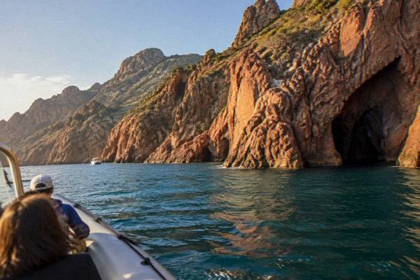
Golfe De Porto, Corsica: The Complete Guide To The UNESCO Gulf
The Golfe de Porto holds the only natural UNESCO World Heritage property on the French Mediterranean coast: the Calanche of Piana, the Gulf of Girolata and the Scandola Reserve, inscribed in 1983.
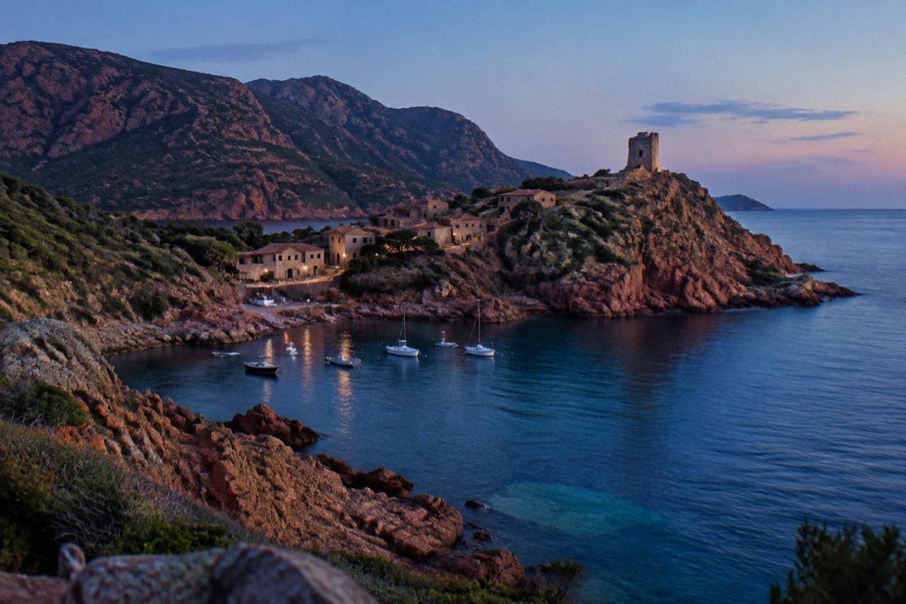
The Golfe de Porto is a stretch of the west coast of Corsica between Cargèse and the Calanques de Piana. Its core, the UNESCO property 'Gulf of Porto: Calanche of Piana, Gulf of Girolata, Scandola Reserve', inscribed in 1983, is visited by boat, since the Scandola land area is closed to the public.
The Golfe de Porto is the stretch of Corsica's west coast where red granite cliffs, a protected marine reserve and a UNESCO World Heritage property meet the sea between Cargèse and the Calanques de Piana. The property, listed by UNESCO as "Gulf of Porto: Calanche of Piana, Gulf of Girolata, Scandola Reserve", was inscribed in 1983 on natural criteria (vii), (viii) and (x), and covers 11,800 hectares. It sits inside the Parc naturel régional de Corse, the regional park created in 1972, whose western sea front runs 80 km from Capu Rossu to Capu Cavallu.
What Is The Golfe De Porto In Corsica?
The Golfe de Porto is a coastal area on the west coast of Corsica, the French Mediterranean island, centred on the small port of Porto and covering the Calanques de Piana to the south, the village of Girolata and the Scandola Nature Reserve to the north. UNESCO inscribed the whole ensemble in 1983 as property 258, "Gulf of Porto: Calanche of Piana, Gulf of Girolata, Scandola Reserve", on natural criteria (vii), (viii) and (x), over 11,800 hectares.
The gulf's three components are distinct. The Calanche of Piana is the belt of red granite rock above the village of Piana, described in full on the Calanques de Piana attraction page. Girolata is a hamlet reachable on foot or by sea, with no road in, detailed on the Girolata guide. Scandola is a nature reserve created by ministerial order on 9 December 1975, the first nature reserve in Corsica, managed by the PNRC. The reserve covers 919 hectares of land, 1,000 hectares of sea and a 70-hectare integral reserve, in the commune of Osani, running from 100 m depth to 540 m altitude.
Scandola's conservation record is part of why UNESCO listed the property. The OEC fact sheet records that the reserve was key to saving the osprey in Corsica. In April 2026 the State and the OEC confirmed a common road map for the property: a management agreement renewed on 27 February 2026, voluntary labelling of boat operators, a QR-code tracking trial for pleasure boats, more controls at sea and renewed quiet zones for the osprey. Boat quotas and licences are to be consolidated in a regulatory framework that is being finalised.
| Element | Figure |
|---|---|
| UNESCO property | 258, inscribed 1983 |
| Property area | 11,800 ha |
| Scandola land area | 919 ha |
| Scandola marine area | 1,000 ha |
| Scandola integral reserve | 70 ha |
| Scandola altitude range | 100 m depth to 540 m altitude |
The regional park frame matters for planning. The PNRC, created in 1972, today covers 4,484 km2 and includes the Castagniccia and the big valleys running down to the sea, so the rules that apply on the coast, on fire and on bivouacs, are park-wide rules rather than local quirks.
How Do You See The Scandola Reserve From The Golfe De Porto?
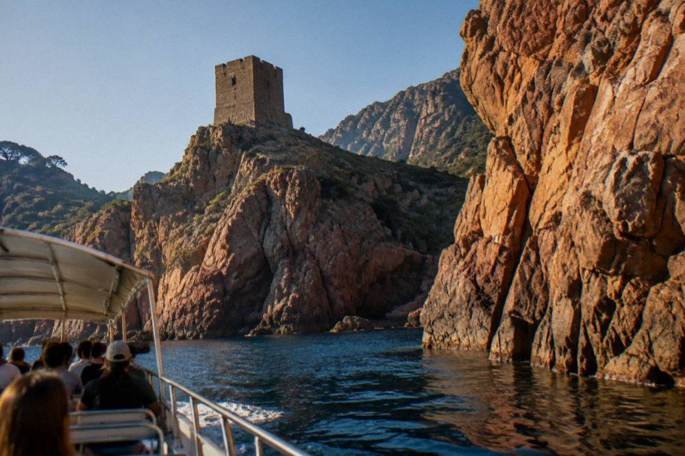
Scandola is visited by boat only: the land area of the reserve is closed to the public, and, as the reserve's rules state, there is no landing in the integral reserve, with daytime anchoring allowed outside the integral reserve and the Gargalu channel and anchors lifted at sunset.
Daytime anchoring is permitted, spearfishing and recreational line fishing are not, and posidonia seagrass beds are to be avoided. These rules shape what a boat trip can do: cruises pass below the cliffs, pause in coves for swimming where it is allowed, and stop at Girolata, which sits just outside the reserve boundary but inside the UNESCO property's gulf.
The departure point changes the shape of the day. From Porto and Ota the crossing to the reserve is short and the trip is a half-day loop. From Sagone and Cargèse operators run longer circuits that combine Scandola, Girolata and the Calanques de Piana in one passage, and from Ajaccio the product is a full-day excursion along the coast. The site's Scandola boat tour guide compares the options in detail, and the Scandola Nature Reserve page covers the reserve's rules.
| Departure point | Product type | What the trip covers |
|---|---|---|
| Porto | Half-day cruise | Scandola reserve cliffs and the Calanche of Piana |
| Ota | Eco-friendly boat tour | Scandola reserve, small-vessel format |
| Sagone and Cargèse | Day cruise with stops | Piana, Scandola, Girolata stop |
| Ajaccio and Porticcio | Full-day excursion | Coastal run north to Scandola |
| Calvi | Half-day cruise | Coastal run south to Scandola |
Can You Swim And Anchor Inside The Golfe De Porto?
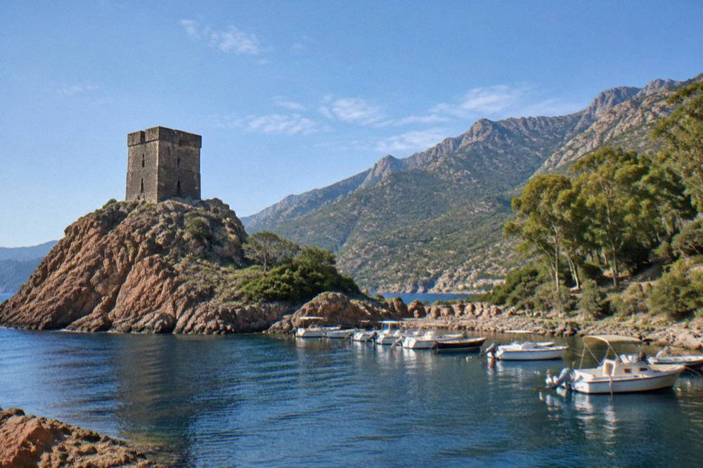
Swimming is part of the offer on several cruises, since some trips include a swimming stop in the coves outside the integral reserve, but anchoring is authorised only in daytime, outside the integral reserve and the Goulet de Gargalu, and anchors must be lifted at sunset. No landing is permitted on the shores of the integral reserve, and recreational spearfishing and line fishing are not allowed in the reserve.
Private boaters should read the rules with care before setting out. Apnea diving is allowed but regulated, and commercial apnea is prohibited. Speed limits apply in the reserve's waters, and the QR-code tracking trial introduced for pleasure boats in 2026 means controls at sea are being stepped up. The osprey quiet zones are part of the same framework and can affect where vessels may linger.
For visitors without a boat, the swimming stops on organised trips are the practical route into the water here. The gulf's water is not lifeguarded in the way the town beaches of Ajaccio are, where the municipality ran seven lifeguard posts from 1 July to the end of August 2026, so swim from a supervised trip or an established beach rather than an improvised anchorage.
Where Is Girolata And How Do You Reach It?
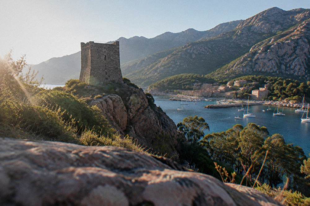
Girolata is a small coastal hamlet inside the Gulf of Girolata, part of the UNESCO property, with no road access: it is reached on foot by trail, about an hour from the Col de la Croix side of the coastal mountains, or by boat, and nearly every Scandola cruise from Porto, Sagone or Cargèse includes a Girolata stop. The hamlet sits on the south edge of the Scandola Reserve in the commune of Osani.
The walk in is one of the classic short hikes of the west coast, and it connects to a wider trail network described in the site's hiking in Corsica guide. Boats moor in the little bay while passengers go ashore for lunch or a swim. Landing rules inside Scandola itself do not apply here, because Girolata is outside the reserve boundary, but the hamlet sits inside the UNESCO gulf and the same fire and access rules cover the surrounding maquis in summer.
What Are The Walking Routes Around The Golfe De Porto?
The long-distance trails that touch the gulf region are the Mare e Monti Sud at 66 km over 5 days ending in Propriano, the Mare a Mare Sud at 73 km over 5 days ending in Propriano, and the Mare e Monti Nord at 121 km over 10 days to Cargèse, all figures from the PNRC's own trail brochure. Around Porto itself the classic day walk is the Gorges de Spelunca between Porto and Évisa, and wild camping is banned across Corsica.
The PNRC brochure gives the detail, and the table below restates it. Bivouac is tolerated only in the marked areas at refuges, and on the GR20 refuge nights must be booked online in advance, at EUR 20 for a bunk, EUR 12 for a bivouac pitch, EUR 27 for a rented tent for one and EUR 39 for two, per person. Those rates apply to the GR20's own refuges rather than to the gulf's day walks, but they frame how the park manages overnight stays everywhere. The rest of the planning pages sit on Corsica Travel Guide.
| Trail | Length | Days | Total climb |
|---|---|---|---|
| Mare e Monti Sud | 66 km | 5 | 2,700 m |
| Mare a Mare Sud | 73 km | 5 | 3,200 m |
| Mare e Monti Nord | 121 km | 10 | 6,100 m |
| Mare a Mare Centre | 84 km | 6 to 7 | 3,900 m |
Closer to the water, the Gorges de Spelunca page covers the valley walk behind Porto, and the Aiguilles de Bavella page covers the massif at the other end of the island's southern ridge. Fire rules apply on all of them: from 15 June to 30 September it is forbidden to light a fire or smoke in forests, maquis and massifs, and the prefecture's daily colour map, updated at 18:00 for the next day, can close some massifs entirely on red days between mid-June and mid-September.
What Is There To Do In Porto Village And Ota?
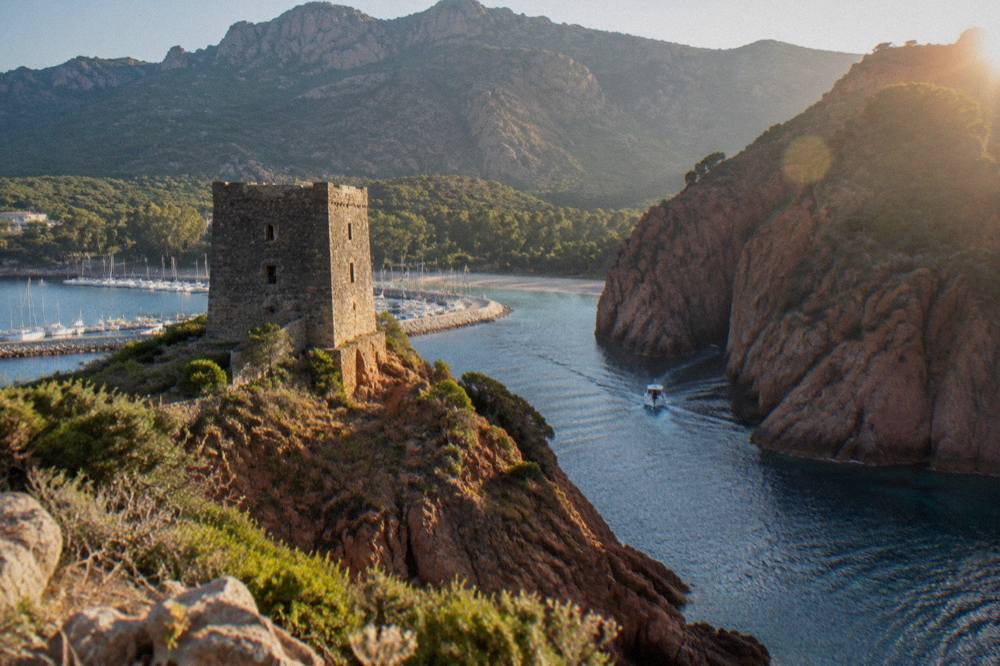
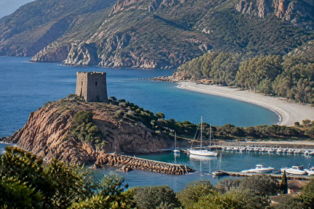
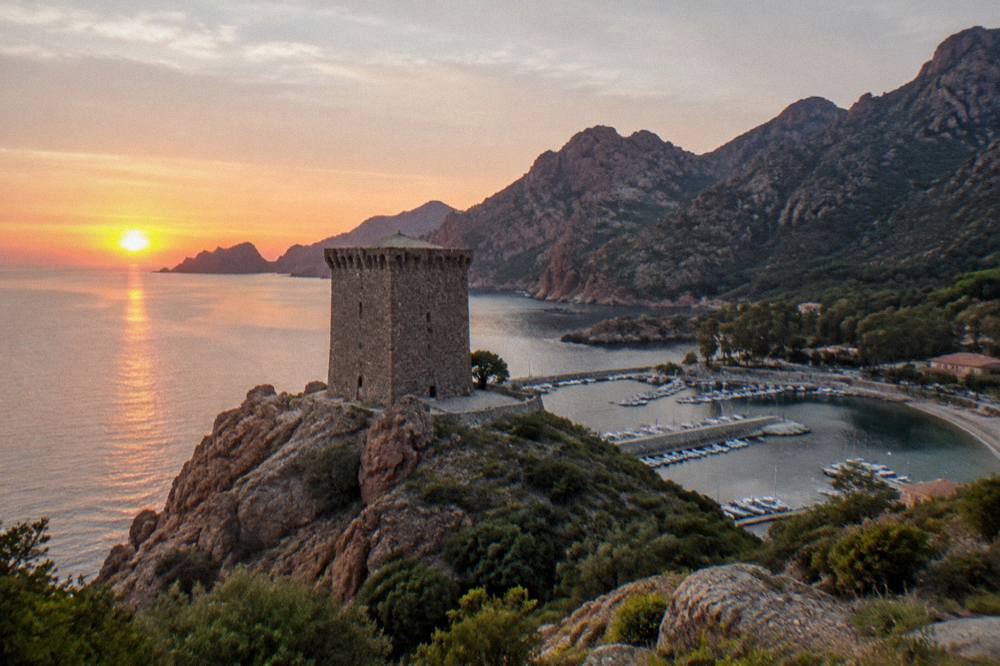
Porto is a small seaside settlement at the mouth of the river of the same name, with a Genoese tower above the beach, a marina from which the Scandola cruises leave, and direct access to the Gorges de Spelunca road up to Évisa; Ota is the village above it on that road. The two form the practical base for the gulf, and the wider coast is covered on this site's area page for the Golfe de Porto and Piana.
The tower is one of a chain of coastal watchtowers, and the beach below it faces south across the gulf toward the Calanques de Piana. Everything in Porto is geared to the sea trips, the beach and the walks: there is no separate museum or monument circuit in the village itself. Visitors who want a town day trip can reach Porto-Vecchio's old streets from the far side of the island, covered on the Porto-Vecchio old town page, but the gulf's own attractions are all natural.
The area context sits on the Golfe de Porto and Piana area page, and the site's overview of the whole island, things to do in Corsica, places the gulf against the beaches of Palombaggia and Saleccia and the citadels of Calvi and Corte, useful when a Corsica itinerary has to balance the west coast against the rest.
When Is The Best Time To Visit The Golfe De Porto?
The Météo-France climate normals for Ajaccio, the nearest long-record station, show July averaging 8.6 mm of rain and August a mean daily high of 29.2 °C, while November carries 111.8 mm of rain and the July figure is the lowest monthly rainfall on the Ajaccio table. Boat trips run through the warmer half of the year, and the PNRC guards its GR20 refuges from 16 May to 4 October, a window that matches the walking season in the hills behind the gulf.
No month is named here as the one to choose, because that is a judgement the figures do not make on their own. What the station data does say is that the summer is hot and dry, the winter mild and wet, and that snow falls only on the high mountains, not on the coast. Summer brings the fire-risk framework with it, and October and November carry the most rain of the year at both Ajaccio and Bastia.
| Month | Ajaccio high °C | Ajaccio rain mm | Bastia high °C | Bastia rain mm |
|---|---|---|---|---|
| May | 22.1 | 49.8 | 22.4 | 53.7 |
| June | 25.9 | 25.9 | 26.4 | 38.8 |
| July | 28.6 | 8.6 | 29.4 | 13.8 |
| August | 29.2 | 15.8 | 29.8 | 21.1 |
| September | 26.1 | 57.8 | 26.0 | 74.5 |
| October | 22.8 | 85.7 | 22.0 | 126.5 |
The Météo-France station normals, 1991-2020, are averages, not forecasts, and mountain weather behind the gulf runs cooler and rougher than the coast. Météo-France publishes mountain forecasts for Corsica, and the GR20 rule that forbids departures from Calenzana after 11:00 exists precisely because afternoon storms in the high country are a standing pattern, not an exception.
How Do You Get To The Golfe De Porto?
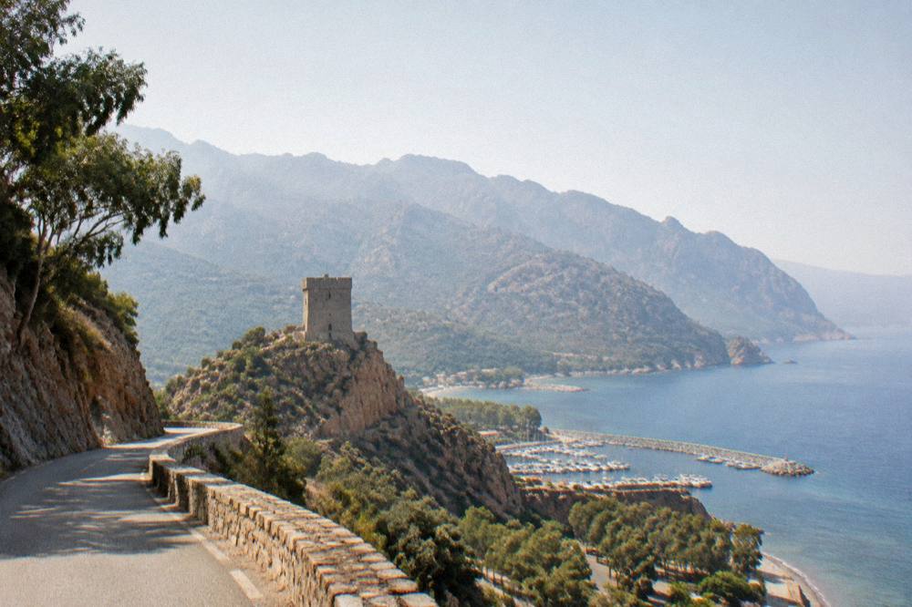
The gulf is reached by road along the D81 coastal road, with Ajaccio the nearest of Corsica's four airports, Ajaccio Napoléon Bonaparte, and Bastia, Figari Sud Corse and Calvi Sainte-Catherine the others; ferry ports serving the island are Ajaccio, Bastia, Bonifacio, L'Île-Rousse, Propriano and Porto-Vecchio, with operators including Corsica Linea and La Méridionale from Marseille, and Corsica Ferries, Moby, Savona and Livorno services into Bastia.
The road itself is narrow and mountainous, and Inforoutes Corse publishes live road conditions and accessibility levels for the main mountain passes, the reference to check before driving the coast in bad weather.
Rail is not an option for the gulf: the Chemins de fer de la Corse run the Ajaccio to Bastia line via Corte, the Ponte-Leccia to Calvi branch and the Balagne coastal line between Calvi and L'Île-Rousse, none of which reach the west coast between Cargèse and Piana. The site's tour of the Corsican train guide covers what the railway does serve.
What Does A Day At The Golfe De Porto Cost?
Local costs around the gulf are in euros, with sight entries elsewhere on the island for comparison at EUR 10 for Maison Bonaparte in Ajaccio, EUR 10 full price at the Palais Fesch and EUR 9 for adults at Filitosa, while boat trip prices on this page render only from live product data and are never quoted in prose. Emergency numbers are 112, 15, 17 and 18, with 196 for sea rescue and PGHM mountain rescue at Ajaccio on 04 95 24 24 00.
The practical spend splits three ways: the boat trip, the accommodation and the road. Tipping follows French law: menus must state "prix service compris" with the service percentage included, and anything extra is optional, per the DGCCRF. For safety, the UK FCDO notes a high wildfire risk in France from April to October, and the US State Department lists France at Level 2, Exercise Increased Caution both of which bear on summer walking in the maquis around the gulf.
Is The Golfe De Porto Worth The Detour On A Corsica Trip?
The gulf holds the only natural UNESCO World Heritage property on this part of the Mediterranean coast, a first-created Corsican nature reserve in Scandola, a road-free hamlet at Girolata and the red granite of the Calanques de Piana, all inside one day's drive, and more than 8.5 million passengers passed through Corsica's ports and airports in 2025, a scale of arrival that makes pre-booked boats and early starts the sensible pattern here as everywhere on the island in summer.
The site's own answer pages weigh the components separately: are the Calanques de Piana worth visiting and is Scandola worth it both take the question directly. For itinerary planning, the Corsica in 5 days and Corsica road trip guides slot the gulf into a west-coast arc with Cargèse, Calvi and the Balagne, and the Calanques de Piana day trip page handles the southern half of the property on a tight schedule.
Common Questions About The Golfe De Porto
Can You Land On The Scandola Reserve?
No. The land area of the Scandola reserve is closed to the public, and no landing is permitted in the integral reserve. Visits are by boat only, as the reserve's rules state.
Where Do Golfe De Porto Boat Trips Leave From?
From Porto and Ota for short loops, from Sagone and Cargèse for longer circuits with a Girolata stop, and from Ajaccio and Calvi for full-day coastal excursions.
How Long Is The Walk To Girolata?
Girolata has no road access and is reached on foot by trail from the Col de la Croix side or by boat. Most Scandola cruises include a Girolata stop, so many visitors arrive by sea.
Can You Wild Camp Around The Golfe De Porto?
Wild camping is banned across Corsica, including inside the regional park. Bivouac is tolerated only in the marked areas at refuges, with online booking on the GR20.
What Is The Emergency Number At The Golfe De Porto?
Call 112 for any emergency, 15 for medical, 17 for police and 18 for fire; 196 is the sea rescue number, and the PGHM mountain rescue base at Ajaccio is on 04 95 24 24 00.
Is There A Train To The Golfe De Porto?
No. The Chemins de fer de la Corse serve Ajaccio to Bastia via Corte, Ponte-Leccia to Calvi and the Balagne coastal line, none of which reach the gulf, so access is by road or by boat.