Can You Drink The Tap Water In Corsica?
How tap water works in Corsica, what French rules cover the island's 360 communal networks, and how to stay hydrated from Ajaccio to the GR20 refuges.
Corsica is a sea-surrounded French island of 8,722 km2 with more than 1,000 km of coastline and a mountainous interior that rises to Monte Cinto at 2,706 m, and like the rest of France it runs its drinking water through public networks governed by national law. The short answer to the tap-water question is below, followed by what the island's own published facts say about where its water sits, how the mountain part of the island changes the picture, and what to drink beside it, from brocciu-making country to the bars of Ajaccio.
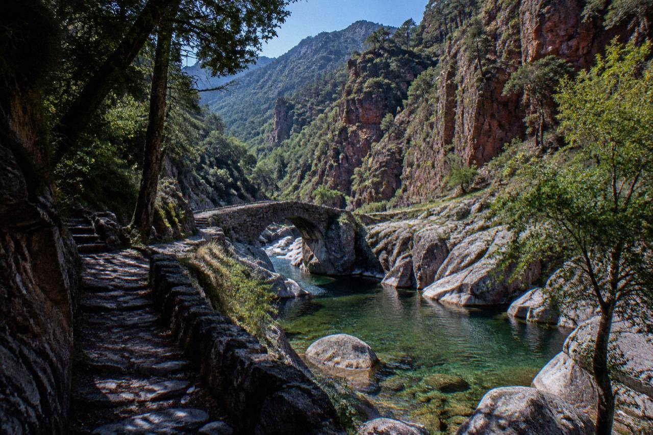
Corsica's tap water is part of the French public water system, the same national framework that governs mainland France, and each of the island's 360 communes operates its own network within it. The Collectivité de Corse, which replaced the former territorial structure on 1 January 2018, oversees the island's two departments, Corse-du-Sud and Haute-Corse. Water quality results are published by the communes under French rules, so the tap in Ajaccio, Bastia and the villages all sits inside one regulated system.
That is the structural answer, and it is the honest one: there is no single island-wide water company and no single island-wide answer card. France requires public water suppliers to monitor and report quality, and Corsica, as part of France, sits inside that requirement. The euro is the currency, the timezone is Europe/Paris, and the tap water follows French public-health law rather than any separate island regime.
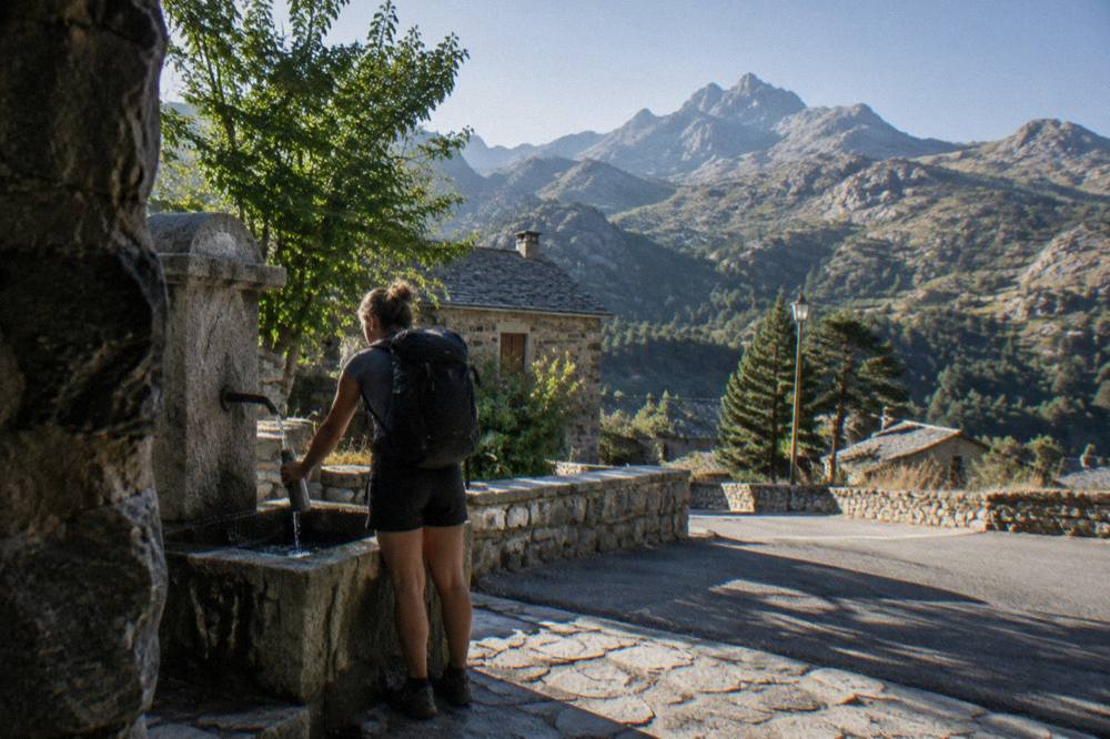
For visitors, the practical reading is simple. In the towns and villages, taps are public supply taps under French regulation. In remote parts of the interior, in refuges and at mountain fountains, the situation depends on the specific source, and the standing advice for any hiker anywhere applies: carry what you need and treat water you cannot verify. The rest of this page sets out what is published about the island's water context, its mountains, its summer climate figures and its emergency framework, so you can plan with facts rather than forum threads.
Where Does Corsica's Water Come From?
Corsica's water comes from its mountains: the island is 8,722 km2 with an interior topped by Monte Cinto at 2,706 m, and the Parc naturel régional de Corse, created in 1972, now covers 4,484 km2 including the big valleys that run down to the sea. The same relief that makes the GR20 famous shapes where water collects and where it is piped from. Rainfall concentrates in October and November, when Ajaccio averages 85.7 mm and 111.8 mm respectively.
The Météo-France station normals for 1991-2020 show the pattern clearly. July at Ajaccio averages just 8.6 mm of rain, the lowest monthly figure on the table, while November carries 111.8 mm. Bastia's station shows the same shape: 13.8 mm in July against 134.3 mm in November. Summer is hot and dry, winter is mild and wet, and snow sits only on the high mountains. That means the island's reservoirs and rivers refill in the cold months and draw down through a long, dry summer exactly when visitor numbers peak.
| Month | Ajaccio Rain (mm) | Bastia Rain (mm) | Ajaccio High (°C) | Bastia High (°C) |
|---|---|---|---|---|
| January | 54.1 | 67.3 | 14.0 | 13.8 |
| April | 53.1 | 71.6 | 18.5 | 18.3 |
| July | 8.6 | 13.8 | 28.6 | 29.4 |
| October | 85.7 | 126.5 | 22.8 | 22.0 |
| November | 111.8 | 134.3 | 18.3 | 17.7 |
Météo-France station data, 1991-2020, for Ajaccio (Campo dell'Oro) and Bastia. The table matters for hydration planning more than it first appears: a July day on the coast with a 28.6 °C average high, in the month with the year's lowest rainfall, is a day when the water bottle does more work than the rain jacket. Hikers moving up into the interior trade coastal heat for altitude, and the distances between reliable water points stretch accordingly.
If a summer downpour or a rainy November week changes your plans entirely, the island has plenty of indoor answers, and the famous drink of Corsica has its own page, as does the wider guide to Corsican drinks, Cap Corse and Pietra. Between them they cover what is poured in the island's bars when the weather sends you indoors.
What About Water On The GR20 And In The Mountains?
On the GR20, water planning is a refuge question: the PNRC refuges are guarded from 16 May to 4 October inclusive, nights must be booked online in advance, and a bunk costs EUR 20 per person with a bivouac pitch at EUR 12, per the PNRC's own 2026 tariffs. The trail runs 180 km north to south in about fifteen stages of 4 to 8.5 hours.
Dogs are not allowed in refuges or rented tents, and no departures from Calenzana are allowed after 11:00 under a municipal fire-risk order.
Meals at the refuges are paid in cash or by cheque to the guardian on site, per the PNRC page, which is worth knowing for anyone planning to buy drinks or supplies along the route. All PNRC rental tents sleep two and come with a 3 cm mat per person; you bring your own sleeping bag. Wild camping is banned across Corsica including the GR20, with bivouac allowed only in the marked areas at the refuges.
Fire rules shape the mountains more than any other single constraint in summer. From 15 June to 30 September it is forbidden to light a fire or smoke in forests, maquis and massifs, and the fire-risk map is updated at 18:00 each day for the next day. From mid-June to mid-September, access to some massifs can be restricted outright. The UK FCDO notes a high wildfire risk in France from April to October, and the US State Department lists France at Level 2, Exercise Increased Caution. None of this is about drinking water, but it is about why the mountains are managed the way they are, and why a hiker's water and behaviour on the trail are treated as safety matters.
| PNRC 2026 refuge item | Price per person |
|---|---|
| Bunk in refuge (bat-flanc) | EUR 20 |
| Bivouac pitch, own tent | EUR 12 |
| Rented tent for 1 (pitch + tent) | EUR 27 |
| Rented tent for 2 (2 pitches + tent) | EUR 39 |
The long-distance alternatives carry the same logic at lower altitude. Mare a Mare Centre runs 84 km from Ghisonaccia to Porticcio, Mare a Mare Sud covers 73 km over five days ending in Propriano, and Mare e Monti Nord stretches 121 km over ten days toward Cargèse. Each crosses village networks where public taps sit under the same French system as the towns.
What Should You Know About Water Safety And Emergencies In Corsica?
Emergency numbers in Corsica are the standard French set: 112 for the EU-wide emergency line, 15 for SAMU medical, 17 for police, 18 for fire, 114 by SMS or app for deaf or speech-impaired callers, and 196 for sea rescue on VHF channel 16. Mountain rescue is the PGHM in Ajaccio on 04 95 24 24 00, with 17 or 112 in an emergency. Ajaccio staffs 7 lifeguard posts on its main beaches from 1 July to the end of August.
The sea is the other water on this island, and it is never far away. Corsica counts more than 1,000 km of coastline, and the beaches, coves and boat trips that come with it are the reason many visitors come at all. Supervised swimming in Haute-Corse is staffed by volunteer firefighters roughly from 1 July to 31 August, reported by local outlets. Whether the water is safe to swim in is a matter for flags and lifeguards, and the question of whether you can swim in Corsica in October has its own answer page.
For food and drink alongside the water question, Corsica's protected produce is documented in official sources. Brocciu obtained its appellation d'origine in 1983 and its AOC in 1998. Prisuttu, lonzu and coppa received AOC status in 2012 and AOP in 2014, with the Nustrale pig breed recognised in 2006. Corsican honey, olive oil, chestnut flour and clémentine de Corse all carry national or European protection, and the vineyards work with Nielluccio and Sciaccarellu for reds and Vermentinu for whites. A drink ordered in a restaurant arrives with the menu's "prix service compris" noted by law, with any extra tip optional.
It sits well on a rest day between mountain stages or on an afternoon when the beach is too hot. Check availability alongside the internal page for the Ajaccio food tour.
How Does Corsica's French Framework Affect Everyday Travel?
Corsica is part of France, so the everyday framework a visitor meets is French: the euro as currency, Europe/Paris as the timezone, French emergency numbers, and French consumer law on restaurant menus. The Collectivité de Corse has been the island's single territorial authority with special status since 1 January 2018, covering Corse-du-Sud and Haute-Corse, with Ajaccio as the capital and Bastia as the second town. Ajaccio counts 76,320 residents and Bastia 46,867.
Getting around follows the same pattern. More than 8.5 million passengers, excluding cruise passengers, passed through Corsica's ports and airports in 2025 according to the ORTC and DREAL annual report published 30 May 2026. Four airports serve the island: Ajaccio Napoléon Bonaparte, Bastia Poretta, Figari Sud Corse and Calvi Sainte-Catherine. Corsica Linea, La Méridionale, Moby and Corsica Ferries run the ferry links from Marseille, Toulon, Nice, Livorno, Savona and Genoa, and Moby with Ichnusa Lines keeps the short Santa Teresa Gallura to Bonifacio crossing, reported at about 50 to 60 minutes.
None of that changes what comes out of the tap, but it explains why the answer to the water question is a French answer. The same national system that puts service compris on the menu, sets the emergency numbers and runs the euro also governs the public water networks of the island's 360 communes. For broader trip questions, the pages on whether Corsica is safe for tourists and how to get to Corsica carry the detail. More on the island as a whole sits across Corsica Travel Guide.
| Everyday framework in Corsica | What applies |
|---|---|
| Currency | Euro |
| Timezone | Europe/Paris (UTC+1, UTC+2 in summer) |
| Emergency numbers | 112, 15, 17, 18, 114, 196 sea rescue |
| Mountain rescue | PGHM Ajaccio 04 95 24 24 00 |
| Authority | Collectivité de Corse since 1 January 2018 |
| Departments | Corse-du-Sud and Haute-Corse |
Common Questions About Tap Water In Corsica
Can You Drink The Tap Water In Corsica?
Corsica's tap water is supplied through public networks run by each of the island's 360 communes under the same French national framework as mainland France, with water quality monitored and reported under French public-health rules. As anywhere in France, results are published locally, and any household or accommodation with a private source follows separate rules.
Is Corsica's Tap Water The Same As Mainland France's?
Yes in framework and no in geography. The regulation is French, since Corsica is part of France and has been served by the Collectivité de Corse since 1 January 2018, but the sources are the island's own mountains, rivers and reservoirs feeding networks that vary commune by commune.
What About Water When Hiking In Corsica?
On the GR20, plan around the PNRC refuges, guarded from 16 May to 4 October, with a bunk at EUR 20 and a bivouac pitch at EUR 12 per person for 2026. Meals and drinks at refuges are paid in cash or cheque to the guardian. Wild camping is banned, and no departures from Calenzana are allowed after 11:00.
Does It Rain A Lot In Corsica?
It depends sharply on the month. Météo-France 1991-2020 normals show Ajaccio averaging 8.6 mm of rain in July and 111.8 mm in November; Bastia averages 13.8 mm in July and 134.3 mm in November. Summer is hot and dry, winter mild and wet, with snow only on the high mountains.
What Emergency Numbers Apply To Water And Beach Safety?
Call 112 as the EU emergency line, 15 for medical, 17 for police, 18 for fire, 114 by SMS, and 196 for sea rescue on VHF channel 16. Mountain rescue is the PGHM Ajaccio on 04 95 24 24 00. Ajaccio staffs 7 lifeguard posts on its main beaches from 1 July to the end of August.
The short version: the tap in Corsica is a French tap, the mountain streams are a planning question with refuge tariffs attached, and the sea around 1,000 km of coastline is watched by lifeguards in summer. Fill the bottle, read the month's rain figure, and pack for the season the island actually has.