Is Corsica Better Than The French Riviera?
A factual comparison of Corsica and the French Riviera: coastline, mountains, hiking trails, ferries, climate data and sight prices, so you can decide which suits your trip.
Corsica and the French Riviera sit on the same sea, but they are different kinds of destination, and the honest answer to which is better depends entirely on what the trip is for. Corsica is an island, the fourth-largest in the Mediterranean, covering 8,722 km2 with a mountainous interior that peaks at Monte Cinto, 2,706 m. The Riviera is a mainland strip. That single structural difference drives almost everything else: how you arrive, what you do when you get there, and how much of your day is spent on a boat or a trail rather than on a promenade.
This page compares the two on figures alone: coastline, relief, trails, crossings, climate station data and published sight prices for Corsica. It does not rank beauty, and it does not quote a price the sources do not carry. For a wider view of the island, the Corsica Travel Guide homepage gathers the main regions and tour pages, and the question of where Corsica is located is covered separately.
Corsica is better than the French Riviera if the trip is built around mountains, long-distance hiking and boat-only coastline, because the island combines more than 1,000 km of shore with an interior rising to Monte Cinto at 2,706 m, something no mainland coast offers. The Riviera is the stronger choice for a trip centred on cities, trains and short hops along one shore. Neither is a better version of the other; they are different products.
The comparison is not really between two rival beaches. Corsica is 8,722 km2 of island, 360 communes, and a population of 365,636 as of 1 January 2026 per the provisional INSEE estimate, with Ajaccio at 76,320 and Bastia at 46,867 residents. It is a big, half-empty mountain block surrounded by sea. The Riviera is a continuous urbanised coastline. If your image is a GR20 stage of 4 to 8.5 hours between refuges, only one of the two has it.
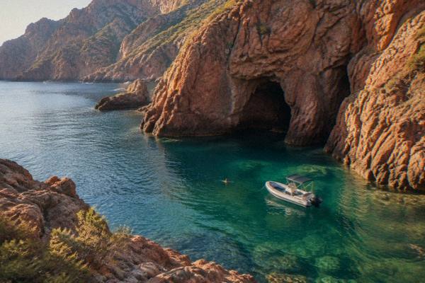
There is also the water-access question. Parts of Corsica's most famous coast, the Scandola reserve, can only be visited by boat, and the terrestrial area is closed to the public. That is a hard geographic fact, not a marketing line, and it shapes every day you spend in the Golfe de Porto area. The trade-off is a coastline that cannot be driven or walked end to end.
How Do The Landscapes Of Corsica And The Riviera Differ?
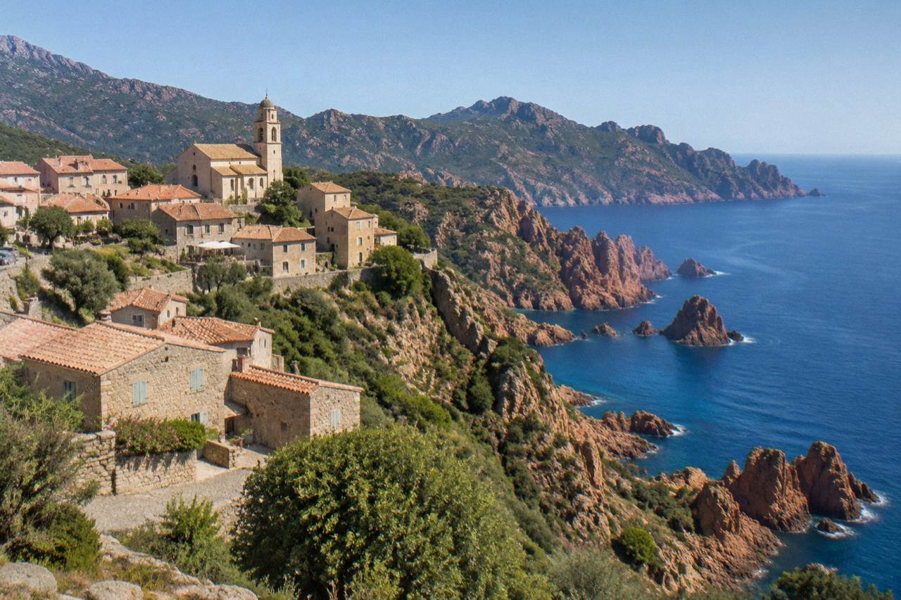
Corsica's landscape is defined by the meeting of high mountains and sea: Monte Cinto at 2,706 m, a Parc naturel régional de Corse created in 1972 covering 4,484 km2, and a UNESCO property, the Gulf of Porto: Calanche of Piana, Gulf of Girolata, Scandola Reserve, inscribed in 1983. The Riviera's landscape is a coastal strip backed by foothills, with no comparable protected mountain-and-sea block.
The numbers are not close. The regional natural park alone, 4,484 km2, is roughly half the island, and it includes the Castagniccia and the big valleys running down to the sea, with a western sea front running 80 km from Capu Rossu to Capu Cavallu. The UNESCO property covers 11,800 ha where red granite calanche, a marine reserve and the cliff-bound hamlet of Girolata sit in one stretch. Scandola itself, created by ministerial order on 9 December 1975 as the first nature reserve in Corsica, holds 1,000 ha of sea and 919 ha of land, and was central to saving the osprey in Corsica.
The practical consequence is that Corsican sightseeing splits into two modes: boat days for the reserve coastline, and mountain or interior days for Corte, the Restonica valley, the Aiguilles de Bavella and the hill villages of the Balagne. A semi-rigid boat day trip from Ajaccio or Porticcio into Scandola and the Calanques de Piana is the standard way to see the protected shore, and you can Check availability alongside the full tour page. A parallel Riviera day rarely needs a boat at all, which tells you the difference.
Which Has The Coastline And Beaches You Can Actually Reach?
Corsica has more than 1,000 km of coastline (about 1,090 km excluding islets and estuaries), including boat-shuttle-only beaches such as Saleccia and Lotu in the Désert des Agriates, reached by taxi-boat from Saint-Florent, by 4x4 track from Casta, or on foot. A mainland coast is road-served almost everywhere, so the trade is quantity and wildness against ease of access.
That reachability cuts both ways. On the Riviera you can reach a beach by train. In Corsica, some of the named beaches are small logistics projects: the Agriates shuttles run roughly April to October, weather permitting. The same applies to the Îles Lavezzi, inside the Bouches de Bonifacio Nature Reserve, visited by boat from Bonifacio, and the Îles Sanguinaires off Ajaccio, which give their name to a string of gulf and sunset cruises.
For a sense of the shoreline's range, the access patterns the sources state read as follows. Saleccia and Lotu in the Désert des Agriates are reached by boat shuttle from Saint-Florent, by 4x4 track from Casta, or on foot. The Scandola reserve coast, a UNESCO property with 1,000 ha of sea, is boat only, its land area closed to the public. The Îles Lavezzi sit inside the Bouches de Bonifacio reserve and are reached by boat from Bonifacio or Porto-Vecchio. The Îles Sanguinaires, in the Gulf of Ajaccio, are served by boat trips from Ajaccio, and the Calanques de Piana are reached by road and by boat trips from Porto.
Want the protected coastline handled for you? The boat day into Scandola and Piana can be cancelled flexibly, and the button below checks live dates.
What Do The Climate Numbers Say?
The Météo-France 1991-2020 station normals for Ajaccio show a hot, dry summer and a mild, wet winter: July averages 8.6 mm of rain, August a mean daily high of 29.2 °C and 11 h 6 min of sunshine a day, while November averages 111.8 mm of rain. Bastia's November figure is 134.3 mm. The Riviera's figures are not in this comparison's sources, so none are quoted here.
Corsica's climate data, stated plainly, reads as follows for Ajaccio (station 20004002, Campo dell'Oro):
| Month | Mean high °C | Mean low °C | Rain mm | Sunshine h/day |
|---|---|---|---|---|
| Jan | 14.0 | 4.7 | 54.1 | 4.4 |
| Apr | 18.5 | 8.3 | 53.1 | 7.7 |
| Jul | 28.6 | 17.7 | 8.6 | 12.1 |
| Aug | 29.2 | 18.1 | 15.8 | 11.1 |
| Oct | 22.8 | 12.6 | 85.7 | 6.7 |
| Nov | 18.3 | 9.0 | 111.8 | 4.7 |
Two points matter for planning. First, October and November carry the most rain at both stations, so an autumn trip sits on the shoulder of that rise; the question can you swim in Corsica in October deals with the water side. Second, the same summer dryness that makes July and August reliable also brings wildfire rules: from 15 June to 30 September it is forbidden to light a fire or smoke in forests, maquis and massifs, and the UK FCDO notes a high wildfire risk in France from April to October. That constraint simply does not exist in the same form on a mainland city break.
Which Is Better For Hiking?
Corsica is the answer if hiking is the point of the trip: the GR20 runs 180 km north to south in about 15 stages of 4 to 8.5 hours, with PNRC refuges guarded from 16 May to 4 October, and the island adds the Mare a Mare and Mare e Monti trails, including Mare a Mare Centre at 84 km and Mare e Monti Sud at 66 km. The Riviera has day walks, not a trail system of this scale.
The GR20's practicalities are unusually well documented. A bunk in a PNRC refuge is EUR 20 per person for 2026, a bivouac pitch is EUR 12, a rented tent for one is EUR 27 and for two is EUR 39, and booking is mandatory online for every option. Rented tents sleep two with a 3 cm mat per person, you bring your own sleeping bag, and dogs are not allowed in refuges or rented tents. There are no departures from Calenzana after 11:00 under a municipal fire-risk order, and wild camping is banned across the island, with bivouacking only in the marked areas at refuges.
The full trail set from the PNRC's own brochure:
| Trail | Length | Days stated | Total climb |
|---|---|---|---|
| GR20 (Fra li Monti) | 180 km | about 15 stages | not stated in the brochure |
| Mare e Monti Nord | 121 km | 10 | 6,100 m |
| Mare a Mare Nord | 139 km (161 km with variant) | 8 to 12 | 5,900 m |
| Mare a Mare Centre | 84 km | 6 to 7 | 3,900 m |
| Mare a Mare Sud | 73 km | 5 | 3,200 m |
| Mare e Monti Sud | 66 km | 5 | 2,700 m |
Whether the GR20 is hard, and whether it is safe alone, are questions with their own pages: is the GR20 hard and is it safe to hike the GR20 alone. Mountain rescue on the island runs through the PGHM in Ajaccio on 04 95 24 24 00, with 112 or 17 in an emergency, useful numbers to have saved before any interior day.
How Do You Get There And Get Around?
Corsica is reached by air through four airports, Ajaccio Napoléon Bonaparte (AJA), Bastia Poretta (BIA), Figari Sud Corse (FSC) and Calvi Sainte-Catherine (CLY), or by ferry from Marseille, Toulon, Nice, Livorno, Savona, Genoa and Santa Teresa Gallura, with crossings that range from about 50-60 minutes on the Sardinia link to 12-13 hours overnight from Marseille. The Riviera is a mainland coast reached by train and car with no crossing at all.
The ferry layer is Corsica-specific. Corsica Linea sails Marseille to L'Île-Rousse, Bastia, Propriano and Ajaccio; La Méridionale sails Marseille to Ajaccio and Porto-Vecchio; Moby sails Livorno, Genoa and Santa Teresa Gallura to Bastia and Bonifacio; Corsica Ferries sails from Toulon, Nice, Livorno and Savona. The Santa Teresa Gallura to Bonifacio link, about 50-60 minutes, is held by Moby and Ichnusa Lines after Sardinia found no rival operator. More than 8.5 million passengers passed through Corsica's ports and airports in 2025 excluding cruise passengers, per the ORTC and DREAL annual report.
On the island, the Chemins de fer de la Corse runs Ajaccio to Bastia via Corte, Ponte-Leccia to Calvi, and the Balagne coastal line between Calvi and L'Île-Rousse. Roads are another difference of kind: Inforoutes Corse publishes live road conditions and accessibility levels for the main mountain passes, because cols close. Whether a car is needed at all is covered in do you need a car in Corsica, and the ferry question has its own page. A Riviera trip answers to a timetable; a Corsica trip answers to a map.
What Do The Sights Cost In Corsica?
Corsican sight entry is inexpensive in euros: Maison Bonaparte is EUR 10 full price, Palais Fesch EUR 10 with EUR 6 for over-65s and free up to 18, the Musée de la Corse and Corte citadel EUR 5.50 on a combined ticket, Filitosa EUR 9 adults, and the Escalier du Roi d'Aragon about EUR 5 with 189 steps.
The published details, so you can plan without guessing:
| Corsica sight | Entry | Opening pattern |
|---|---|---|
| Maison Bonaparte, Ajaccio | EUR 10; EUR 8 non-EU 18-25 and large families; free EU under-26 | Closed Mondays; 1 Jul-30 Sep 10:00-17:30 |
| Palais Fesch, Ajaccio | EUR 10; EUR 6 over-65s; free up to 18 | Daily 09:00-17:00 |
| Musée de la Corse and citadel, Corte | EUR 5.50; one ticket covers both | 1 May-31 Oct daily 10:00-19:00 |
| Filitosa | EUR 9; EUR 7 reduced; family EUR 28 | 1 Apr-2 Nov |
| Escalier du Roi d'Aragon, Bonifacio | about EUR 5 | Monthly hours; closed shoes required |
Food is part of the same picture. Brocciu obtained its appellation d'origine in 1983, the charcuterie trio of prisuttu, lonzu and coppa took AOC in 2012 and AOP in 2014, Corsican honey and olive oil carry AOP designations, and clémentine de Corse holds an IGP from 2007. Restaurant bills include service by law, with any extra tip optional, per the DGCCRF. Whether the island is expensive overall is answered, with the same sourcing discipline, in is Corsica expensive.
So Which Should You Choose?
Choose Corsica for mountains meeting the sea, a 180 km grande randonnée, boat-only reserves and a low population density of 365,636 people across 8,722 km2; choose the French Riviera for city-to-city ease, train access and a mainland strip without ferry timetables or mountain pass closures. On every figure this page can verify, the two are not competing for the same trip.
A week in Corsica is usually structured as bases and boat days: Ajaccio or Porto-Vecchio for the south, Calvi or L'Île-Rousse for the Balagne, Corte for the interior. How many days that needs is its own question, answered in how many days in Corsica is enough, and whether the island justifies the journey at all is asked straight in is Corsica worth visiting.
Common Questions About Corsica Versus The French Riviera
Is Corsica Better Than The French Riviera?
Not better, different. Corsica offers an island of 8,722 km2 with more than 1,000 km of coastline, Monte Cinto at 2,706 m, the GR20 and boat-only reserves. The Riviera offers a mainland coastal strip with train access. Pick by trip type, not by ranking.
Is Corsica Part Of France Like The Riviera?
Yes. Corsica is a French island, run by the Collectivité de Corse, a single territorial authority with special status reported to be in place since 1 January 2018. The details are on the page is Corsica part of France or Italy.
Does Corsica Have More Coastline Than The Riviera?
Corsica has more than 1,000 km of coastline, about 1,090 km excluding islets and estuaries.
Which Is Easier To Reach Without A Car?
The Riviera, because it is a mainland strip. In Corsica the Chemins de fer de la Corse links Ajaccio, Bastia via Corte, Ponte-Leccia, Calvi and L'Île-Rousse, but mountain areas and several beaches need a boat, a 4x4 track or serious walking.
When Is The Best Time To Visit Corsica?
The Météo-France normals show July averaging 8.6 mm of rain at Ajaccio and August a mean high of 29.2 °C, while October and November carry the most rain, 85.7 mm and 111.8 mm. GR20 refuges are guarded from 16 May to 4 October, which frames the hiking season.