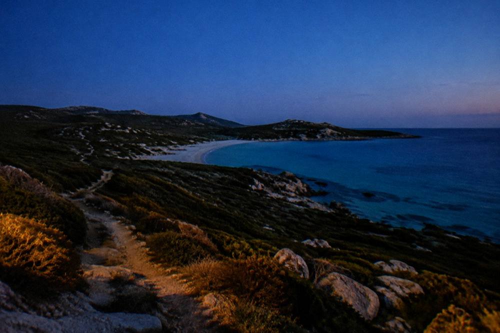
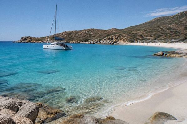
Desert Des Agriates
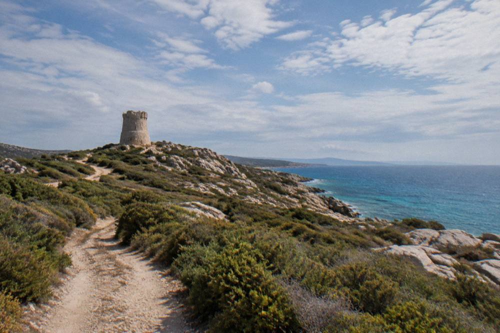
The Désert des Agriates is the wild coastal stretch of northern Corsica between Saint-Florent and the Plage de l'Ostriconi, a maquis-covered landscape with no through village and two of the island's best-known beaches, Saleccia and Lotu.
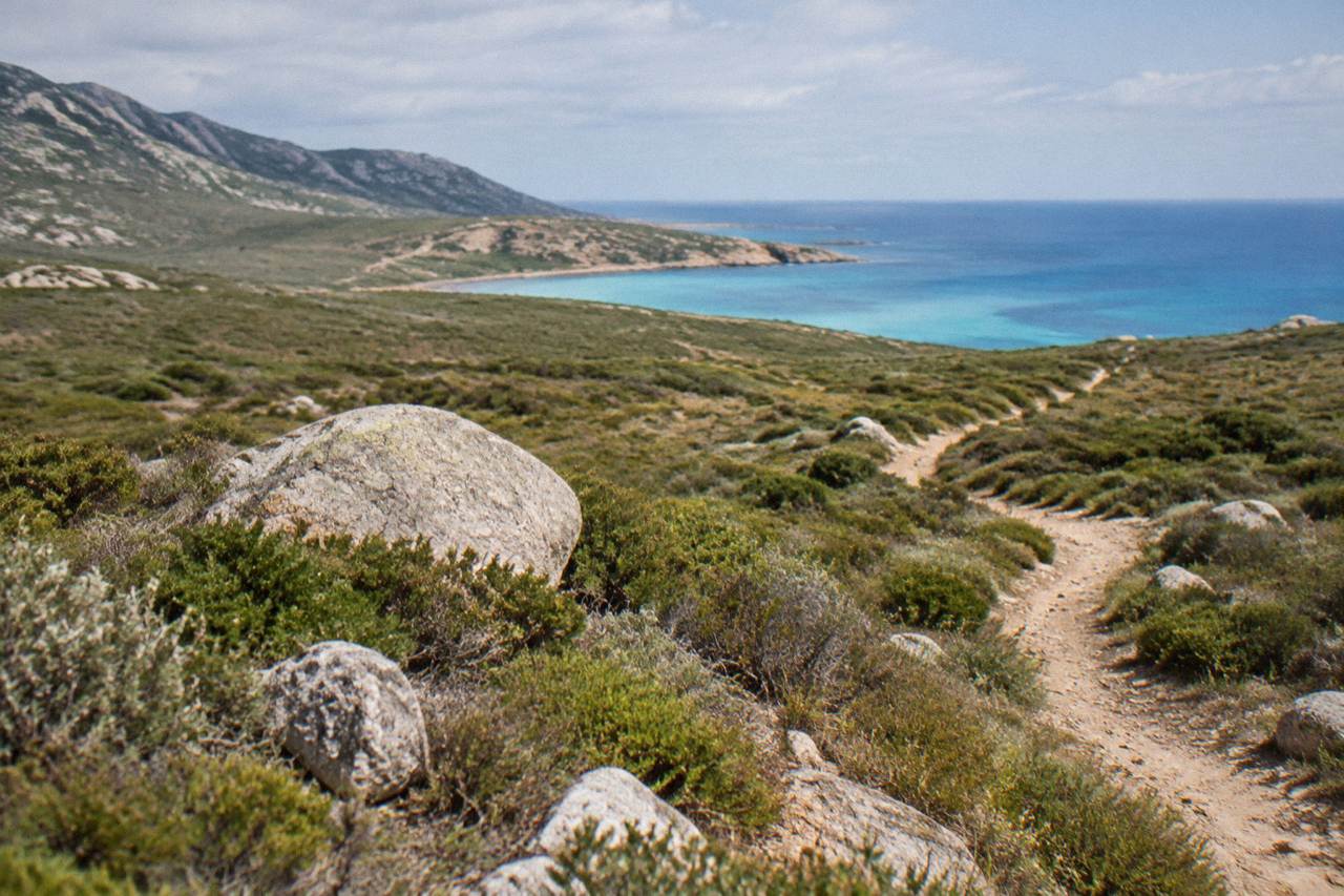
The Désert des Agriates is reached by boat shuttle from Saint-Florent (roughly April to October, weather permitting, as reported), by 4x4 track from Casta, or on foot. It holds the beaches of Saleccia and Lotu and has no regular road access.
Corsica's Désert des Agriates is not a desert in the Saharan sense. It is a large, roadless sweep of maquis, rock and sand on the island's north coast, running between Saint-Florent at the base of the Cap Corse peninsula and the Plage de l'Ostriconi on the Balagne side, and it holds two beaches whose names circulate far beyond the island: Saleccia and Lotu. There is no village inside it, no regular road through it, and no rail line anywhere near it. What there is, per the reported description on the visit-corsica.com heritage page, is a landscape best understood by its access rules: by boat shuttle from Saint-Florent about April to October, weather permitting, by 4x4 track from Casta, or on foot. The Désert des Agriates, its access options in practice, the tours that cover it, and its fit within a wider northern Corsica trip are all covered here.
What Is The Désert Des Agriates In Corsica?
The Désert des Agriates is a protected coastal area of northern Corsica between Saint-Florent and the Plage de l'Ostriconi, covered in maquis scrub and without a regular through road, whose best-known features are the beaches of Saleccia and Lotu. Reported access runs by boat shuttle from Saint-Florent roughly April to October, weather permitting, by 4x4 track from Casta, or on foot, and no shuttle fares or timetables are fixed public facts.
The name misleads more than it informs. The word "desert" refers to the emptiness of the terrain, not to sand dunes or aridity: the ground is dense low maquis, the scrubland vegetation that covers so much of wild Corsica, folded over low hills that drop to a sequence of sandy coves along a genuinely sea-facing coast. The island's geography frames everything here. Corsica covers 8,722 km2 and is the fourth-largest island in the Mediterranean, with more than 1,000 km of coastline and a mountainous interior that peaks at Monte Cinto, 2,706 m. The Agriates sit at the opposite end of that scale: low, coastal and open to the sea on the north and west, forming the hinge between the Cap Corse peninsula to the east and the Balagne, the region around Calvi and L'Île-Rousse, to the west.
Practically, the emptiness is the point. Because no regular road crosses the area, the beaches inside it stay tied to a small set of access methods, each of which changes the character of the day. A boat arrival from Saint-Florent, a slow 4x4 run in from Casta, and a walk along the coastal path give three different Agriates, and the sections below take them one at a time.
The area also sits inside fire-risk country. Corsica's standing rule forbids lighting fires or smoking in forests, maquis and massifs from 15 June to 30 September, and a daily colour map of massif access is published each evening at 18:00 for the next day. In midsummer that map matters for any plan that involves walking into the Agriates, and checking it belongs in the morning routine alongside the weather.
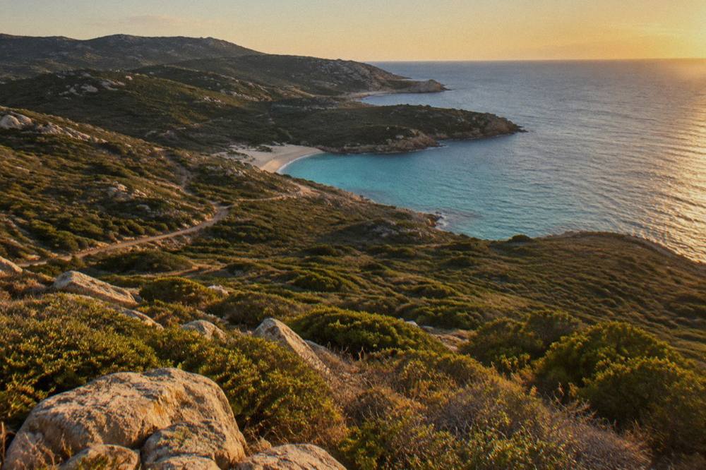
How Do You Get To The Désert Des Agriates?
The Désert des Agriates is reached by boat shuttle or taxi-boat from the port of Saint-Florent, reported as running about April to October and weather permitting, by 4x4 track from Casta on the Cap Corse side, or on foot along the coastal path. The shuttle services are private operators, so fares, times and running days change and need confirming at Saint-Florent before you commit.
Those three reported methods come from the visit-corsica.com natural-heritage page on the Désert des Agriates, and they are the whole picture. There is no public bus, no train and no ordinary tarmac road into the area. The Chemins de fer de la Corse network runs Ajaccio to Bastia via Corte, Ponte-Leccia to Calvi, and the Balagne coastal line between Calvi and L'Île-Rousse, none of which touches the Agriates; the nearest stations sit well to the west. For anyone relying on public transport, the realistic shape of the day is a bus or drive to Saint-Florent first, then a shuttle decision.
The boat option is the one people picture. Saint-Florent is a small port town at the base of the Cap Corse peninsula, and its harbour is where the private shuttle and taxi-boat operators tie up. The crossing to the Agriates beaches is reported as short, in the order of fifteen to twenty minutes. Because these are private, seasonal, weather-dependent services, nothing about them belongs in an evergreen plan beyond the pattern: turn up at the port, or contact the operators ahead, and expect the season to run about April to October with the sea having the final word.
The 4x4 option comes in from Casta, on the eastern edge of the area toward the Cap Corse side, over an authorised track rather than a road. This is where a guided product earns its keep, because driving the track yourself means having the right vehicle, knowing the access rules and accepting the terrain. The third option, on foot, costs nothing but time and water: the coastal path links Saint-Florent westward into the Agriates, and walking in is the only way to feel the scale of the place. The fire-risk map in summer applies to all of it.
| Access method | Starting point | Season | What to confirm locally |
|---|---|---|---|
| Boat shuttle or taxi-boat | Saint-Florent port | About April to October, weather permitting | Fares, sailing times, running days |
| 4x4 track | Casta | Dry weather | Track access conditions, vehicle rules |
| On foot | Saint-Florent or western end | Year-round, fire-map permitting | Daily massif access colour, water supply |
A reasonable middle path for travellers who want the beaches without the logistics is a guided day. More options, including catamaran days out of L'Île-Rousse and a boat tour from Calvi toward Scandola, sit in the trio above.
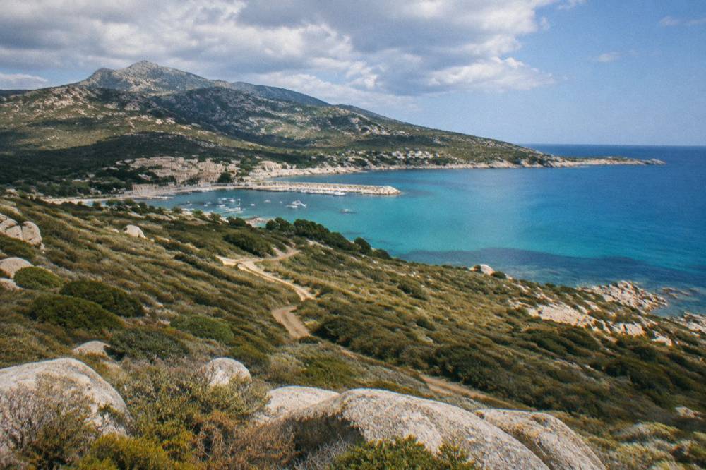
Which Beaches Sit Inside The Désert Des Agriates?
The two named beaches of the Désert des Agriates are Saleccia and Lotu, both reported as reached by boat shuttle from Saint-Florent, by 4x4 track from Casta or on foot. Their separate pages on this site describe each beach in detail.
Saleccia and Lotu are the pair that made the Agriates famous, and both are covered in dedicated guides on this site: Saleccia beach and Lotu beach. What can be said at the level of the area as a whole is structural, not scenic: both sit on the coast inside the roadless stretch, both share the same three reported access methods, and both therefore reward the same planning, an early start, a shuttle or track plan settled the day before, and supplies carried in, because nothing inside the area is a town.
On the western edge, the boundary of the Agriates runs toward the Plage de l'Ostriconi, a dune-backed beach at the mouth of the Ostriconi river on the Balagne side, which has its own page under Plage de l'Ostriconi. Ostriconi is reachable by ordinary road in a way the interior beaches are not, which makes it a useful fallback or a first stop for travellers driving the coast road between Saint-Florent and Calvi or L'Île-Rousse before or after an Agriates day.
For swimmers, the standing safety picture for the island applies. Corsica's supervised beaches are a summer institution: Ajaccio operated seven lifeguard posts from 1 July to the end of August 2026 on its main beaches, and Haute-Corse's supervised beaches are reported as staffed by volunteer firefighters about 1 July to 31 August. Remote beaches inside the Agriates do not fit that pattern; the honest description is that a swim there is an unguarded one, in the sea, on a beach with no road out, and it deserves the respect that implies.
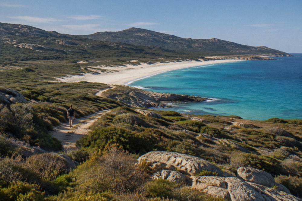
Can You Drive To Saleccia And Lotu?
Driving into the Désert des Agriates means the authorised 4x4 track from Casta, not a normal road, and a standard rental car is the wrong tool for it. Reported access is by 4x4 track from Casta, by boat shuttle from Saint-Florent, or on foot, and no Cap Corse road times, track fares or parking rules for the area are published figures.
The distinction matters because visitors routinely underestimate it. The track from Casta is a mountain-and-scrub track through the terrain the area protects, and the reported description of the region is explicit that this is the vehicle route. Rental agreements on Corsica commonly exclude unsealed tracks anyway, which turns a puncture into a contractual problem on top of a logistical one. The guided jeep products in the tour section below exist precisely to answer this: an operator with the vehicle, the route knowledge and the authorisation carries the day.
For a self-drive holiday, the workable frame is to drive the good road to Saint-Florent, park there, and take the shuttle; or to book a 4x4 or jeep tour from Calvi or Saint-Florent and let someone else handle the track. Saint-Florent itself is a pleasant base for this: it sits under the Patrimonio wine appellation, reported as sitting at the base of the Cap Corse peninsula, so the town combines a working port, shuttle access to the Agriates and one of Corsica's named wine areas within a short drive.
Road conditions anywhere in the Corsican mountains have a single reliable reference point: Inforoutes Corse, which as reported publishes live road status and accessibility levels for the main cols. Nothing about the Agriates track belongs to that col network, but the habit of checking applies, particularly after autumn storms, when closures of this kind of road are normal and temporary rather than permanent.
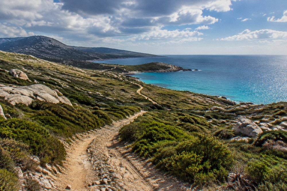
What Are The Best Agriates And Cap Corse Tours?
The strongest guided options for the Désert des Agriates are the Cap Corse and Agriates half-day trip, which links the peninsula coast to the Agriates, and, from the Balagne side, a full-day catamaran trip in the Agriates from L'Île-Rousse and a four-hour boat tour from Calvi toward Scandola, all bookable with free cancellation through their live listings.
Starting from Saint-Florent or the east, the Cap Corse and Agriates half-day trip is the natural pick: a half-day format, covering the Cap Corse coast and the Agriates in one guided loop, ideal for a first visit or a family with limited patience for logistics. Check availability close to the date you want, because the half-day format is the sort of product that fills in high summer.
From the west, the choice widens. The full-day catamaran trip from L'Île-Rousse spends its day in the Agriates from the seaward side, a completely different proposition from the track: no dust, a boat deck, and a coastline that only really reveals its shape from the water. From Calvi, the four-hour boat tour runs toward the Scandola reserve, which swaps the Agriates for the UNESCO-inscribed Gulf of Porto, and pairs well for travellers based in the Balagne who want one sea day and one land day.
For active travellers, the canyoning and e-bike products around Ajaccio and Bocognano show the other face of the island, and the Désert des Agriates day-trip planner on this site strings the area into a fuller itinerary. Whichever tour shape suits, the operator's live listing is where the current price, duration and departure details live, and none of those figures should be assumed from one season to the next.
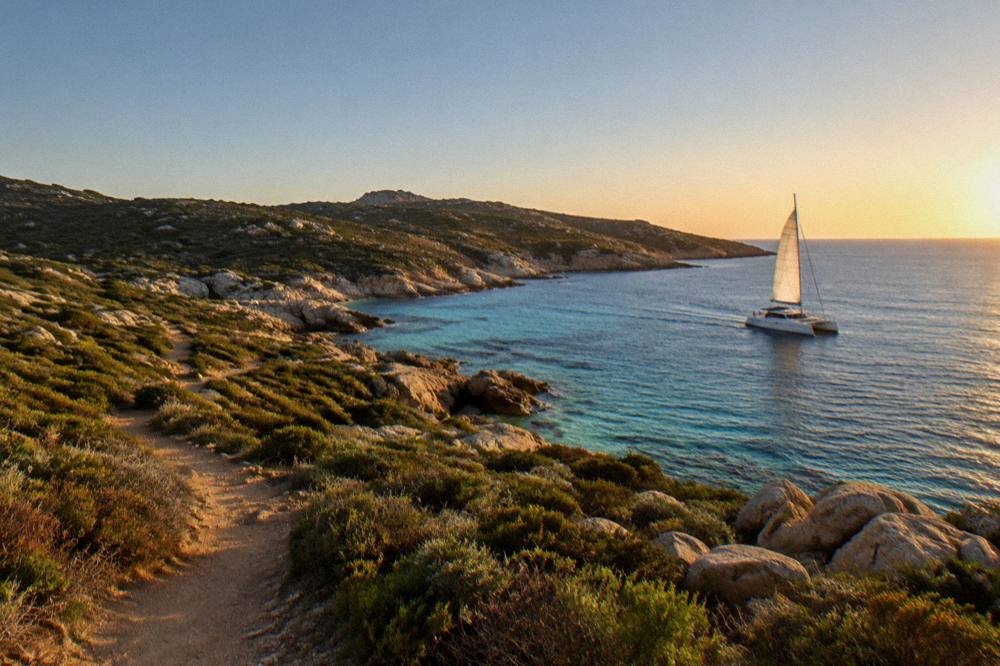
What Is The Weather Like In The Agriates?
The north-coast climate follows the Corsican pattern of a hot, dry summer and a mild, wet winter: Météo-France station normals for 1991-2020 show July averaging 8.6 mm of rain at Ajaccio and August averaging mean daily highs of 29.2 °C, while November carries 111.8 mm at Ajaccio and 134.3 mm at Bastia, and no sea-temperature figure is published from a licensed source.
The two nearest long-record stations frame the island's north: Ajaccio on the west coast and Bastia on the east. The tables below give the station normals, and the honest reading for the Agriates is that the area lies between them, coastal, exposed and dry in summer, with the fire-risk season as the real constraint on land access rather than temperature. Snow, in the island's pattern, falls only on the high mountains, which the Agriates definitively is not.
| Month | Ajaccio high °C | Ajaccio low °C | Ajaccio rain mm | Ajaccio sun h/day |
|---|---|---|---|---|
| Jan | 14.0 | 4.7 | 54.1 | 4.4 |
| Feb | 14.2 | 4.3 | 48.1 | 5.5 |
| Mar | 16.0 | 5.9 | 50.4 | 6.8 |
| Apr | 18.5 | 8.3 | 53.1 | 7.7 |
| May | 22.1 | 11.8 | 49.8 | 9.3 |
| Jun | 25.9 | 15.4 | 25.9 | 11.1 |
| Jul | 28.6 | 17.7 | 8.6 | 12.1 |
| Aug | 29.2 | 18.1 | 15.8 | 11.1 |
| Sep | 26.1 | 15.4 | 57.8 | 8.7 |
| Oct | 22.8 | 12.6 | 85.7 | 6.7 |
| Nov | 18.3 | 9.0 | 111.8 | 4.7 |
| Dec | 15.1 | 5.8 | 73.9 | 4.0 |
| Month | Bastia high °C | Bastia low °C | Bastia rain mm | Bastia sun h/day |
|---|---|---|---|---|
| Jan | 13.8 | 5.4 | 67.3 | 4.5 |
| Feb | 13.9 | 5.1 | 63.5 | 5.5 |
| Mar | 15.8 | 6.8 | 63.7 | 6.3 |
| Apr | 18.3 | 9.1 | 71.6 | 7.3 |
| May | 22.4 | 12.6 | 53.7 | 8.7 |
| Jun | 26.4 | 16.5 | 38.8 | 10.2 |
| Jul | 29.4 | 19.4 | 13.8 | 11.2 |
| Aug | 29.8 | 19.8 | 21.1 | 10.1 |
| Sep | 26.0 | 16.7 | 74.5 | 7.9 |
| Oct | 22.0 | 13.4 | 126.5 | 5.9 |
| Nov | 17.7 | 9.5 | 134.3 | 4.5 |
| Dec | 14.8 | 6.4 | 88.1 | 4.5 |
The planning consequence is simple. Summer days are dry, hot and long on daylight, but they are also the fire-rule season: from 15 June to 30 September no fires and no smoking in forests, maquis and massifs, with the daily access map published the evening before. Spring and autumn drop the fire constraint and keep usable sea-adjacent temperatures, at the price of a real chance of rain, above all in October and November, when the monthly totals at both stations climb steeply.
What Should You Combine With The Désert Des Agriates?
The natural pairings are Saint-Florent and the Patrimonio appellation at the base of Cap Corse, the Cap Corse peninsula itself, and the Balagne coast toward L'Île-Rousse and Calvi, all reachable along the north-coast road, with the Museum of Bastia on the peninsula's east side reported as open 10:00 to 18:30 in high season, closed Sunday and Monday in low season.
Northern Corsica packs well. A week based between Saint-Florent and Calvi can hold an Agriates day, a Cap Corse loop, a Balagne villages drive and a sea day, without a single long transfer. On the Cap Corse side, the peninsula's east coast carries Erbalunga and its waterfront, and Bastia anchors the region's transport as the island's second town, with the Vieux Port de Bastia as its historic heart. The Museum of Bastia, in the Palais des Gouverneurs, is reported as running high-season hours of 10:00 to 18:30 and low-season hours of 09:00 to 12:00 and 14:00 to 17:00, closed Sunday and Monday; as a reported schedule, confirm before you go.
On the Balagne side, Calvi and its citadel close the loop westward, and the islands and reserves of the west coast, from the Calanques de Piana to the Scandola nature reserve, make a different kind of day if a second sea trip appeals. Travellers mixing the north with a fuller island circuit will find the framing on Corsica Travel Guide's overview of the island's regions, and the island-wide pick list on the things to do in Corsica page.
| Sight | Admission | Opening |
|---|---|---|
| Filitosa prehistoric site | EUR 9 adults, EUR 7 reduced, EUR 28 family | 1 April to 2 November, 09:00 to sunset |
| Musée de la Corse and Citadelle de Corte | EUR 5.50 full, one ticket covers museum and citadel | 1 May to 31 Oct daily 10:00-19:00 |
| Maison Bonaparte, Ajaccio | EUR 10 full, free for EU residents under 26 | Every day except Monday |
| Palais Fesch, Ajaccio | EUR 10 full, EUR 6 over 65, free up to 18 | Daily 09:00 to 17:00 |
Those four sights sit outside the Agriates, but they are the fixed-price anchors most often folded into a northern loop, and every figure in the table is an admission or opening fact from this site's data. Inside the Agriates itself there is nothing to buy, which is either the attraction or the inconvenience, depending on how much water you carried in.
Is The Désert Des Agriates Worth Visiting?
The Désert des Agriates earns its place on a Corsica trip for travellers who want the island's wild, roadless coast rather than its resort beaches: it holds Saleccia and Lotu, it is reachable without a car via the reported Saint-Florent shuttle, and it pairs naturally with Cap Corse and the Balagne, though it demands more planning than a beach with a road.
The honest trade-off runs like this. Against the Agriates stand the logistics: no road in, seasonal private shuttles, a track that punishes the wrong vehicle, and a summer fire map that can close walking access on the wrong day. For the Agriates stand the two beaches, the emptiness, and the fact that this is one of the few Mediterranean coastlines where "roadless" is a structural fact rather than a marketing word. Families with small children may prefer Santa Giulia beach or Palombaggia in the south, both road-served; walkers and photographers will take the Agriates.
Solo travellers and cautious hikers have a reasonable question about safety, and the island's standing answer covers it: emergency numbers 112, 15, 17, 18, 114 and 196 at sea, with mountain rescue through the PGHM in Ajaccio on 04 95 24 24 00. Carrying water, telling someone the route and checking the evening access map are the practical precautions for any day inside the area.
Common Questions About The Désert Des Agriates
How Do You Get To The Désert Des Agriates?
Reported access is by boat shuttle or taxi-boat from Saint-Florent port, about April to October and weather permitting, by 4x4 track from Casta, or on foot along the coastal path. The shuttles are private operators, so fares and times are confirmed at Saint-Florent.
Can You Drive To Saleccia Beach In Corsica?
Only by the authorised 4x4 track from Casta, which is not a road and is unsuitable for a standard rental car. The alternatives are the Saint-Florent boat shuttle, a guided jeep or 4x4 tour, or walking in.
When Do The Saint-Florent Beach Shuttles Run?
The reported season runs about April to October, weather permitting, because the services are private and sea-dependent. Exact running days and times change and are confirmed with the operators at the port.
Is The Désert Des Agriates A Real Desert?
No. It is a roadless stretch of maquis-covered coast between Saint-Florent and the Plage de l'Ostriconi in northern Corsica, with sandy coves including Saleccia and Lotu. The name describes the emptiness, not the climate.
Can You Walk Into The Agriates?
Yes, the coastal path is one of the three reported access methods. In summer, check the daily fire-risk access map published at 18:00 for the next day, carry water, and remember that fires and smoking are banned in maquis and massifs from 15 June to 30 September.
What Else Is Near The Désert Des Agriates?
Saint-Florent and the Patrimonio wine appellation at the base of Cap Corse, the Cap Corse peninsula itself, and the Balagne coast toward L'Île-Rousse and Calvi, all within a northern Corsica loop that comfortably fills several days.
The Désert des Agriates is the part of northern Corsica that resists convenience, and that is exactly the terms on which it should be booked: pick an access method, check the sea and the fire map, carry more water than seems reasonable, and the emptiest stretch of the island's more than 1,000 km of coastline gives back a day that a road-served beach cannot.