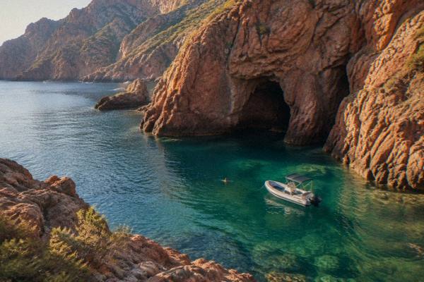
Porto Corsica
The Golfe de Porto and Piana stretch of the Corsican west coast holds a UNESCO World Heritage property, a boat-only nature reserve and red granite cliffs, all inside one small area served from the villages of Porto, Ota, Piana and Cargèse.
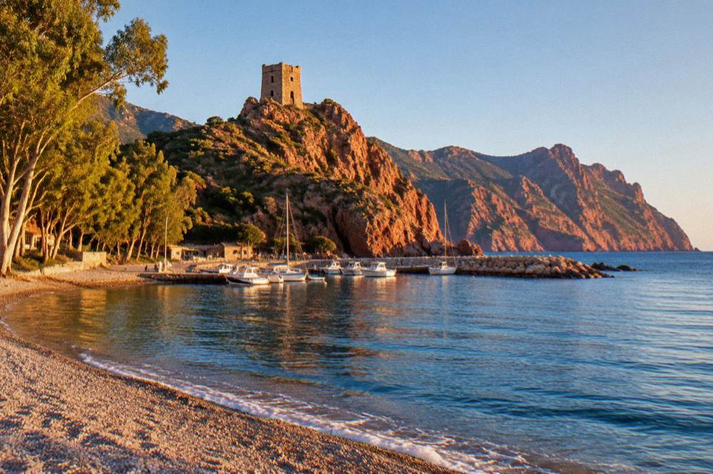
Porto, in the Golfe de Porto on Corsica's west coast, is the practical base for the UNESCO property Gulf of Porto: Calanche of Piana, Gulf of Girolata, Scandola Reserve, inscribed in 1983. Scandola can only be visited by boat, the Calanques de Piana can be seen from the road and from the water, and Girolata is reached on foot or by sea.
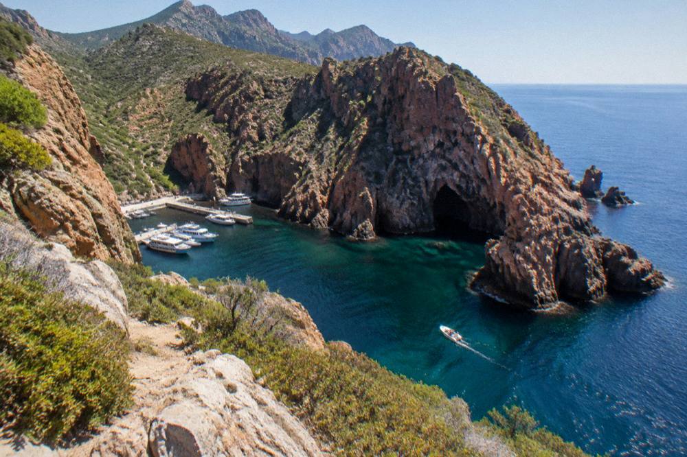
Porto sits at the mouth of a river gorge on the west coast of Corsica, the French Mediterranean island, with the red granite of the Calanques de Piana to the south and the Scandola Nature Reserve to the north. The whole stretch is one UNESCO World Heritage property, listed in 1983, and it is the only place in France where a natural property of this kind covers sea, cliffs and a marine reserve in a single inscription. This guide sets out what the property contains, how the boat system works, what can be reached by road, and how the area fits into a wider Corsica route; for the island-wide picture, the Corsica Travel Guide homepage pulls the regions together.
What Is The Golfe De Porto In Corsica?
The Golfe de Porto is a stretch of the Corsican west coast that carries a single UNESCO World Heritage property, "Gulf of Porto: Calanche of Piana, Gulf of Girolata, Scandola Reserve", inscribed in 1983 under natural criteria (vii)(viii)(x) and covering 11,800 hectares, dossier 258. It combines the red granite Calanche of Piana, the marine reserve of Scandola and the isolated village of Girolata into one protected coastline.
The property sits on the island's west coast, between Cargèse to the south and the Punta much further north. The village of Porto, at the river mouth, and the small commune of Ota just uphill act as the local base; Piana perches above the Calanche to the south. Inland, the Gorges de Spelunca climb from Porto towards Évisa and the Forêt d'Aïtone. The area belongs to the wider sweep of the Golfe de Porto attraction guide on this site.
Corsica's regional park frames the whole picture. The Parc naturel régional de Corse was created in 1972 and today covers 4,484 km2 of the island's 8,722 km2, and its western sea front runs 80 km from Capu Rossu to Capu Cavallu, which includes this coast. The park manages the Scandola reserve on behalf of the State.
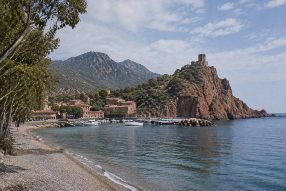
What makes the area unusual in a European context is that the three components are protected as one continuous natural system rather than as separate parks. The UNESCO inscription covers the cliffs, the sea and the reserve together, and the practical consequence for a visitor is simple: the coast is the attraction, and the way to see it is by boat. The things to do in Corsica overview places the Golfe de Porto among the island's headline draws alongside Bonifacio and the Cap Corse.
| UNESCO property fact | Figure |
|---|---|
| Property name | Gulf of Porto: Calanche of Piana, Gulf of Girolata, Scandola Reserve |
| Dossier number | 258 |
| Year inscribed | 1983 |
| Natural criteria | (vii)(viii)(x) |
| Area | 11,800 ha |
| Managing body of the reserve | Parc naturel régional de Corse |
How Do You Visit The Scandola Nature Reserve From Porto?
Scandola is a nature reserve created by ministerial order on 9 December 1975, the first in Corsica, with 1,000 hectares of sea, 919 hectares of land and a 70-hectare integral reserve in the commune of Osani, and visits are by boat only, because the land area is closed to the public. There is no landing in the integral reserve, and reported rules also close recreational line fishing and spearfishing in the reserve.
The reserve runs from 100 m depth to 540 m altitude, an extraordinary range for a coastal protected area, and it was key to saving the osprey in Corsica. Management is by the Parc naturel régional de Corse, and the Office de l'Environnement de la Corse shares steering with the State: a management agreement was renewed on 27 February 2026, and a State and OEC steering committee on 28 April 2026 confirmed a common roadmap. The measures now in force include voluntary labelling of boat operators, a QR-code tracking trial for pleasure boats, more controls at sea and renewed osprey quiet zones. Quotas, licences and flow controls are to be consolidated in a regulatory framework being finalised, with no announced year.
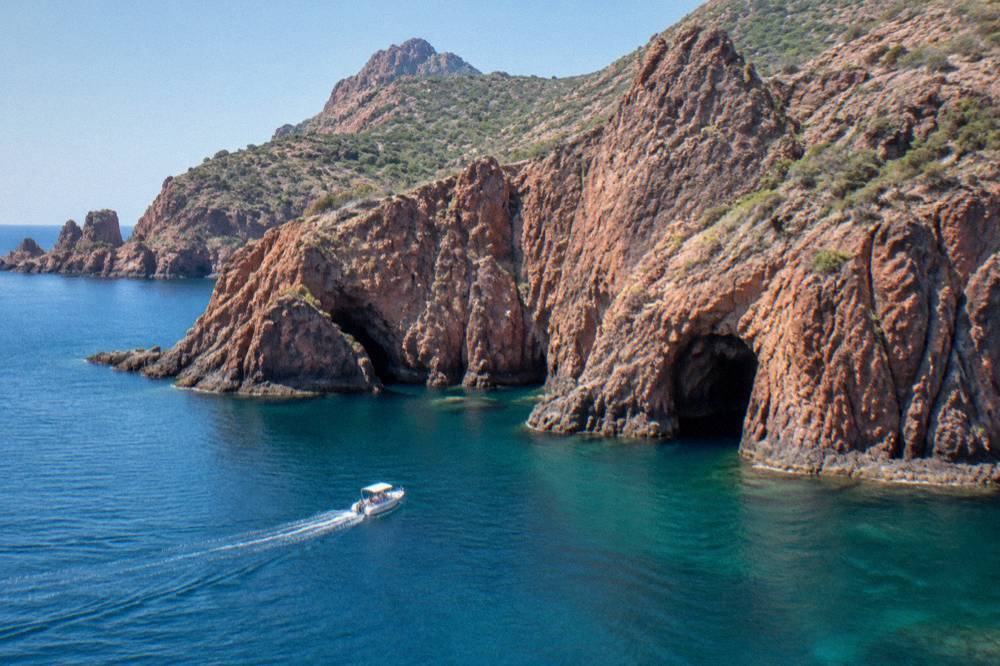
Because access is by sea, the boat operators define the visit. Trips leave from Porto itself and from Ota, Piana, Cargèse and Sagone, and from Ajaccio and Calvi further afield. The vessels range from large passenger boats with audio guides to small-group semi-rigid boats, and the smaller craft can enter more of the sea caves along the Calanche.
Anchoring is authorised in daytime outside the integral reserve and the Gargalu channel, with anchors lifted at sunset, and boats must avoid the posidonia seagrass beds. These rules shape what the operators can do, which is why a Scandola cruise is a passage along the coast rather than a landing trip.
| Scandola reserve rule | What applies |
|---|---|
| Land access | Closed to the public, visits by boat only |
| Landing in the integral reserve | Not permitted |
| Anchoring | Daytime only, outside the integral reserve and the Gargalu channel |
| Anchors | Lifted at sunset |
| Recreational fishing | Line fishing and spearfishing prohibited for individuals |
| Dogs in refuges | Not allowed inside refuges or rented tents |
Why Are The Calanques De Piana Red?
The Calanques de Piana are massifs of red granite, listed inside the UNESCO property as the "Calanche of Piana", and their colour comes from the granite itself, weathered into towers, needles and collapsed forms above the sea between Porto and Piana. They can be seen from the coast road between the two villages and from the water, and boat trips from Porto, Piana, Cargèse and Sagone all pass beneath them.
The road between Porto and Piana threads the Calanche, and the Calanques de Piana guide on this site covers the lookouts and the walking options in detail. From the sea the same rocks look different: the shorter cruises from Porto focus on the Calanche and the sea caves, while the longer loops add Girolata and Scandola in one outing. The Calanques de Piana tour page compares the sea options, including short trips of an hour and a half from Porto that cover only the Calanche.
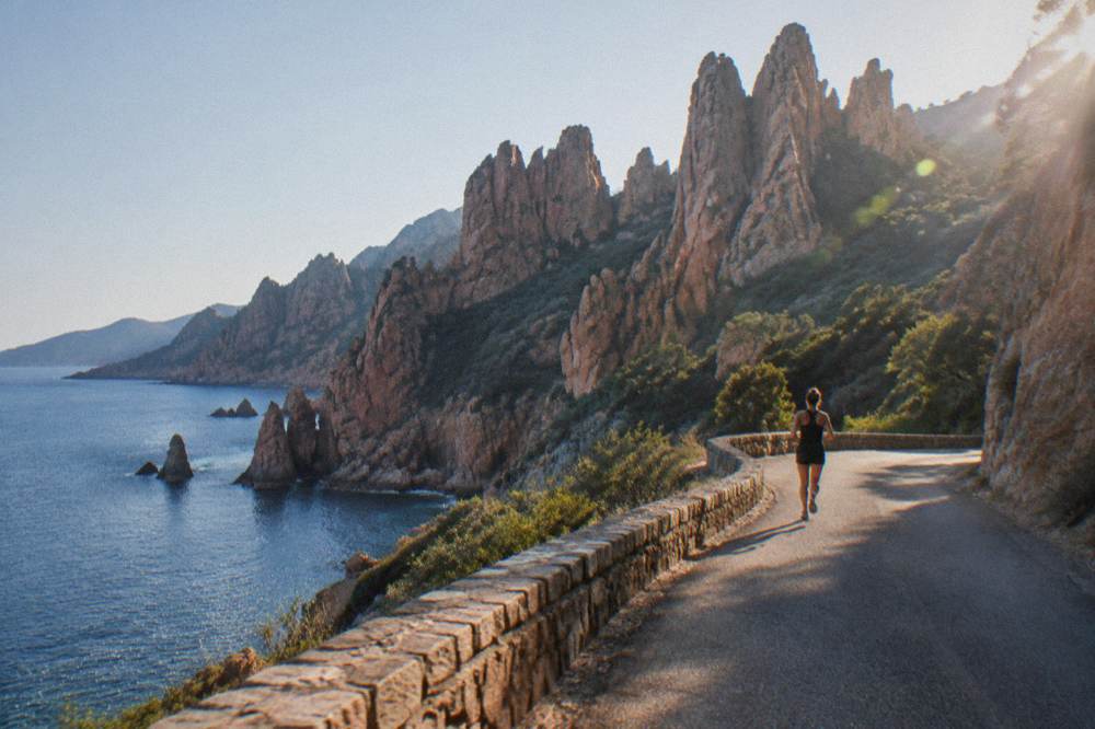
The granite is the reason the UNESCO property exists. Natural criterion (viii) covers the geological story of the Calanche, and criterion (vii) covers the visual drama of the coastline; together with the marine ecosystems of Scandola, listed under criterion (x), they make the property one of the few in the Mediterranean inscribed on all three natural criteria at once.
What Is There To Do In Girolata In Corsica?
Girolata is a small coastal settlement inside the Gulf of Girolata, the third named component of the UNESCO property, reachable by boat or on foot rather than by through road, and many Scandola cruises from Porto and Cargèse include a stop there. The bay gives the gulf its name, and the walking route down to it is one of the classic short hikes of the west coast.
The Girolata guide on this site describes the trails and the boat-shuttle practicalities. Cruises that include a Girolata stop run from Porto and from Cargèse and Sagone to the south; the Cargèse shuttle with a Girolata stop and the Sagone small-group cruise both list the stop as a feature. Meals at Girolata are paid on site, and thePNRC booking platform notes that meals at refuges are paid in cash or cheque to the guardian, a pattern that also applies in the small coastal inns of the area.
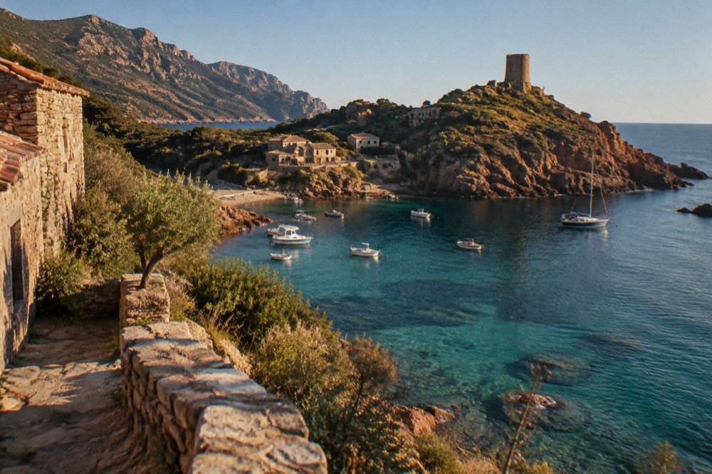
For walkers, the coast around the gulf connects into the long-distance network described below, and the Spelunca gorge above Porto gives a shaded river alternative on hot days. The Golfe de Porto pages gather the options.
Can You Hike Around The Golfe De Porto In Corsica?
Yes, and the area sits on two of Corsica's long-distance trails: the Mare e Monti Nord, which runs 121 km over 10 days with 6,100 m of climbing as far as Cargèse, and whose coastline crosses this sector, plus day walks such as the Spelunca gorge from Porto towards Évisa and the paths down to Girolata. The GR20 itself crosses the interior further east and does not touch the coast here.
The Parc naturel régional de Corse publishes the trail figures, and they matter for planning because the west coast walks are lower and earlier in the season than the high mountains. Wild camping is banned across Corsica including the GR20; bivouac is tolerated only in the marked areas at refuges, and on the GR20 those must be reserved online per person. The 2026 refuge rates published by the PNRC are EUR 20 per person for a bunk, EUR 12 for a bivouac pitch, EUR 27 for a rented tent for one and EUR 39 for two, with every PNRC rental tent sleeping two and carrying a 3 cm mat per person; bring your own sleeping bag.
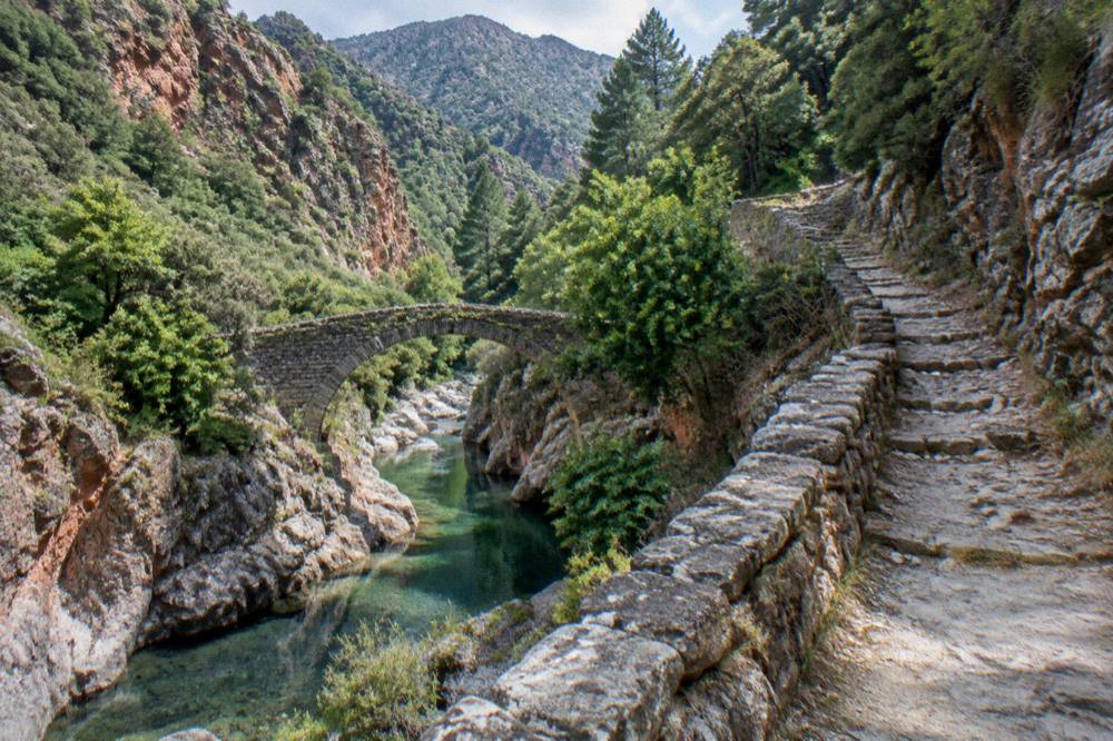
The fire rules shape summer walking everywhere on the island. From 15 June to 30 September it is forbidden to light a fire or smoke in forests, maquis and massifs, the fire-risk map is updated at 18:00 for the next day, and from mid-June to mid-September access to some massifs can be restricted. On the GR20, no departures from Calenzana are allowed after 11:00 under a municipal order. The UK FCDO notes a high risk of wildfires in France from April to October, and the US State Department lists France at Level 2, Exercise Increased Caution. Emergency numbers are 112, 15, 17, 18, 114 and 196 for sea rescue, and mountain rescue is the PGHM at Ajaccio on 04 95 24 24 00.
| PNRC long-distance trail | Length | Days | Total climb | End point |
|---|---|---|---|---|
| Mare e Monti Nord | 121 km | 10 | 6,100 m | Cargèse |
| Mare a Mare Nord | 139 km (161 km with variant) | 8 to 12 | 5,900 m | West coast |
| Mare a Mare Centre | 84 km | 7 (Ghisonaccia to Porticcio) | 3,900 m | Porticcio |
| Mare a Mare Sud | 73 km | 5 | 3,200 m | Propriano |
| Mare e Monti Sud | 66 km | 5 | 2,700 m | Propriano |
Where Does The Golfe De Porto Fit In A Corsica Road Trip?
Porto sits roughly midway on the west coast road between Ajaccio, the capital with 76,320 residents, and Calvi in the Balagne, making it a natural overnight stop on a coastal loop of the island. Road times from Corte, inland, run 1 h 30 from Ajaccio, 1 h from Bastia and 1 h 30 from Calvi, and Inforoutes Corse publishes live road conditions and pass accessibility levels for the mountain routes.
A loop that pairs the Golfe de Porto with the north or the south works well. Southbound, the road continues to Cargèse and Ajaccio, covered in the Ajaccio area guide. Northbound, it climbs to Calvi and the Balagne, described in Calvi and the Balagne. The Corsica regions overview page maps how the pieces fit, and drivers should read the site's driving advice: mountain roads are narrow, and Inforoutes is the standing reference for closures and pass conditions.
The two museums of Ajaccio make an easy pairing on the same loop. Maison Bonaparte, the national museum on Rue Saint-Charles, 200 m from the bus station and ferry terminal and served by bus 8 from the airport, is open every day except Monday; from 1 July to 30 September its hours are 10:00 to 17:30, and entry is EUR 10 full price, EUR 8 for non-EU residents aged 18 to 25 and large families, free for EU residents under 26. Palais Fesch charges EUR 10 full, EUR 6 for over-65s and is free up to 18, daily 09:00 to 17:00. Further inland at Corte, the Musée de la Corse and citadel cost EUR 5.50 full with one ticket covering both.
| Sight | Entry | Opening pattern |
|---|---|---|
| Maison Bonaparte, Ajaccio | EUR 10, EUR 8 non-EU 18-25 and large families, free EU under 26 | Closed Monday |
| Palais Fesch, Ajaccio | EUR 10, EUR 6 over 65, free up to 18 | Daily 09:00-17:00 |
| Musée de la Corse and citadel, Corte | EUR 5.50, EUR 4, EUR 3, one ticket both | Daily 1 May-31 Oct 10:00-19:00 |
| Filitosa, Sollacaro | EUR 9, EUR 7 reduced, EUR 28 family | 1 April to 2 November |
Which Boat Trip From Porto Corsica Should You Choose?
The choice comes down to three formats: a short Calanche-only cruise from Porto or Piana, a half-day Scandola and Calanche loop, or a longer small-group trip with a swim stop or a Girolata stop, and the deciding factors are boat size, group size and whether you want time ashore at Girolata. All prices and durations for the bookable options render on the pick cards below, and the operator's live listing carries the current figures.
The Porto half-day cruise with audio guide, the Marine Evasion La Calypso cruise and the Corse Emotion half-day trip all loop Scandola and the Calanche from Porto itself. The cruise with a swimming stop adds a swim; the small-group loops from Cargèse and the Sagone cruises add the Girolata stop. From Calvi in the north, a separate boat tour runs down to Scandola, useful if you are staying in the Balagne rather than in Porto.
Beyond boats, the area supports active days: canyoning operates on the west of the island, and the hilltop-villages day trip from the Calvi side reaches the interior settlements of the Balagne. For a taste of a different coast altogether, the Bonifacio boat tour pages cover the far south.
When Is The Best Time To Visit Porto Corsica?
The Météo-France 1991-2020 station normals for Ajaccio, the nearest long record for the west coast, show July averaging 8.6 mm of rain and August a mean daily high of 29.2 °C, while November carries 111.8 mm of rain and February the lowest mean daily low at 4.3 °C, so summer is hot and dry and winter mild and wet, with snow only on the high mountains.
The sea trips run seasonally, and the guarded GR20 refuges run 16 May to 4 October in 2026, a window that matches the practical boat season. The fire-risk window of mid-June to mid-September is the constraint on walking: check the daily map, published at 18:00 for the next day, before setting out on any massif path. Lifeguard coverage at Ajaccio's beaches ran 1 July to the end of August 2026 across seven posts, and Haute-Corse's supervised beaches are staffed by volunteer firefighters about 1 July to 31 August.
| Month | Ajaccio mean daily high | Ajaccio mean daily low | Rain mm | Sunshine h/day |
|---|---|---|---|---|
| May | 22.1 °C | 11.8 °C | 49.8 | 9.3 |
| June | 25.9 °C | 15.4 °C | 25.9 | 11.1 |
| July | 28.6 °C | 17.7 °C | 8.6 | 12.1 |
| August | 29.2 °C | 18.1 °C | 15.8 | 11.1 |
| September | 26.1 °C | 15.4 °C | 57.8 | 8.7 |
| October | 22.8 °C | 12.6 °C | 85.7 | 6.7 |
Money matters are simple here: the currency is the euro, restaurant menus must state "prix service compris" with the service percentage included by law, and any extra tip is optional.
Common Questions About Porto Corsica
Can You Land At Scandola?
No. The land area of the Scandola Nature Reserve is closed to the public and visits are by boat only, with no landing in the integral reserve. Anchoring is authorised in daytime outside the integral reserve and the Gargalu channel, and anchors must be lifted at sunset.
How Do You Get To Girolata In Corsica?
Girolata is reached by boat or on foot. Many Scandola cruises from Porto, Cargèse and Sagone include a stop there, and walking routes descend to the gulf from the surrounding heights.
Is The Golfe De Porto A UNESCO Site?
Yes. The property "Gulf of Porto: Calanche of Piana, Gulf of Girolata, Scandola Reserve", dossier 258, was inscribed on the World Heritage List in 1983 under natural criteria (vii)(viii)(x), covering 11,800 ha.
Where Do Scandola Boats Leave From?
From Porto and Ota, from Piana, from Cargèse and Sagone, and on longer day formats from Ajaccio and Calvi. The format ranges from large passenger boats with audio guides to small-group semi-rigid boats.
Can You Drive The Calanques De Piana?
Yes, the coast road between Porto and Piana passes through the Calanche, and the red granite can be seen from the road as well as from the sea. Boat trips from Porto and Piana pass beneath the cliffs and into the sea caves.
Is Wild Camping Allowed Around The Golfe De Porto?
No. Wild camping is banned across Corsica, and bivouac is tolerated only in the marked areas at refuges, reserved online per person, at EUR 12 per person for a pitch in 2026.
The Golfe de Porto and Piana compress the best of Corsica's west coast into one short stretch: a boat-only reserve, red granite cliffs under a UNESCO inscription, a village you walk or sail to, and gorges climbing inland from the sea.