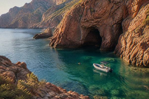
Scandola Nature Reserve
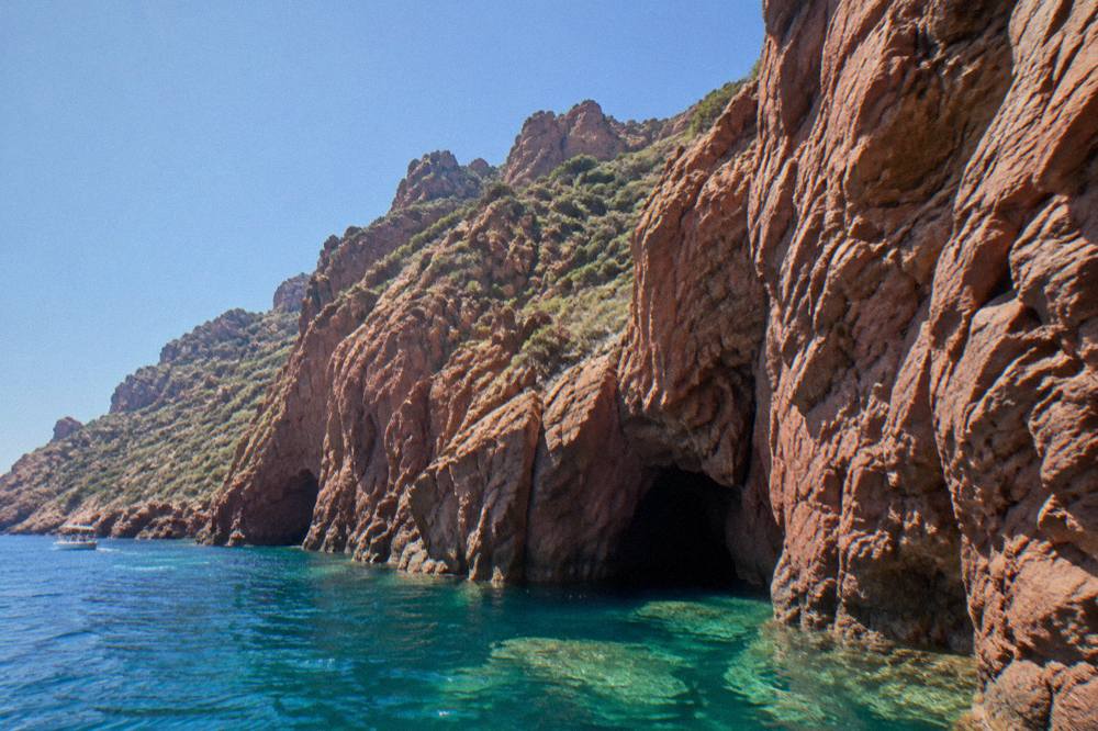
The Scandola Nature Reserve protects a stretch of red cliffs and sea on Corsica's west coast, inside the UNESCO-listed Gulf of Porto. Access is by boat only, and the rules are strict.
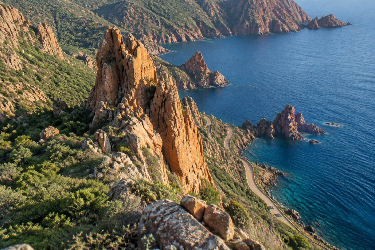
The Scandola Nature Reserve is a Corsican nature reserve created by ministerial order on 9 December 1975, covering 919 ha of land and 1,000 ha of sea. It sits inside the UNESCO World Heritage property inscribed in 1983, and visits are by boat only.
The Scandola Nature Reserve sits on the west coast of Corsica, the French Mediterranean island, where red volcanic cliffs drop into a protected stretch of the Golfe de Porto. It was the first nature reserve created on the island, by ministerial order of 9 December 1975, and it now sits inside a UNESCO World Heritage property inscribed in 1983. The reserve is managed by the Parc naturel régional de Corse, the park authority created in 1972, and its land area is closed to the public: the only way in is by sea. This page gathers what the official record states about the reserve, how boat access works, and what else sits close enough to combine on the same stretch of coast.
What Is The Scandola Nature Reserve In Corsica?
The Scandola Nature Reserve is a protected land and sea area on Corsica's west coast, created by ministerial order on 9 December 1975 as the first nature reserve on the island. It covers 919 hectares of land and 1,000 hectares of sea, including a 70 hectare integral reserve, in the commune of Osani, and it is managed by the Parc naturel régional de Corse. The Office de l'Environnement de la Corse (OEC) fact sheet gives those figures, along with a terrain that runs from 100 m depth at sea to 540 m altitude on land.
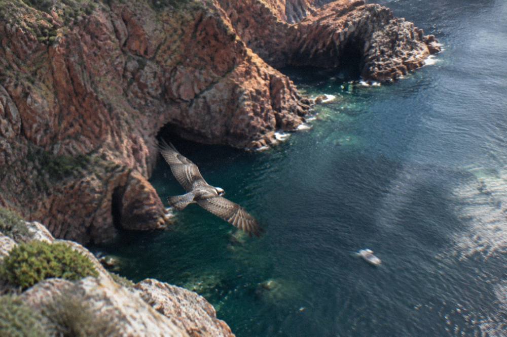
The reserve was key to saving the osprey, the balbuzard pêcheur, in Corsica, according to the same OEC page. That single conservation result explains a lot of the access rules that follow: quiet zones for nesting birds, restrictions on landing, and speed limits on the water. The osprey quiet zones were renewed in the April 2026 joint State and OEC steering measures.
Scandola is not a standalone protection. It forms part of a much larger listed property together with its neighbours, which is why a visit almost always pairs with the Calanques de Piana and the Gulf of Girolata on the same boat run. For the wider picture of that coast, see the Golfe de Porto overview.
The park authority's management role covers both the marine zone and the cliffs above it, and the OEC, the Office de l'Environnement de la Corse, handles scientific oversight and enforcement at sea.
Why Is Scandola A UNESCO World Heritage Site?
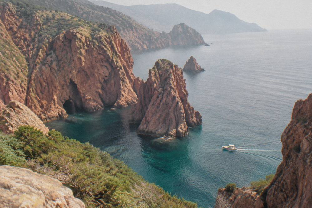
Scandola is one part of the UNESCO World Heritage property "Gulf of Porto: Calanche of Piana, Gulf of Girolata, Scandola Reserve", inscribed in 1983 as property 258 under natural criteria (vii), (viii) and (x), covering a total of 11,800 hectares of coast and sea on Corsica's west side. The UNESCO listing recognises the whole Gulf of Porto stretch of coast, not the reserve alone, and that distinction matters when reading tour descriptions: a "UNESCO cruise" typically covers Piana's Calanche, Girolata and Scandola in one loop.
The three natural criteria attached to the inscription each say something different about what is being protected. Criterion (vii) covers outstanding natural beauty, criterion (viii) covers geological values, and criterion (x) covers biodiversity and habitat for threatened species. The osprey story sits under the last of these, and the red granite rock of the Calanche of Piana under the second. A boat through the property passes, in effect, through all three justifications at once.
The table below separates the reserve from the wider listed property, using the figures each official source attaches to each.
| Protection | Year | Size | Managing or listing body |
|---|---|---|---|
| Scandola Nature Reserve | 1975 (order of 9 Dec) | 919 ha land, 1,000 ha sea, 70 ha integral reserve | Parc naturel régional de Corse |
| UNESCO property 258 | 1983 | 11,800 ha | UNESCO, natural criteria (vii)(viii)(x) |
| Parc naturel régional de Corse | 1972 | 4,484 km2 | PNRC |
The park's western sea front runs 80 km from Capu Rossu to Capu Cavallu, which places Scandola inside a much longer protected coastline. The Calanques de Piana and the hamlet of Girolata are the two neighbours named in the UNESCO property title itself, and both appear on most boat itineraries from Porto.
How Do You Visit The Scandola Nature Reserve From Corsica?
Visits to Scandola are by boat only: the reserve's land area is closed to the public, and landing is not permitted in the integral reserve, according to the access rules published by the Office de l'Environnement de la Corse. Daytime anchoring is allowed outside the integral reserve and the Goulet de Gargalu, with anchors lifted at sunset, and recreational line fishing and spearfishing are prohibited. There is no walk-in entrance, no visitor centre on the cliffs and no road to the shoreline inside the reserve.
Boat tours run out of several bases along the west coast. From Ajaccio and Porticcio, full-day guided cruises cover the crossing and the reserve in one outing; from Porto, Ota and Cargèse, shorter loops concentrate on Scandola, the Calanques de Piana and a stop at Girolata. The Scandola and Girolata boat trip page lays out the Porto-base day in detail, and the wider Scandola boat tour guide compares the main formats.
The flagship option from the island's capital is the guided reserve cruise: Check availability for the Ajaccio and Porticcio departure.
Where Do Scandola Boat Tours Depart From?
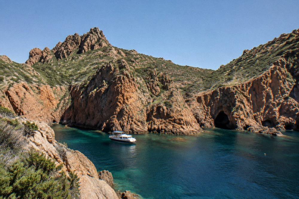
Scandola boat tours depart from five main areas on Corsica's west coast: Ajaccio and Porticcio in the south, Porto and nearby Ota at the closest point, Cargèse and Sagone between the two, and Calvi in the north, and the departure port sets both the length of the day and which other sights the route covers.
| Departure area | Typical route focus | Tour formats |
|---|---|---|
| Ajaccio / Porticcio | Full-day crossing, Scandola, return | Guided boat tour, semi-rigid day trip |
| Golfe de Porto / Ota | Scandola, Calanche de Piana, Girolata stop | Half-day cruise, eco-friendly boat, swimming-stop cruise |
| Cargèse / Sagone | Scandola, Girolata stop, Piana | Afternoon cruise, small-group cruise, 6-hour cruise |
| Calvi | Long run south to Scandola | 4-hour boat tour |
The choice of base usually follows where the rest of the trip is anchored. A stay in the Balagne, around Calvi and L'Île-Rousse, puts the reserve at the far end of a long day at sea. A stay in Porto or Ota puts it on the doorstep, with the shortest loops and the most chances to add a swim stop or a Girolata landing in the same outing. A stay in Ajaccio or Porticcio turns the reserve into the centrepiece of a full day that otherwise spends its hours on the water getting there and back.
The Porto-base half-day cruise is the closest-to-reserve product, pairing the reserve with the Calanche de Piana and an audio guide on board.
From the southern capital, the aperitif format covers a different stretch of water entirely, the Îles Sanguinaires off Ajaccio, and works as a lighter sea day before or after a long Scandola outing.
What Rules Apply On The Water Inside Scandola?
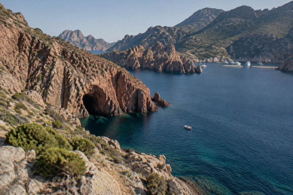
The published rules for Scandola state that only the marine part is open, that no landing is permitted on the shores of the 70 hectare integral reserve, that anchoring is authorised in daytime outside the integral reserve and the Goulet de Gargalu with anchors lifted at sunset, and that recreational line fishing and spearfishing are prohibited. Apnea diving is allowed but regulated, with commercial apnea prohibited, and boat traffic is subject to speed limits and navigation rules on approach.
Divers and swimmers are told to avoid the posidonia seagrass beds, which are part of what the natural criteria of the UNESCO listing recognise. For kayakers and private boaters the same landing bans apply as to tour vessels: the reserve's land section is closed to everyone, and the only hamlet inside the wider gulf area, Girolata, is reached by sea or on foot rather than through the reserve itself.
In April 2026 the State and the OEC confirmed a joint roadmap at a steering committee on 28 April, following a management agreement renewed on 27 February 2026. The confirmed measures are voluntary labelling of boat operators, a QR-code tracking trial for pleasure boats, more controls at sea, and renewed osprey quiet zones. Boat quotas and licences are to be consolidated in a regulatory framework that is being finalised, and no date has been given for it.
The direction of travel is clear even where the timeline is not. Labelling lets passengers see which operators have signed up to the code of conduct; the QR-code trial gives the authorities a count of pleasure-boat movements; quiet zones put parts of the coast off limits during the osprey breeding period. None of this changes what a visitor sees from a tour boat, but it changes who may run one and how many hulls share the water.
What Is The Weather Like Around Scandola?
The Météo-France 1991-2020 climate normals for Ajaccio show a hot, dry summer and a mild, wet winter: July averages 8.6 mm of rain and a 28.6 °C mean daily high, while November carries 111.8 mm of rain and August has the highest mean daily high at 29.2 C. Boat trips to Scandola run through the warmer half of the year, and the sea state, not the air temperature, is what operators watch when deciding whether a crossing runs.
| Month | Mean daily high (°C) | Mean daily low (°C) | Rain (mm) | Sunshine (h/day) |
|---|---|---|---|---|
| May | 22.1 | 11.8 | 49.8 | 9.3 |
| Jun | 25.9 | 15.4 | 25.9 | 11.1 |
| Jul | 28.6 | 17.7 | 8.6 | 12.1 |
| Aug | 29.2 | 18.1 | 15.8 | 11.1 |
| Sep | 26.1 | 15.4 | 57.8 | 8.7 |
| Oct | 22.8 | 12.6 | 85.7 | 6.7 |
These are station normals for Ajaccio, Campo dell'Oro, the nearest long-record station to the reserve on the south side, and mountain weather on the coast road west of Porto can differ from them. October and November carry the heaviest rain of the year at both Ajaccio and Bastia, and sea conditions on the exposed west coast respond quickly to autumn systems. The month-by-month picture is laid out in the site's Corsica weather guide, and the broader planning question is covered under what is the best month to visit Corsica.
What Else Can You Combine With Scandola On The Same Coast?
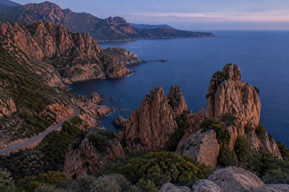
The three sights named in the UNESCO property, the Calanche of Piana, the Gulf of Girolata and the Scandola Reserve, sit next to each other on the same stretch of coast, so a single boat loop from Porto covers all three, and the D81 coast road links Porto and Piana for a land-based half of the day. Inforoutes Corse publishes live road conditions and accessibility levels for the main cols and coast roads, which is the standing reference to check before driving the Piana section.
| Sight | What the official record states | Covered on this site |
|---|---|---|
| Calanques de Piana | Named in the UNESCO property title, red rock coast | Calanques de Piana guide |
| Girolata | Named in the UNESCO property title, sea-access hamlet | Girolata guide |
| Golfe de Porto | The listed property's anchor point | Golfe de Porto guide |
| Is Scandola worth the day? | The site's answer page | Is Scandola worth it? |
Further afield, the same west coast logic extends south to the Îles Sanguinaires off Ajaccio and north to the Désert des Agriates beaches such as Saleccia and Lotu, while the inland counterweight to a sea day is the Restonica valley above Corte. Visitors pairing the reserve with the island's heritage sights can also manage the Citadelle de Corte on a cross-island route, where one ticket covers the museum and the citadel.
A two-day pattern works well on paper for this coast. Day one stays on the water: the boat loop from Porto through Scandola, Piana and Girolata. Day two stays on the road: the D81 between Porto and Piana on one side, with the Inforoutes map checked first, and the stretch down toward Cargèse on the other. South of Cargèse the coast turns toward Sagone and Ajaccio, and north of Porto the road climbs toward the Calvi coast, so the reserve sits at the hinge of two very different drives.
What Safety And Practical Rules Should You Know For A Corsica Boat Day?
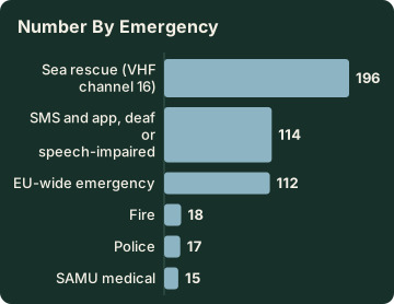
The standing safety facts for a Corsica sea day are these: the fire rule bans fires and smoking in forests, maquis and massifs from 15 June to 30 September, the UK FCDO notes a high wildfire risk in France from April to October, and the emergency numbers are 112, 15 for medical, 17 for police, 18 for fire, 114 by SMS and 196 for sea rescue on VHF channel 16. Mountain rescue is reached through PGHM Ajaccio on 04 95 24 24 00, with 17 or 112 in an emergency.
| Emergency | Number |
|---|---|
| EU-wide emergency | 112 |
| SAMU medical | 15 |
| Police | 17 |
| Fire | 18 |
| SMS and app, deaf or speech-impaired | 114 |
| Sea rescue (VHF channel 16) | 196 |
| PGHM Ajaccio mountain rescue | 04 95 24 24 00 |
On the water, the reserve's own rules cover most of the risk: stay with the vessel, respect the integral reserve boundaries, and follow the crew's instructions on anchoring and swimming stops. On land, the fire-risk map is updated at 18:00 for the next day, and from mid-June to mid-September access to some massifs can be restricted, which matters for anyone combining a boat day with a hike such as the coastal path into Girolata. The site's wider Corsica Travel Guide collects the full practical picture, including airport and ferry access for reaching the west coast in the first place.
Is The Scandola Nature Reserve Worth The Trip?
The case for Scandola rests on three verifiable points: it is the first nature reserve created in Corsica, it sits inside a UNESCO natural World Heritage property inscribed in 1983, and it played a decisive role in saving the osprey on the island, all stated by the Office de l'Environnement de la Corse and the UNESCO listing. Against that stands the access constraint, which is boat-only travel along a coast with no road, no landing in the core zone and rules that limit what a visit can physically include.
The value question therefore turns on the format. A Porto-base loop keeps the day short and adds the Calanche of Piana and Girolata; an Ajaccio departure makes the reserve the centrepiece of a full island day; a Calvi departure suits a Balagne-based stay. Whichever fits, the reserve itself is seen from the water, and the April 2026 measures on labelled operators and tracked pleasure boats point toward tighter management of exactly that traffic in the seasons ahead.
Common Questions About The Scandola Nature Reserve In Corsica
Can You Land At The Scandola Nature Reserve?
No. The reserve's land area is closed to the public and visits are by boat only, and landing is not permitted in the integral reserve, according to the access rules published by the Office de l'Environnement de la Corse.
Is Scandola Part Of UNESCO?
Yes. Scandola is one of three named parts of the World Heritage property "Gulf of Porto: Calanche of Piana, Gulf of Girolata, Scandola Reserve", inscribed in 1983 as property 258 under natural criteria (vii), (viii) and (x), covering 11,800 ha.
What Is The Best Port To Leave From For Scandola?
Porto is the closest base, with short loops that add the Calanques de Piana and a Girolata stop. Ajaccio and Porticcio run full-day crossings, Cargèse and Sagone sit between the two, and Calvi offers a longer run south.
Are There Visitor Quotas At Scandola?
Quotas, licences and flow controls are to be consolidated in a regulatory framework that is being finalised, and no year has been announced for it. The confirmed April 2026 measures are voluntary operator labelling, a QR-code tracking trial for pleasure boats, more controls at sea and renewed osprey quiet zones.
Can You Fish Or Dive In The Reserve?
Recreational line fishing and spearfishing are prohibited. Apnea diving is allowed but regulated, with commercial apnea prohibited, and anchoring is authorised in daytime outside the integral reserve and the Goulet de Gargalu, with anchors lifted at sunset.
Who Manages The Scandola Nature Reserve?
The Parc naturel régional de Corse, the regional park created in 1972, manages the reserve in the commune of Osani. The reserve was key to saving the osprey in Corsica, and the quiet zones protecting the bird were renewed in April 2026.
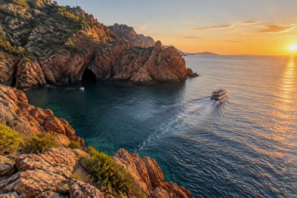
A Scandola day is, in the end, a simple equation: a protected coast that can only be seen from the water, a set of departure ports that shape the day, and rules that keep the reserve exactly as the 1975 order intended. Pick the base that matches the rest of the trip, book the boat, and let the cliffs answer the rest.