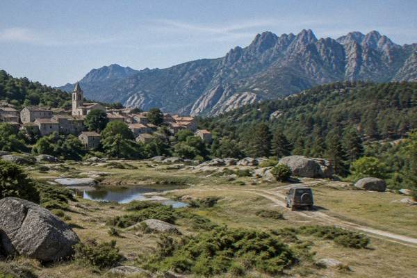
Zonza
Zonza sits in the Alta Rocca, the mountainous south of Corsica, between Porto-Vecchio and the Aiguilles de Bavella. This guide covers what the area holds, how access rules work, what the climate data shows and which day trips fit.
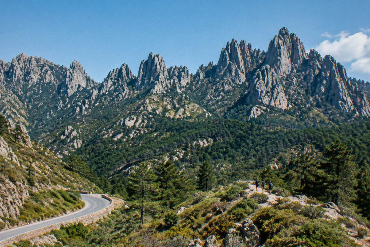
Zonza is a commune in the Alta Rocca region of southern Corsica, the inland mountain country behind Porto-Vecchio and Bonifacio. The area's landmarks are the Aiguilles de Bavella, the Ospedale forest and the Cuscionu plateau, all inside the Parc naturel régional de Corse.
Zonza is a commune in the Alta Rocca, the mountainous interior of southern Corsica, the French Mediterranean island of 8,722 km2 with more than 1,000 km of coastline and a spine of high summits that includes Monte Cinto at 2,706 m. The town itself sits inland, but it belongs to a landscape that runs downhill to the sea: the granitic massifs of the south rise between the beach towns of Porto-Vecchio and the cliffs of Bonifacio, and the whole sector falls within the Parc naturel régional de Corse, the regional park created in 1972 that today covers 4,484 km2 of the island. The Corsica Travel Guide has assembled this page from what the park authority, the weather service and the tour operators themselves publish, because the Alta Rocca is the part of southern Corsica where the coast gives way to needle-sharp ridges, chestnut and pine forests, and high granite plateaus.
Where Is Zonza And The Alta Rocca In Corsica?
Zonza is a commune in the Alta Rocca, the inland mountain region of southern Corsica, sitting behind the coastal strip that runs from Porto-Vecchio to Bonifacio. The area lies entirely inside the Parc naturel régional de Corse, the regional natural park created in 1972, which now protects 4,484 km2 of the island, and its terrain is granitic and high rather than coastal.
Corsica divides into two departments, Corse-du-Sud and Haute-Corse, governed together by the Collectivité de Corse since 1 January 2018. The Alta Rocca is the far south of Corse-du-Sud: a country of forested ridges and bare plateaus rather than beaches. It is the inland counterpart to the southern Corsican coast, and its anchor landmarks, the Aiguilles de Bavella and the plateaus above them, are a short drive up from Porto-Vecchio, the second-town-scale resort hub of the southeast.
The park the area belongs to is not a small enclosure. The Parc naturel régional de Corse, created in 1972, now covers 4,484 km2 including the Castagniccia and big valleys running to the sea, and its western sea front runs 80 km from Capu Rossu to Capu Cavallu. That single figure explains why the Alta Rocca matters to a park better known for its coastline: the southern massifs are the park's high ground, and the roads that reach them climb out of the resort towns quickly.
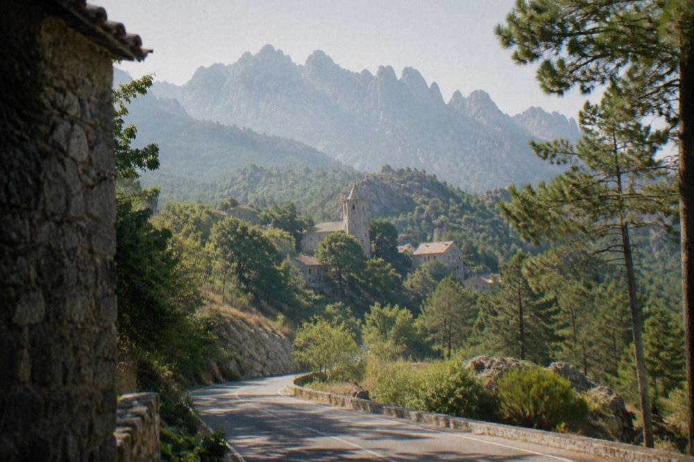
What Are The Aiguilles De Bavella Above Zonza?
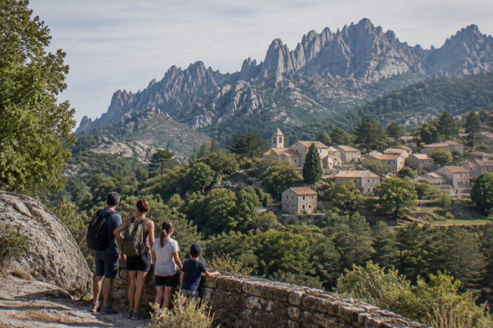
The Aiguilles de Bavella are a chain of jagged granite peaks in the southern Corsican mountains above the Zonza area, and they are the signature landmark of the Alta Rocca. They sit at the top of the climb from Porto-Vecchio toward the col, and the tours that serve the area list them alongside the Ospedale forest as the region's two headline sights.
The operators that run guided vehicles in this sector describe their routes as taking in the Ospedale forest and the Bavella needles together, which reflects the geography: the forest sits on the climb, the needles at the top. Tour listings for the area, reported here without endorsement, cover the sector from Porto-Vecchio as a single day of driving, and a second operator runs a plateau itinerary from the same base. Both are bookable products whose prices and durations are shown on their own listings.
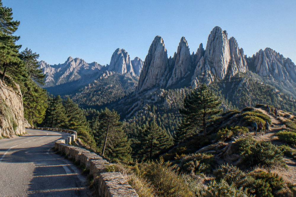
The standing advice for driving this high country comes from the island's road authority rather than from tour operators. Inforoutes Corse publishes live road conditions and accessibility levels for the main mountain passes, and theCorsican authorities publish a daily colour map of massif access, updated at 18:00 for the next day, because from mid-June to mid-September access to some massifs can be restricted on high fire-risk days. Checking the pass status before setting out from Zonza or Porto-Vecchio is the practical step.
What Can You Do Around Zonza And The Alta Rocca?
Around Zonza the activities divide into three groups: driving and 4x4 tours through the Ospedale forest to the Bavella needles, guided trips onto the Cuscionu and Coscione plateaus, and day trips down to the southern coast at Porto-Vecchio and Bonifacio. Every one of the guided products is based in Porto-Vecchio, from which the massif is reached by road.
Two 4x4 tours operate from Porto-Vecchio into this exact country: one covering the Ospedale forest and the Bavella needles, and one covering the Cuscionu plateau and the wider Alta Rocca. A guided electric mountain bike ride on the Plateau du Coscione also runs from Porto-Vecchio. None of these figures belong in prose, since each product's price and duration renders on its own card.
| Tour | Base | What It Covers |
|---|---|---|
| Ospedale Forest & Bavella 4x4 | Porto-Vecchio | The Ospedale forest and the Bavella needles |
| Cuscionu Plateau & Alta Rocca 4x4 | Porto-Vecchio | The Cuscionu plateau and the Alta Rocca |
| E-MTB Ride, Coscione Plateau | Porto-Vecchio | A guided electric mountain bike ride on the Plateau du Coscione |
Beyond the guided products, the area's draw is self-directed: mountain roads, forest tracks and trailheads. The trail network of the wider park is documented by the PNRC, and its long routes pass through the southern mountains, a subject covered in the hiking section below. For a grounded sense of how this island region fits together, the Corsica regions overview sets the Alta Rocca beside the coast and the Corte interior, the island's other high country.
Families with a naturalist streak have one further option that pairs with a southern loop. The A Cupulatta turtle park, a skip-the-line admission product sold in the Sagone area on the west coast, is listed as a day trip rather than a city activity, and its ticket carries the same free-cancellation terms as the other bookable products on this site. For visitors staying in the Alta Rocca who want a slow day between mountain drives, Check availability before committing to the drive west.
Is The Ospedale Forest Worth A Stop On The Way To Zonza?
The Ospedale forest is one of the two named sights on the standard guided itinerary of the southern massif, listed by operators alongside the Bavella needles, and it sits on the road climb between Porto-Vecchio and the high country. Tour listings present it as a destination in its own right rather than a drive-past, which is the strongest published signal of its standing.
The published record for the forest is, frankly, thin: the park authority's documents describe the regional park's extent and its forests in general terms, and the tour operators supply the specific pairing of Ospedale with Bavella. The structure of the visit is as follows. The forest and the needles are sold together on a single day tour from Porto-Vecchio, in a small group, by 4x4 vehicle, and the product carries the operator's own rating and review history on its card.
For independent travellers, the same country is reachable by ordinary car up the mountain road from Porto-Vecchio, subject to the live pass and massif access conditions published by Inforoutes Corse. The practical rule that governs any stop in the forests of the south is the fire rule, treated in full below: from 15 June to 30 September it is forbidden to light a fire or smoke in forests, maquis and massifs, and that rule applies to a picnic in the Ospedale pines exactly as it does to a summit ridge.
When Is The Best Time To Visit Zonza And The Alta Rocca?
The Météo-France climate normals for Ajaccio, the reference station for southern Corsica, show a hot dry summer and a mild wet winter, with July averaging 8.6 mm of rain and August averaging a mean daily high of 29.2 °C, while November carries 111.8 mm of rain. Snow in Corsica falls on the high mountains, and the southern massifs qualify.
The data supports several different answers on the best month, depending on the activity. The monthly figures below are the 1991-2020 station normals for Ajaccio, published by Météo-France, and they are the correct baseline for planning a trip to the southern interior.
| Month | Mean Daily High °C | Mean Daily Low °C | Rain mm | Sunshine h/day |
|---|---|---|---|---|
| Jan | 14.0 | 4.7 | 54.1 | 4.4 |
| Feb | 14.2 | 4.3 | 48.1 | 5.5 |
| Mar | 16.0 | 5.9 | 50.4 | 6.8 |
| Apr | 18.5 | 8.3 | 53.1 | 7.7 |
| May | 22.1 | 11.8 | 49.8 | 9.3 |
| Jun | 25.9 | 15.4 | 25.9 | 11.1 |
| Jul | 28.6 | 17.7 | 8.6 | 12.1 |
| Aug | 29.2 | 18.1 | 15.8 | 11.1 |
| Sep | 26.1 | 15.4 | 57.8 | 8.7 |
| Oct | 22.8 | 12.6 | 85.7 | 6.7 |
| Nov | 18.3 | 9.0 | 111.8 | 4.7 |
| Dec | 15.1 | 5.8 | 73.9 | 4.0 |
Two planning consequences follow from the table. First, the summer months combine the highest temperatures with the lowest rainfall, and also with the fire-season access rules: the same July that averages 8.6 mm of rain is inside the 15 June to 30 September window in which fires and smoking are banned in forests, maquis and massifs. Second, October and November carry the most rain, 85.7 mm and 111.8 mm respectively at Ajaccio, which matters for mountain roads and for any walking plans on the high plateaus.
What Are The Access And Fire Rules In The Mountains Around Zonza?
From 15 June to 30 September it is forbidden to light a fire or smoke in forests, maquis and massifs across Corsica, and a daily colour map of massif access is published, updated at 18:00 for the next day, with some massifs closed entirely on the highest-risk days. These rules are stated by the Parc naturel régional de Corse and apply across the Alta Rocca.
The fire-risk system is the single most consequential rule set for this region, and it is deterministic rather than advisory. Access, circulation and parking can be regulated or banned on trails and tracks in affected zones by prefectoral order. The relevant emergency numbers are also fixed and worth carrying in the mountains: 112 as the European emergency number, 15 for medical, 17 for police, 18 for fire, 114 by SMS or app, and 196 for sea rescue, with the PGHM mountain rescue base at Ajaccio reachable on 04 95 24 24 00 outside an emergency call.
| Rule | Period Or Detail | Applies To |
|---|---|---|
| No fires, no smoking in forests, maquis and massifs | 15 June to 30 September | All of Corsica, including the Alta Rocca |
| Daily massif access colour map | Updated at 18:00 for the next day | Mid-June to mid-September restriction window |
| Some massifs closed fully on the highest-risk days | By prefectoral order | Trails, tracks and parking in affected zones |
| Wild camping | Banned across Corsica | Bivouac only in marked areas at refuges |
Wild camping is banned across the island, with bivouac tolerated only in designated areas near the park authority's refuges, and those refuge pitches must be reserved online. That rule matters less on a day visit to the Bavella col than on a long-distance walk, but it closes off the idea of a free night on the Cuscionu plateau.
What Walking Routes Pass Through The Southern Mountains Near Zonza?
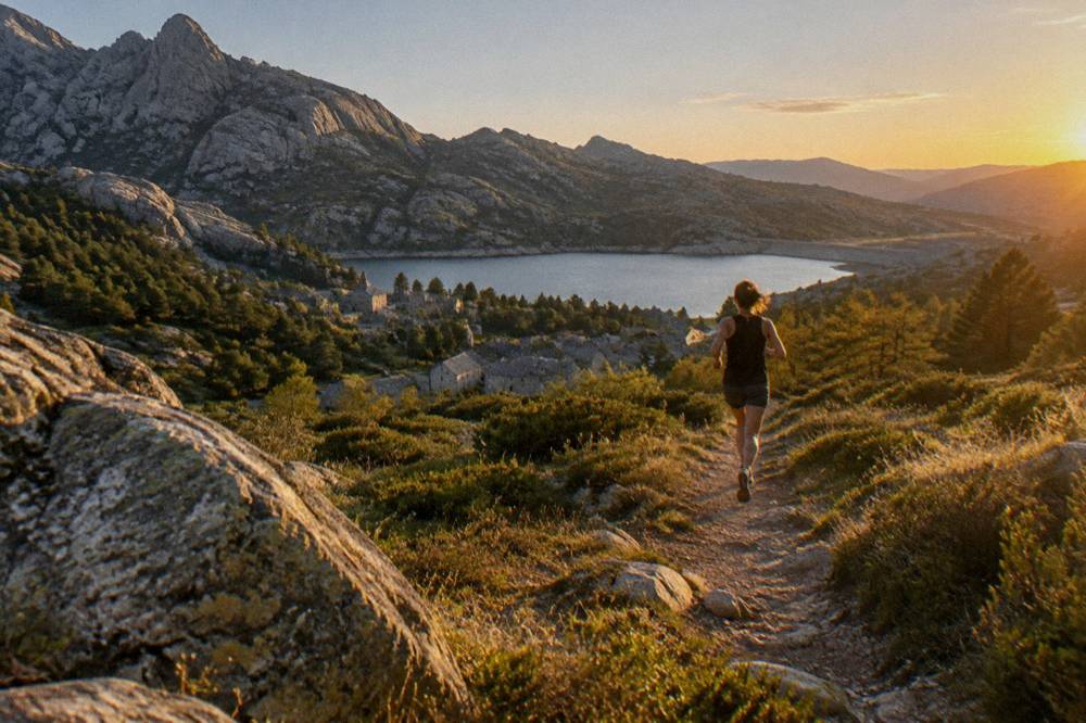
The PNRC documents a family of long walking routes across Corsica, led by the GR20 at 180 km with about fifteen stages of 4 to 8.5 hours, and by the Mare a Mare and Mare e Monti trails, of which the southern pair end at Propriano: Mare a Mare Sud at 73 km and Mare e Monti Sud at 66 km. The southern routes cross the high country behind the coast.
The southern trails are the ones that touch this region's world: Mare a Mare Sud runs 73 km over five days with 3,200 m of climbing and ends in Propriano, the small port in the Sartène and Valinco area, while Mare e Monti Sud covers 66 km over five days with 2,700 m of climbing to the same finish. For anyone weighing the Alta Rocca against the island's other walking country, the full route set is set out below.
| Route | Length | Days | Total Climb |
|---|---|---|---|
| GR20 (Fra li Monti) | 180 km | About 15 stages of 4 to 8.5 h | Not published in the primary sources |
| Mare e Monti Nord | 121 km | 10 | 6,100 m |
| Mare a Mare Nord | 139 km (161 km with the variant) | 8 to 12 | 5,900 m |
| Mare a Mare Centre | 84 km | 6 to 7 | 3,900 m |
| Mare a Mare Sud | 73 km | 5 | 3,200 m |
| Mare e Monti Sud | 66 km | 5 | 2,700 m |
For the 2026 season the PNRC's refuges were guarded from 16 May to 4 October inclusive, and booking a night, whether a bunk at EUR 20 per person, a bivouac pitch for your own tent at EUR 12, or a rented tent at EUR 27 for one person or EUR 39 for two, is mandatory and online only. Dogs are not allowed inside refuges or rented tents, and there are no GR20 departures from Calenzana after 11:00 under a municipal fire-risk order. These figures are the park authority's own published rates.
Which Day Trips Combine Well With Zonza And The Alta Rocca?
The natural day-trip pairings from the Alta Rocca run downhill to the coast: Porto-Vecchio for the old town and beaches, Bonifacio for the citadel cliffs and the Lavezzi islands, and the west coast for the Scandola reserve, with guided tours serving the latter by boat from ports on the Golfe de Porto. Road times published by the Corte museum give a framework for the island's distances.
The practical geography favours the southeast. Porto-Vecchio is the base the area's own tours depart from, and Bonifacio lies beyond it; the road-times table published by the Musée de la Corse lists Corte at 2 hours from Porto-Vecchio and 2 h 45 from Bonifacio, which conveys the scale of the island's southern half. From the Alta Rocca, the coast is the close option and the far northwest the long one.
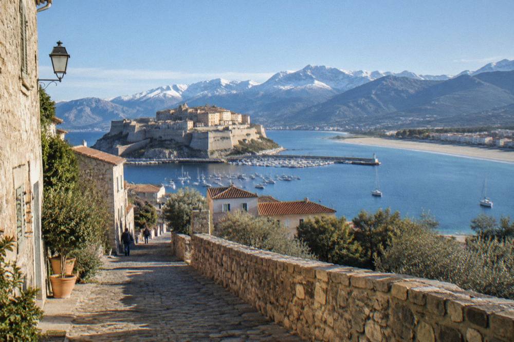
Boat trips are the strongest coastal pairing. A Scandola boat tour covers the UNESCO-inscribed Gulf of Porto, and a Bonifacio boat tour reaches the cliffs and the Lavezzi islands from the marina below the old town. Neither is an Alta Rocca product, but both fit a southern itinerary that starts in the mountains and ends on the water, and the sea is never more than a valley away on this island.
For a second mountain day, the Cuscionu plateau itinerary above covers the high ground, and the guided electric mountain bike ride on the Plateau du Coscione offers the same country at a different pace, both from Porto-Vecchio. The beach alternative, Palombaggia, sits on the coast road south of Porto-Vecchio and pairs with a morning in the massif.
Common Questions About Zonza And The Alta Rocca
Where Is Zonza In Corsica?
Zonza is a commune in the Alta Rocca, the inland mountain region of southern Corsica, behind the coastal strip between Porto-Vecchio and Bonifacio. The whole area lies inside the Parc naturel régional de Corse, created in 1972, which now covers 4,484 km2 of the island.
What Are The Aiguilles De Bavella?
The Aiguilles de Bavella are a chain of jagged granite peaks above the Zonza area, listed by the region's tour operators as one of the two headline sights of the southern massif together with the Ospedale forest. Guided 4x4 tours from Porto-Vecchio cover both in a single day.
Can You Camp Wild Around Zonza?
No. Wild camping is banned across Corsica, including on the GR20 and inside the regional park, and bivouac is tolerated only in designated areas near the PNRC's refuges, which must be reserved online in advance.
Are The Mountain Roads Around Zonza Affected By Fire Rules?
Yes. From 15 June to 30 September it is forbidden to light a fire or smoke in forests, maquis and massifs, and a daily colour map of massif access is published at 18:00 for the next day. On the highest-risk days some massifs can be closed entirely by prefectoral order, so check the published status before setting out.
What Is The Weather Like In The Alta Rocca?
The Météo-France 1991-2020 normals for Ajaccio show a hot dry summer and a mild wet winter: July averages 8.6 mm of rain, August a mean daily high of 29.2 °C, and November 111.8 mm of rain. Snow falls on the high mountains, and the southern massifs are high ground.
Which Tours Run To The Alta Rocca?
Two guided 4x4 tours run from Porto-Vecchio, one covering the Ospedale forest and the Bavella needles and one covering the Cuscionu plateau and the Alta Rocca, and a guided electric mountain bike ride on the Plateau du Coscione runs from the same base. Prices and durations are shown on each product's card.
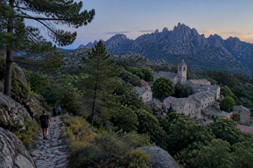
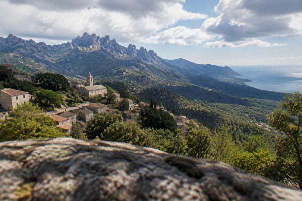
The Alta Rocca rewards careful planning: a base in or near Zonza or Porto-Vecchio, a check of the massif access map before any high driving or walking, respect for the 15 June to 30 September fire rules, and a mix of mountain days and coastal ones. The peaks, the forest and the plateaus sit within an hour of some of the finest boat trips in the western Mediterranean, and the combination of granite and sea is what makes this corner of southern Corsica distinct.