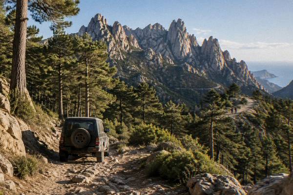
Bavella
The Aiguilles de Bavella are a chain of sharp granite peaks above the Col de Bavella in southern Corsica, the interior's most dramatic skyline within reach of both Porto-Vecchio and Ajaccio.
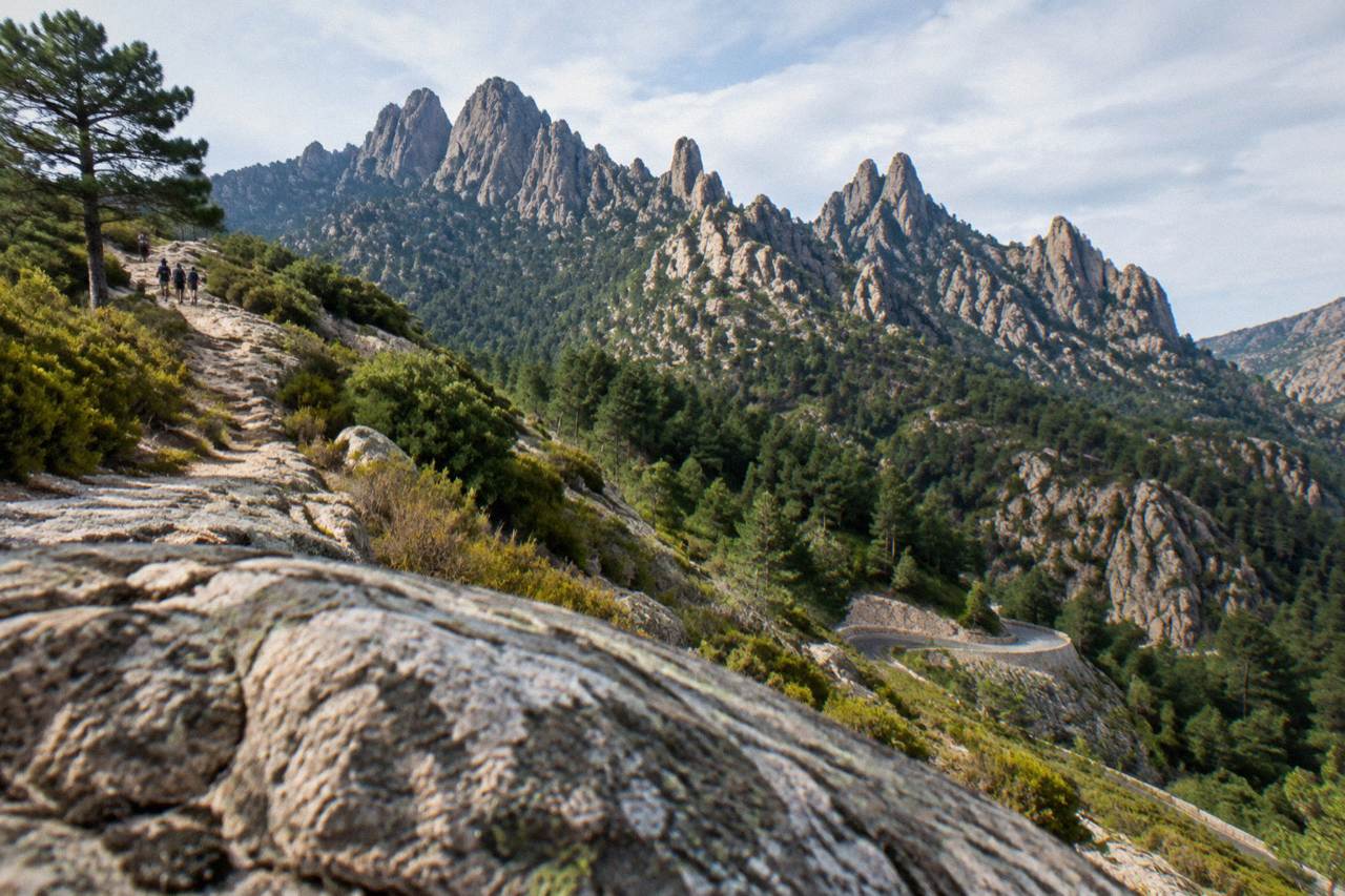
The Aiguilles de Bavella are jagged granite peaks above the Col de Bavella in southern Corsica, about 43 km as the crow flies from Ajaccio, reached by mountain road and best known for walking trails, the GR20's southern stages and forested slopes inside the Parc naturel régional de Corse.
The Aiguilles de Bavella are a chain of sharp granite peaks standing above the Col de Bavella in southern Corsica, the French Mediterranean island's most theatrical inland skyline. They sit well inside the mountainous interior: Corsica covers 8,722 km2, its highest summit is Monte Cinto at 2,706 m, and the needles belong to the same granite high country, roughly 43 km as the crow flies from Ajaccio and close to the towns of Porto-Vecchio and Sartène by road. The massif falls within the Parc naturel régional de Corse, the regional park created in 1972 that now spans 4,484 km2 and reaches down to the sea on the west coast. This page from the Corsica Travel Guide sets out what the needles are, how to reach them, what the walking involves, and the rules that matter in fire season.
Where Are The Aiguilles De Bavella In Corsica?
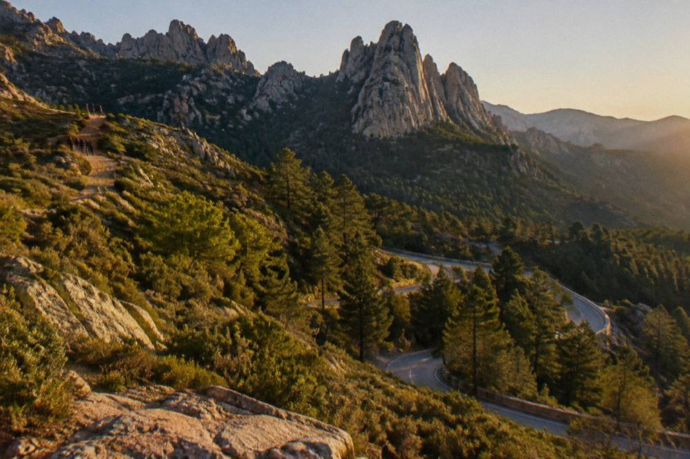
The Aiguilles de Bavella stand above the Col de Bavella in the far south of Corsica's mountainous interior, about 43 km as the crow flies from Ajaccio and roughly 58 km from Porto-Vecchio in the same straight-line measure, inside the Parc naturel régional de Corse. The massif is inland: the nearest coast lies at Porto-Vecchio to the east and the beaches of the far south beyond it. Mountain roads, not motorways, connect the col to the coast.
The needles form part of the southern granite chain that runs down Corsica's spine towards Sartène and Bonifacio. The regional park that contains them was created in 1972 and covers 4,484 km2, including the Castagniccia and the big valleys that run to the sea, with a western sea front of 80 km from Capu Rossu to Capu Cavallu. Bavella is at the opposite end of that story: forest, rock and high passes, with the island's more than 1,000 km of coastline a drive away down the mountain roads.
Distances here are straight-line figures, not driving times. Corsican mountain roads are slow and winding, and no straight-line number converts into hours. For live conditions on the passes and the RD 268, Inforoutes Corse publishes real-time road status and accessibility levels for the main cols, and it is the standing reference to check before any mountain drive.
| Bavella fact | Figure |
|---|---|
| Region | Southern interior, Parc naturel régional de Corse |
| Distance from Ajaccio | about 43 km as the crow flies |
| Distance from Porto-Vecchio | about 58 km as the crow flies |
| Distance from Sartène | about 39 km as the crow flies |
| Park creation | 1972 |
| Park area | 4,484 km2 |
| Main road at the col | RD 268 |
A day trip is the natural way to see the needles from the coast, and the site's Bavella day trip itinerary covers the practical sequence from Porto-Vecchio or Bonifacio. For the wider southern picture, the guide to things to do in Corsica places Bavella alongside the coast and the gorges.
What Are The Aiguilles De Bavella?
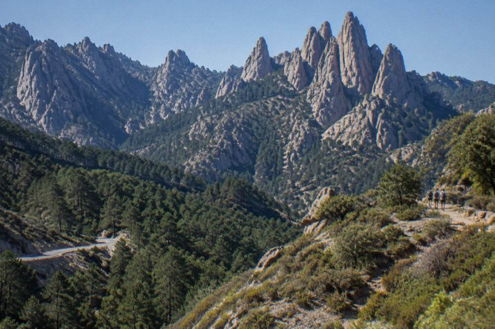
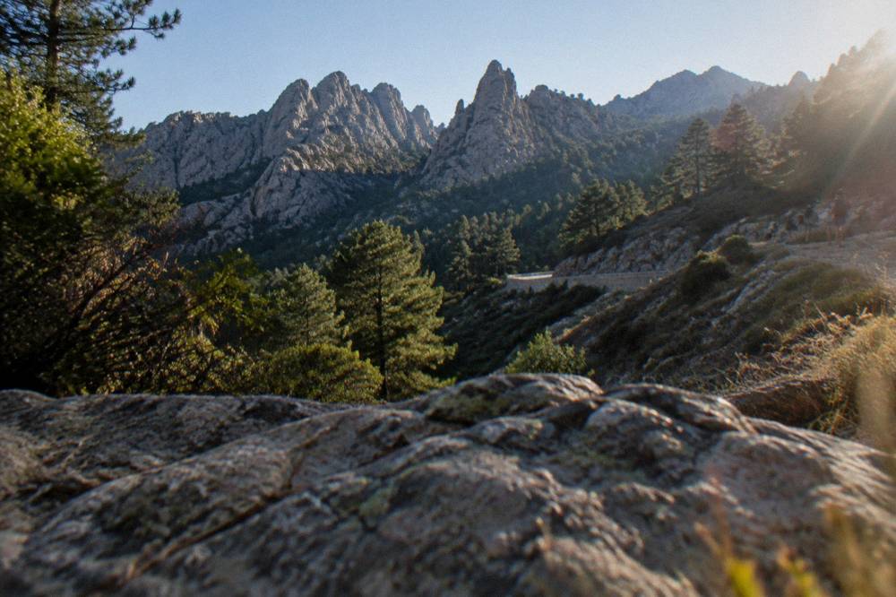
The Aiguilles de Bavella are a row of jagged granite peaks, the southern outpost of Corsica's high mountain chain, shaped into needles and towers above forested slopes near the Col de Bavella. They are a landscape of rock, pine and maquis rather than a single summit: the massif carries walking trails on its flanks and the GR20 on its high ground, and it lies wholly inside the regional park.
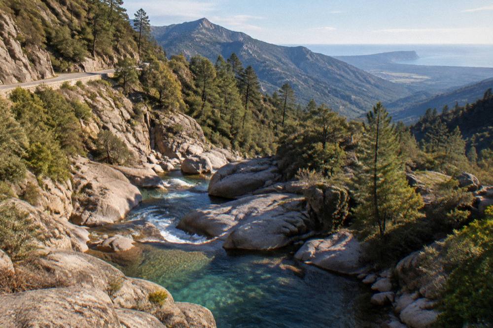
The granite story runs through southern Corsica. The needles belong to the same tortured rock country that produces the Calanques de Piana on the west coast, another UNESCO-listed granite landscape at Calanques de Piana, though Bavella's rocks stand inland above forest rather than above the sea. The contrast is the island's geography in miniature: more than 1,000 km of coastline wrapped around an interior that tops out at 2,706 m on Monte Cinto.
The forests around the col are part of the park's southern woodlands, continuous with the Ospedale forest that slopes down towards Porto-Vecchio. Walking here moves between granite, pine cover and open ground, with the needles visible from many angles along the trail network. The GR20, Corsica's famous 180 km north-south traverse, crosses this southern high country in its closing stages: the trail runs about 15 stages of 4 to 8.5 hours over the whole island, and Bavella sits on its southern half.
Descriptions of water colour, crowd levels or specific viewpoints beyond what the sources state are left out here. What the record does give is structure: peaks, forest, trails, a col crossed by the RD 268, and a massif managed within the park's rules, including the fire-season access regime described below.
How Do You Get To The Col De Bavella?
The Col de Bavella is reached by mountain road, most commonly the RD 268 from the east via Porto-Vecchio and the Ospedale forest, or from the west via Sartène and the interior roads, with no rail link and no straight-line shortcut, as Corsican mountain roads are slow. The needles stand at the col, so arriving at the pass is arriving at the sight.
There is no train to Bavella. The Chemins de fer de la Corse runs three lines, Ajaccio to Bastia via Corte, Ponte-Leccia to Calvi and the Balagne coastal line from Calvi to L'Île-Rousse, all of them far to the north and west of the massif. A visitor arriving by ferry at Porto-Vecchio, Ajaccio or Bonifacio, or by air at Figari Sud Corse, reaches Bavella by road only.
The road itself is the experience for many visitors. The RD 268 climbs through forest to the col, and Inforoutes Corse publishes live road conditions and accessibility levels for the principal cols, a standing service worth checking in winter and after storms. Passes in Corsica can close or carry restrictions, and the accessibility-level system exists precisely because conditions change. No opening dates for any pass are stated here.
| Approach | Direction | Notes |
|---|---|---|
| RD 268 via Porto-Vecchio and Ospedale | from the east | forest climb to the col |
| Interior roads via Sartène | from the west | about 39 km from Sartène as the crow flies |
| From Ajaccio | from the north-west | about 43 km as the crow flies, mountain roads throughout |
| From Bonifacio | from the south-east | about 69 km as the crow flies |
For travellers who would rather not drive the mountain roads themselves, a guided 4x4 day from Porto-Vecchio covers the Ospedale forest and the needles in one loop, with a guide who handles the road. The tour has its own page at Ospedale Forest and Bavella Needles 4x4 tour, and you can also Check availability.
What Walking Routes Start At Bavella?
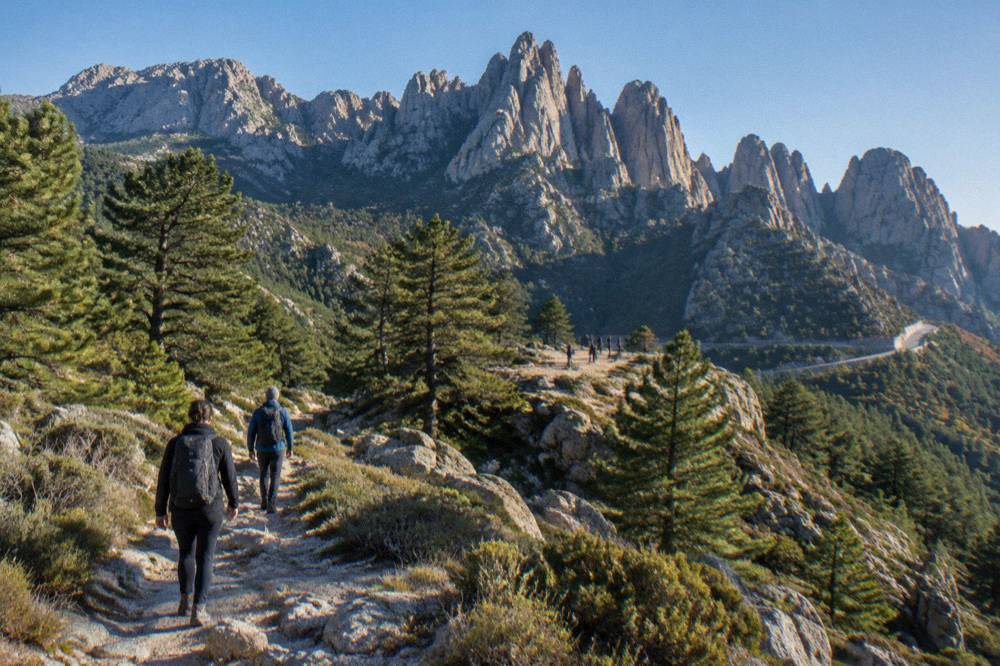
Walking at Bavella ranges from short forest loops around the col to serious stages of the GR20 across the high ground, with the long-distance Mare a Mare Sud and Mare e Monti Sud trails also crossing the southern interior: Mare a Mare Sud runs 73 km over 5 days to Propriano with 3,200 m of climbing, and Mare e Monti Sud runs 66 km over 5 days, also ending in Propriano, with 2,700 m of climbing. Trail choice decides everything at Bavella.
The GR20 is the headline route of the island's interior. It runs 180 km north to south in about 15 stages of 4 to 8.5 hours each, with refuges and gîtes along the way, and the southern stages cross the high country around and beyond Bavella before the trail descends towards Conca. Stage 1 at the other end of the island, Calenzana to Ortu di u Piobbu, takes about 6 h 30 out, a measure of what a GR20 day involves. Calenzana is the northern start, and no departure from Calenzana is allowed after 11:00 under a municipal order tied to fire risk.
The regional park's trail network gives gentler options. The Mare a Mare family crosses the island coast to coast, and the Mare e Monti routes run along the coast ranges; the full set of lengths is in the table below. Around the col itself, forest paths and short approaches to the needles fit a half day, though the park's materials do not itemise named short loops with times, so none is invented here.
| Trail | Length | Days | Total climbing | End point |
|---|---|---|---|---|
| GR20 (Fra li Monti) | 180 km | about 15 stages | not stated | Conca (south) |
| Mare a Mare Nord | 139 km (161 km with variant) | 8 to 12 | 5,900 m | west coast |
| Mare a Mare Centre | 84 km | 6 to 7 | 3,900 m | Porticcio or Tavera |
| Mare a Mare Sud | 73 km | 5 | 3,200 m | Propriano |
| Mare e Monti Nord | 121 km | 10 | 6,100 m | Cargèse |
| Mare e Monti Sud | 66 km | 5 | 2,700 m | Propriano |
The site's wider GR20 and hiking guide covers the refuge system and booking rules in detail, and the question of whether the GR20 is hard has its own answer page.
What Are The GR20 Refuge Rules And Prices?
Nights on the GR20 in the Parc naturel régional de Corse refuges must be booked online in advance, for a bunk, a bivouac pitch or a rented tent alike: a refuge bunk costs EUR 20 per person, a bivouac pitch with your own tent EUR 12, a rented tent for one person EUR 27 and a rented tent for two EUR 39, per person for the first two options and as stated for the tents. In 2026 the refuges were guarded from 16 May to 4 October inclusive.
Booking is exclusive to the park's online platform with card payment, and quotas apply per refuge. Changes are possible up to 48 hours before a stage, subject to availability, and the nature of the booking cannot be changed. A full refund is possible up to two months before. Meals at the refuges are paid on site in cash or by cheque to the guardian.
The tents deserve a note: every PNRC rental tent sleeps two and comes with a 3 cm mat per person, and you bring your own sleeping bag. Dogs are not allowed inside refuges or rented tents. Wild camping, meanwhile, is banned across Corsica including the GR20, and bivouac is allowed only in the marked areas near the refuges, with a per-person reservation.
| Option | 2026 price | Notes |
|---|---|---|
| Refuge bunk (bat-flanc) | EUR 20 per person | online booking only |
| Bivouac pitch, own tent | EUR 12 per person | marked areas near refuges only |
| Rented tent, 1 person | EUR 27 | tent plus pitch, sleeps two, 3 cm mat |
| Rented tent, 2 persons | EUR 39 | two bivouacs plus tent |
| Guarded season | 16 May to 4 October 2026 | per the PNRC page |
What Is The Weather Like At Bavella?
The climate record for Corsica shows a hot dry summer and a mild wet winter, and Bavella, sitting high in the interior, follows that pattern with the altitude's cooling effect on top: July averages 8.6 mm of rain at the Ajaccio station and August a mean daily high of 29.2 °C at the coast, while November averages 111.8 mm of rain at Ajaccio, figures from the Météo-France station normals for 1991-2020 at Ajaccio's Campo dell'Oro. Snow in Corsica falls on the high mountains.
The station normals are coastal measurements, and the needles stand well above them. What matters for planning is the shape of the year: dry warm months from June through August, rain building through October and November, and winter conditions on the high ground.
| Month | Mean daily high | Mean daily low | Rain mm | Sunshine h/day |
|---|---|---|---|---|
| Jan | 14.0 | 4.7 | 54.1 | 4.4 |
| Apr | 18.5 | 8.3 | 53.1 | 7.7 |
| Jul | 28.6 | 17.7 | 8.6 | 12.1 |
| Aug | 29.2 | 18.1 | 15.8 | 11.1 |
| Oct | 22.8 | 12.6 | 85.7 | 6.7 |
| Nov | 18.3 | 9.0 | 111.8 | 4.7 |
The fuller month-by-month picture, including the Bastia station normals, sits on the Corsica weather by month page. For the mountains specifically, Météo-France publishes mountain forecasts, and storm vigilance matters on ridges and summits anywhere in the interior.
What Fire Rules Apply At Bavella In Summer?
From 15 June to 30 September it is forbidden to light a fire or smoke in Corsica's forests, maquis and massifs, a rule that applies across the Bavella country, and a daily fire-risk map is published at 18:00 for the next day, on which access to some massifs can be restricted from mid-June to mid-September, with certain massifs closed entirely on the worst days under prefectural orders. This regime, not any single closure, is the standing pattern.
The map matters to anyone planning a walk. On red or very severe days, préfectoral arrêtés can ban access, circulation and parking on trails and tracks in the affected zones. The GR20's own rules tie into the same system, including the Calenzana 11:00 departure limit. UK travel advice for France notes a high wildfire risk in the summer season from April to October, and the US State Department lists France at Level 2, Exercise Increased Caution.
For the drive to the col, Inforoutes Corse is again the standing reference: it publishes live road status for the main routes and cols, and checking it is the sensible habit on any mountain day. The fire rule and the road check together cover the two things that most often disrupt a Bavella plan.
Can You Combine Bavella With The Rest Of Southern Corsica?
Bavella pairs naturally with the whole southern circuit: Porto-Vecchio's old town and the beaches of Palombaggia and Santa Giulia to the east, Bonifacio's citadel and cliffs and the Lavezzi islands to the south, the prehistoric site of Filitosa to the west, and the Ospedale forest on the drive itself, all reachable on a southern Corsica itinerary that splits coast and mountain across several days.
The straight-line distances make the point: Sartène lies about 39 km away as the crow flies, Porto-Vecchio about 58 km, Bonifacio about 69 km. On the ground those are mountain-road journeys, and the southern circuit works best with two or three nights split between the coast and the interior. A typical plan takes the Ospedale forest road out of Porto-Vecchio, stops at the col, then descends towards Sartène or back east.
The coast gives the counterweight to the mountains. Palombaggia beach and Santa Giulia beach sit behind Porto-Vecchio, the Bonifacio citadel and cliffs and the Lavezzi islands fill the far south, and Filitosa breaks the westward drive with its standing stones. The prehistoric site is open 1 April to 2 November, 09:00 to sunset, with entry at EUR 9 for adults, EUR 7 reduced and EUR 28 for a family.
What Does A Day At Bavella Look Like Without A Car?
A car-free day at Bavella is possible but depends on a guided tour from Porto-Vecchio or a private transfer, because no public transport serves the col and the island's trains run nowhere near it; the practical options are the guided 4x4 day from Porto-Vecchio covering the Ospedale forest and the needles, or basing in Porto-Vecchio and joining a tour, with the island's four airports and its ferry ports delivering you to the coast first.
The question of whether you need a car in Corsica has a general answer, and Bavella is one of the places that shapes it: the massif sits at the end of forest roads with no rail alternative. The 4x4 tour solves it in one booking, and the site's dedicated Porto-Vecchio boat trips guide covers what to do with the coastal half of a Porto-Vecchio stay.
For the sea-day counterpart, the far south's water trips from Bonifacio reach the Lavezzi islands, and the needles give the inland bookend. Between them, the Ospedale forest, the cols and the trails of the regional park fill the mountain days.
What Should You Pack For Bavella?
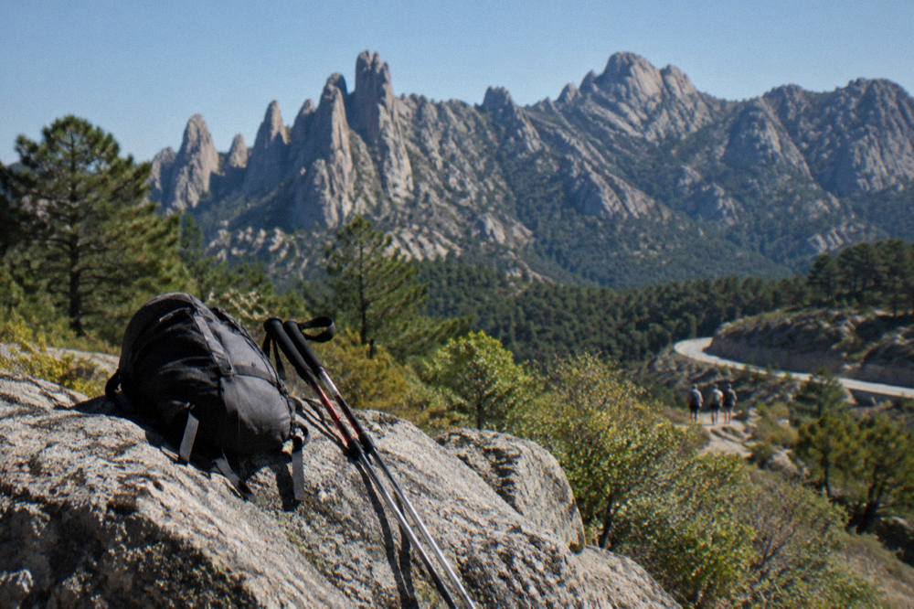
Pack for mountains, not for the beach: strong walking shoes, layers for altitude, water, sun protection and a paper or offline map, because the needles stand high in the interior where weather changes fast, the fire rule forbids smoking from 15 June to 30 September, and refuge meals are paid in cash or by cheque on site if you are staying overnight along the GR20.
Footwear is the first item. The Escalier du Roi d'Aragon in Bonifacio requires closed-toe flat shoes for its 189 steps, and mountain trails demand more than that: proper boots for anything on the GR20's southern ground, and at minimum grippy shoes for the forest paths. A windproof layer belongs at the col even in summer, and a warm one outside it.
If a refuge night is in the plan, the booking rules above apply and the sleeping bag is yours to bring, since the rental tents supply only a 3 cm mat per person. Emergency numbers are worth saving: 112 for the European emergency service, 15 for medical, 17 for police, 18 for fire, 114 by SMS or app, and 196 for sea rescue; mountain rescue reaches the PGHM in Ajaccio on 04 95 24 24 00, with 112 or 17 in an emergency.
How Does Bavella Compare With Corsica's Other Mountain Areas?
Bavella is the south's mountain headline where the Restonica valley and Corte are the centre's, and the Calanques de Piana and the Golfe de Porto are the west's granite-and-sea equivalent: road times to Corte from the main towns run 1 hour from Bastia, 1 h 30 from Ajaccio and Calvi, 2 hours from Porto-Vecchio and 2 h 45 from Bonifacio and Propriano, while Bavella is measured from Ajaccio at about 43 km as the crow flies.
The Restonica valley above Corte gives high lakes and gorge walking in the island's geographic heart, reached from the old capital whose citadel and museum open daily 10:00 to 19:00 in high season, one ticket at EUR 5.50 covering both. The Golfe de Porto and Girolata country, with the Scandola reserve, put the same granite drama against the sea, inscribed by UNESCO in 1983 as the Gulf of Porto: Calanche of Piana, Gulf of Girolata, Scandola Reserve.
Bavella's distinction is accessibility from the south. The needles stand closer to Porto-Vecchio, Bonifacio and Figari than any other high massif, which is why the 4x4 tours run from Porto-Vecchio and why the col appears on so many southern circuits. The three mountain areas together, Restonica, Piana and Bavella, cover the island's granite high country from centre to west to south.
Common Questions About The Aiguilles De Bavella
Where Are The Aiguilles De Bavella?
The Aiguilles de Bavella stand above the Col de Bavella in southern Corsica's mountainous interior, about 43 km as the crow flies from Ajaccio and about 58 km from Porto-Vecchio in the same straight-line measure, inside the Parc naturel régional de Corse.
Can You Hike The Aiguilles De Bavella?
Yes. Walking at Bavella ranges from forest paths around the col to GR20 stages across the high ground, and the long-distance Mare a Mare Sud trail runs 73 km over 5 days to Propriano with 3,200 m of climbing.
How Do You Get To Bavella Without A Car?
There is no public transport to the col and the island's trains run nowhere near it, so the practical option is a guided 4x4 tour from Porto-Vecchio covering the Ospedale forest and the needles, or a private transfer.
What Is The Fire Rule At Bavella?
From 15 June to 30 September it is forbidden to light a fire or smoke in forests, maquis and massifs across Corsica, and a daily fire-risk map published at 18:00 for the next day can restrict access to some massifs from mid-June to mid-September.
Is The GR20 Near Bavella?
The GR20 runs 180 km north to south across Corsica in about 15 stages of 4 to 8.5 hours, and its southern stages cross the high country around Bavella before the trail descends towards Conca.
When Are The GR20 Refuges Guarded?
In 2026 the Parc naturel régional de Corse refuges were guarded from 16 May to 4 October inclusive, and every bunk, bivouac pitch and rented tent must be booked online in advance through the park's platform.
The Aiguilles de Bavella give southern Corsica its mountain finale: granite needles over pine forest, a col crossed by one of the island's great roads, trails from short loops to GR20 stages, and a set of rules, fire season, refuge booking and live road status, that reward a plan made around them. Pair the massif with the beaches and cliffs of the far south and the island's two faces sit within one long weekend's reach.