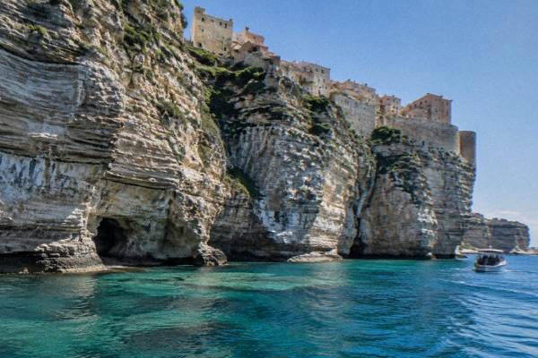
Bonifacio Cliffs
This page gathers what is known about the cliffs, the Escalier du Roi d'Aragon, the boat trips that show them from the water, and the protected islands just offshore.
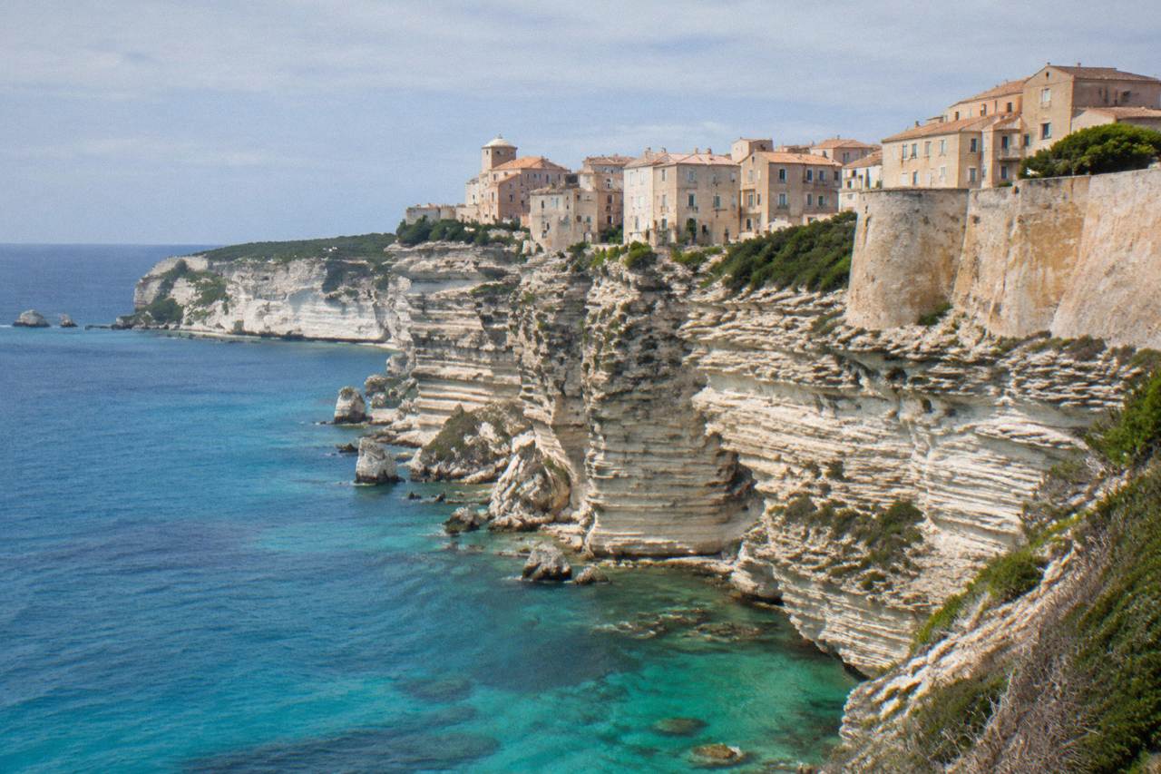
The Bonifacio cliffs are the limestone cliffs on which the upper town of Bonifacio stands, at the southern tip of Corsica. The Escalier du Roi d'Aragon cuts 189 steps down the cliff face, and sea trips run from the harbour below to the cliffs and the Îles Lavezzi inside the Bouches de Bonifacio nature reserve.
The Bonifacio cliffs are the limestone walls at the southern tip of Corsica, the French Mediterranean island, on which the old upper town of Bonifacio stands. The town looks south across the strait towards Sardinia, and the Santa Teresa Gallura to Bonifacio ferry crossing that links the two islands takes about 50 to 60 minutes, reported by the maritime press. Below the walls, the harbour launches boat trips along the cliff face and out to the Îles Lavezzi, which sit inside the Bouches de Bonifacio nature reserve. This page sets out what the primary sources actually say about the cliffs themselves, the famous stairway cut into the rock, the sea trips, and how to reach the town.
What Are The Bonifacio Cliffs In Corsica?
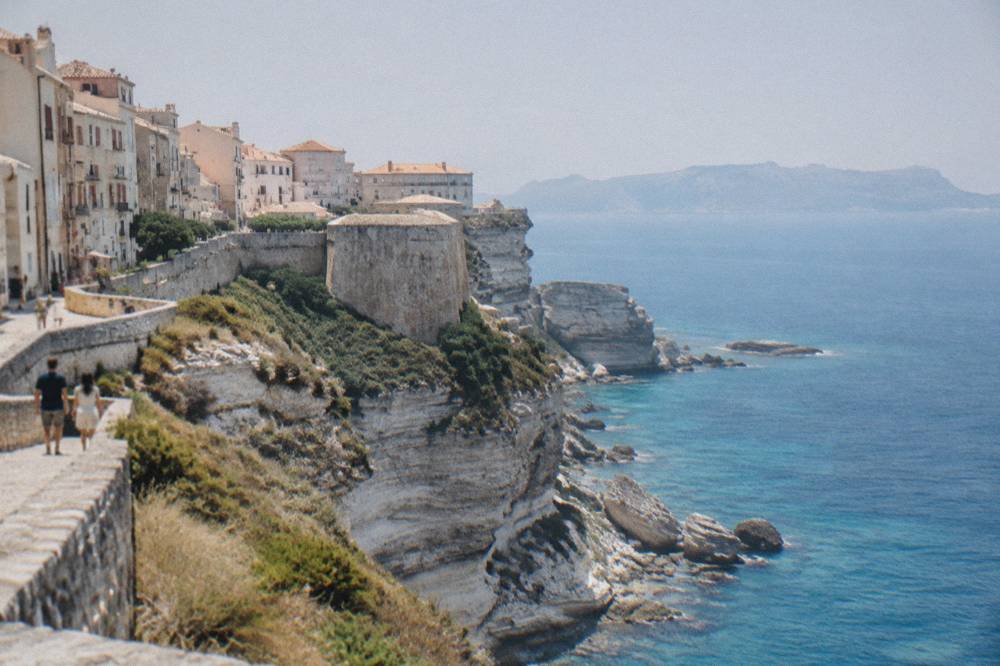
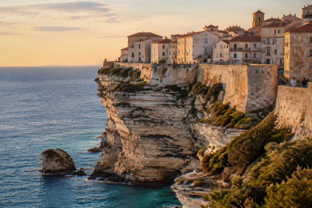
The Bonifacio cliffs are the high limestone cliffs on the southern coast of Corsica that carry the fortified upper town of Bonifacio above the sea, facing Sardinia across the strait at the island's southern tip. The stairway called the Escalier du Roi d'Aragon descends 189 steps down the cliff face, and the town's harbour sits in a sheltered inlet below, from which boat trips run to the cliffs and the Îles Lavezzi.
Bonifacio occupies a narrow limestone promontory at the southern end of Corsica. The old town stands on the cliff top, and the modern harbour lies below at the water. The scale of the setting comes from the strait: Sardinia lies just to the south, close enough that the Escalier du Roi d'Aragon offers a 180-degree view over the cliffs towards it, as the town's own reservation page describes. The strait is also a working sea lane. Moby and Ichnusa Lines operate the Santa Teresa Gallura to Bonifacio ferry, and a report of 9 October 2026 confirmed the two operators keep the route after Sardinia found no rival bidder.
The cliffs are not only a backdrop. They are the reason the town exists where it does, the reason the harbour sits where it sits, and the reason the coast here is protected. The Îles Lavezzi and the waters around them form part of the Bouches de Bonifacio nature reserve, managed, as reported by the prefecture, by the Office de l'Environnement de la Corse. The reserve shapes what boats may do and where swimmers may go, which matters for anyone planning a day on the water. For the wider picture of the town, see the Bonifacio area guide, and for the question of whether the detour is worth it, the answer page is Bonifacio worth visiting covers the trade-offs.
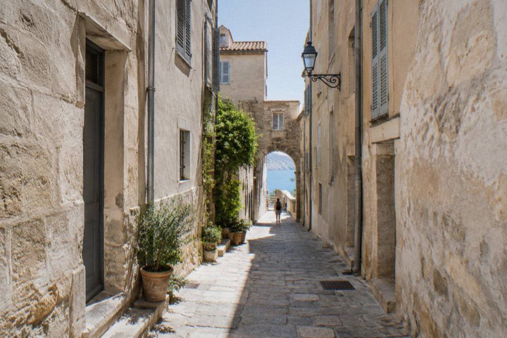
What Can You See And Do At The Bonifacio Cliffs?
The core activities at the Bonifacio cliffs are walking the upper town on the cliff top, descending the 189 steps of the Escalier du Roi d'Aragon to the water, and taking a boat trip from the harbour to see the cliff face and the Îles Lavezzi from the sea. Children who complete the stairway receive a diploma at the top, per the town's reservation page.
The cliff-top walk and the stairway are the two land-side draws. The Escalier du Roi d'Aragon is cut directly into the cliff: 189 steps, with a 180-degree view over the cliffs towards Sardinia, and a diploma handed to children at the top. The entry price is reported at about EUR 5, hours change month by month, and closed-toe flat shoes are required, so confirm those details before you go. The dedicated page on this site, the Escalier du Roi d'Aragon guide, goes deeper on the stairway itself.
The sea side is just as important. The cliff face can only really be read from a boat, and several trips run from Bonifacio harbour: a cruise of the cliffs and the Lavezzi islands, a catamaran trip with snorkelling among the Lavezzi islands, a guided snorkelling cruise, a sunset aperitif dining boat, and a longer day trip to La Maddalena and Lavezzi.
| Trip | Departs From | What It Covers |
|---|---|---|
| Cruise of the Cliffs and the Lavezzi Islands | Bonifacio | The cliff face below the town and the Îles Lavezzi |
| Catamaran with snorkelling | Bonifacio | Lavezzi islands with snorkelling stops from a catamaran |
| Guided Lavezzi snorkelling cruise | Bonifacio | Small-group guided snorkelling around the Lavezzi islands |
| Sunset aperitif dining boat | Bonifacio | The cliffs at sunset with an aperitif served on board |
| La Maddalena and Lavezzi day trip | Bonifacio | A small-group day trip across to the La Maddalena archipelago and Lavezzi |
Note that the La Maddalena trip crosses into Sardinian waters; the La Maddalena archipelago belongs to Sardinia, and the trip departs from Bonifacio in Corsica. Both statements are true at once.
How Do You Visit The Escalier Du Roi D'Aragon Below The Bonifacio Cliffs?
The Escalier du Roi d'Aragon is a stairway of 189 steps cut into the Bonifacio cliff face, giving a 180-degree view over the cliffs towards Sardinia; the entry fee is reported at about EUR 5 with hours that change by month and closed-toe flat shoes required, so confirm current details before you go. Children receive a diploma at the top.
The stairway is the one piece of the cliffs with a fixed number attached to it: 189 steps, per the town's own reservation page. The page also gives the 180-degree view over the cliffs towards Sardinia and the children's diploma. The fee, the monthly opening hours and the closed-shoes rule are as reported here, and the hours genuinely shift with the seasons, so treat them as a planning range and check them on the day. Steep stone steps cut into a cliff face are exactly the place for flat, closed shoes, which the rules require in any case.
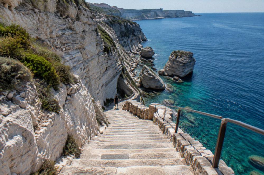
The stairway pairs naturally with a harbour trip: walk down in the morning while the day is cooler, then take a boat out to see the same cliff face from below. Check availability if that combination fits your dates.
What Do The Bonifacio Cliffs Look Like From A Boat?
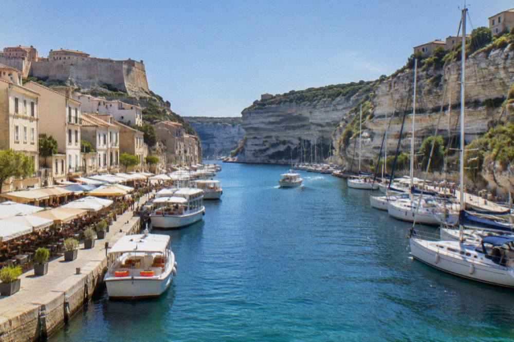
From the water, the Bonifacio cliffs show as a continuous limestone wall with the upper town's walls and houses lined along the top, the harbour inlet tucked at its base, and the Escalier du Roi d'Aragon visible as a cut in the rock face; trips from the harbour run along this wall before heading south to the Îles Lavezzi inside the Bouches de Bonifacio reserve.
The harbour at Bonifacio sits below the town, and the departure point for the cliff cruises is a short walk from the base of the old town. The sequence of a typical trip, as the operator listings describe it, is the cliff face first, then the open water south towards the Lavezzi archipelago, with stops for swimming or snorkelling on the longer versions. The sunset aperitif trips stay closer to the cliffs and serve drinks on board. None of this requires a car: everything on the water leaves from the harbour, and everything on land is within walking distance of it.
The comparison worth making is with Corsica's other great cliff coast, the red granite of the Calanques de Piana on the west of the island, inside the UNESCO property "Gulf of Porto: Calanche of Piana, Gulf of Girolata, Scandola Reserve", inscribed in 1983. The Calanques de Piana guide and the Scandola Nature Reserve guide cover that coast, whose rules are stricter still: the Scandola reserve's land area is closed to the public and visits are by boat only, as reported by the Office de l'Environnement de la Corse. Bonifacio's cliffs are limestone, white, and approached from a working harbour town; Piana's are red and approached from the small ports of the Golfe de Porto.
What Are The Îles Lavezzi And The Bouches De Bonifacio Reserve?
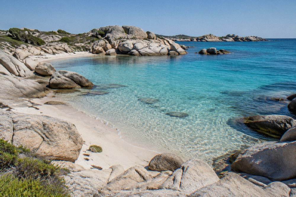
The Îles Lavezzi are a small granite island group in the strait between Bonifacio and Sardinia, lying inside the Bouches de Bonifacio nature reserve, which, as reported by the prefecture, is managed by the Office de l'Environnement de la Corse; the islands are a standard stop on the boat trips from Bonifacio harbour, with swimming and snorkelling on the guided versions.
The reserve is the legal frame around the southern strait. The prefecture's own documents place the Lavezzi islands inside the Réserve Naturelle des Bouches de Bonifacio and name the Office de l'Environnement de la Corse as its manager, so the usual reserve rules on anchoring, landing and fishing apply in these waters, and some zones carry tighter restrictions than others. Swimmers and snorkellers on the guided trips are taken to the permitted spots, which is one practical argument for taking a guided trip rather than a bare boat hire. The dedicated page on this site, the Îles Lavezzi guide, covers the islands in detail, and the question can you swim at the Lavezzi islands addresses the swimming question directly.
A practical note on geography: the La Maddalena archipelago, which some day trips from Bonifacio visit, is Sardinian, not Corsican. The trips depart from Bonifacio in Corsica and cross the strait. Anyone combining the two islands in one trip should keep that border in mind for documents and for the ferry timetables between Santa Teresa Gallura and Bonifacio.
| Bonifacio Cliffs Essentials | Figure |
|---|---|
| Escalier du Roi d'Aragon steps | 189 |
| View from the stairway | 180 degrees over the cliffs towards Sardinia |
| Entry fee for the stairway | About EUR 5 |
| Stairway hours | Change month by month |
| Footwear rule on the stairway | Closed-toe flat shoes required |
| Reserve covering the Îles Lavezzi | Bouches de Bonifacio, managed by the OEC |
| Sardinia ferry crossing time | About 50 to 60 minutes |
How Do You Get To The Bonifacio Cliffs In Corsica?
Bonifacio sits at the southern tip of Corsica, reached by road from the island's ports and airports, or directly by sea on the Santa Teresa Gallura to Bonifacio ferry operated by Moby and Ichnusa Lines, a crossing of about 50 to 60 minutes; the nearest of Corsica's four airports is Figari Sud Corse, and the town's harbour is the departure point for the cliff trips.
Corsica has four airports: Ajaccio Napoléon Bonaparte (AJA), Bastia Poretta (BIA), Figari Sud Corse (FSC) and Calvi Sainte-Catherine (CLY). Figari is the one that serves the far south. On the sea side, Corsica's ferry ports are Ajaccio, Bastia, Bonifacio, L'Île-Rousse, Propriano and Porto-Vecchio, with mainland sailings from Marseille, Nice, Toulon, Livorno, Genoa, Savona and Santa Teresa Gallura. Propriano and Porto-Vecchio are the closest big ports to Bonifacio for anyone arriving with a car.
| Ferry Route To Corsica | Operator | Notes |
|---|---|---|
| Santa Teresa Gallura to Bonifacio | Moby and Ichnusa Lines | Route retained, report of 9 October 2026 |
| Marseille to Ajaccio, Bastia, Propriano, L'Île-Rousse | Corsica Linea | Year-round service |
| Marseille to Ajaccio, Porto-Vecchio | La Méridionale | Year-round service |
| Livorno to Bastia | Corsica Ferries, Moby | Frequent link |
| Savona to Bastia | Corsica Ferries | Mainland Italy link |
| Nice to Corsican ports | Corsica Ferries | Seasonal elements |
For the planning question behind all of this, how do you get to Corsica has the fuller picture, and do you need a car in Corsica addresses the driving question. Within Bonifacio itself a car is a burden rather than a help: the harbour, the upper town and the stairway are all linked on foot.
When Is A Good Time To See The Bonifacio Cliffs In Corsica?
Corsica has a hot dry summer and a mild wet winter, with snow only on the high mountains, per the Météo-France 1991-2020 station normals; at Ajaccio July averages 8.6 mm of rain and August a mean daily high of 29.2 °C, while November carries 111.8 mm, so the cliff walk and the boat trips are above all summer-season activities, though the town itself stays open through the year.
The boat season in Bonifacio follows that curve, with the fuller schedules in the warm months. The stairway keeps reported hours across much of the year, moving with daylight, and the question of swimming late in the season is handled on the page can you swim in Corsica in October.
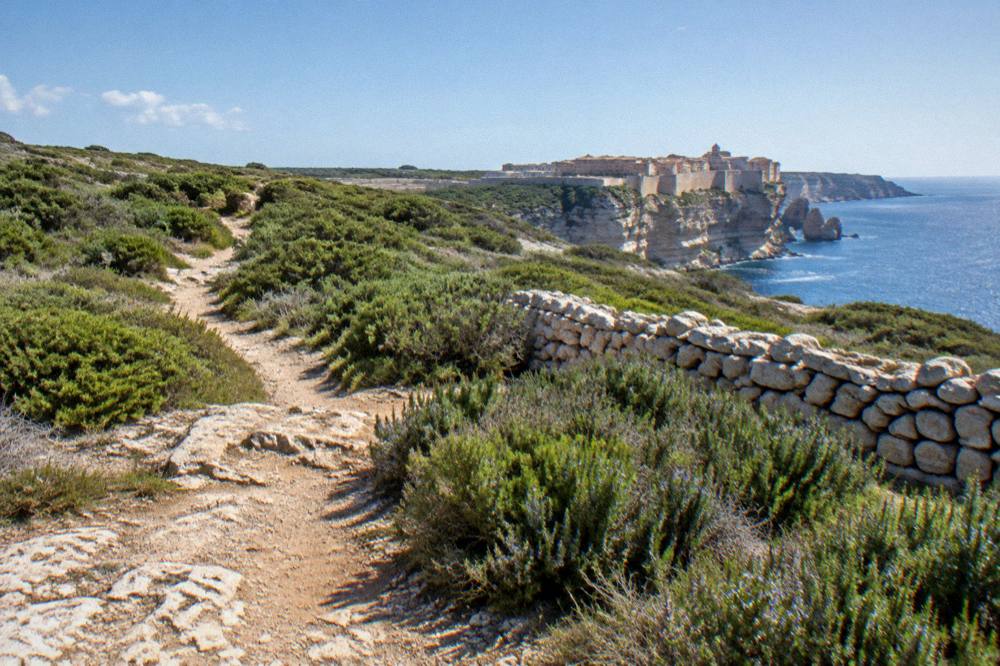
One seasonal rule matters on any Corsican coastal walk: from 15 June to 30 September it is forbidden to light a fire or smoke in forests, scrub and massifs. On a limestone cliff path the rule is the same as in the maquis. The UK FCDO also notes a high wildfire risk in France from April to October.
| Month | Mean Daily High Ajaccio (C) | Rain Ajaccio (mm) | Rain Bastia (mm) |
|---|---|---|---|
| May | 22.1 | 49.8 | 53.7 |
| June | 25.9 | 25.9 | 38.8 |
| July | 28.6 | 8.6 | 13.8 |
| August | 29.2 | 15.8 | 21.1 |
| September | 26.1 | 57.8 | 74.5 |
| October | 22.8 | 85.7 | 126.5 |
What Else Is Near The Bonifacio Cliffs In Corsica?
The far south around Bonifacio holds some of Corsica's best-known beaches, Palombaggia and Santa Giulia near Porto-Vecchio and Rondinara on the coast road, plus the prehistoric site of Filitosa inland, and the region connects north to Porto-Vecchio, the Alta Rocca and the Aiguilles de Bavella, so the cliffs work well as one stop on a southern Corsica route rather than a single-day destination.
A common plan, covered on this site as the Bonifacio day trip from Porto-Vecchio, bases travellers in Porto-Vecchio and comes down to the cliffs for the day. Stay longer and the southern beaches come into range: Palombaggia, Santa Giulia and Rondinara all sit on the coast between the two towns. Inland, Filitosa is open 1 April to 2 November, EUR 9 for adults, EUR 7 reduced, family ticket EUR 28, with the site open from 09:00 to sunset and the museum to 19:00, per the site's own timetable page. Into the mountains, the Restonica valley and the Aiguilles de Bavella mark the transition from coast to the island's high interior.
For anyone building a whole-island trip, the Corsica Travel Guide homepage and the island-wide things to do in Corsica round-up cover the rest of the island, from the Balagne in the north to the GR20 along the spine, 180 km in about 15 stages of 4 to 8.5 hours per the Corsican Assembly's own text, with PNRC refuges guarded from 16 May to 4 October in 2026 and nights bookable online only.
How Many Days Do You Need For The Bonifacio Cliffs?
A single full day covers the upper town, the Escalier du Roi d'Aragon and one boat trip to the cliffs and the Îles Lavezzi; two days add a second trip at a different hour, a beach such as Rondinara or Palombaggia, and a stop at Filitosa on the road north, per the day-trip patterns this site documents.
The half-day rhythm is tight but workable: the stairway in the morning, the town at midday, a boat in the afternoon. The sunset aperitif trip is the natural second outing, because it uses the hours after the day trips have returned. The fuller question, including the trade-off against Porto-Vecchio and the beaches, is handled on the answers page how many days do you need in Bonifacio. Anyone pairing Bonifacio with the west-coast cliff scenery of Piana and Scandola, using the picks below for the Porto side, should think in terms of a week for both coasts; the itineraries on this site, from three days to fourteen, cover those builds.
What Should You Know Before Visiting The Bonifacio Cliffs?
Bring closed-toe flat shoes for the 189 steps of the Escalier du Roi d'Aragon, where they are required, carry water on the cliff path, book the boat trips ahead in the summer season, note that the stairway's fee of about EUR 5 and its monthly hours are reported rather than fixed, and keep the fire rule in mind: no fires or smoking in forests, scrub and massifs from 15 June to 30 September.
The emergency numbers for Corsica are 112, 15 for medical, 17 for police, 18 for fire, 114 by SMS or app, and 196 for sea rescue. For anyone heading from the coast into the mountains afterwards, the PGHM mountain rescue in Ajaccio is 04 95 24 24 00, with 112 or 17 in an emergency. Tipping follows French law: menus must state "prix service compris", and any extra tip is optional. The currency is the euro. Road conditions across the island, including the mountain passes, are published live by Inforoutes Corse, which is worth a check before any long drive to or from Bonifacio.
Common Questions About The Bonifacio Cliffs In Corsica
How Many Steps Does The Escalier Du Roi D'Aragon Have?
The Escalier du Roi d'Aragon has 189 steps cut down the Bonifacio cliff face, with a 180-degree view over the cliffs towards Sardinia, per the town of Bonifacio's own reservation page. Children receive a diploma at the top.
What Does The Escalier Du Roi D'Aragon Cost?
The entry fee is reported at about EUR 5, with monthly hours that change through the year and closed-toe flat shoes required. Confirm the current fee and hours before you go.
Can You See The Bonifacio Cliffs From A Boat?
Yes. Boat trips from Bonifacio harbour run along the cliff face below the upper town before heading out towards the Îles Lavezzi, and a sunset aperitif version stays close to the cliffs in the evening.
Are The Îles Lavezzi Part Of Corsica?
Yes, the Îles Lavezzi are Corsican islands in the strait between Bonifacio and Sardinia, inside the Bouches de Bonifacio nature reserve, managed, as reported by the prefecture, by the Office de l'Environnement de la Corse. The La Maddalena archipelago, which some day trips also visit, is Sardinian.
How Far Is Bonifacio From Sardinia?
Bonifacio sits at the southern tip of Corsica facing Sardinia across the strait, and the Santa Teresa Gallura to Bonifacio ferry crossing takes about 50 to 60 minutes, operated by Moby and Ichnusa Lines.
Is One Day Enough For The Bonifacio Cliffs?
One full day covers the upper town, the stairway and a boat trip. A second day adds a beach such as Rondinara or Palombaggia, or the prehistoric site of Filitosa, open 1 April to 2 November, on the road north.
The Bonifacio cliffs, in short, are a compact destination: one stairway of 189 steps, one harbour launching trips to a protected island group, and one strait crossing that ties Corsica to Sardinia in under an hour.