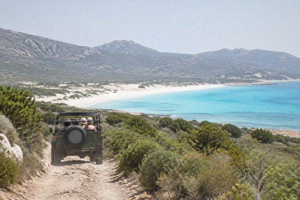
Lotu Beach
Lotu Beach sits at the western edge of the Désert des Agriates in Corsica, reachable by boat shuttle from Saint-Florent, by 4x4 track from Casta, or on foot. This guide sets out the access options, the rules that apply, and what else to combine with a day on this stretch of the Corsican coast.
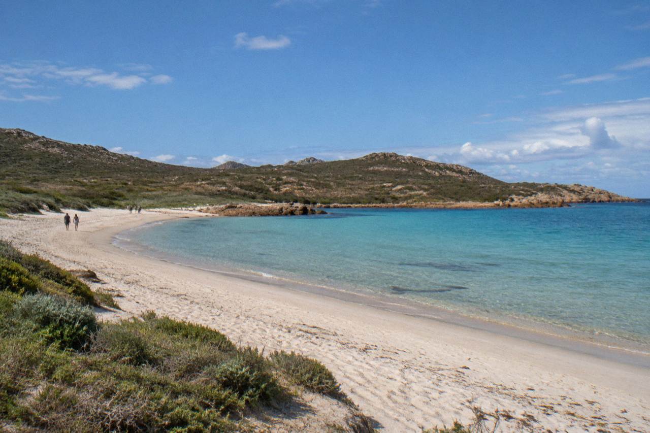
Lotu Beach is reached by boat shuttle from Saint-Florent (about April to October, weather permitting), by 4x4 track from Casta, or on foot, per visit-corsica.com. There is no train and no ordinary road to the sand, and the Désert des Agriates around it is subject to summer fire-access rules.
Lotu Beach lies on the northern coast of Corsica, inside the Désert des Agriates, the wild stretch of maquis and sand that runs west of Saint-Florent toward the Golfe de Saint-Florent's outer shore. The island has more than 1,000 km of coastline, and Lotu sits on one of its least road-accessible parts: there is no ordinary road to the sand. Visit-corsica.com, the tourist board site, reports that the beach is reached by boat shuttle from Saint-Florent, by 4x4 track from Casta, or on foot, and that shuttles run about April to October, weather permitting. This guide sets out what the sources say about each access route, the rules that apply in the Agriates in summer, and how to build a day or a week around this corner of the island.
Where Is Lotu Beach In Corsica?
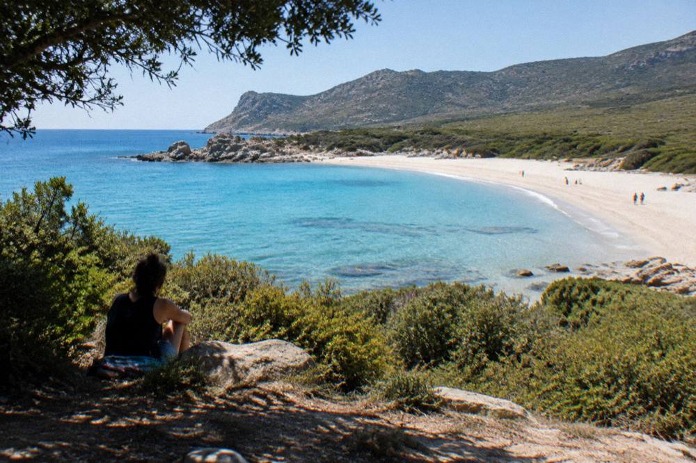
Lotu Beach stands on the northern shore of Corsica, inside the Désert des Agriates, the protected coastal wildland that stretches west of Saint-Florent in Haute-Corse, and its neighbour beach Saleccia lies just along the same shore. The Agriates is a stretch of maquis, sand and rocky capes with no settlement at its western end, which is why the beach has no village attached to it and no ordinary road reaching the sand.
The Désert des Agriates is one of the defining landscapes of northern Corsica. Visit-corsica.com, reporting on the area, describes access to its beaches by boat, by 4x4 track and on foot, and the pattern holds for both Saleccia and Lotu. Saint-Florent, the small port town at the base of the Cap Corse peninsula, is the practical gateway: the shuttles leave from its port. The drive along the coast from Bastia to Saint-Florent is the usual approach for visitors arriving by ferry at Bastia, one of the island's main ports alongside Ajaccio, Bonifacio, L'Île-Rousse, Propriano and Porto-Vecchio.
What makes the Agriates unusual for a Mediterranean island coast is the emptiness. Corsica is 8,722 km2 with a population of 365,636 at 1 January 2026 in the provisional INSEE estimate, and a large share of that population lives in the main towns: Ajaccio, the capital, counts 76,320 residents and Bastia 46,867 in the 2023 census figures published in August 2026. The Agriates coast, by contrast, carries no town, no village at its western end and no through road, so a day at Lotu is a day reached by water, track or boot.
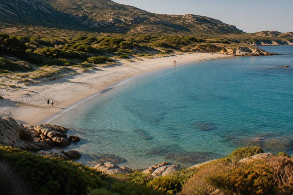
For orientation, the neighbouring strand Saleccia Beach shares the same access pattern and the same shore of the Agriates, and the two are often discussed together. Further around the northern coast, Plage de Ostriconi sits at the western edge of the Agriates near the Balagne border, reachable by road, which makes a useful contrast for anyone comparing the region's beaches.
How Do You Get To Lotu Beach?
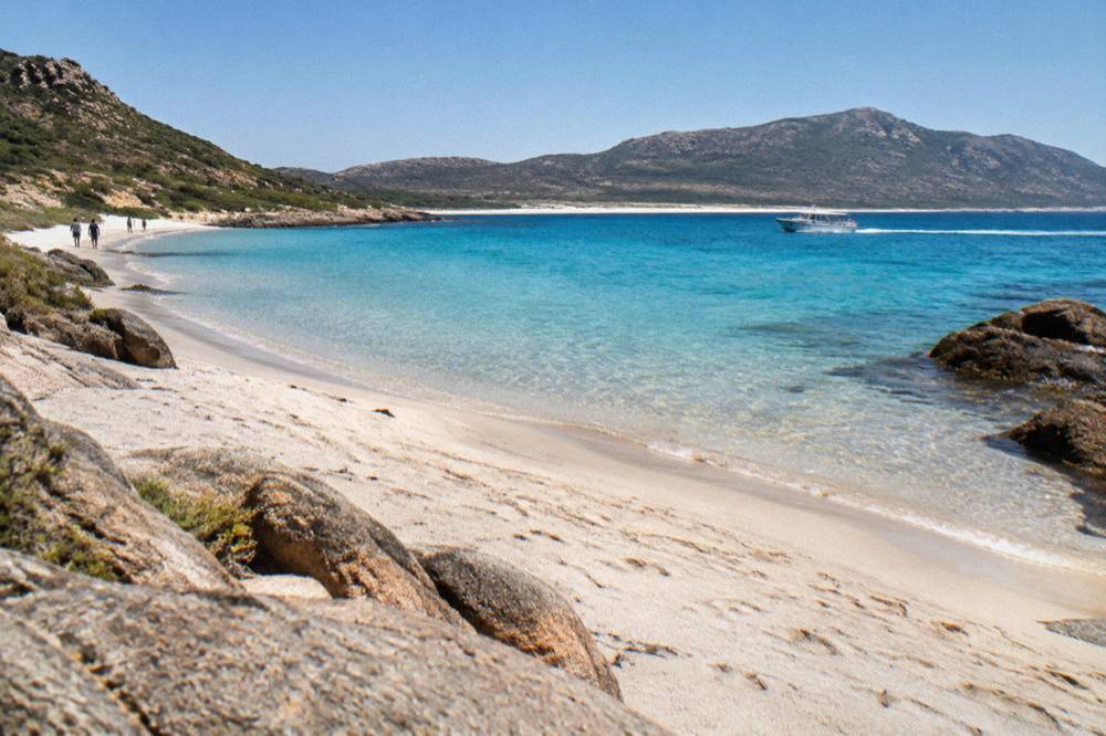
Lotu Beach is reached three ways, per visit-corsica.com: by boat shuttle from Saint-Florent port, running about April to October and weather permitting, with a crossing of roughly 15 to 20 minutes; by 4x4 track from Casta, taking about 45 minutes on the authorized track; or on foot through the Agriates. There is no regular road, no train line and no scheduled bus to the sand itself.
The boat shuttle is the route the tourist board describes first. Taxi-boats and shuttles run from Saint-Florent's port across the Golfe de Saint-Florent to the Agriates beaches, and the tourist board reports the season as about April to October, always weather permitting, since the crossing depends on sea conditions in the gulf. Private operators run the shuttles; fares and exact timetables change through the season, so confirm with the operator or the Saint-Florent tourist office before planning a crossing.
The 4x4 route runs from Casta, on the Saint-Florent side of the Agriates, on an authorized track. The tourist board reports about 45 minutes of driving on the track, which is why the route is normally driven with a vehicle suited to rough ground or with one of the local shuttle services rather than a rental hatchback. The third option, on foot, is the one the Agriates rewards: the area is walking country, and the coast paths linking Saint-Florent, Saleccia and Lotu are part of the island's long-distance network, including the Mare e Monti and Mare a Mare trails the PNRC documents for the region.
The Chemins de fer de la Corse train network does not serve this coast: its lines run Ajaccio to Bastia via Corte, Ponte-Leccia to Calvi, and the Balagne coastal line between Calvi and L'Île-Rousse, all far to the west and south of the Agriates. For the same reason, anyone staying in the Balagne can combine a stay there with a day trip east: the balance of a Corsica trip that includes both the Calvi citadel and the Agriates beaches is a common northern-island shape.
| Access route | Start point | Timing | Season and notes |
|---|---|---|---|
| Boat shuttle or taxi-boat | Saint-Florent port | About 15 to 20 minutes | About April to October, weather permitting, private operators |
| 4x4 track | Casta | About 45 minutes on the authorized track | Suitable vehicle or local shuttle needed |
| On foot | Saint-Florent or along the coast path | Depends on route chosen | Walking access through the Agriates, no booking needed |
The figures in the table are the ones the tourist board reports, and the weather caveat on the shuttle matters: the Golfe de Saint-Florent can close to small boats when wind or swell builds, and a planned beach day can shift to a Saint-Florent day. Building a flexible day around the crossing is the practical answer.
What Rules Apply Around Lotu Beach And The Agriates?
The Désert des Agriates falls under Corsica's standing summer fire rules: from 15 June to 30 September it is forbidden to light a fire or smoke in forests, maquis and massifs, wild camping is banned across the island, and daily fire-risk maps published around 18:00 for the next day can restrict access to massifs from mid-June to mid-September. Lotu's visitors plan around these rules, not around any beach-specific permit.
The fire rule is the one that changes plans most often. The PNRC page on the GR20 and the massifs sets out the framework: the daily colour map of massif access is updated at about 18:00 for the following day, and when the risk level is high enough, prefectural orders can close massifs, tracks and trails entirely, including parking and circulation in affected zones. The Agriates is one of the massifs covered by this system in Haute-Corse. In practice this means checking the prefecture-linked map the evening before any Agriates day in high summer, exactly as hikers on the GR20 do.
Camping follows a second standing rule. Wild camping is banned across Corsica, including inside the regional park, with bivouac tolerated only in designated areas near refuges on the GR20 and with a reservation. There is no camping at Lotu: the beach and the maquis behind it are not a place to pitch a tent, and the ban is enforced under municipal and prefectural orders.
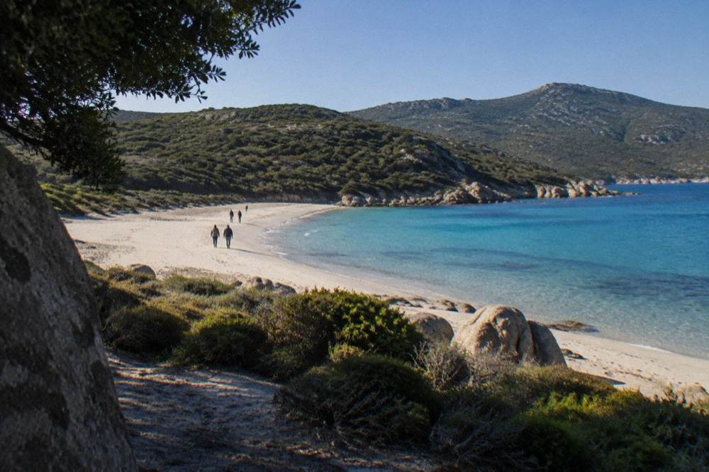
Swimming safety on this coast follows the island-wide pattern rather than a beach-specific lifeguard posting. Ajaccio's main beaches have 7 lifeguard posts from 1 July to the end of August, and in Haute-Corse supervised beaches are staffed by volunteer firefighters from about 1 July to 31 August, per local reporting. A remote Agriates beach is not in that supervised network, so swimmers treat it as unguarded water. The emergency numbers for the whole island are 112 for all emergencies, 15 for medical, 17 for police, 18 for fire, 114 by SMS or app, and 196 for sea rescue on VHF channel 16 at sea.
| Rule | What applies | Period |
|---|---|---|
| Fire and smoking ban | No fires or smoking in forests, maquis and massifs | 15 June to 30 September |
| Massif access map | Daily colour map updated about 18:00 for the next day; massifs can close on high-risk days | Mid-June to mid-September |
| Wild camping | Banned across Corsica; bivouac only at designated GR20 refuge areas with reservation | Year-round |
| Supervised swimming | Ajaccio 7 posts; Haute-Corse beaches staffed by volunteer firefighters | 1 July to 31 August |
When Is The Best Time Of Year For Lotu Beach?
The shuttle season sets the window: visit-corsica.com reports boats from Saint-Florent about April to October, weather permitting, and Corsica's climate normals show why that window exists, with July averaging 8.6 mm of rain at Ajaccio and November averaging 111.8 mm, so the beach months sit inside the dry half of the year while autumn storms and winter rain close the crossing down.
The Météo-France station normals for 1991-2020 give the background. At Ajaccio, July averages a high of 28.6 °C with 8.6 mm of rain and 12 h 6 min of sunshine a day, and August averages a high of 29.2 °C with 15.8 mm. At Bastia, the station closer to the Agriates coast, July averages a high of 29.4 °C with 13.8 mm of rain, and October carries 126.5 mm with November at 134.3 mm. October and November carry the most rain on both tables, which is why the shuttle season tapers as autumn deepens, beyond the simple daylight arithmetic. The wider set of guides lives on Corsica Travel Guide.
Spring and early autumn are the months when the access math and the weather align most comfortably. April at Ajaccio averages a high of 18.5 °C, May 22.1 °C, June 25.9 °C, and September 26.1 °C with 57.8 mm of rain. The fire rules bite from mid-June, so a May or late-September trip avoids both the massif-closure risk and the peak-season demand on shuttle seats, while still sitting inside the reported boat season. No month is declared best here: the figures are stated and the choice follows from them.
| Month | Ajaccio high °C | Ajaccio rain mm | Bastia high °C | Bastia rain mm |
|---|---|---|---|---|
| April | 18.5 | 53.1 | 18.3 | 71.6 |
| May | 22.1 | 49.8 | 22.4 | 53.7 |
| June | 25.9 | 25.9 | 26.4 | 38.8 |
| July | 28.6 | 8.6 | 29.4 | 13.8 |
| August | 29.2 | 15.8 | 29.8 | 21.1 |
| September | 26.1 | 57.8 | 26.0 | 74.5 |
| October | 22.8 | 85.7 | 22.0 | 126.5 |
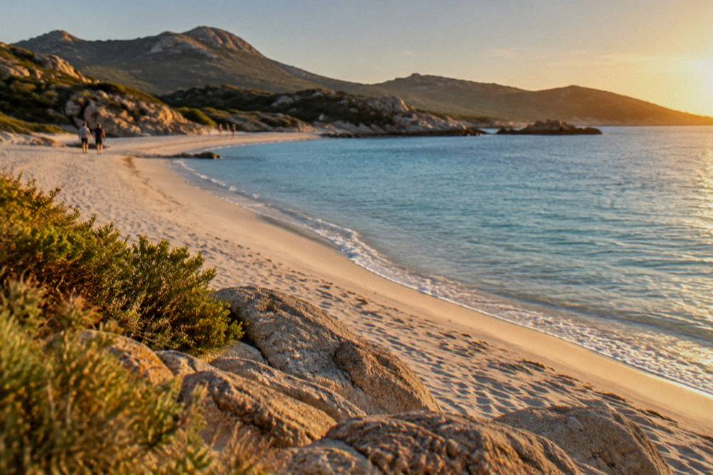
What the sources do give is the seasonal shape, and that shape is consistent: dry, bright, shuttle-friendly summers, and a wet autumn that belongs to walkers rather than swimmers.
What Can You Combine With Lotu Beach On The Same Trip?
Saint-Florent is the natural base, with the shuttles from its port, the Patrimonio wine appellation at the base of Cap Corse reported by the tourist board, and a day trip covering Cap Corse and the Agriates available as a booked excursion, while the wider north offers Calvi, the Balagne villages and the Désert des Agriates itself as neighbours within a single week.
A northern Corsica itinerary hangs together well around Lotu. Saint-Florent supplies the port, the restaurants and the departure point; Cap Corse, the peninsula north of town, carries its own string of villages and the Patrimonio appellation, which the tourist board reports sits at the base of the peninsula. A booked half-day excursion covering Cap Corse and the Agriates desert runs from the Saint-Florent area, which suits travellers who would rather not arrange the 4x4 track themselves. The Check availability link beside the island's water-based days is worth using early in planning, since coastal trips anchor the rest of a northern itinerary.
West of the Agriates, the Balagne opens up. Calvi and its citadel, Île-Rousse, and the hilltop villages behind the coast make a second base, and the region's beaches, including Plage de Ostriconi on the Agriates' western edge, link the two areas by road along the D81 coast. The distance between the two bases is a single morning's drive on the coast road, and Inforoutes Corse publishes live road conditions and pass accessibility levels for anyone checking before setting out.
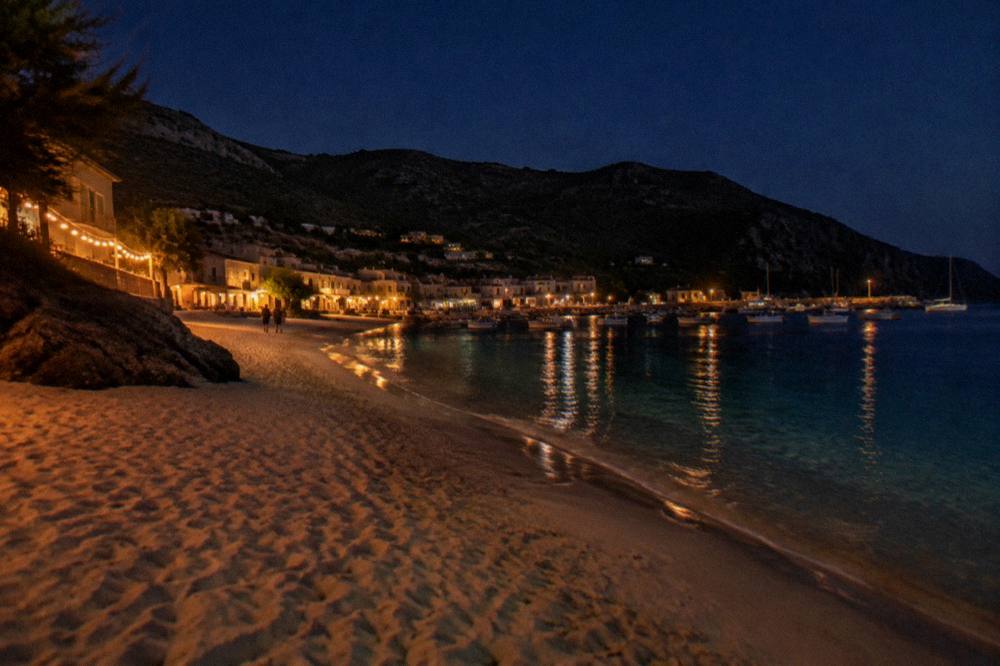
For a fuller survey of the island's strands beyond the Agriates, the island's beaches run from Palombaggia Beach and Santa Giulia Beach near Porto-Vecchio to Rondinara Beach and Plage de Roccapina in the far south, each with its own access profile, and the question of which single strand ranks first is treated separately in What Is The Best Beach In Corsica?. Lotu's case in that conversation is isolation and the boat approach, not convenience.
How Does Lotu Compare With Other Corsican Beaches?
Lotu and Saleccia stand apart from the rest of Corsica's beaches on access alone: both sit inside the Désert des Agriates with no ordinary road, reached by shuttle boat, 4x4 track or on foot, while the island's other headline beaches, Palombaggia, Santa Giulia, Rondinara, Roccapina and Ostriconi, are road-served strands, so the choice between them is a choice between a boat day and a drive-to beach.
The comparison matters for planning because everything else follows from access. A road beach can be visited spontaneously, with a town or a carpark within reach and the island's supervised-swimming network nearby in season. An Agriates beach is a committed day: the crossing or the track, the supplies carried in, and no lifeguard post on the sand. Neither is the better beach as a fact; they are different products, and the climate table above governs both equally.
| Beach | Area of Corsica | Access profile |
|---|---|---|
| Lotu | Désert des Agriates, Haute-Corse | Boat shuttle from Saint-Florent, 4x4 track from Casta, or on foot |
| Saleccia | Désert des Agriates, Haute-Corse | Same three routes as Lotu, shared shore |
| Plage de Ostriconi | Western Agriates edge, near the Balagne | Road access on the coast side |
| Palombaggia | Near Porto-Vecchio, south-east | Road-served beach close to town |
| Santa Giulia | Near Porto-Vecchio, south-east | Road-served beach close to town |
| Rondinara | Between Bonifacio and Porto-Vecchio | Road-served beach |
| Plage de Roccapina | Near Bonifacio, far south | Road access on a quieter coastal road |
Within the far south, the comparison shifts again: the Lavezzi Islands off Bonifacio are a boat-only destination like the Agriates beaches, but for an archipelago rather than a strand, reached by the cruises and catamaran trips that leave from Bonifacio and Porto-Vecchio. The divide that Lotu illustrates, water access versus road access, repeats across the island, and it is the single most useful sorting question when planning which beaches to visit.
What Should You Pack And Plan For A Day At Lotu?
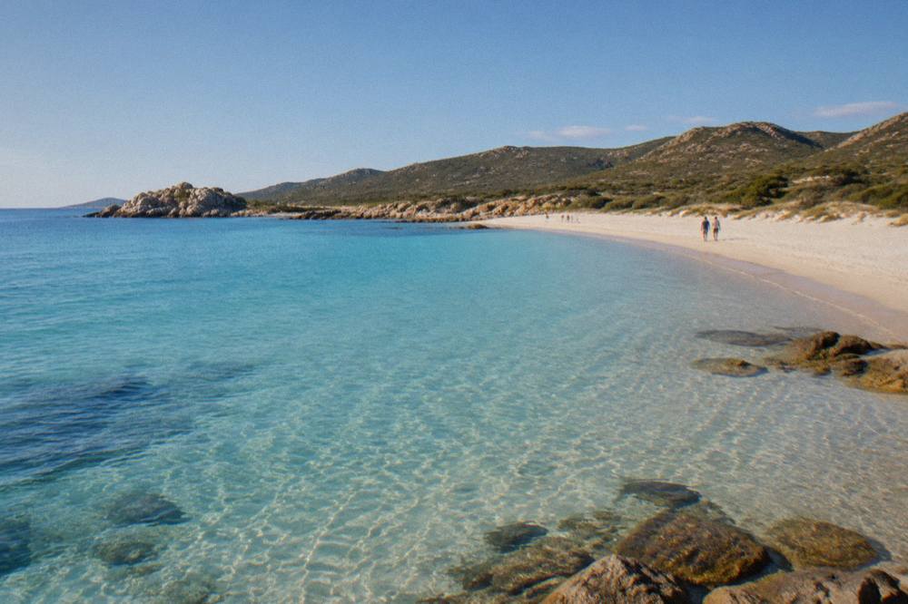
A day at Lotu is a self-sufficient day: everything carried in by boat, track or foot, no shops or services at the beach, water and sun protection for the full stay, shoes suited to sand and rough track, and a plan checked against the evening fire-risk map in summer, with the last shuttle time confirmed with the operator so the return is fixed before the day starts.
The self-sufficiency point follows directly from the geography. There is no village, no kiosk and no road at the western Agriates shore, and the shuttle operators run to their own schedules, which vary with the season and the weather. A morning departure with a planned afternoon return, and a fallback in Saint-Florent if the sea closes the gulf, is the shape of a low-stress day. The climate normals argue for serious sun protection from June through September, when the Ajaccio table shows 11.1 to 12.1 hours of daily sunshine and July and August highs above 28 C.
Footwear earns its place twice over: the sand itself, and the track or path for anyone arriving overland. The same packing logic serves the walking approach, since the coast paths of the Agriates are rough ground, and the island's emergency framework, with 112 as the general number and 196 for sea rescue, assumes a caller who knows where they are. Downloading the day's fire-risk map the evening before covers the one rule most likely to change plans between June and mid-September.
For anyone building the whole trip around water, the island's boat and snorkel offering extends well beyond the Agriates: the Scandola Nature Reserve on the west coast is visited by boat only, with the land part of the reserve closed to the public, per the Office de l'Environnement de la Corse, and the reserve sits inside the UNESCO property "Gulf of Porto: Calanche of Piana, Gulf of Girolata, Scandola Reserve", inscribed in 1983. A northern stay at Lotu and a western boat day at Scandola Nature Reserve or the Calanques de Piana make a natural two-base week.
Common Questions About Lotu Beach
How Do You Get To Lotu Beach?
By boat shuttle or taxi-boat from Saint-Florent port, a crossing of roughly 15 to 20 minutes reported by the tourist board, by 4x4 on the authorized track from Casta, taking about 45 minutes, or on foot through the Désert des Agriates. There is no ordinary road, train or scheduled bus to the beach.
When Do The Shuttles To Lotu Run?
Visit-corsica.com reports the Saint-Florent boat shuttles to the Agriates beaches running about April to October, weather permitting, with private operators setting fares and timetables. Confirm the day's sailing with the operator or the Saint-Florent tourist office.
Can You Camp At Lotu Beach?
No. Wild camping is banned across Corsica, including the Désert des Agriates, and bivouac is tolerated only in designated areas near GR20 refuges with a reservation. The beach and the maquis behind it carry no camping provision.
Is Lotu Beach Supervised By Lifeguards?
No beach-specific lifeguard posting is recorded for Lotu. On the island's supervised network, Ajaccio's main beaches have 7 lifeguard posts from 1 July to the end of August, and Haute-Corse's supervised beaches are staffed by volunteer firefighters about 1 July to 31 August, per local reporting. Treat the Agriates shore as unguarded water.
Are There Fires Or Smoking Rules At Lotu Beach?
Yes, island-wide. From 15 June to 30 September it is forbidden to light a fire or smoke in forests, maquis and massifs, and the daily massif access map, updated about 18:00 for the next day, can close the Agriates and other massifs entirely on high-risk days between mid-June and mid-September.
What Is Close To Lotu Beach?
Saleccia Beach on the same Agriates shore, Saint-Florent as the gateway port with the shuttles, the Patrimonio appellation at the base of Cap Corse, and, further west, Plage de Ostriconi and the Balagne coast around Calvi and Île-Rousse.
A day at Lotu is a day planned around water, weather and the few rules that protect the Agriates: check the evening fire map in summer, confirm the shuttle, carry everything in, and the beach at the end of the crossing is one of the quietest strands the Corsican coast has to offer.