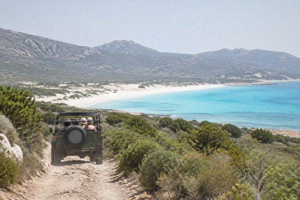
Saleccia Beach
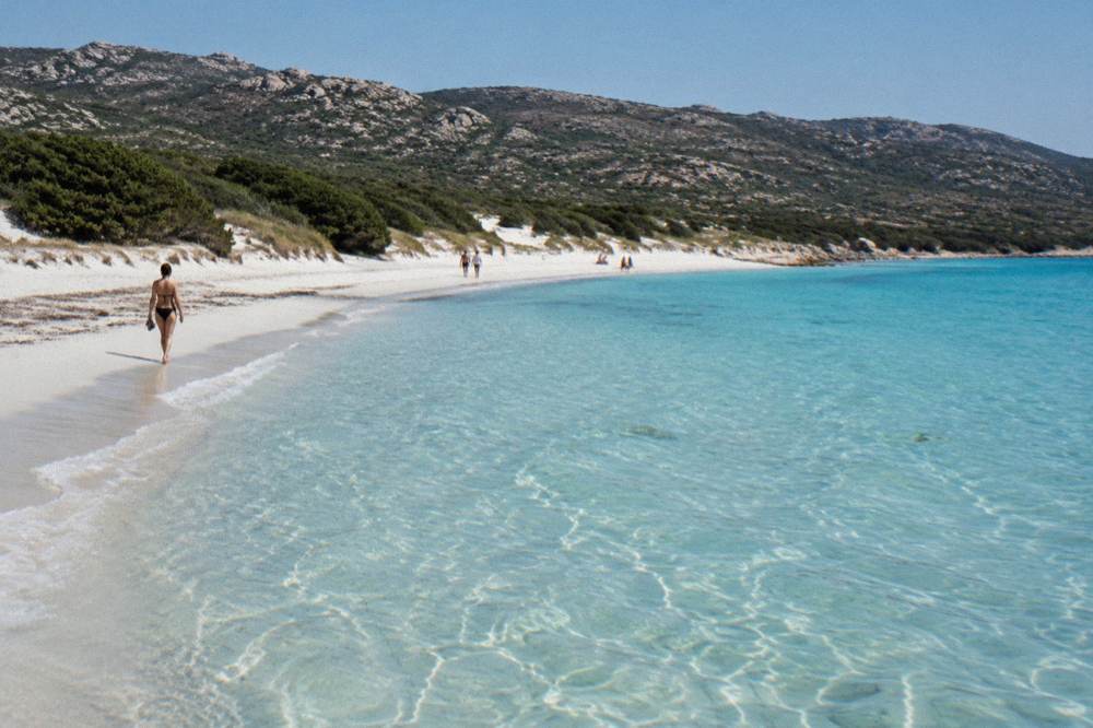
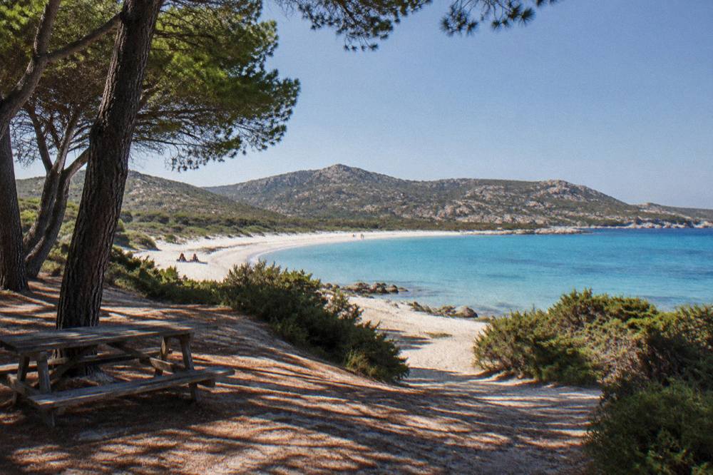
Saleccia Beach lies on the northern coast of Corsica inside the Désert des Agriates, a protected coastal wilderness with no through road, which is exactly why the sand stays quiet and the water stays clear.
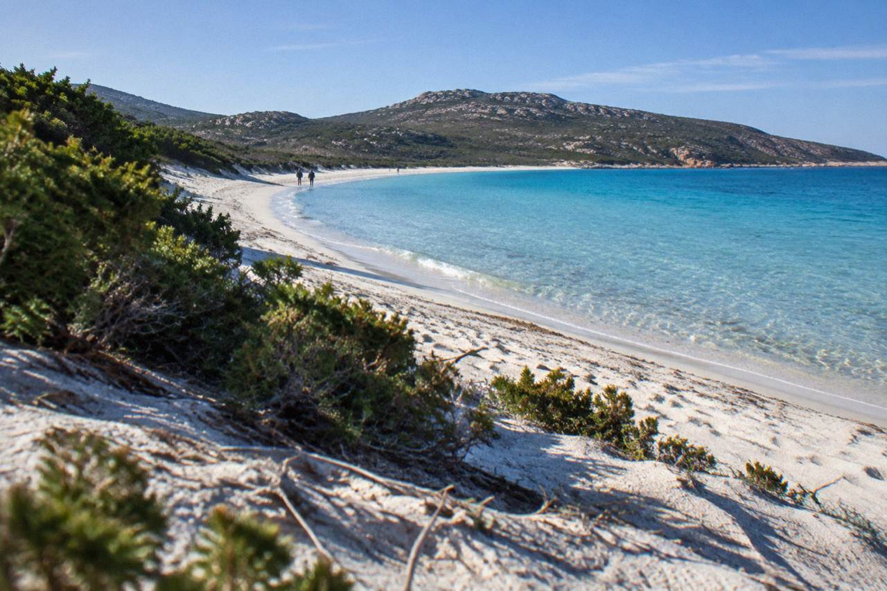
Saleccia Beach is reached by boat shuttle from Saint-Florent (reported as running about April to October, weather permitting), by 4x4 track from Casta, or on foot through the Désert des Agriates in Corsica. There is no regular public road in, so most itineraries plan a boat day, a 4x4 transfer or a hike from Saint-Florent.
Saleccia Beach sits on the northern shore of Corsica, inside the Désert des Agriates, the stretch of protected maquis and sand that runs west from Saint-Florent toward the Golfe de Saint-Florent's outer headlands. Corsica is the French Mediterranean island of 8,722 km2 with more than 1,000 km of coastline, and the Agriates is one of the few long coastal strips on the island with no through road. That single geographic fact shapes everything about a visit: you arrive by sea, by rough track or on your own feet, and the beach keeps the character that road-free access preserves. This page sets out what the sources actually say about getting there, swimming, the neighbouring beach at Lotu, and how to build the day around a boat trip, a 4x4 transfer or a walk.
Where Is Saleccia Beach In Corsica?
Saleccia Beach lies in the Désert des Agriates on the northern coast of Corsica, west of Saint-Florent, facing the open Mediterranean with no through road along the shore. The Agriates is a protected coastal area of maquis and sand, and Saleccia sits at its western end, with the neighbouring beach of Lotu just beyond it on the way toward the Golfe de Porto's wilder coastline.
The Désert des Agriates is not a desert in any climatic sense. The Météo-France station normals for Ajaccio, 1991 to 2020, show a mild wet winter and a hot dry summer, and the maquis that covers the hills above the beach is thick vegetation. The "desert" in the name refers to the absence of through routes and permanent settlement along this stretch, which is why access is the single biggest planning question for any visitor.
Saint-Florent, the small port town at the base of the Cap Corse peninsula, is the natural gateway. The town sits at the eastern edge of the Agriates, with the Patrimonio wine appellation just inland at the base of Cap Corse, as reported by the tourism authority's own pages. From Saint-Florent the coast runs west and the road gives out; everything beyond is track, trail or sea. For orientation across the whole island, the Corsica Travel Guide homepage maps the main regions, and a wider look at beaches across Corsica puts Saleccia in context against Palombaggia, Santa Giulia and the others.
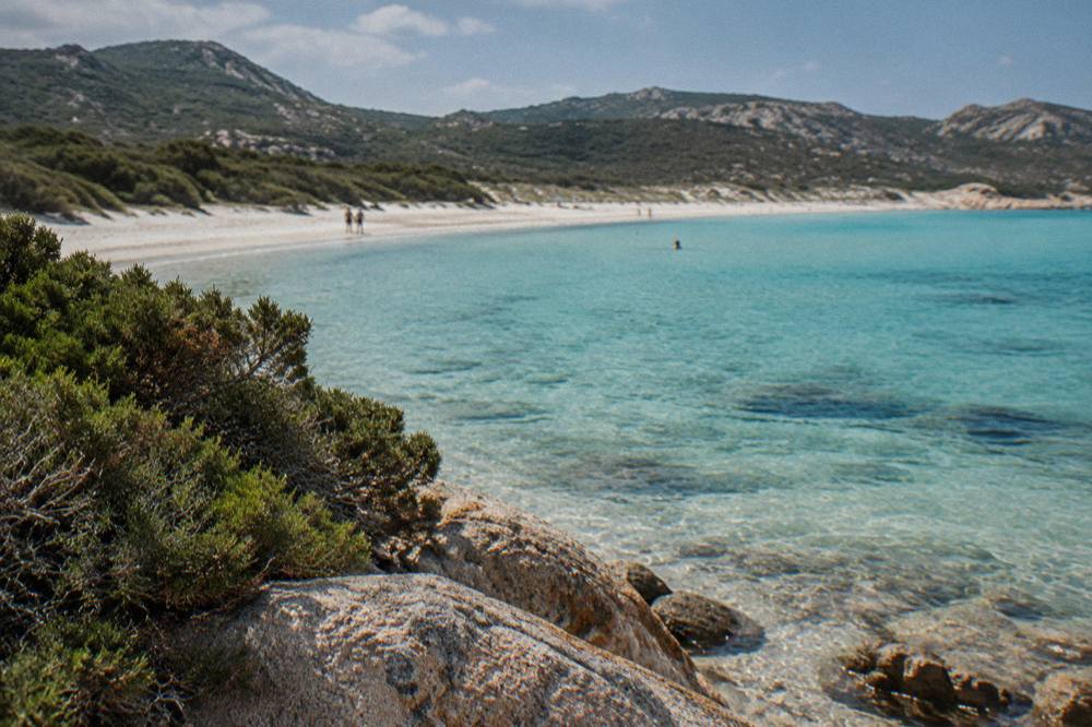
How Do You Get To Saleccia Beach From Saint-Florent?
There are three reported ways to reach Saleccia Beach: a boat shuttle from Saint-Florent port, reported as running about April to October and weather permitting; a 4x4 track from Casta; or the walking trail through the Désert des Agriates. There is no ordinary road and no scheduled public bus, so every itinerary starts with one of those three choices, and the shuttle schedules depend on sea conditions on the day.
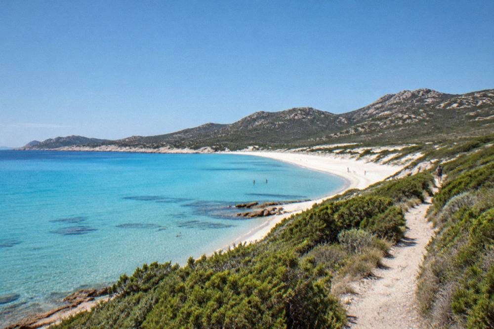
The tourism authority's page on the Désert des Agriates is the source for those three access routes, and each comes with its own trade-offs. The boat shuttle is the simplest for families and for anyone without a high-clearance vehicle: you walk on at Saint-Florent and step off on the sand. The 4x4 track from Casta is a rough unpaved route, and hire-car insurance on Corsica generally excludes it, which matters if you are weighing a self-drive plan. On foot, the coastal trail links Saint-Florent, Saleccia and Lotu, and it is the option that turns the journey itself into the day's activity.
| Access route | Starting point | Season or condition reported | Notes from the sources |
|---|---|---|---|
| Boat shuttle | Saint-Florent port | About April to October, weather permitting | Private operators, sea-state dependent |
| 4x4 track | Casta | Dry-weather track, high-clearance vehicle | Unpaved route across the Agriates |
| On foot | Saint-Florent or Lotu | Check the daily fire-risk map 15 June to 30 September | Coastal trail through the maquis |
One planning point that surprises first-time visitors: the fire rules. From 15 June to 30 September it is forbidden to light a fire or smoke in forests, maquis and massifs anywhere in Corsica, and the prefecture-linked fire-risk map is updated at 18:00 for the next day, with some massifs closed entirely on the highest-risk days. The UK Foreign Office notes a high wildfire risk in France from April to October. The Agriates is exactly the kind of maquis-covered massif those rules cover, so check the map the evening before a hike and take water seriously. For a fuller rundown of access and seasonal notes, the Lotu Beach guide covers the neighbouring cove reached the same three ways, and the wider Désert des Agriates overview context page on the island's coastlines explains how this stretch fits the island's 1,000 km of shore.
Can You Reach Saleccia Beach By Boat Tour Instead Of The Shuttle?
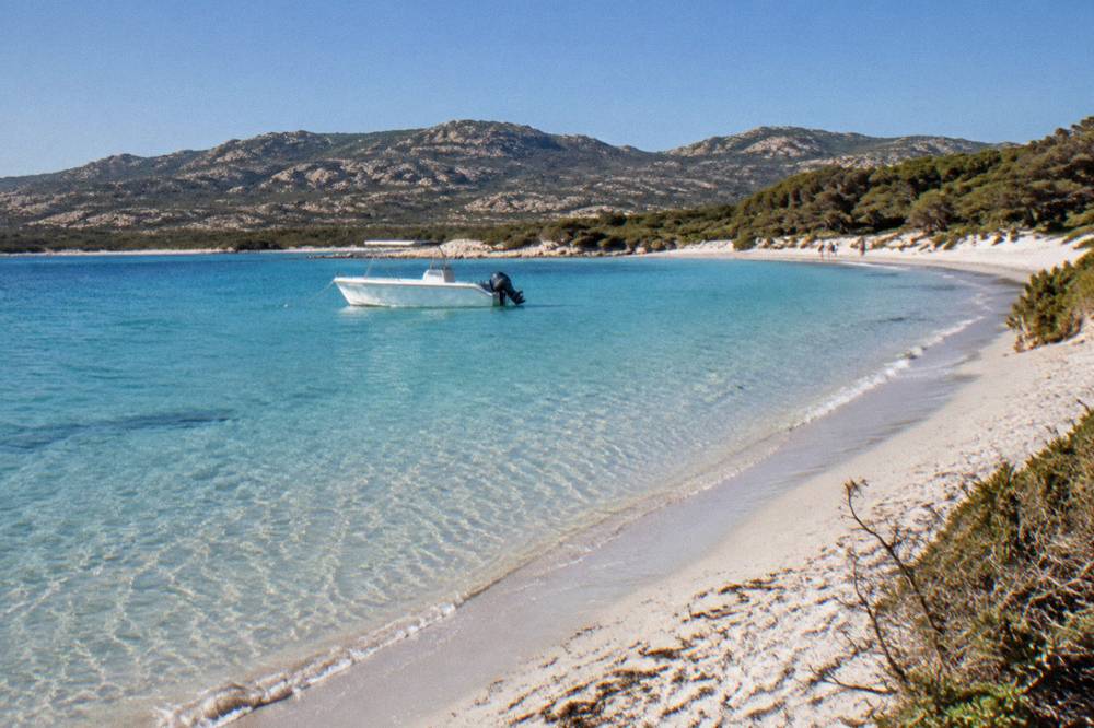
Yes, and for many visitors a boat tour is the most reliable way in: guided sea trips run along the Corsican coast from several ports, and the Agriates shoreline is a regular feature of northern island itineraries. The tours listed below cover the Gulf of Calvi, the Lavezzi islands in the far south and a half-day trip through Cap Corse and the Agriates itself, so the choice depends on which part of the coast you want to see from the water.
A half-day trip through Cap Corse and the Désert des Agriates from Saint-Florent is the pick that touches this beach's own shoreline, pairing the peninsula's headlands with the Agriates coast. The Gulf of Calvi snorkelling trip covers different water on the northwest coast, and the Lavezzi catamaran with snorkelling sits at the opposite end of the island off Bonifacio. Between them they show the range of what a day on a Corsican boat actually looks like, and all three are bookable with free cancellation windows before departure.
It runs from Calvi rather than Saint-Florent, so treat it as a second sea day on a northern itinerary rather than a substitute for the Saint-Florent shuttle.
Is Saleccia Beach Good For Swimming?
Saleccia is a swimming beach in the straightforward Mediterranean sense: it faces open sea over sand, with no road, no port and no river mouth at the beach itself in the sources, and supervision on this coast follows the island-wide pattern reported for Haute-Corse, where volunteer firefighters staff supervised beaches about 1 July to 31 August. Outside that window, and on any unsupervised beach, swimming is at your own judgement, and the standard sea-safety advice applies: check flags where posted, and never swim alone in offshore wind.
What the sources do give is the supervision pattern: Ajaccio's main beaches have seven lifeguard posts from 1 July to the end of August, and in Haute-Corse, the department that includes Saint-Florent and the Agriates coast, supervised beaches are staffed by volunteer firefighters about 1 July to 31 August. Saleccia itself is not on either published list, so plan on the assumption that it is an unsupervised beach and swim accordingly.
The emergency framework is the same as everywhere on the island: 112 is the general EU emergency number, 15 for medical, 17 for police, 18 for fire, and 196 for sea rescue, monitored on VHF channel 16 at sea. If you are on a boat tour rather than swimming from the shore, the crew carries that responsibility; if you are on your own, keep a phone charged and know the numbers.
Saleccia Or Lotu: Which Agriates Beach Should You Choose?
Saleccia and Lotu are the two named beaches of the Désert des Agriates, reached by the same three routes, and the practical difference is position: Lotu lies just west of Saleccia along the same shore, deeper into the Agriates from Saint-Florent, so a walk between them is the usual way to see both in one day. Neither has a road, neither has a published fee in the sources, and the choice between them usually comes down to which end of the trail your legs or your shuttle favours.
Because both beaches share the same access pattern, many itineraries treat them as a pair. The boat shuttle from Saint-Florent stops at both, the 4x4 track from Casta serves the same corner of coast, and the coastal path links them directly. If you are walking in from Saint-Florent, Saleccia comes first; if you are walking back from the far end, Lotu is the last stretch before the trail turns inland. The Lotu Beach guide covers that beach in the same detail as this page, and both sit inside the wider Désert des Agriates coastal region this site maps in its regional overview.
| Saleccia | Lotu | |
|---|---|---|
| Region | Désert des Agriates, west of Saint-Florent | Désert des Agriates, west of Saleccia |
| Boat shuttle from Saint-Florent | Reported, about April to October | Reported, same route and season |
| 4x4 access | Track from Casta | Same track network from Casta |
| On foot | Coastal trail from Saint-Florent | Coastal trail, next beach west of Saleccia |
| Published entry or parking fee | None in the sources | None in the sources |
What Else Is There To Do Near Saleccia In Northern Corsica?
The area around Saleccia stacks up a full northern itinerary: Saint-Florent and the Patrimonio appellation at the base of Cap Corse, the Cap Corse peninsula itself, the Balagne coast west toward L'Île-Rousse and Calvi, and inland, the old capital of Corte with its citadel and museum, all reachable on day trips from a single base.
The Musée de la Corse in Corte costs EUR 5.50 full price and one ticket covers both the museum and the citadel, which makes it one of the clearer-value inland stops on the island.
Saint-Florent itself is the working base: a port town with shuttle departures, and the gateway to the Patrimonio appellation reported by the tourism authority. North of it, Cap Corse runs up as a finger of headlands and harbours, with the half-day Cap Corse and Agriates trip covering both in one guided loop. West along the coast, the Balagne holds Calvi and its citadel, Île-Rousse and the hilltop villages behind them; the Calvi citadel guide covers the town that anchors that shore. Inland, Corte sits in the island's mountainous middle: road times of one hour from Bastia and one and a half from Ajaccio make it a realistic inland day from a northern base, and the Citadelle de Corte page details what the combined ticket includes.
Prehistory has a place here too. Filitosa, the megalithic site in the Taravo valley of southwest Corsica, is open 1 April to 2 November with adult entry at EUR 9, and while it is a long way from the Agriates, it answers the question of what Corsica looked like before any of these towns existed. The Filitosa guide covers it fully.
When Is The Best Time Of Year To Visit Saleccia Beach?
The shuttle season reported for the Agriates runs about April to October, weather permitting, and the Météo-France station normals for Ajaccio, 1991 to 2020, show why: July averages 8.6 mm of rain and 12 h 6 min of sunshine a day, while November carries 111.8 mm of rain and 4 h 42 min of sunshine. No single month is named as the best here, because the sources give figures, not rankings, but the sea-access season and the rainfall table together frame the choice.
The climate of Corsica is a hot dry summer and a mild wet winter, with snow only on the high mountains, and the station normals quantify it. October and November carry the most rain on the Ajaccio table, and the shoulder months of May and June sit between: May shows a mean daily high of 22.1 °C against July's 28.6 C. For a beach-and-boat plan, the window in which the shuttle reportedly runs and the rainfall figures stay low overlaps from late spring to early autumn; for hiking the Agriates trail, the same window collides with the 15 June to 30 September fire rules, which is why the fire-risk map matters as much as the rain chart.
| Month | Ajaccio mean daily high | Ajaccio mean daily low | Rain mm | Sunshine h/day |
|---|---|---|---|---|
| April | 18.5 °C | 8.3 °C | 53.1 | 7.7 |
| May | 22.1 °C | 11.8 °C | 49.8 | 9.3 |
| June | 25.9 °C | 15.4 °C | 25.9 | 11.1 |
| July | 28.6 °C | 17.7 °C | 8.6 | 12.1 |
| August | 29.2 °C | 18.1 °C | 15.8 | 11.1 |
| September | 26.1 °C | 15.4 °C | 57.8 | 8.7 |
| October | 22.8 °C | 12.6 °C | 85.7 | 6.7 |
Source of the figures: Météo-France station data, 1991 to 2020, for the Ajaccio station.
How Does Saleccia Compare With Corsica's Famous Southern Beaches?
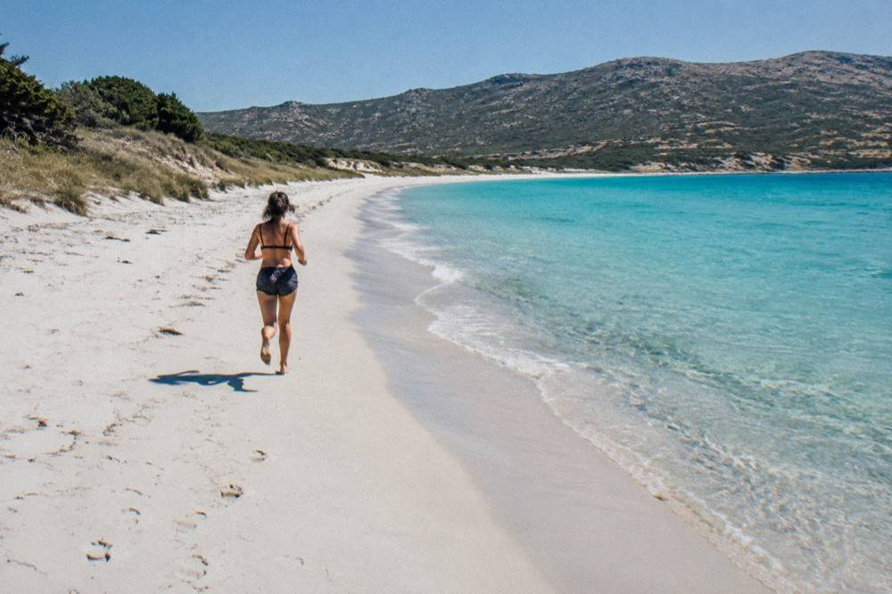
Saleccia's distinction is structural rather than scenic ranking: where the big named beaches of southern Corsica, Palombaggia, Santa Giulia and Rondinara, sit near Porto-Vecchio and Bonifacio with paved access, Saleccia sits behind a roadless stretch of the Agriates, which changes the effort and the logistics of the day.
Palombaggia lies on the southeast coast with its own following among visitors to Porto-Vecchio, Santa Giulia curves in a sheltered bay of the same coast, and Rondinara sits between Bonifacio and Porto-Vecchio in a wide sweep of sand. All three are covered in depth on their own pages: Palombaggia Beach, Santa Giulia Beach and Rondinara Beach. Further afield, Roccapina and Ostriconi on the west and northwest coasts share something of Saleccia's wilder character, Ostriconi sitting at the edge of the Agriates' western side.
| Beach | Region of Corsica | Access character |
|---|---|---|
| Saleccia | Désert des Agriates, north | Boat shuttle, 4x4 track or on foot, no road |
| Lotu | Désert des Agriates, north | Same three routes as Saleccia |
| Palombaggia | Southeast, near Porto-Vecchio | Paved access, covered in its own guide |
| Santa Giulia | Southeast, near Porto-Vecchio | Paved access, covered in its own guide |
| Rondinara | Between Bonifacio and Porto-Vecchio | Paved access, covered in its own guide |
| Ostriconi | Northwest coast | Covered in its own guide |
The point of the table is not to grade the sand. It is that a Corsica beach itinerary usually splits in two: the southern beaches, easy to reach and easy to chain together on a road trip, and the Agriates pair, which rewards a whole day given over to the sea, the track or the trail. Travellers who try to bolt Saleccia onto a southern-base itinerary generally regret the drive; the beach repays a northern base in Saint-Florent or the Balagne.
Can You Combine Saleccia With A Longer Corsica Coast Itinerary?
Yes, and the island's geography makes it natural: Saint-Florent pairs with Cap Corse and the Balagne on a northern loop, while a second week can take in the Scandola Nature Reserve and the Calanques de Piana on the west coast and the Bonifacio cliffs and Lavezzi islands in the far south.
The UNESCO property "Gulf of Porto: Calanche of Piana, Gulf of Girolata, Scandola Reserve" was inscribed in 1983 and is visited by boat, and the Lavezzi islands sit inside the Bouches de Bonifacio Nature Reserve, so both anchor full sea days of their own.
From a Saint-Florent base, the north fills three or four days: the Agriates boat day, a Cap Corse loop, and the Balagne with Calvi and Île-Rousse. The west coast then adds the Golfe de Porto, with the Scandola Nature Reserve, Girolata and the Calanques de Piana all best seen from the water under the reserve's boat-only access rule. The south holds the Bonifacio citadel and cliffs, the Lavezzi islands and the trio of southern beaches above. Inland, the Restonica valley and the Aiguilles de Bavella cover the mountains for anyone who wants the interior after the coast, and the natural swimming holes of the Piscines naturelles de Cavu sit on the route between them.
Ferry logistics frame the whole loop. Four airports serve the island, Ajaccio Napoléon Bonaparte (AJA), Bastia Poretta (BIA), Figari Sud Corse (FSC) and Calvi Sainte-Catherine (CLY), and for a northern itinerary Bastia is the practical arrival point. By sea, Bastia is served from Livorno, Savona and Genoa, and crossings run about 4 to 5 hours from Livorno and about 6.5 hours from Savona, as reported by an aggregator; more than 8.5 million passengers passed through Corsica's ports and airports in 2025 excluding cruise passengers, which is the scale of the summer flow the northern beaches sit inside.
| Arrival route | Crossing time | Notes |
|---|---|---|
| Livorno to Bastia | About 4 to 5 hours | Serves a Saint-Florent base |
| Savona to Bastia | About 6.5 hours | Reported range |
| Santa Teresa Gallura to Bonifacio | About 50 to 60 minutes | Sardinia link, Moby and Ichnusa Lines |
| Bastia Poretta airport | Flight arrival | Closest airport to the Agriates |
| Calvi Sainte-Catherine airport | Flight arrival | Serves a Balagne base |
What Should You Pack For A Day At Saleccia Beach?
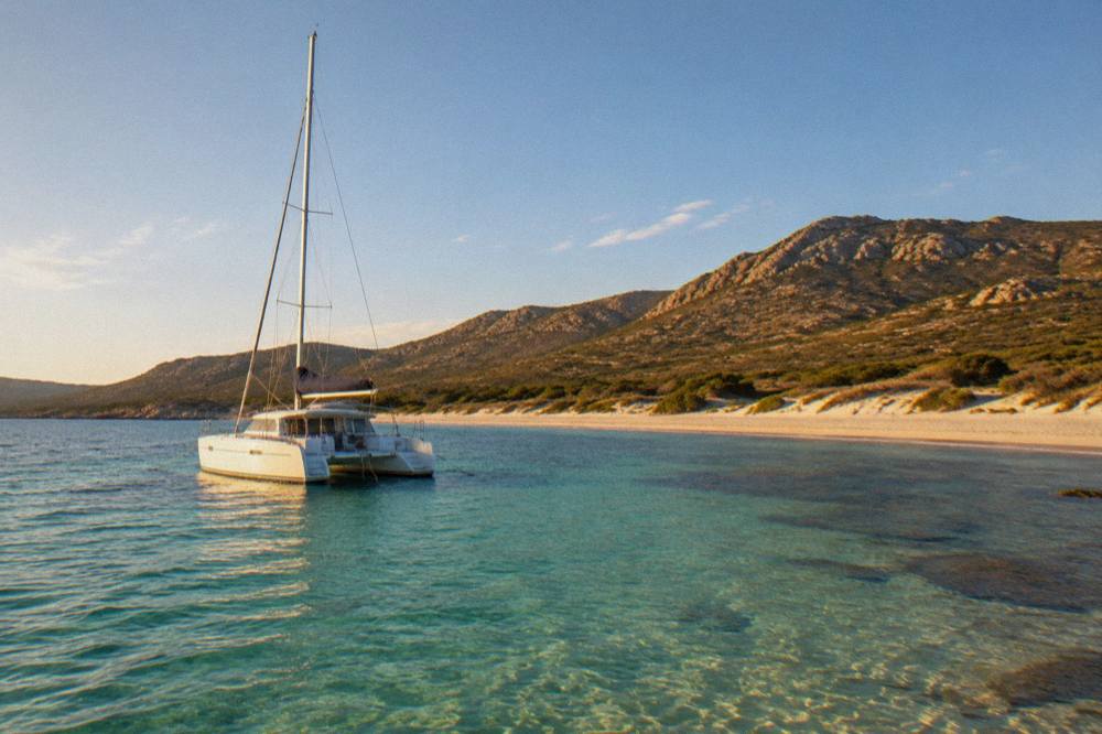
Pack for a beach with no road behind it: more water than feels reasonable, shade of your own, closed shoes if any part of the day involves the track or the trail, and no expectation of buying anything forgotten. From 15 June to 30 September the fire rules ban smoking in the maquis outright, ash and embers being the whole point of the ban, so a day in the Agriates in that window is a no-smoking day by law, not by courtesy.
The practical list follows from the access page above. If you arrive by shuttle, everything for the day comes on the boat with you and leaves with you. If you walk, the fire-risk map checked the evening before is part of the kit, and the trail through the maquis offers no resupply. Sun protection matters on any Mediterranean beach, and the July normals, a mean daily high of 28.6 °C at Ajaccio and 12 h 6 min of sunshine a day, give the shape of a midsummer day. A charged phone belongs in the bag not for photographs but for the emergency numbers: 112 ashore, 196 at sea.
Common Questions About Saleccia Beach In Corsica
How Do You Get To Saleccia Beach?
By boat shuttle from Saint-Florent, reported to run about April to October and weather permitting; by 4x4 track from Casta; or on foot along the coastal trail through the Désert des Agriates. There is no ordinary road and no scheduled bus.
Can You Drive To Saleccia Beach In Corsica?
Only by the unpaved 4x4 track from Casta, which is reported as a rough route across the Agriates requiring a high-clearance vehicle. Standard hire-car use of the track is generally not covered, and there is no paved access.
Is Saleccia Beach Supervised By Lifeguards?
The published supervision pattern for Haute-Corse, reported by local sources, has volunteer firefighters staffing supervised beaches about 1 July to 31 August. Saleccia does not appear on the published list, so plan for an unsupervised beach and swim within your own judgement.
What Is The Best Month To Visit Saleccia Beach?
No source names a best month. The shuttle season is reported as about April to October, and the Météo-France Ajaccio normals for 1991 to 2020 show July averaging 8.6 mm of rain and November 111.8 mm, which frames the practical window for a sea-access beach.
Are Saleccia And Lotu The Same Beach?
No. They are two neighbouring beaches of the Désert des Agriates, with Lotu lying just west of Saleccia along the same shore, and both are reached by the same boat shuttle, the same track network and the same coastal trail.
Can You Hike Between Saleccia And Lotu?
Yes, the coastal trail links them directly, and the walk between Saint-Florent, Saleccia and Lotu is a standard way to see the Agriates on foot. From 15 June to 30 September, check the fire-risk map published daily at 18:00 before setting out, and note that smoking is banned in the maquis throughout that period.
Saleccia Beach rewards exactly the kind of planning this page describes: a base in Saint-Florent, one of the three reported access routes chosen in advance, a check of the fire-risk map in the summer window, and a boat trip or a walk that treats the Agriates coastline as the destination rather than an obstacle. Build the day that way and the roadless stretch that makes the beach harder to reach is the same stretch that makes it worth the trip.