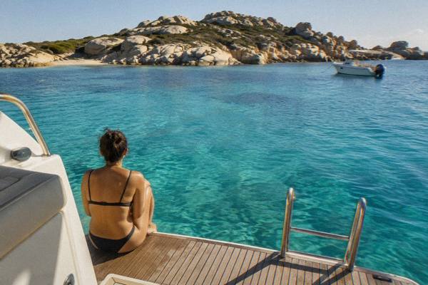
Corsica Vs Sardinia
Corsica and Sardinia face each other across the narrow strait at Bonifacio, and many travellers weigh the two islands against each other. This guide compares them on the facts: landscape, trails, beaches, food, weather and the ferry that links them.
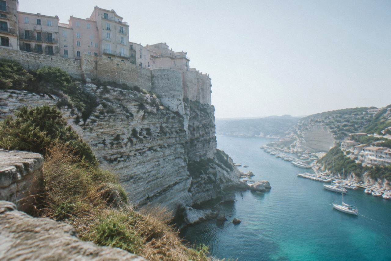
Corsica is the fourth-largest Mediterranean island, 8,722 km2 with more than 1,000 km of coastline and a mountainous interior rising to Monte Cinto at 2,706 m. Sardinia lies just across the Bouches de Bonifacio, about 50 to 60 minutes from Bonifacio by ferry, so the two can be combined in one trip.
Corsica and Sardinia sit facing each other at the southern tip of the Bonifacio cliffs, separated by a strait narrow enough that the ferry between Bonifacio and Santa Teresa Gallura takes about 50 to 60 minutes, per the operator's route information. That closeness shapes how the two islands are compared: they share a sea, granite coasts and a mountain backdrop, yet they belong to two countries, run on two currencies of which Corsica's is the euro, and answer to two very different tourism machines. This page compares them the only way this site compares anything, on published figures, and the published figures here are Corsica's: 8,722 km2 of island, more than 1,000 km of coastline and an interior that climbs to Monte Cinto at 2,706 m.
Which Island Should You Choose, Corsica Or Sardinia?
The honest answer is that the two islands are closer than most comparison articles suggest, and the deciding facts are practical ones rather than beauty contests. Corsica measures 8,722 km2, ranks as the fourth-largest Mediterranean island, and carries a mountainous interior that tops out at Monte Cinto at 2,706 m, all figures from the Collectivité de Corse's own environmental documentation. Sardinia sits directly across the strait from Bonifacio.
What separates the experience of the two islands is structure. Corsica is a single territorial collectivity, the Collectivité de Corse, with a resident population of 365,636 as of the provisional INSEE estimate for 1 January 2026, spread across 360 communes, many of them mountain villages of a few hundred people. The island's tourism runs through four airports, Ajaccio Napoléon Bonaparte, Bastia Poretta, Figari Sud Corse and Calvi Sainte-Catherine, and ferry ports including which is why the practical pages on this site, such as Corsica airports and flight planning, matter as much as any beach guide.
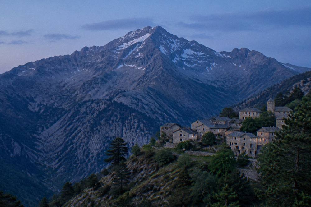
The comparison also depends on what a reader wants from the word "island". If the answer is walking, Corsica holds the GR20, a 180 km mountain traverse that the Corsican Assembly's own documentation describes as about fifteen stages of 4 to 8.5 hours each. If the answer is a shorter, drive-and-swim holiday, both islands deliver, and the choice comes down to flights, ferries and which coast you prefer. The full things to do in Corsica roundup covers the Corsican option in detail.
How Do Corsica And Sardinia Compare On Size And Landscape?
Corsica covers 8,722 km2 and is the fourth-largest island in the Mediterranean, with more than 1,000 km of coastline and a mountainous interior that rises from sea level to Monte Cinto at 2,706 m. Its regional nature park, the Parc naturel régional de Corse, created in 1972, today spans 4,484 km2, more than half the island.
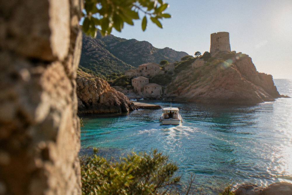
Those figures come from the Collectivité de Corse's environmental strategy documents and the UNESCO inscription record, and they describe an island where the mountains press close to the sea. The park's western sea front alone runs 80 km from Capu Rossu to Capu Cavallu. Only the interior, Corte, the Niolu and the high massifs around Bavella, counts as inland; everywhere else the sea is within reach, which is why boat trips, from the Scandola reserve cruises to the Sanguinaires gulf tours, sit at the centre of Corsican tourism.
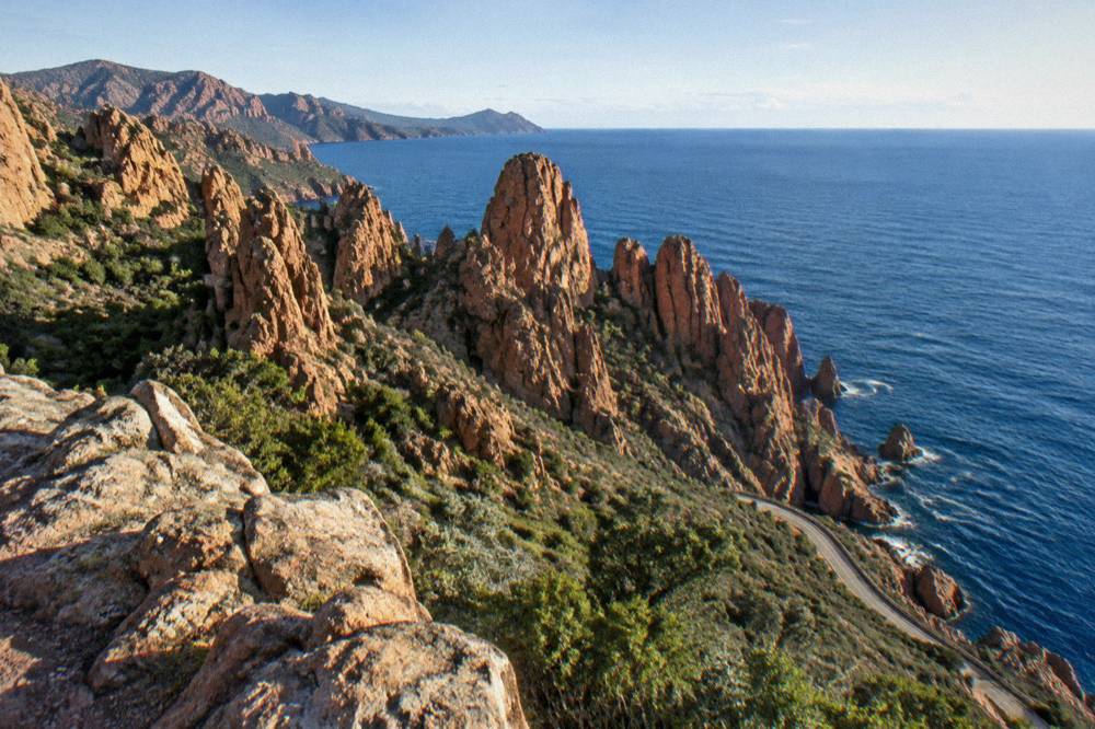
Corsica's landscape recognition is formal: the UNESCO World Heritage property "Gulf of Porto: Calanche of Piana, Gulf of Girolata, Scandola Reserve", inscribed in 1983 under natural criteria, covers 11,800 ha on the west coast. Scandola itself, created by ministerial order on 9 December 1975, was the first nature reserve in Corsica, with 1,000 ha of sea, 919 ha of land and a 70 ha integral reserve, managed by the PNRC. Sardinia's coastal protections are a matter for Italian sources.
| Corsica fact | Figure |
|---|---|
| Area | 8,722 km2 |
| Mediterranean rank | Fourth-largest island |
| Coastline | More than 1,000 km |
| Highest summit | Monte Cinto, 2,706 m |
| Regional park | PNRC, created 1972, 4,484 km2 |
| Population | 365,636 (1 Jan 2026, provisional) |
| Communes | 360 |
How Easy Is It To Combine Corsica And Sardinia In One Trip?
It is genuinely easy, because the two islands are linked by a year-round short ferry: Moby and Ichnusa Lines operate Santa Teresa Gallura in Sardinia to Bonifacio in Corsica, a crossing of about 50 to 60 minutes, and a report of 9 October 2026 confirmed the operators kept the route after Sardinia found no rival bidder. A combined trip needs no long sea leg.
That route matters because Bonifacio sits at Corsica's southern tip, and from there the rest of the island opens northward: the Bonifacio boat trips to the Lavezzi islands, the cliffs and the Escalier du Roi d'Aragon, with its 189 steps cut down the cliff and a 180-degree view over the strait to Sardinia. The dedicated pages on the Corsica Sardinia ferry crossing and on combining both islands in one trip cover the logistics, and the broader question of which island suits you better is answered elsewhere on this site.
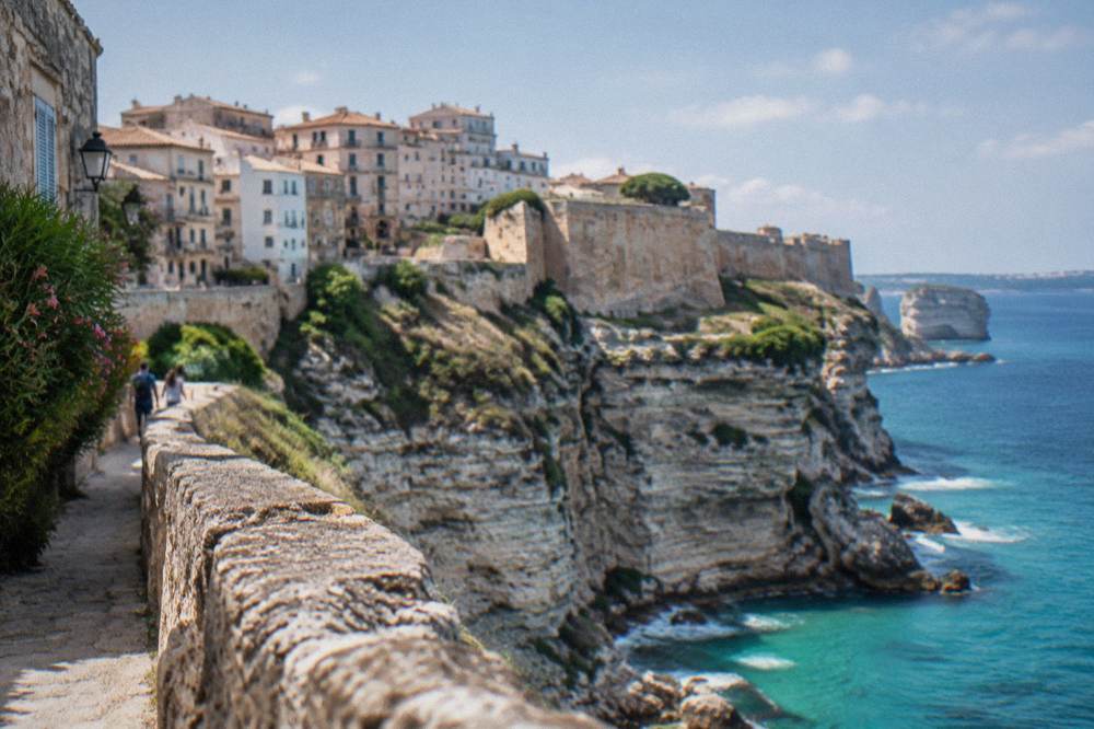
On the Corsican side of the strait, the pairing works well with a day of cliffs and water. These picks cover the southern and western highlights:
Longer crossings connect Corsica to the French and Italian mainlands: Corsica Linea sails Marseille to Ajaccio, Bastia, Propriano and L'Île-Rousse, La Méridionale sails Marseille to Ajaccio and Porto-Vecchio, and Corsica Ferries links Toulon and Nice to the main Corsican ports, with Livorno, Savona and Genoa on the Italian side. Reported crossing times range from about 4 to 5 hours on Livorno to Bastia to about 12 to 13 hours, mostly overnight, on Marseille routes. More than 8.5 million passengers, excluding cruise passengers, passed through Corsica's ports and airports in 2025, per the ORTC and DREAL annual report published 30 May 2026.
| Ferry route to Corsica | Crossing time |
|---|---|
| Santa Teresa Gallura to Bonifacio | About 50 to 60 minutes |
| Livorno to Bastia | About 4 to 5 hours |
| Savona to Bastia | About 6.5 hours |
| Nice to Bastia | About 7.5 to 10 hours |
| Toulon to Ajaccio or Bastia | About 10 to 13 hours |
| Marseille to Ajaccio or Bastia | About 12 to 13 hours |
What Does Corsica Offer That Sardinia Does Not?
Corsica's distinctive assets are its UNESCO-listed Gulf of Porto, which combines the Calanche of Piana, the Gulf of Girolata and the Scandola Reserve in one 11,800 ha natural property, and the GR20, a 180 km high-mountain traverse with guarded refuges that the PNRC runs under a mandatory online booking system. Neither has a direct equivalent across the strait.
Scandola deserves the emphasis. The reserve's land area is closed to the public and visits are by boat only, reported on the OEC's access rules, with daytime anchoring allowed outside the integral reserve and no recreational line or spear fishing. A State and OEC steering committee on 28 April 2026 renewed the management agreement and confirmed measures including voluntary labelling of boat operators, a QR-code tracking trial for pleasure boats and renewed osprey quiet zones, with quotas and licences to be consolidated in a regulatory framework being finalised. In plain terms: the reserve is actively tightening how it is visited, and booking a licensed boat excursion, such as the Scandola and Girolata day trip, is the standard way in.
Beyond the reserve, Corsica stacks its sights along one west-coast corridor: the Calanques de Piana, the village of Girolata reachable by sea or on foot, and the Golfe de Porto, all inside the UNESCO property. Inland, Corte holds the old capital's citadel and the Musée de la Corse, where a single ticket at EUR 5.50 full rate covers both museum and citadel, per the museum's practical page. Ajaccio pairs Maison Bonaparte, EUR 10 full price and free for EU residents under 26, with the Palais Fesch at EUR 10 full and EUR 6 for over-65s, open daily 09:00 to 17:00 for the 2026 period.
| Corsican sight | Entry | Notes |
|---|---|---|
| Maison Bonaparte, Ajaccio | EUR 10 full, EUR 8 non-EU 18-25 and large families | Free for EU under-26s, closed Mondays |
| Palais Fesch, Ajaccio | EUR 10 full, EUR 6 over-65s, free up to 18 | Daily 09:00 to 17:00 |
| Musée de la Corse and citadel, Corte | EUR 5.50 full, EUR 4 and EUR 3 reduced | One ticket covers both |
| Filitosa prehistoric site | EUR 9 adults, EUR 7 reduced, EUR 28 family | Open 1 April to 2 November |
| Scandola Reserve | Boat visit only | Landing banned in the integral reserve |
Which Island Is Better For Hiking, Corsica Or Sardinia?
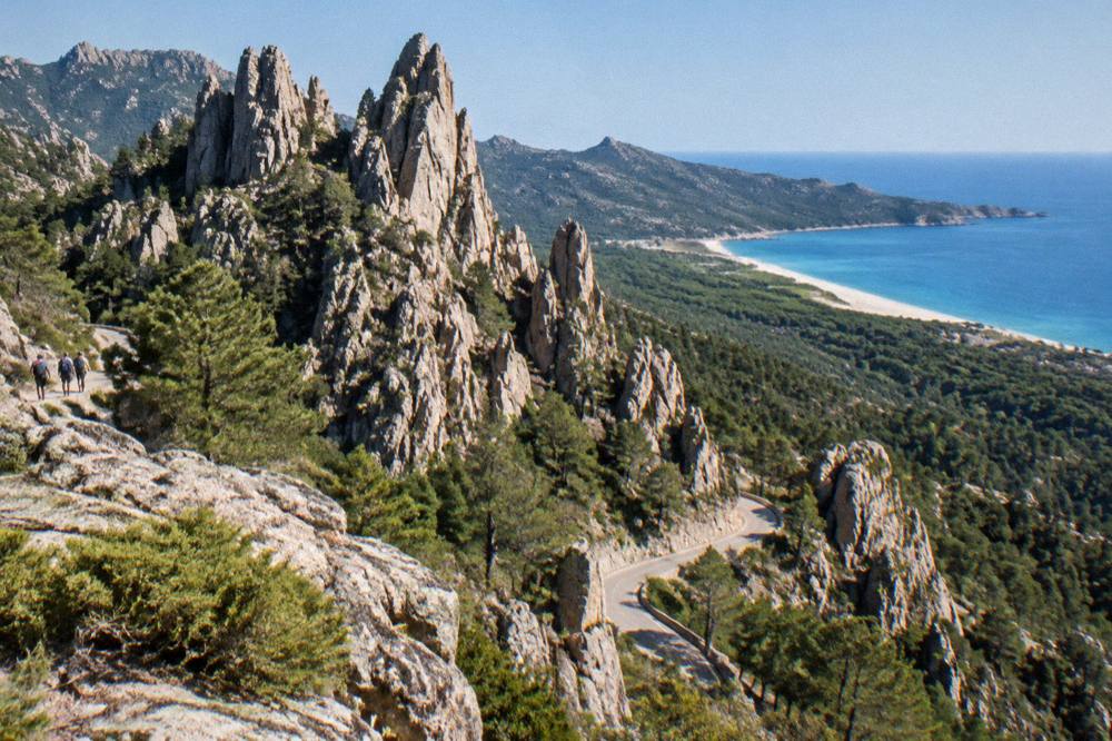
On documented trail infrastructure, Corsica's case rests on the GR20: 180 km north to south, about fifteen stages of 4 to 8.5 hours, with PNRC refuges guarded from 16 May to 4 October in the 2026 season and a mandatory online booking system for every bunk and bivouac pitch. The island also runs a full network of crossing trails, the Mare a Mare and Mare e Monti routes, at measured lengths from 66 km to 139 km.
The long-trail numbers come from the PNRC's own brochure. Mare a Mare Nord runs 139 km, or 161 km with the variant, over 8 to 12 days. Mare a Mare Sud is 73 km, finishing in Propriano, and Mare e Monti Sud is 66 km, also finishing in Propriano. Mare e Monti Nord runs 121 km over about 10 days toward Cargèse. The GR20 guide page and the broader hiking guide walk through all of it.
| Corsican long trail | Length | Days | Total climb |
|---|---|---|---|
| GR20 (Fra li Monti) | 180 km | About 15 stages | Not published in the sources |
| Mare e Monti Nord | 121 km | 10 | 6,100 m |
| Mare a Mare Nord | 139 km (161 km variant) | 8 to 12 | 5,900 m |
| Mare a Mare Centre | 84 km | 6 to 7 | 3,900 m |
| Mare a Mare Sud | 73 km | 5 | 3,200 m |
| Mare e Monti Sud | 66 km | 5 | 2,700 m |
Refuge logistics are strictly regulated. PNRC 2026 rates are EUR 20 per person for a bunk, EUR 12 for a bivouac pitch with your own tent, EUR 27 for a one-person rented tent and EUR 39 for a two-person rented tent. Dogs are not allowed inside refuges or rented tents, and no GR20 departures are permitted from Calenzana after 11:00 under a municipal fire-risk order. Wild camping is banned across the island; bivouac is tolerated only in the marked areas at refuges, and it must be reserved. From 15 June to 30 September, lighting fires or smoking in forests, maquis and massifs is forbidden, and a daily fire-risk map published at 18:00 for the next day can restrict access to some massifs from mid-June to mid-September. The rest of the planning pages sit on Corsica Travel Guide.
For walkers who want the mountain feel without the GR20's commitment, a guided day out works well, and the Corsican side of a comparison trip pairs nicely with an organised excursion:
How Do The Beaches Compare In Corsica And Sardinia?
Corsica's beach case is documented in kilometres rather than adjectives: more than 1,000 km of coastline, with signature strands including Palombaggia and Santa Giulia near Porto-Vecchio, Rondinara between Bonifacio and the gulf, and Saleccia and Lotu in the Désert des Agriates, the latter two reachable by boat shuttle from Saint-Florent, by 4x4 track from Casta or on foot, per the island's tourism board.
The Agriates detail matters for planning. The shuttle season runs roughly April to October, weather permitting, and the boat from Saint-Florent is the standard approach, which makes a stay in the Saint-Florent area, covered in the Corsica beaches guide, a natural base for that stretch of coast. Further south, the beach pairs around Porto-Vecchio each have their own page on this site: Palombaggia, Santa Giulia and Rondinara.
Swimming safety is organised on the Corsican side. Ajaccio operated seven lifeguard posts on its main beaches from 1 July to the end of August 2026, and Haute-Corse's supervised beaches are staffed by volunteer firefighters over roughly the same period. Emergency numbers are standard French ones: 112, with 15 for medical, 17 for police, 18 for fire, 114 by SMS and 196 for sea rescue. A family itinerary built around beaches and easy sightseeing is laid out in Corsica with kids, and one gentle stop that suits all ages is the turtle park near Sagone:
What Is The Weather Like On Corsica Compared With Sardinia?
The documented Corsican picture comes from the Météo-France station normals for 1991-2020: a hot, dry summer and a mild, wetter winter, with July averaging 8.6 mm of rain at Ajaccio and November averaging 111.8 mm, and mean daily highs of 29.2 °C in August. Snow falls on the high mountains, not on the coast.
Both islands share the same broad Mediterranean regime, but this article gives only Corsica's figures, from the two reference stations at Ajaccio Campo dell'Oro and Bastia. The numbers below are station means for Ajaccio. November carries the highest monthly rain total at Ajaccio, 111.8 mm, and Bastia's November figure is higher still at 134.3 mm. July is the low point for rain at both stations. The month-by-month detail, useful for timing a combined trip, sits in Corsica weather by month and the best time to visit Corsica.
| Month | Ajaccio high °C | Ajaccio low °C | Rain mm | Sunshine h/day |
|---|---|---|---|---|
| January | 14.0 | 4.7 | 54.1 | 4.4 |
| March | 16.0 | 5.9 | 50.4 | 6.8 |
| May | 22.1 | 11.8 | 49.8 | 9.3 |
| July | 28.6 | 17.7 | 8.6 | 12.1 |
| August | 29.2 | 18.1 | 15.8 | 11.1 |
| September | 26.1 | 15.4 | 57.8 | 8.7 |
| November | 18.3 | 9.0 | 111.8 | 4.7 |
| Month | Bastia high °C | Bastia low °C | Rain mm | Sunshine h/day |
|---|---|---|---|---|
| January | 13.8 | 5.4 | 67.3 | 4.5 |
| March | 15.8 | 6.8 | 63.7 | 6.3 |
| May | 22.4 | 12.6 | 53.7 | 8.7 |
| July | 29.4 | 19.4 | 13.8 | 11.2 |
| August | 29.8 | 19.8 | 21.1 | 10.1 |
| September | 26.0 | 16.7 | 74.5 | 7.9 |
| November | 17.7 | 9.5 | 134.3 | 4.5 |
How Do Food And Drink Compare Between The Two Islands?
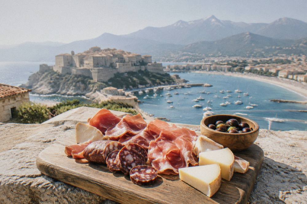
Corsica's food identity is unusually well documented in appellations: brocciu obtained its appellation d'origine in 1983, the charcuterie trio of prisuttu, lonzu and coppa gained AOC in 2012 and AOP in 2014, chestnut flour, olive oil and honey all carry protected Corsican names, and the island's wine appellations include Patrimonio, Ajaccio, Vin de Corse and Muscat du Cap Corse.
The detail rewards attention. The Corsican charcuterie designations rest on the Nustrale pig breed, recognised in 2006. Clementine de Corse obtained its IGP in 2007 and Label Rouge in 2014, reported by the tourism board. The main grape varieties behind the wines are Nielluccio and Sciaccarellu for reds and Vermentinu for whites, per the same source. What this means against Sardinia is a matter of taste rather than record, but the Corsican table is measurably distinctive, and the pages on Corsican food and what to eat, Corsican wine and Corsican drinks cover it course by course.
One budget note that surprises visitors from tipping cultures: French law requires menus to state "prix service compris" with the service percentage included, and an additional tip is optional, per the DGCCRF's official guidance. Practical money questions are handled in Is Corsica expensive and the cost and budget guide.
Where Should You Stay On The Corsican Side?
Corsica's bases split cleanly by purpose: Ajaccio (76,320 residents) and Bastia (46,867) as the two towns, Bonifacio and Porto-Vecchio for the southern beaches, Calvi and L'Île-Rousse for the Balagne, and Corte for the mountain interior, with road times to Corte of about 1 hour from Bastia, 1 h 30 from Ajaccio and Calvi, and 2 h 45 from Bonifacio or Propriano, per the Corte museum's own access page.
Those driving times explain the island's rhythm: nothing is far, but mountain roads set the pace. A car is the standard way to cover the island, and the guides to car rental in Corsica and driving in Corsica cover the rules, including checking Inforoutes Corse for live mountain-pass conditions before setting out. Lodging options run from campgrounds to villas, covered in where to stay, luxury hotels and villas and vacation rentals.
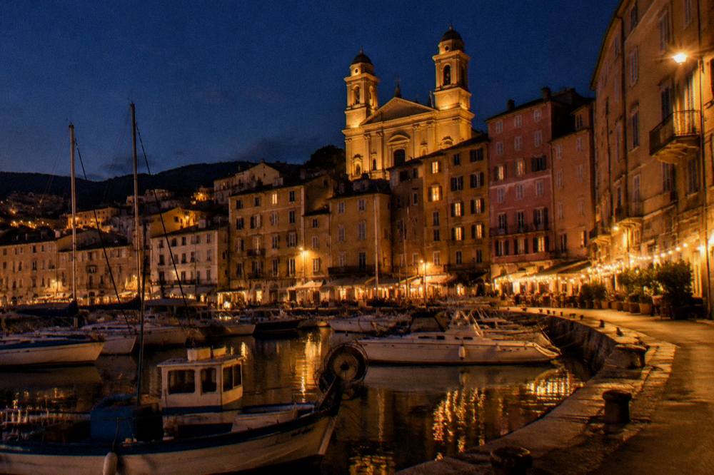
For a first visit, this site's itineraries do the sequencing work: Corsica in 3 days, 5 days, one week and longer up to 14 days, plus dedicated north and south routes and a full road trip plan. A combined Corsica-and-Sardinia trip works best with a Bonifacio base at the start or the end, so the strait crossing costs a single hour of the itinerary. The team behind this comparison is the same one behind every page of Corsica Travel Guide.
Before the closing questions, here are the three experiences that pair best with a two-island plan, all bookable in advance:
Common Questions About Corsica Vs Sardinia
Is Corsica Better Than Sardinia?
Neither island is measurably "better" on any published figure. Corsica offers 8,722 km2 of territory, more than 1,000 km of coastline, the UNESCO-listed Gulf of Porto and the GR20 long-distance trail; Sardinia lies 50 to 60 minutes away by ferry from Bonifacio. The full discussion sits at Is Corsica better than Sardinia.
Can You Visit Corsica And Sardinia In One Trip?
Yes. Moby and Ichnusa Lines run the Santa Teresa Gallura to Bonifacio ferry, a crossing of about 50 to 60 minutes, and the route was confirmed retained in October 2026. Bonifacio makes a practical hinge for a two-island itinerary.
How Far Apart Are Corsica And Sardinia?
They face each other across the Bouches de Bonifacio, and the ferry between Bonifacio and Santa Teresa Gallura takes about 50 to 60 minutes. On a clear day the Escalier du Roi d'Aragon's 189 steps give a 180-degree view from the Bonifacio cliffs toward Sardinia.
Which Island Has Better Hiking?
Corsica's documented trail system is the GR20, 180 km in about fifteen stages of 4 to 8.5 hours, plus the Mare a Mare and Mare e Monti routes from 66 km to 139 km, all with published lengths in PNRC material. Comparable Sardinian figures belong to Italian sources.
Do Corsica And Sardinia Use The Same Currency?
No. Corsica, as part of France, uses the euro. Check the current situation for Sardinia before travel, as it sits under Italian arrangements.
What Is The Best Way To Reach Corsica For A Two-Island Trip?
Fly into one of Corsica's four airports, Ajaccio, Bastia, Figari or Calvi, or arrive by ferry from Marseille, Toulon, Nice, Livorno, Savona or Genoa, then use the short Bonifacio to Santa Teresa Gallura crossing to add Sardinia. More than 8.5 million passengers moved through Corsica's ports and airports in 2025.