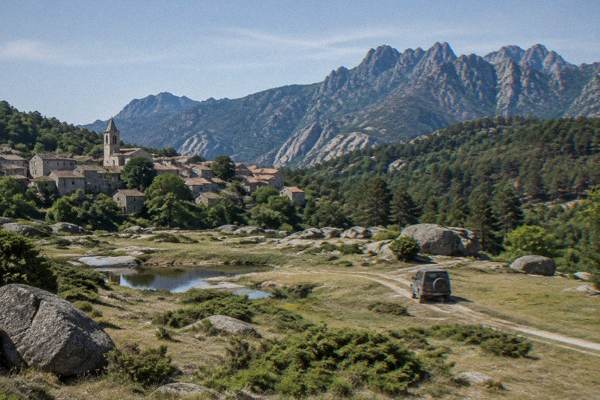
Cucuruzzu
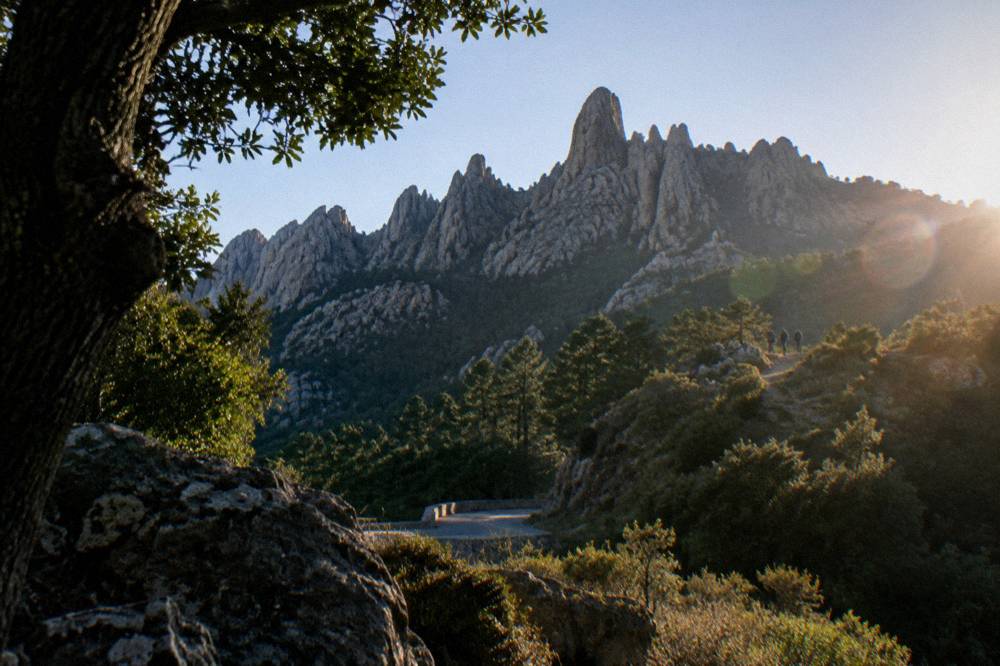
Cucuruzzu and Capula stand at Levie in the Alta Rocca, the forested mountain region of southern Corsica, and they pair naturally with Filitosa, the Aiguilles de Bavella and the beaches of the south coast.
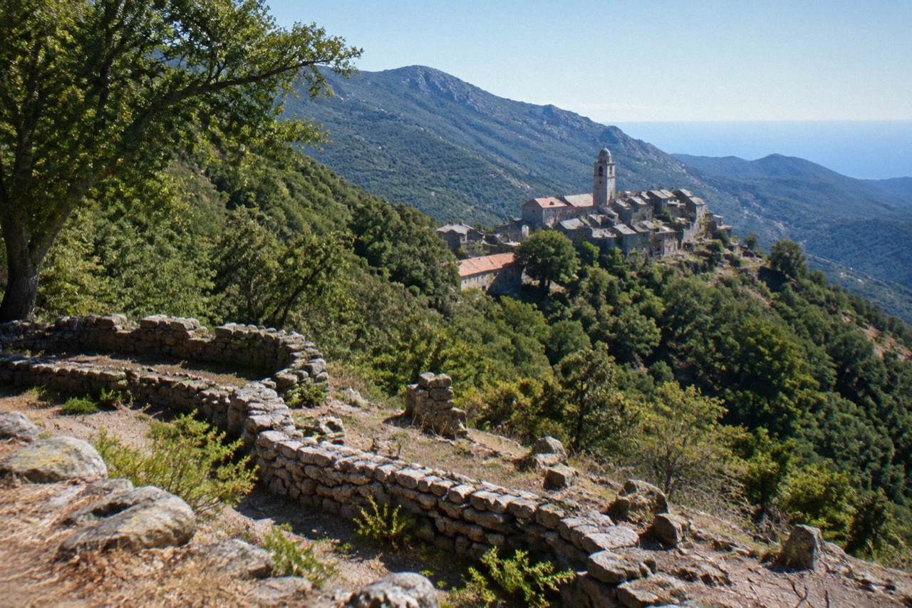
Cucuruzzu and Capula are prehistoric sites at the village of Levie, in the Alta Rocca of southern Corsica, a region of chestnut and pine forest between Porto-Vecchio, Sartène and the Aiguilles de Bavella. The nearest fully documented prehistoric site with published hours and prices is Filitosa at Sollacaro, open 1 April to 2 November.
Corsica is a French Mediterranean island of 8,722 km2 with more than 1,000 km of coastline and a mountainous interior that rises to Monte Cinto at 2,706 m, and the Alta Rocca, in the south, is one of its most wooded and least built-up regions. Within it, at the village of Levie, stand the two neighbouring prehistoric sites of Cucuruzzu and Capula, archaeology set in forest country rather than on the coast. The region around them, from Porto-Vecchio to Sartène and the Aiguilles de Bavella, is covered in detail across this site's guide to Corsica's regions, and this page gathers what the published sources say about planning a visit around Levie.
What Is Cucuruzzu And Where Does It Sit In Corsica?
Cucuruzzu is a prehistoric archaeological site at the village of Levie, in the Alta Rocca region of southern Corsica, and Capula is the second site on the same hillside, the two of them forming one archaeological stop in the island's mountainous interior. The region belongs to the Parc naturel régional de Corse, the regional park created in 1972, which today covers 4,484 km2.
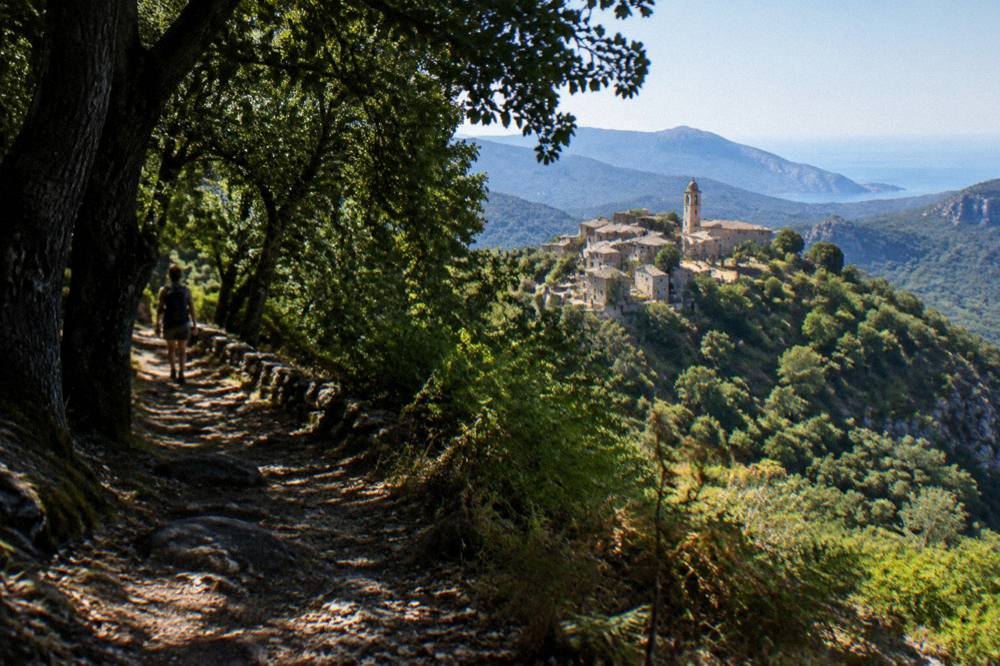
Levie is inland territory. The Alta Rocca sits behind the south coast, between the Gulf of Porto-Vecchio, the Valinco gulf around Propriano and the high needles of Bavella, and its economy and its trails are shaped by forest, chestnut groves and mountain streams rather than by beaches. The park's own documentation lists the Castagniccia and the big valleys running to the sea inside its boundary, and the western sea front of the park runs 80 km from Capu Rossu to Capu Cavallu.
For a trip planner, that position matters more than any single monument. A day built around Levie reaches forest walking, high viewpoints at the Aiguilles de Bavella and, within the same southern half of the island, the megalithic site of Filitosa near Sollacaro. Nothing about the sites themselves needs a boat, but the same region's edges touch three different seas of coastline, from Palombaggia to Rondinara.
The Collectivité de Corse, the island's single territorial authority with special status since 1 January 2018, administers the island through two departments, Corse-du-Sud and Haute-Corse, and Levie falls in Corse-du-Sud, whose population INSEE estimated at about 175,100 in 2026. The island as a whole counted 365,636 residents on 1 January 2026 in the provisional INSEE estimate, and population has grown every year since 2021.
How Do You Build A Day Around Cucuruzzu And Capula?
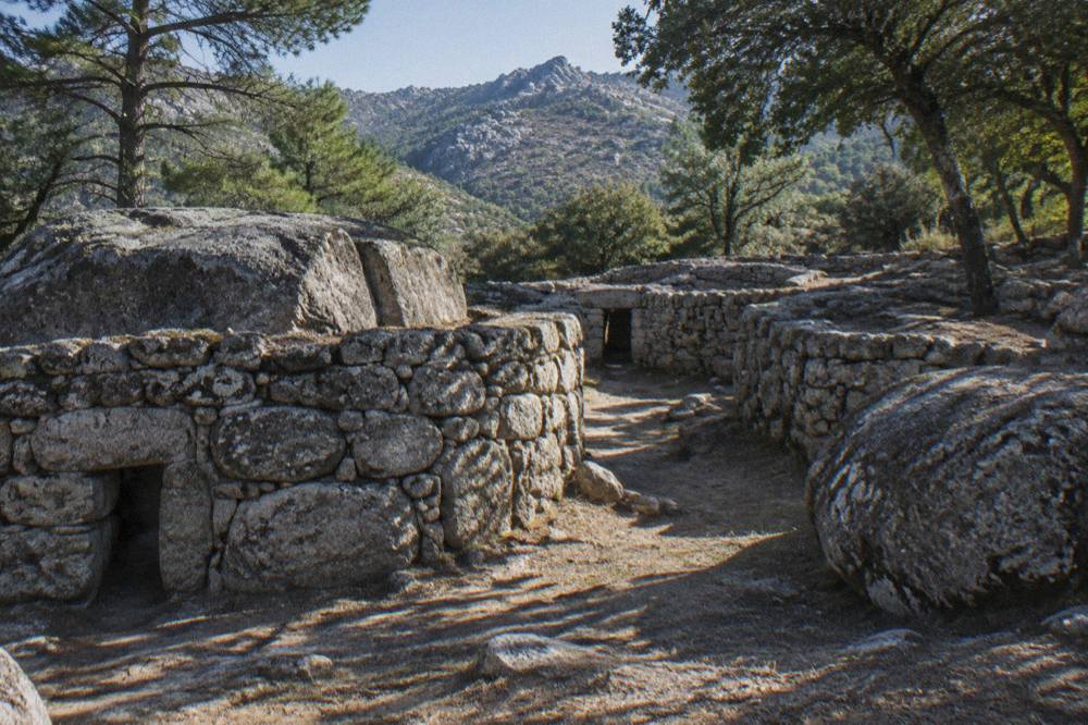
A day around Cucuruzzu and Capula works best as an Alta Rocca loop: the two Levie sites in the morning, forest and viewpoint stops in the middle of the day, and either the Bavella needles or the Valinco coast in the afternoon, with Sartène and Propriano as the practical service towns on the western side of the region.
The anchor towns are easy to place. Porto-Vecchio lies on the east coast, Sartène inland to its south-west, and Propriano on the Gulf of Valinco, and the Alta Rocca rides the high ground between them. No train serves the region: the Chemins de fer de la Corse run on the Ajaccio to Bastia line via Corte, the Ponte-Leccia to Calvi line and the Balagne coastal line between Calvi and L'Île-Rousse, all of them far to the north and west. A car, or a guided tour, is the practical answer, and this site's Corsica car rental guide covers the driving side.
Road conditions in the mountains change with the seasons and the weather. Inforoutes Corse, reported by the island authority, publishes live road status and accessibility levels for the main mountain passes, and checking it the evening before an Alta Rocca day is the standing pattern. The island's roads are characteristically narrow and mountainous, which is why the drive is part of the day rather than a chore before it.
Fire season shapes summer access across the whole interior. From 15 June to 30 September it is forbidden to light a fire or smoke in forests, maquis and massifs, and the prefecture-linked fire-risk map is updated at 18:00 each day for the next day; from mid-June to mid-September access to some massifs can be restricted on the highest-risk days. That rule applies to the forests around Levie exactly as it applies to the GR20.
A reasonable rhythm is a morning at the sites, lunch in one of the Alta Rocca villages, and an afternoon at Bavella or on the coast. The table below sets out the main components.
| Stop | What The Region Offers | Nearest Service Towns |
|---|---|---|
| Cucuruzzu and Capula | Two prehistoric sites at Levie | Levie, Sartène |
| Aiguilles de Bavella | High needles and forest trails | Zonza, Porto-Vecchio |
| Filitosa | Megalithic site with museum | Sollacaro, Sartène |
| Gulf of Valinco | Propriano port and beaches | Propriano, Sartène |
| Ospedale forest | Reservoir and pine country | Porto-Vecchio |
How Does Cucuruzzu Compare With Filitosa In Corsica?
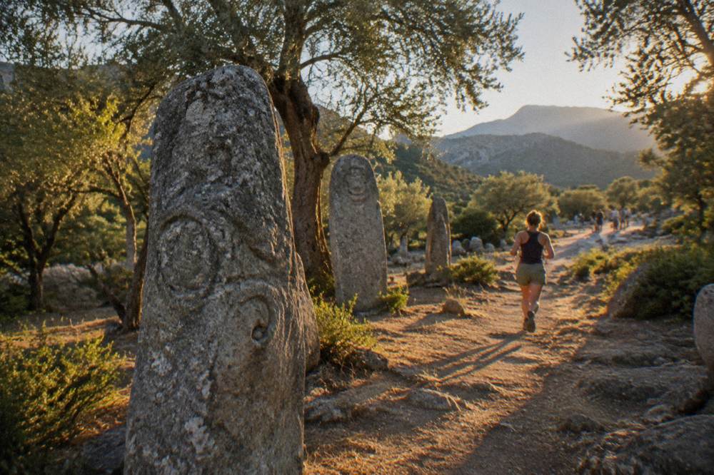
Filitosa, at Sollacaro in the Taravo valley west of the Alta Rocca, is the prehistoric site in southern Corsica with fully published hours and prices: it is open 1 April to 2 November, 09:00 to sunset, with adults at EUR 9, a reduced rate of EUR 7 and a family ticket at EUR 28, and the site recommends allowing about 1 h 30 for a visit.
The two places make a natural pairing because they sit on either side of the same southern hill country, Filitosa nearer the coast road and Levie up in the forest. Filitosa's own practical page states its museum hours as 09:00 to 19:00, and its season runs roughly two-thirds of the year. A traveller combining both in one day has a long but workable loop out of Porto-Vecchio, Sartène or Propriano.
What follows is the full published price and season picture for Filitosa, taken from the site's own timetable and rates page.
| Filitosa Ticket | Price | Notes |
|---|---|---|
| Adult (18+) | EUR 9 | Full price |
| Reduced (6 to 17, disabled) | EUR 7 | Reduced rate |
| Family (2 adults + 2 children 6 to 17) | EUR 28 | Single ticket |
| Under 6 | Free | No charge |
Season and hours for the same site:
| Period | Opening | Hours |
|---|---|---|
| 1 April to 2 November | Daily | 09:00 to sunset (site) |
| Museum | Same season | 09:00 to 19:00 |
Filitosa obtained recognition in the modern era of Corsican heritage protection in the same decades that the island's food products were gaining their appellation labels: brocciu obtained its appellation d'origine in 1983, and the Corsican charcuterie cuts prisuttu, lonzu and coppa received AOC status in 2012 and AOP status in 2014. A day in the south can carry both threads, the megaliths and the lunch table.
What Else Can You See On A Southern Corsica Prehistory Route?
Beyond Cucuruzzu and Filitosa, a southern Corsica heritage route can take in the Musée de la Corse in the citadel at Corte, at EUR 5.50 full price with one ticket covering both museum and citadel, the Maison Bonaparte in Ajaccio at EUR 10, and the Palais Fesch, also in Ajaccio, at EUR 10 full price with free entry up to 18.
Corte is the old capital and sits inland, and the museum's own practical page gives the road times that make it reachable: one hour from Bastia, one and a half from Ajaccio, one and a half from Calvi, two from Porto-Vecchio, two hours forty-five from Bonifacio and two hours forty-five from Propriano. Those are the only road times this site publishes for Corte, and they place the town as the northern anchor of any interior route that starts from the Alta Rocca.
In Ajaccio, the two museums keep different calendars. Maison Bonaparte, on Rue Saint-Charles 200 m from the bus station and ferry terminal and served by bus 8 from the airport, opens every day except Monday, with hours that change three times a year. The Palais Fesch lists daily 09:00 to 17:00 for 16 January to 31 December 2026, closed Christmas, New Year and 1 November.
| Museum | Town | Full Price | Closing Day |
|---|---|---|---|
| Maison Bonaparte | Ajaccio | EUR 10 | Monday |
| Palais Fesch | Ajaccio | EUR 10 | 25 Dec, 1 Jan, 1 Nov |
| Musée de la Corse and citadel | Corte | EUR 5.50 | 31 Dec to 14 Jan |
| Filitosa | Sollacaro | EUR 9 | 3 Nov to 31 Mar |
Bonifacio adds a different kind of monument at the southern tip of the island: the Escalier du Roi d'Aragon, 189 steps cut down the cliff with a 180-degree view over the straits towards Sardinia, with a fee of about EUR 5 reported and closed shoes required. The details are in this site's Bonifacio citadel and cliffs guide.
Which Walking Trails Cross The Alta Rocca Near Cucuruzzu?
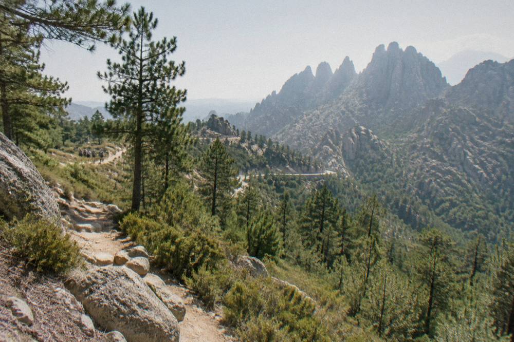
The Alta Rocca is crossed by the Mare a Mare Sud, a waymarked trail of 73 km over about 5 days that ends in Propriano with 3,200 m of climbing, and by the Mare e Monti Sud, 66 km over 5 days ending in Propriano with 2,700 m of climbing, both documented in the Parc naturel régional de Corse's own trail brochure.
Those two routes put the region on the long-distance walking map without the commitment of the GR20. The GR20 itself, the island's famous north to south mountain route of 180 km in about 15 stages of 4 to 8.5 hours, runs along the island's spine further east and north, and its 2026 refuge season runs from 16 May to 4 October with guarded refuges and mandatory online booking. Everything else covered here is indexed on Corsica Travel Guide.
The park's trail network, all lengths from the same official brochure, looks like this.
| Trail | Length | Days | Total Climb |
|---|---|---|---|
| Mare a Mare Nord | 139 km (161 km with variant) | 8 to 12 | 5,900 m |
| Mare a Mare Centre (Ghisonaccia to Porticcio) | 84 km | 7 | 3,900 m |
| Mare a Mare Sud (ends Propriano) | 73 km | 5 | 3,200 m |
| Mare e Monti Nord (to Cargèse) | 121 km | 10 | 6,100 m |
| Mare e Monti Sud (ends Propriano) | 66 km | 5 | 2,700 m |
For walkers planning overnight stages, the PNRC's 2026 refuge rates on the GR20 are EUR 20 per person for a bunk, EUR 12 for a bivouac pitch with your own tent, EUR 27 for a rented tent for one and EUR 39 for two. All rental tents sleep two and come with a 3 cm mat per person; bring a sleeping bag. Dogs are not allowed inside refuges or rented tents, no GR20 departures are allowed from Calenzana after 11:00 under a municipal fire-risk order, and wild camping is banned across the island, with bivouac tolerated only in the marked areas at refuges. The full picture is in the site's Restonica valley guide, which covers the same interior walking country further north.
Can You Reach Cucuruzzu On A Guided Tour From Porto-Vecchio?
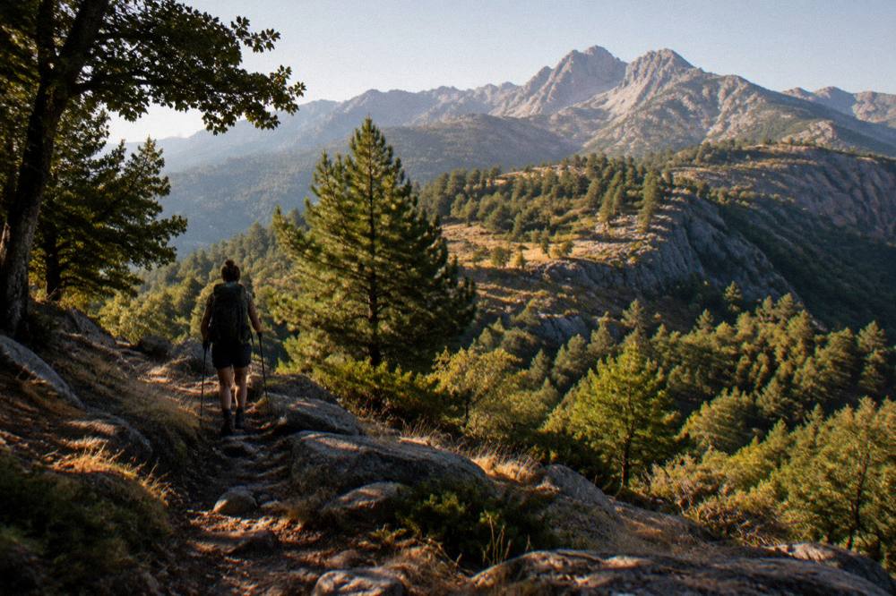
Yes, guided touring from Porto-Vecchio covers the Alta Rocca: the offerings listed on this site include a 4x4 tour of the Ospedale forest and the Bavella needles from Porto-Vecchio and a Cuscionu plateau and Alta Rocca 4x4 tour, also from Porto-Vecchio, both of which tour the mountain region around Levie rather than the coastal resorts.
For travellers who would rather not drive the mountain roads, those two products are the practical option. The Cuscionu plateau tour in particular ranges across the high southern interior that the Mare e Monti Sud crosses on foot.
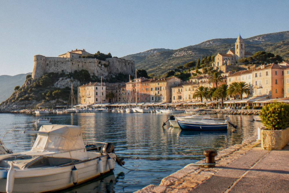
Water and stone define the region's other excursions. The piscines naturelles de Cavu, the natural rock pools on the Cavu river between Porto-Vecchio and Bonifacio, sit within the same day's reach, and the site's Cavu rock pools guide covers them. To the north-west, the Golfe de Porto with the Calanques de Piana, Girolata and the Scandola Reserve forms the island's UNESCO World Heritage property, "Gulf of Porto: Calanche of Piana, Gulf of Girolata, Scandola Reserve", inscribed in 1983.
Check availability if a coast day after the forest day appeals; more background is in the site's Scandola nature reserve guide.
What Is The Weather Like Around Cucuruzzu And The Alta Rocca?
The nearest long-run station data for southern Corsica are the Météo-France 1991-2020 climate normals for Ajaccio, which show a hot, dry summer and a mild, wet winter: July averages 8.6 mm of rain and August a mean daily high of 29.2 °C, while November carries 111.8 mm and the annual total is 635.0 mm.
The mountains take snow in winter, and the Alta Rocca, being high inland country, runs cooler than the coast on any given day. The table gives the Ajaccio station normals month by month, the reference series for the island's western and southern side.
| Month | High °C | Low °C | Rain mm | Sunshine h/day |
|---|---|---|---|---|
| Jan | 14.0 | 4.7 | 54.1 | 4.4 |
| Feb | 14.2 | 4.3 | 48.1 | 5.5 |
| Mar | 16.0 | 5.9 | 50.4 | 6.8 |
| Apr | 18.5 | 8.3 | 53.1 | 7.7 |
| May | 22.1 | 11.8 | 49.8 | 9.3 |
| Jun | 25.9 | 15.4 | 25.9 | 11.1 |
| Jul | 28.6 | 17.7 | 8.6 | 12.1 |
| Aug | 29.2 | 18.1 | 15.8 | 11.1 |
| Sep | 26.1 | 15.4 | 57.8 | 8.7 |
| Oct | 22.8 | 12.6 | 85.7 | 6.7 |
| Nov | 18.3 | 9.0 | 111.8 | 4.7 |
| Dec | 15.1 | 5.8 | 73.9 | 4.0 |
October and November carry the most rain at both of the island's long-run stations, and the Bastia normals tell the same story with higher figures: 126.5 mm in October and 134.3 mm in November on the east side. Filitosa's season, closing on 2 November, tracks the same logic: the prehistory season in the south is a spring-to-autumn affair.
What Should You Know About Safety And Rules Around Cucuruzzu?
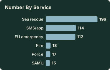
The rules that matter around Levie are the island-wide ones: no fires or smoking in forests, maquis and massifs from 15 June to 30 September, a fire-risk access map updated at 18:00 daily for the next day, and emergency numbers 112 for the EU standard, 15 for medical, 17 for police, 18 for fire, 114 by SMS or app and 196 for sea rescue.
Mountain rescue in Corsica is coordinated by the PGHM at Ajaccio, reachable on 04 95 24 24 00, with 17 or 112 as the emergency entry points. The UK Foreign Office notes a high risk of wildfires in France from April to October, and the US State Department lists France at Level 2, Exercise Increased Caution. Ajaccio's main beaches are lifeguarded at seven posts from 1 July to the end of August, and Haute-Corse's supervised beaches are staffed by volunteer firefighters over roughly the same window, about 1 July to 31 August.
| Service | Number | Use |
|---|---|---|
| EU emergency | 112 | General emergency |
| SAMU | 15 | Medical |
| Police | 17 | Police |
| Fire | 18 | Fire |
| SMS/app | 114 | Deaf or speech-impaired callers |
| Sea rescue | 196 | VHF channel 16 at sea |
| PGHM Ajaccio | 04 95 24 24 00 | Mountain rescue base |
Tipping follows French law: menus must state "prix service compris" with the service percentage included, and any extra tip is optional. The currency is the euro, and the timezone is Europe/Paris, UTC+1 in winter and UTC+2 in summer.
Common Questions About Cucuruzzu And Capula In Corsica
Where Are Cucuruzzu And Capula?
Both sites stand at the village of Levie, in the Alta Rocca region of southern Corsica, the forested mountain country between Porto-Vecchio, Sartène, Propriano and the Aiguilles de Bavella.
How Far Is Cucuruzzu From Filitosa?
Both sites sit in southern Corsica, Filitosa at Sollacaro near the Taravo valley and Cucuruzzu at Levie in the hills behind, and the two are commonly combined on one loop day out of Sartène, Propriano or Porto-Vecchio. This site publishes road times only for Corte, so check your route planner for the current drive.
For planning, the region's fully documented prehistoric site is Filitosa at Sollacaro: open 1 April to 2 November, 09:00 to sunset, adults EUR 9, reduced EUR 7, family EUR 28, free under 6.
Can You Hike Around The Alta Rocca?
Yes. The Mare a Mare Sud crosses the region, a 73 km trail over about 5 days ending in Propriano with 3,200 m of climbing, and the Mare e Monti Sud runs 66 km over 5 days, also ending in Propriano. Wild camping is banned across Corsica; use the refuges and booked accommodation along the routes.
When Is The Best Season For The Southern Corsica Interior?
The Météo-France 1991-2020 normals for Ajaccio show July averaging 8.6 mm of rain and August a mean daily high of 29.2 °C, with November carrying 111.8 mm. Fire-risk restrictions on forest massifs apply from mid-June to mid-September, which is why spring and early autumn suit forest walking, and Filitosa's season runs 1 April to 2 November.
Are There Guided Tours Of The Alta Rocca?
Yes.
The Alta Rocca rewards the traveller who treats Cucuruzzu and Capula as one stop inside a bigger mountain day, paired with Filitosa's published season on the west side, the Bavella needles above and, when the forest gives way to sea, the boat trips of the south and west coasts.