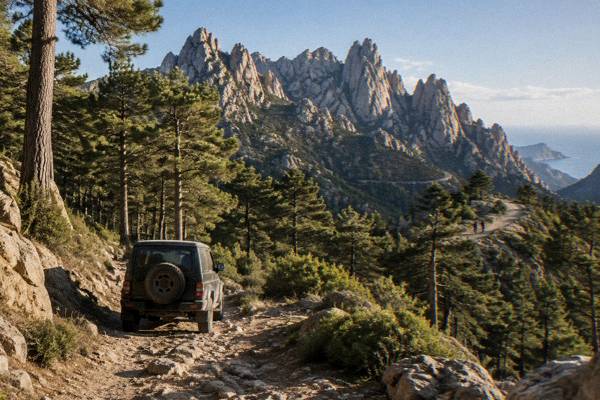
Bavella Day Trip
The Aiguilles de Bavella are the granite spine of southern Corsica, reached by the RD 268 road through the Ospedale forest above Porto-Vecchio. This guide covers access, walks, costs and timing for a one-day visit.
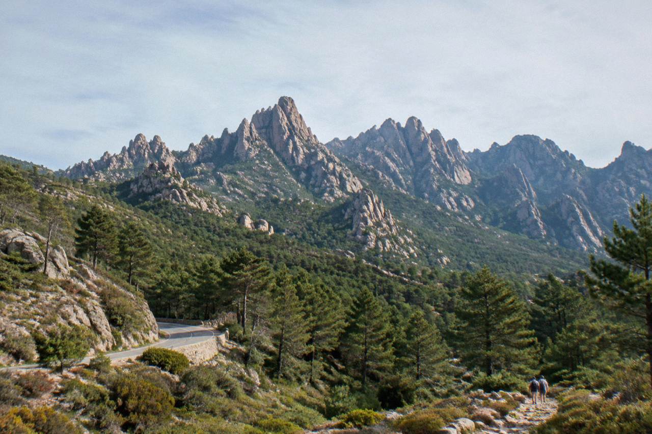
A Bavella day trip takes you to the Col de Bavella, about 43 km as the crow flies from Ajaccio, on the RD 268 through the Ospedale massif in the Parc naturel régional de Corse. Plan on a full day from Porto-Vecchio or Ajaccio, check Inforoutes Corse before setting out, and keep the 15 June to 30 September fire rules in mind.
The Aiguilles de Bavella are a chain of granite peaks in the far south of Corsica, the French Mediterranean island, sitting inland behind the coastal towns of Porto-Vecchio and Bonifacio inside the Parc naturel régional de Corse. The pass that serves them, the Col de Bavella, lies on the RD 268, about 43 km as the crow flies from Ajaccio, and the whole area belongs to the mountainous interior rather than the seaside strip. A day trip here is a day of rocks, pines and hairpin bends, and this guide sets out what the official sources say about getting there, walking there, and what it costs.
Why Visit The Aiguilles De Bavella In Corsica?
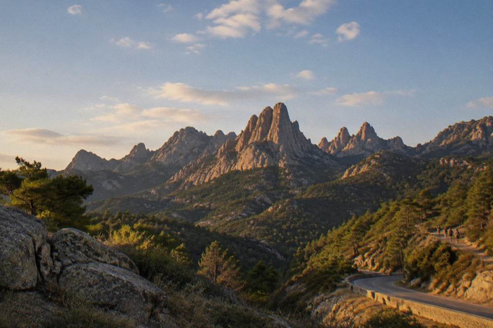
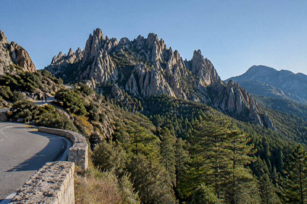
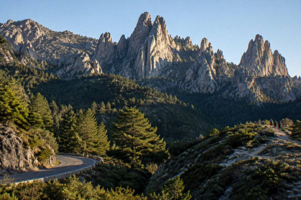
The Aiguilles de Bavella are the high point of any southern Corsica road trip: a line of red granite needles above the Col de Bavella, inside a regional natural park created in 1972 that now covers 4,484 km2 of the island's mountainous interior. The site sits inland from Porto-Vecchio and Bonifacio, and the needles themselves are a named attraction of the Alta Rocca region. They give a completely different picture of Corsica from the beaches, and the drive to reach them crosses the Ospedale massif on one of the island's mountain roads.
The Parc naturel régional de Corse was created in 1972 and now extends to 4,484 km2, including the Castagniccia and the big valleys that run down to the sea. Its western sea front runs 80 km from Capu Rossu to Capu Cavallu, and its southern sector takes in the Bavella massif. The park is the managing authority for several of the island's protected areas, and the Aiguilles de Bavella sit within this framework of mountain protection.
Corsica itself covers 8,722 km2, making it the fourth-largest island in the Mediterranean, with more than 1,000 km of coastline and Monte Cinto at 2,706 m as its summit. Bavella is the southern counterpart to that high interior: lower than the central massif, but high enough that the approach roads are genuine mountain roads. More on the Aiguilles de Bavella attraction is on its own page, and the area also appears on the site's Corsica road trip route.
How Do You Get To The Col De Bavella?
The Col de Bavella is reached by road, on the RD 268, which climbs from the east coast through the Ospedale massif toward the pass below the needles; the site lies about 43 km as the crow flies from Ajaccio and is served by no rail line. Corsican mountain roads are slow and winding, so a straight-line figure is never a drive time. Inforoutes Corse publishes live road conditions and pass accessibility levels, and the standing advice is to check it before any mountain drive.
The Chemins de fer de la Corse network does not serve the south-east: its lines run Ajaccio to Bastia via Corte, Ponte-Leccia to Calvi, and the Balagne coastal line between Calvi and L'Île-Rousse. Bavella is therefore a driving destination, usually approached from Porto-Vecchio via the Ospedale lake road, or from Solenzara on the east coast. The site's tour of the Corsican train covers the rail network that does exist.
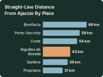
Distances help with orientation, though none of them is a driving time. Measured from Ajaccio, as the crow flies:
| Place | Straight-line distance from Ajaccio |
|---|---|
| Aiguilles de Bavella | about 43 km |
| Porto-Vecchio | about 58 km |
| Bonifacio | about 69 km |
| Propriano | about 31 km |
| Sartène | about 39 km |
| Corte | about 54 km |
Roads in the massif can be affected by weather and by fire-risk orders. From 15 June to 30 September it is forbidden to light a fire or smoke in forests, maquis and massifs, and the fire-risk map is updated at 18:00 each day for the next day; from mid-June to mid-September access to some massifs can be restricted. Check Inforoutes Corse for road status and the prefecture-linked map for massif access on the morning of the trip.
What Can You Do On A Bavella Day Trip In Corsica?
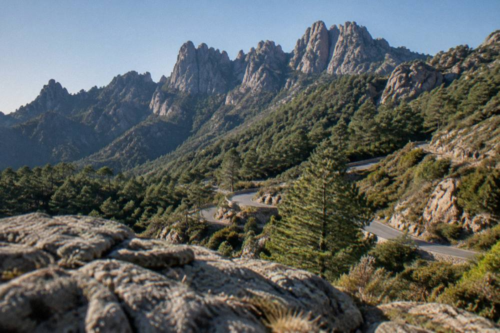
A Bavella day trip is built on three things: the viewpoint at the Col de Bavella under the granite needles, walks on the trails that leave the pass, including GR20 variants, and the forest drive itself through the Ospedale massif with stops at the lake and the viewpoints. The needles are a walking and driving destination rather than a museum or a beach, so the day is shaped by which trailhead you choose.
The GR20, the island's long-distance mountain path, runs 180 km north to south in about fifteen stages of 4 to 8.5 hours each, and its southern stages cross the Bavella massif. A day visitor does not need to commit to a stage: shorter walks from the pass let you touch the same terrain in a few hours. Wild camping is banned across Corsica including the GR20, and bivouac is allowed only in the marked areas at refuges, so a day trip with a return to the coast is the simplest format.
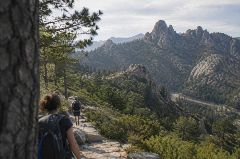
Guided options exist for travellers who would rather not drive the mountain roads themselves. A 4x4 tour of the Ospedale forest and the Bavella needles runs from Porto-Vecchio, covering exactly this terrain, and it is one of the products this site lists for the south-east. The full current price, rating and duration render on the tour block below.
For a contrast day, the sea side of the south is covered in the Bonifacio and Lavezzi day trip guide, and the question of combining the island's mountains and its straits is treated in can you visit Corsica and Sardinia in one trip.
What Does A Bavella Day Trip From Ajaccio Or Porto-Vecchio Cost?
The mountain itself costs nothing: the Col de Bavella is a public road pass and the trails are free, so the day's budget goes on fuel, food and any entry fees at stops you add along the way. Sight prices in southern Corsica are in euros, and the ones printed below come from each site's own listing: Filitosa, the prehistoric site near Sollacaro, is EUR 9 adults, EUR 7 reduced, EUR 28 for a family, open 1 April to 2 November.
If the itinerary loops through Sartène or Propriano, Filitosa fits naturally on a southern route. Its season runs 1 April to 2 November, the site opens at 09:00 and the museum runs to 19:00, with the visit itself listed at about an hour and a half. Other paid sights that pair with a longer southern loop, with prices from their own pages:
| Sight | Full price | Opening pattern |
|---|---|---|
| Filitosa (Sollacaro) | EUR 9 | 1 April to 2 November, 09:00 to sunset |
| Maison Bonaparte (Ajaccio) | EUR 10 | every day except Monday, seasonal hours |
| Palais Fesch (Ajaccio) | EUR 10 | daily 09:00 to 17:00 |
| Musée de la Corse (Corte) | EUR 5.50 | daily in high season, 10:00 to 19:00 |
Meals at the pass are paid in cash or cheque at refuge counters on the GR20, according to the PNRC page, and prices are set by the guardians. In town, menus must state "prix service compris" with the service percentage included, so an extra tip is optional, per the French consumer authority's own guidance. The wider set of guides lives on Corsica Travel Guide.
When Is The Best Time Of Year For A Bavella Day Trip?
No month is officially the best, but the pattern in the climate normals is clear: southern Corsica has a hot, dry summer and a mild, wet winter, with snow only on the high mountains, so the shoulder months carry less heat for walking and the summer months carry the fire-season rules. July averages 8.6 mm of rain at Ajaccio against November's 111.8 mm, and August has the highest mean daily high at 29.2 °C in the 1991-2020 station normals.
The Météo-France station normals for Ajaccio, 1991-2020, give the month-by-month picture:
| Month | Mean daily high | Mean daily low | Rain | Sunshine h/day |
|---|---|---|---|---|
| March | 16.0 °C | 5.9 °C | 50.4 mm | 6.8 |
| April | 18.5 °C | 8.3 °C | 53.1 mm | 7.7 |
| May | 22.1 °C | 11.8 °C | 49.8 mm | 9.3 |
| June | 25.9 °C | 15.4 °C | 25.9 mm | 11.1 |
| July | 28.6 °C | 17.7 °C | 8.6 mm | 12.1 |
| August | 29.2 °C | 18.1 °C | 15.8 mm | 11.1 |
| September | 26.1 °C | 15.4 °C | 57.8 mm | 8.7 |
| October | 22.8 °C | 12.6 °C | 85.7 mm | 6.7 |
Two seasonal rules matter more than the thermometer. First, from 15 June to 30 September no fires and no smoking in forests, maquis and massifs, and massif access can be restricted on high-risk days between mid-June and mid-September. Second, the road status can change with storms at any time of year, which is why the standing advice is the Inforoutes Corse check rather than any fixed calendar. Rainy-day alternatives are collected in the site's Corsica in the rain guide.
Is The Bavella Area Good For Hiking?
Yes: the Bavella massif carries stages of the GR20, the island's 180 km mountain path, walked in about fifteen stages of 4 to 8.5 hours, and the southern end of the trail finishes at Conca after crossing this terrain. The PNRC runs guarded refuges along it, bookable only online, and the 2026 refuge season runs 16 May to 4 October inclusive.
The long trails of the park, with lengths and climbing totals from the PNRC's own brochure, are these:
| Trail | Length | Days | Total climbing |
|---|---|---|---|
| GR20 (Fra li Monti) | 180 km | about 15 stages | not published by the PNRC |
| Mare e Monti Nord | 121 km | 10 | 6,100 m |
| Mare a Mare Nord | 139 km (161 km with variant) | 8 to 12 | 5,900 m |
| Mare a Mare Centre | 84 km | 6 to 7 | 3,900 m |
| Mare a Mare Sud | 73 km | 5 | 3,200 m |
| Mare e Monti Sud | 66 km | 5 | 2,700 m |
For a single day at Bavella, refuge booking does not apply, but two rules do: dogs are not allowed inside refuges or rented tents, and the no-departure rule at Calenzana after 11:00 shows how the fire-risk orders work in practice. The site's wider GR20 and hiking guide covers the full trail, and the Restonica valley, the other classic inland day trip, has its own Restonica and Corte day trip page.
What Should A One-Day Bavella Itinerary Look Like?
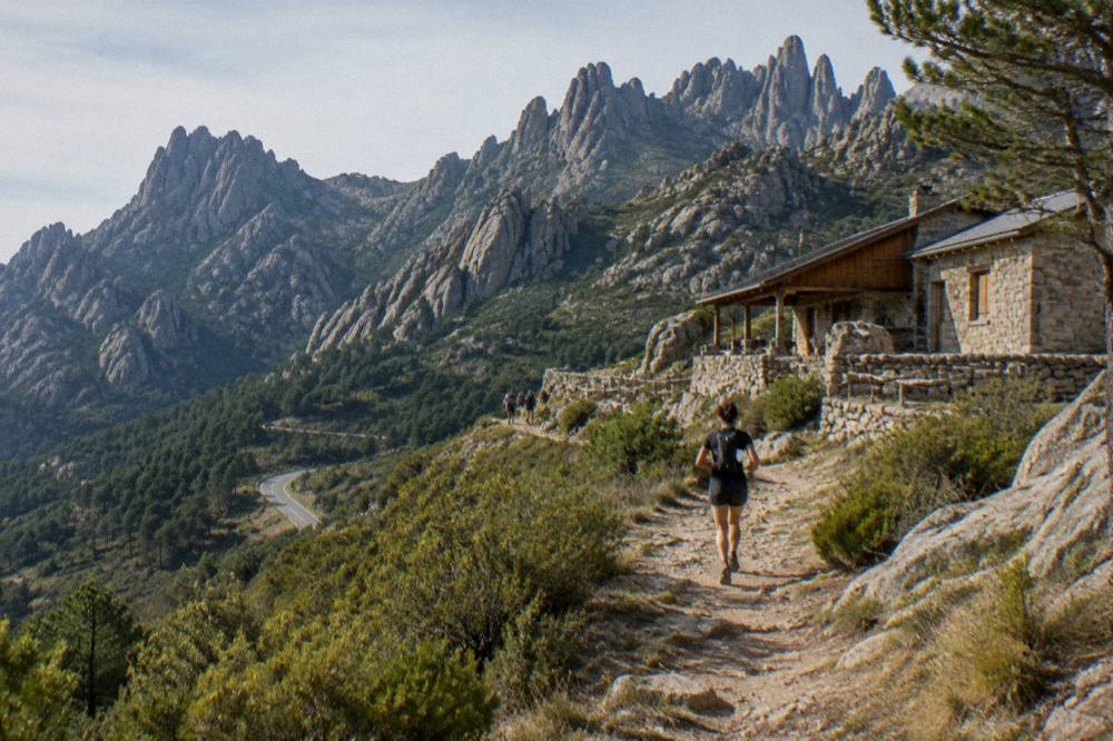
A workable day runs: early start from Porto-Vecchio or Ajaccio, the Ospedale lake and forest road to the Col de Bavella, a walk of two to four hours from the pass, lunch at the pass or in Zonza, then a descent either back to the coast or through the Alta Rocca toward Sartène and Propriano. Allow the whole day: the roads are slow, and the straight-line figures in this guide are never drive times.
From Ajaccio, the southern loop can take in Sartène, about 39 km as the crow flies, and Filitosa before or after the mountains. From Porto-Vecchio, the direct approach is shorter in distance but still a full mountain road. Either way, check Inforoutes Corse in the morning, carry water, and keep the 15 June to 30 September no-smoking rule in mind at every stop. The full-day Bonifacio sea trip from Ajaccio and Porticcio is the alternative if the forecast turns marine: it covers the Bonifacio cliffs and the strait, and the product's own page carries the current price and rating, with Check availability for live dates.
Other inland and southern day trips that pair with Bavella on a longer stay include the Balagne villages day trip in the north-west and the Désert des Agriates day trip on the north coast. For the island-wide picture, the things to do in Corsica page is the site's root guide.
Is A Bavella Day Trip Safe?
Yes, with the standing mountain rules respected: the emergency numbers are 112, 15 for medical, 17 for police, 18 for fire, 114 by SMS or app, and 196 for sea rescue, and mountain rescue in Ajaccio answers on 04 95 24 24 00, with 112 or 17 for emergencies. The UK FCDO notes a high risk of wildfires in France from April to October, and the US State Department lists France at Level 2, Exercise Increased Caution.
The numbers worth saving before any mountain day in Corsica:
| Service | Number |
|---|---|
| European emergency | 112 |
| Medical (SAMU) | 15 |
| Police | 17 |
| Fire | 18 |
| SMS or app for deaf or speech-impaired users | 114 |
| Sea rescue | 196 |
Add the mountain-specific rules: no fires or smoking in forests, maquis and massifs from 15 June to 30 September, the 18:00 fire-risk map update, and possible massif closures on high-risk days. On the coast, Ajaccio ran seven lifeguard posts on its main beaches from 1 July to the end of August 2026, and Haute-Corse's supervised beaches were staffed by volunteer firefighters about 1 July to 31 August. The site's Corsica safety guide collects the full picture.
Bavella Or The Coast: Which Corsica Day Trip Should You Pick?
Pick Bavella for granite, forest and walking, and the coast for cliffs, swimming and boats: the two day trips are complements, not rivals, and many visitors run one of each. A sea day out of Porto-Vecchio reaches the Lavezzi islands, while a mountain day reaches the needles, and the two options share the same bases on the south-east coast.
The boat side of the south is covered by the site's Porto-Vecchio boat trips page, which lists the cruising options from the same base you would drive from. Further afield, the Sanguinaires boat trip from Ajaccio in the west and the Calanques de Piana day trip on the west coast are both sea days under the same sky as the Bavella massif. A week that mixes one mountain day at Bavella with one or two sea days gives the fullest picture of the island's split personality, sea on every side and a mountainous interior, and the choice between the two is a matter of forecast as much as taste.
Common Questions About A Bavella Day Trip In Corsica
How Far Is The Col De Bavella From Ajaccio?
About 43 km as the crow flies from Ajaccio, and the driving route is far longer because Corsican mountain roads are slow and winding. Never read a straight-line distance as a drive time, and check Inforoutes Corse for live road status before setting out.
Can You Hike The GR20 From The Col De Bavella In One Day?
The GR20 runs 180 km in about fifteen stages of 4 to 8.5 hours, and its southern stages cross the Bavella massif. Short walks from the pass cover the same terrain in a few hours without committing to a full stage, and refuge nights, at EUR 20 for a bunk or EUR 12 for a bivouac pitch, must be booked online in the 2026 season running 16 May to 4 October.
Is The RD 268 To Bavella Always Open?
The RD 268 is a mountain road whose status can change with weather and storm damage, and Inforoutes Corse publishes live road conditions and pass accessibility levels. Treat any closure you hear about as transient unless stated otherwise, and check on the morning of travel.
What Does A Bavella Day Trip Cost?
The pass and the trails are free, so the budget is fuel and food. If you add Filitosa on a southern loop, entry is EUR 9 for adults, EUR 7 reduced and EUR 28 for a family of two adults and two children aged 6 to 17, free under 6, with the site open 1 April to 2 November.
When Are The Fire Rules In Force At Bavella?
From 15 June to 30 September it is forbidden to light a fire or smoke in forests, maquis and massifs, and from mid-June to mid-September access to some massifs can be restricted on high-risk days. The prefecture-linked fire-risk map is updated at 18:00 for the next day.
What Emergency Numbers Apply In The Bavella Massif?
Call 112 for any emergency, 15 for medical, 17 for police, 18 for fire, and 196 for sea rescue. Mountain rescue is reached through 112 or 17, and the PGHM base in Ajaccio answers on 04 95 24 24 00.
A Bavella day trip is the simplest way to touch inland Corsica from the south-coast resorts: one mountain road, one pass under granite needles, and walks that belong to the same trail system as the GR20 itself. Check the road status, respect the fire-season rules, and the needles do the rest.