Is Corsica Safe
Corsica is a French Mediterranean island of 8,722 km2 with more than 1,000 km of coastline and a mountainous interior, and the honest answer to whether it is safe is yes, with three specific risks to understand: summer wildfire rules, mountain terrain, and the sea.
Yes, Corsica is a safe destination for travellers, and the risks worth preparing for are seasonal wildfires from mid-June to late September, mountain hiking on trails like the GR20, and sea conditions, all of which are managed with clear official rules and emergency numbers.
Corsica is a French Mediterranean island of 8,722 km2 with more than 1,000 km of coastline and a mountainous interior that rises to Monte Cinto at 2,706 m, and it is a safe destination in the ordinary sense that matters to travellers: violent risk to visitors is low, the US State Department reports France at Level 2, "Exercise Increased Caution", and the UK Foreign Office raises no Corsica-specific warning beyond a general wildfire note for France between April and October. The real safety conversation on this island is not about crime. It is about three things the landscape itself controls: summer fire rules that close massifs and ban smoking on trails, mountain terrain that demands respect on routes like the GR20, and a sea that is calm in the morning and serious by afternoon. This guide lays out what the official sources actually say, which numbers to dial, and how the rules change with the season.
Is Corsica Safe For Tourists Overall?
Corsica is a safe destination for tourists in the way most of France is safe, with the US State Department reporting France at Level 2, "Exercise Increased Caution", and no Corsica-specific advisory from either the US or the UK authorities. The UK Foreign Office notes one France-wide hazard relevant here, a high risk of wildfires in the summer season from April to October, and the island's own rules, particularly the 15 June to 30 September fire ban, are the practical response to that hazard.
The island's safety profile is shaped by geography more than by anything else. With 8,722 km2 of territory, 360 communes and a population of 365,636 as of 1 January 2026 per the provisional INSEE estimate, Corsica is one of the least densely populated parts of France, and much of its area sits inside the Parc naturel régional de Corse, created in 1972, which now covers 4,484 km2. What that means for a visitor is simple: the things most likely to hurt you are the mountain and the sea, not other people.
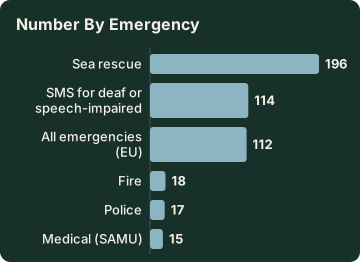
Emergency infrastructure follows the French national system, and it is worth memorising before arrival. The numbers below are the official ones from the French government's service-public site.
| Emergency | Number | Notes |
|---|---|---|
| All emergencies (EU) | 112 | Works from any phone |
| Medical (SAMU) | 15 | Ambulance and medical emergencies |
| Police | 17 | Immediate police assistance |
| Fire | 18 | Sapeurs-pompiers |
| SMS for deaf or speech-impaired | 114 | Text-based emergency contact |
| Sea rescue | 196 | VHF channel 16 at sea |
| Mountain rescue (PGHM Ajaccio) | 04 95 24 24 00 | Or dial 17 or 112 in an emergency |
For a broader comparison of traveller questions about the island, the companion page is Corsica safe for tourists covers the everyday side, and Corsica travel tips collects the practical basics for a first trip.
What Are The Wildfire Rules In Corsica?
From 15 June to 30 September it is forbidden to light a fire or smoke in Corsica's forests, scrub (the maquis) and massifs, under rules published by the Parc naturel régional de Corse, and the fire-risk access map for the island's massifs is updated every day at 18:00 for the following day.
From mid-June to mid-September, access to some massifs can be restricted or closed entirely when the risk level is high, and on extreme days certain massifs are shut to the public by prefectural order.
This is the single most important safety rule on the island, and it applies to hikers, drivers and beach visitors alike, because the maquis that covers the hills burns fast and the summer is dry. The Météo-France climate normals for Ajaccio (station data, 1991-2020) show July averaging just 8.6 mm of rain and August 15.8 mm, against 111.8 mm in November: the summer is genuinely arid, and the ban is not bureaucratic caution.
Practically, the rules translate into a handful of behaviours. Check the daily access map each evening for the next day's plans. Never smoke on a trail between 15 June and 30 September, the ban covers the massifs explicitly. Barbecues and any open flame in forested areas fall under the same prohibition. And if a massif shows as closed, respect it, prefectural orders carry fines and the closure exists because conditions are genuinely dangerous.
The UK Foreign Office's France advice flags a high risk of wildfires in the summer season, April to October, so the window of awareness is even wider than the strict legal ban. If a Corsica road trip or a south Corsica itinerary is on your plan, build a daily habit of checking road and massif status, since Inforoutes Corse publishes live road conditions and pass accessibility levels for the main mountain routes.
Is It Safe To Swim And Go Boating In Corsica?
Swimming in Corsica is safe on supervised beaches, with Ajaccio operating 7 lifeguard posts from 1 July to the end of August on its main beaches and Haute-Corse's supervised beaches staffed by volunteer firefighters from about 1 July to 31 August, while the universal sea-safety rule is to swim in lifeguarded zones and know that sea rescue is reached on 196 or VHF channel 16.
The island's more than 1,000 km of coastline means the sea is never far away, and most of the water-safety picture is about choosing where and when to swim. Lifeguard coverage is concentrated in the July and August school-holiday window on the main town beaches, and outside that window, and on the countless coves with no post at all, swimmers are effectively on their own judgement. Wind can pick up in the afternoon, and conditions that were fine at 10:00 can change by 15:00.
For boat trips, the safety question mostly answers itself if you sail with a licensed operator, and the island has an enormous supervised-cruise offering around the Îles Sanguinaires, the Calanques de Piana, Scandola and the Îles Lavezzi. Both are covered in detail in Ajaccio boat tours and the Sardinia day trip guide.
The rules at sea follow French maritime law. At sea, emergencies go to 196 or VHF channel 16. The full picture is in the Scandola Nature Reserve guide.
| Sea safety item | Detail |
|---|---|
| Lifeguards, Ajaccio | 7 posts, 1 July to end of August, main town beaches |
| Lifeguards, Haute-Corse | Volunteer firefighters, about 1 July to 31 August |
| Sea rescue number | 196, or VHF channel 16 |
| Scandola anchoring | Daytime only, outside the integral reserve and Gargalu channel, anchors up at sunset |
| Scandola fishing | Recreational line and spear fishing prohibited |
Is Hiking In Corsica Dangerous?
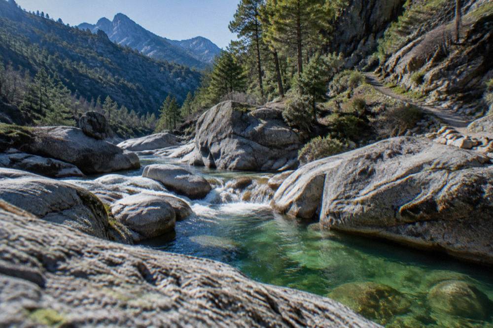
Hiking in Corsica is safe for prepared walkers and demanding for unprepared ones, because the island's flagship trail, the GR20, runs 180 km north to south in about 15 stages of 4 to 8.5 hours each, and its rules exist precisely because the terrain is serious: refuge nights must be booked online in advance, no departures from Calenzana are allowed after 11:00 under a municipal fire-risk order, and mountain rescue is reached through the PGHM in Ajaccio on 04 95 24 24 00 or by dialing 112.
The GR20 has a reputation as one of Europe's hardest long-distance trails, and the official numbers explain why. The Assemblea di Corsica's own text describes a route of 180 km with about fifteen stages of 4 to 8.5 hours walking, guarded refuges, and strict booking: every night, whether a bunk, a bivouac pitch or a rented tent, must be reserved in advance on the PNRC's online platform. Wild camping is banned across Corsica, and on the GR20 bivouacking is allowed only in the marked areas near the refuges.
The fire rules bind hikers directly. The no-departure rule after 11:00 from Calenzana, the northern start, is a municipal order tied to fire risk, and the daily massif access map decides whether a given section is open at all. The full planning picture, including refuge prices and season dates, is in the site's GR20 guide and the wider hiking in Corsica page; for the specific question of going alone, see is it safe to hike the GR20 alone.
Beyond the GR20, the island's other long trails, the Mare a Mare and Mare e Monti routes, are gentler but still mountain routes where the same rules apply: no smoking in the massifs in summer, check the access map, carry water, and know that weather in the high interior is not the weather on the coast.
| Long trail | Length | Stages or days |
|---|---|---|
| GR20 (Fra li Monti) | 180 km | About 15 stages of 4 to 8.5 hours |
| Mare e Monti Nord | 121 km | 10 days |
| Mare a Mare Nord | 139 km (161 km with variant) | 8 to 12 days |
| Mare a Mare Centre | 84 km | 6 to 7 days |
| Mare a Mare Sud | 73 km | 5 days |
| Mare e Monti Sud | 66 km | 5 days |
Is Driving In Corsica Safe?
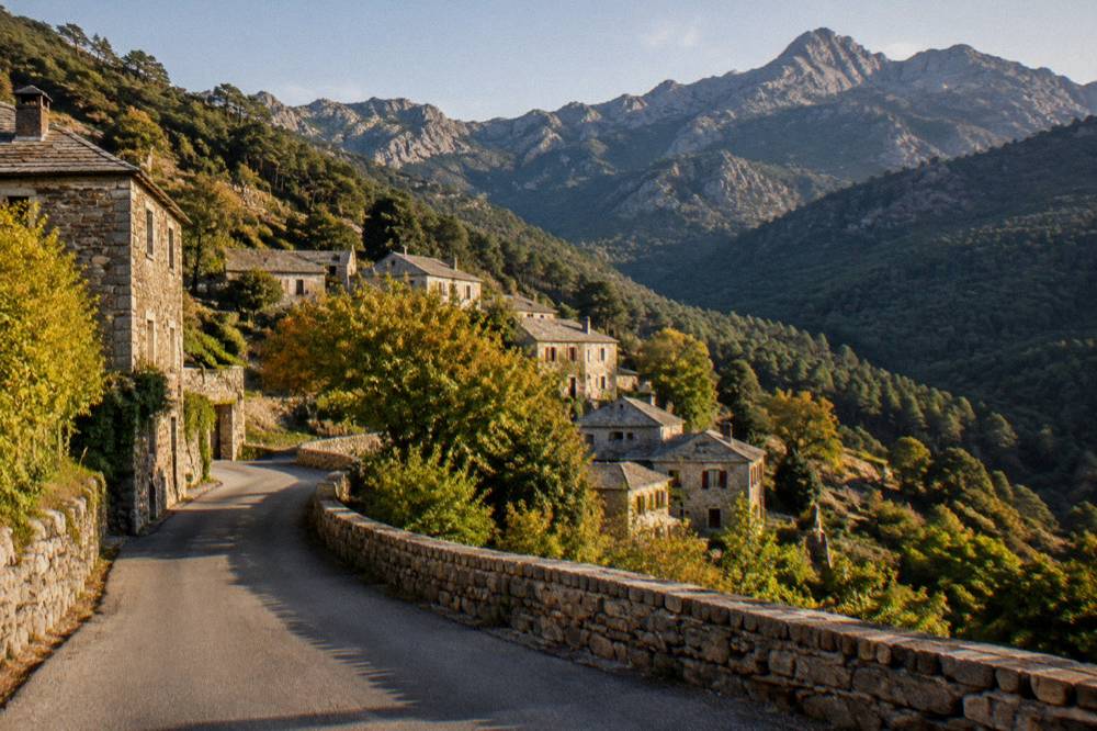
Driving in Corsica is safe but demands more attention than mainland motorway motoring, because the island's roads are narrow, mountainous and shared with everything from coaches to livestock, and the authoritative source for real-time conditions is Inforoutes Corse, which publishes live road status and accessibility levels for the main mountain passes, including colour-coded equipment requirements and restrictions for larger vehicles.
The island's geography makes its road network inherently winding: an 8,722 km2 island with a 2,706 m summit in the middle means roads climb, descend and cling. The D81 along the Calanques de Piana is the classic example, a spectacular cliff road where patience matters more than pace. Storms occasionally close mountain sections, which is exactly why the live Inforoutes Corse feed exists, and checking it before a day of driving in the interior is the local habit worth copying. Everything else covered here is indexed on Corsica Travel Guide.
Standard French road rules apply, with no Crit'Air requirement or Corsica-specific speed-limit regime. The practical advice that follows from the island's own character: allow more time than a map suggests, expect single-lane stretches with passing places, and treat the fire-risk season as a reason to park only where it is permitted, since massif access rules can restrict parking on tracks and pistes on high-risk days.
For everything on renting a vehicle, the Corsica car rental and driving in Corsica guides cover the practical side, and getting around Corsica compares car, train and bus options.
Are The Ferries And Airports In Corsica Safe?
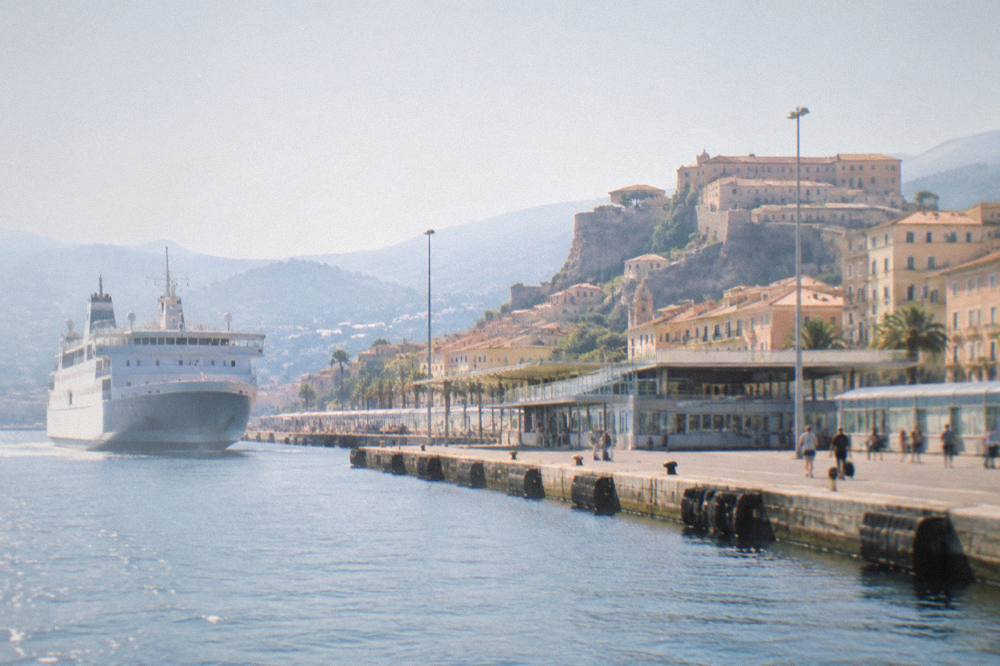
Corsica's ferries and airports are safe, mainstream European transport links, with four airports (Ajaccio Napoléon Bonaparte, Bastia Poretta, Figari Sud Corse and Calvi Sainte-Catherine) and ferry ports at Ajaccio, Bastia, Bonifacio, L'Île-Rousse, Propriano and Porto-Vecchio served by established operators including Corsica Linea, La Méridionale, Moby and Corsica Ferries, and more than 8.5 million passengers passed through the island's ports and airports in 2025.
That 2025 figure, reported in the ORTC and DREAL annual summary published in May 2026, gives a sense of scale: this is a heavily trafficked island with mature transport infrastructure, not a remote outpost. Ferry safety is regulated under French and EU maritime law, and the crossing times from the mainland are long, roughly 12 to 13 hours from Marseille and around 10 to 13 hours from Toulon, mostly overnight, so the usual advice about seasickness remedies and booking a cabin applies.
The one sea link with a genuinely short crossing is Santa Teresa Gallura in Sardinia to Bonifacio, about 50 to 60 minutes, operated by Moby and Ichnusa Lines under a continuing public-service arrangement. Planning details for every route are in ferry to Corsica, Nice to Corsica ferry and Corsica Sardinia ferry, while the flying side is covered in flights to Corsica and the individual airport guides.
Is Corsica Safe For Families And Solo Travellers?
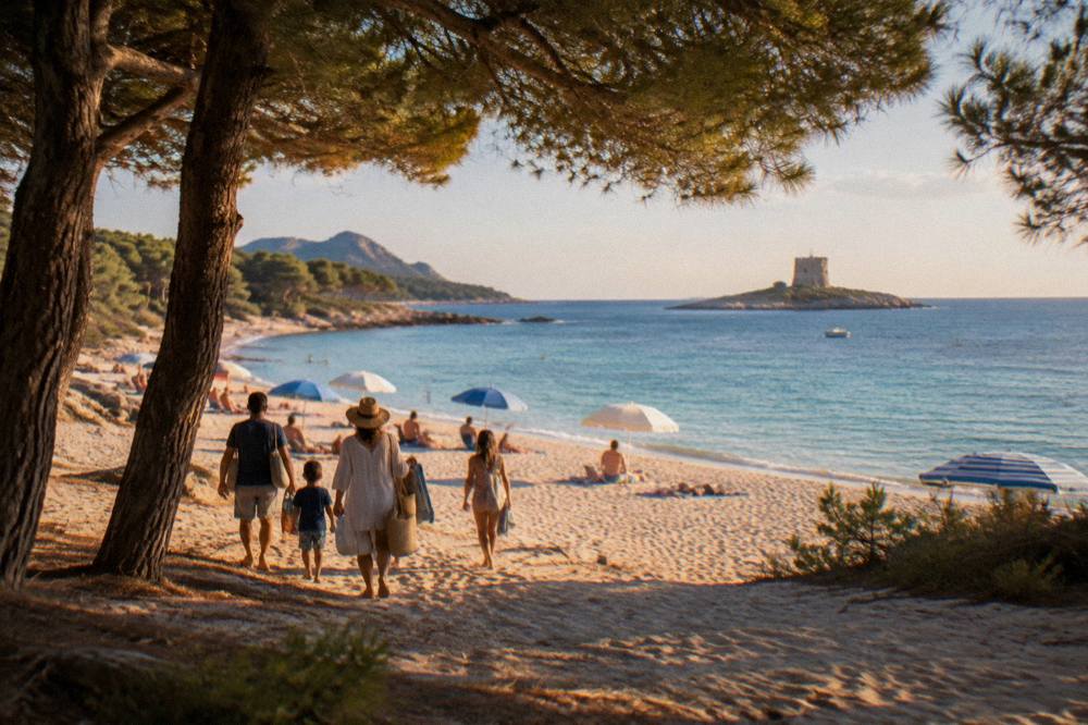
Corsica is a safe destination for families and solo travellers on the same conditions as the rest of France, with the US State Department reporting France at Level 2, "Exercise Increased Caution", and the practical family-safety picture centred on choosing supervised beaches in July and August, respecting the fire rules on excursions, and dialing 112 for any emergency.
For families, the supervised-beach window is the anchor. Ajaccio's 7 lifeguard posts run 1 July to the end of August, Haute-Corse's supervised beaches are staffed by volunteer firefighters over roughly the same period, and outside that window the beaches are unsupervised, so swimming decisions sit with the adults. The Corsica with kids guide builds whole itineraries around this reality, favouring calm, accessible beaches such as Palombaggia and Santa Giulia. Boat tours are another family-friendly option precisely because a crew handles the safety side; the turtle park at A Cupulatta is a fully land-based alternative.
For solo travellers, the two questions that matter are terrain and communication. The terrain question is answered above, in the hiking section: tell someone your route, book refuges in advance on the GR20, and respect closure days. The communication question is largely solved by the fact that France's emergency system, including the 114 SMS service for deaf or speech-impaired callers, works everywhere on the island. The Corsica solo guide covers the practical side of travelling alone here.
Tap water, jellyfish and crime statistics fall outside the scope of this page, so the honest position is to rely on ordinary French travel practice and the Corsica cost and budget and where to stay in Corsica guides for the rest of the planning picture.
When Is The Best Time To Visit Corsica For Safety And Comfort?
There is no single officially best month to visit Corsica, but the safety-relevant pattern is clear from the Météo-France station normals for 1991-2020: the summer is hot and dry, with July averaging 8.6 mm of rain and 28.6 °C daytime highs at Ajaccio, and carries the fire-season access rules, while October and November carry the most rain, 85.7 mm and 111.8 mm respectively at Ajaccio, which matters for mountain plans.
The trade-off is straightforward. July and August bring the warmest, most reliable beach weather, 12 h 6 min of sunshine per day on the July average at Ajaccio, along with the full lifeguard season, but also the fire-risk restrictions that can close massifs and the 11:00 departure rule at Calenzana. June and September sit at the edges of the fire season, with June averaging 25.9 °C highs and 25.9 mm of rain at Ajaccio and September 26.1 °C and 57.8 mm, and supervised swimming thins out outside the July-August window.
Winter is mild on the coast, 14.0 °C average highs in January at Ajaccio, wet, and snowy only on the high mountains, which makes it a walking and sightseeing season rather than a swimming one. The month-by-month breakdown, with both the Ajaccio and Bastia station tables, is in Corsica weather by month, and the broader planning view is in best time to visit Corsica.
| Month | Avg high °C (Ajaccio) | Avg low °C (Ajaccio) | Rain mm | Sunshine h/day |
|---|---|---|---|---|
| Jan | 14.0 | 4.7 | 54.1 | 4.4 |
| Mar | 16.0 | 5.9 | 50.4 | 6.8 |
| May | 22.1 | 11.8 | 49.8 | 9.3 |
| Jun | 25.9 | 15.4 | 25.9 | 11.1 |
| Jul | 28.6 | 17.7 | 8.6 | 12.1 |
| Aug | 29.2 | 18.1 | 15.8 | 11.1 |
| Sep | 26.1 | 15.4 | 57.8 | 8.7 |
| Oct | 22.8 | 12.6 | 85.7 | 6.7 |
| Nov | 18.3 | 9.0 | 111.8 | 4.7 |
Météo-France station data, 1991-2020, Ajaccio (Campo dell'Oro).
Common Questions About Safety In Corsica
Is Corsica Safe For Tourists?
Yes. The US State Department reports France at Level 2, "Exercise Increased Caution", with no Corsica-specific advisory, and the UK Foreign Office raises only a France-wide wildfire note for April to October. The main preparation is seasonal: know the fire rules, the sea rescue number 196 and the general emergency number 112.
What Is The Emergency Number In Corsica?
Dial 112 for any emergency in Corsica. The full French set applies: 15 for medical (SAMU), 17 for police, 18 for fire, 114 by SMS for deaf or speech-impaired callers, and 196 for sea rescue, with VHF channel 16 at sea. Mountain rescue (PGHM Ajaccio) can be reached on 04 95 24 24 00.
Can You Smoke Or Light A Fire In Corsica In Summer?
No. From 15 June to 30 September it is forbidden to light a fire or smoke in forests, maquis scrub and massifs across Corsica, and from mid-June to mid-September access to some massifs can be restricted. The fire-risk map is updated daily at 18:00 for the next day.
Are Corsica's Beaches Supervised?
Ajaccio operates 7 lifeguard posts from 1 July to the end of August on its main beaches, and Haute-Corse's supervised beaches are staffed by volunteer firefighters from about 1 July to 31 August. Outside that window, and on unsupervised coves, swimming is at your own judgement.
Is The GR20 Dangerous?
The GR20 is demanding rather than dangerous for prepared walkers: 180 km in about 15 stages of 4 to 8.5 hours, with mandatory online booking for refuge and bivouac nights, a ban on departures from Calenzana after 11:00, and wild camping prohibited across the island. Check the daily massif access map and the weather before each stage.
Is It Safe To Drive In Corsica?
Yes, but the roads are narrow and mountainous. Inforoutes Corse publishes live road conditions and accessibility levels for the main passes, and checking it before driving in the interior, especially after storms, is the standard local practice.
The short version of all of this: Corsica is safe the way mountains and sea are safe, meaning the island rewards preparation and punishes carelessness mostly with inconvenience. Learn three numbers, 112, 196 and the PGHM line, respect the summer fire rules, swim where and when it is supervised, and book mountain nights in advance, and the island's real hazards are already managed before you arrive.