Corsica Car Rental
Corsica is a sea-surrounded island of 8,722 km2 with a mountainous interior, and a rental car is the tool that connects the two. Here is what the sources say about where to pick one up, what the roads demand and what the alternatives cost in reach.
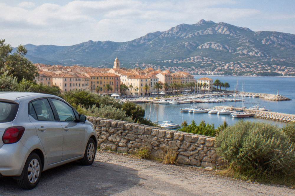
Yes, a rental car unlocks Corsica: pickups sit at all four airports and the main ferry ports, mountain roads are slow, and summer brings fire-season access rules from 15 June to 30 September.
Corsica covers 8,722 km2 and is the fourth-largest island in the Mediterranean, with more than 1,000 km of coastline and an interior that climbs to Monte Cinto at 2,706 m. That shape is the whole argument about car rental. The beaches, ports and boat trips sit on the rim; Corte, the Niolu and the Aiguilles de Bavella sit inland, and the roads between them are narrow, winding and slow. Renting a car on the island raises practical questions: where pickups sit, what the roads demand, which rules apply in summer, and when the alternatives beat driving.
The island's population is 365,636 (INSEE provisional estimate, 1 January 2026), spread across 360 communes, many of them small hill villages with no rail line and thin bus service. Ajaccio, the capital, counts 76,320 residents and Bastia 46,867, but the destinations people cross the sea for, from the Calanques de Piana to the Désert des Agriates, lie well outside both. The site's overview of getting around Corsica covers trains and buses in detail; this page stays on four wheels.
Do You Need A Car In Corsica?
A rental car is the practical answer for most of Corsica because the island's headline sights sit on slow mountain roads between small towns, though a car is genuinely optional if you base in one town and take boat trips, and the deeper question is covered on the site's dedicated page. The Chemins de fer de Corse connect Ajaccio to Bastia via Corte, Ponte-Leccia to Calvi and Calvi to L'Île-Rousse on the Balagne coast, but the rail map touches only a fraction of the coast.
The honest answer depends on the trip. A week in Calvi with a catamaran day and a sunset cruise needs no car at all. A loop taking in Filitosa, the Golfe de Porto, the Calanques de Piana and the Alta Rocca is a road trip by definition. The full reasoning, town by town, sits on Do You Need A Car In Corsica, and the wider transport picture, ferries included, on ferry to Corsica.
One planning fact matters more than any other: on this island, distance in kilometres means almost nothing. The only published road times in the sources are those to Corte, listed below. Everything else on this page is given as straight-line distance, as the crow flies, and never as a drive time.
Where To Pick Up A Rental Car In Corsica?
The four Corsican airports, Ajaccio Napoléon Bonaparte (AJA), Bastia Poretta (BIA), Figari Sud Corse (FSC) and Calvi Sainte-Catherine (CLY), carry rental desks serving the whole island, and the ferry ports of Ajaccio, Bastia, Bonifacio, L'Île-Rousse, Propriano and Porto-Vecchio give arrivals a second set of pickup points. Which one to choose depends on where the first night is booked, not on price alone.
Ajaccio airport and Bastia airport are the workhorses: the capital sits on the west coast facing the Golfe de Porto and Sartène country, and Bastia in the northeast opens the Cap Corse, Saint-Florent and the Castagniccia. Figari serves the far south, Bonifacio and Porto-Vecchio, and Calvi Sainte-Catherine serves the Balagne. The site's guide to Corsica airports maps all four, with dedicated pages for Ajaccio airport and Bastia airport.
Sailing in from Livorno, Savona or Marseille is a car-free crossing if you prefer to rent on the island rather than bring a vehicle over.
| Pickup point | Airport code or port | What it opens up |
|---|---|---|
| Ajaccio | AJA / ferry port | Îles Sanguinaires, Golfe de Porto, Calanques de Piana, Corte |
| Bastia | BIA / ferry port | Cap Corse, Saint-Florent, Désert des Agriates, Castagniccia |
| Figari Sud Corse | FSC | Bonifacio, Porto-Vecchio, Palombaggia, Santa Giulia, Rondinara |
| Calvi Sainte-Catherine | CLY | Balagne villages, L'Île-Rousse, Revellata, Girolata and Scandola by boat |
| L'Île-Rousse | ferry port | Balagne coast, Agriates catamaran departures |
| Propriano and Porto-Vecchio | ferry ports | Valinco, Sartène, Alta Rocca, the south-east beaches |
How Slow Are The Roads In Corsica?
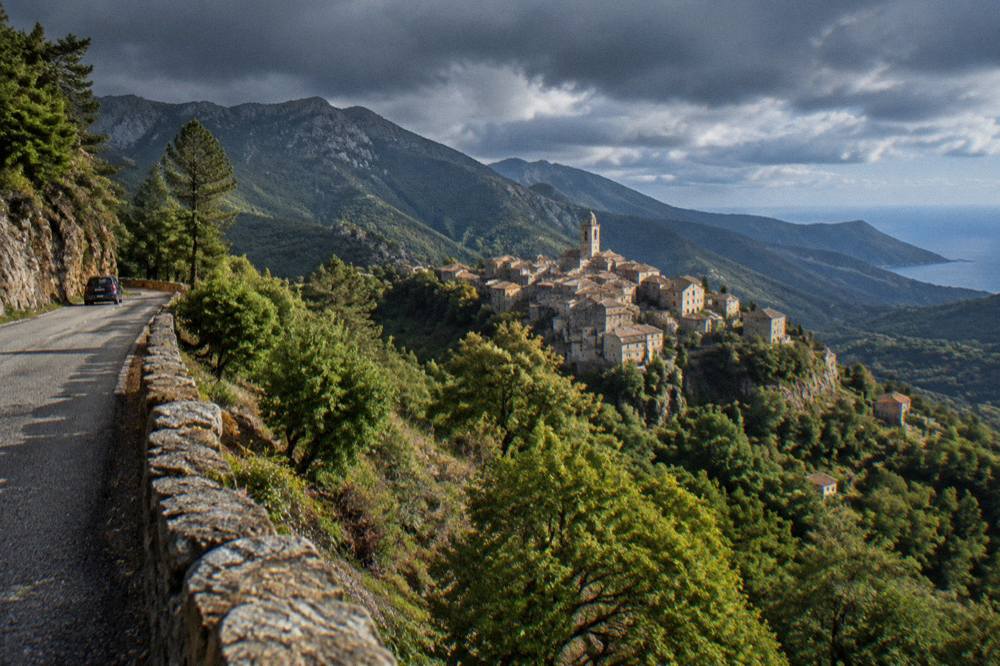
Corsican mountain roads are narrow, winding and genuinely slow, and no straight-line distance on this page converts into a drive time, because the only published road times in the sources are the Corte times: 1 hour from Bastia, 1 h 30 from Ajaccio and from Calvi, 2 hours from Porto-Vecchio and 2 h 45 from Bonifacio and Propriano. Everything else is as the crow flies, and the crow does not use mountain passes.
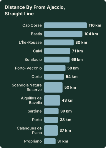
Straight-line distances from Ajaccio, computed from coordinates, give a sense of scale only: Bastia about 104 km, Bonifacio about 69 km, Porto-Vecchio about 58 km, Calvi about 71 km, Corte about 54 km, Porto about 38 km, Sartène about 39 km, Propriano about 31 km. In mainland France, 38 km is a half-hour; in Corsica it can be a different proposition entirely, and the D81 through the Calanques de Piana is a road to plan around rather than race through.
Inforoutes Corse publishes live road status and accessibility levels for the principal cols, per the Collectivité de Corse's road information service, updated as conditions change. Checking a pass the evening before driving it is simply how the island works. The dedicated page on driving in Corsica goes deeper on road types and driving style.
| From Ajaccio, straight line | Distance (about, as the crow flies) |
|---|---|
| Propriano | 31 km |
| Porto | 38 km |
| Sartène | 39 km |
| Calanques de Piana | 37 km |
| Aiguilles de Bavella | 43 km |
| Scandola Nature Reserve | 50 km |
| Corte | 54 km |
| Porto-Vecchio | 58 km |
| Bonifacio | 69 km |
| Calvi | 71 km |
| L'Île-Rousse | 80 km |
| Bastia | 104 km |
| Cap Corse | 116 km |
| Road time to Corte | Published time |
|---|---|
| From Bastia | 1 hour |
| From Ajaccio | 1 hour 30 |
| From Calvi | 1 hour 30 |
| From Porto-Vecchio | 2 hours |
| From Bonifacio | 2 hours 45 |
| From Propriano | 2 hours 45 |
Some journeys make more sense with a driver. A guided 4x4 day reaches the Cuscionu plateau and the Alta Rocca on tracks and passes that reward local knowledge, and the operator's tour page lists it as Check availability beside the site's own Alta Rocca and Zonza guide.
What Kind Of Car Suits Corsican Roads?
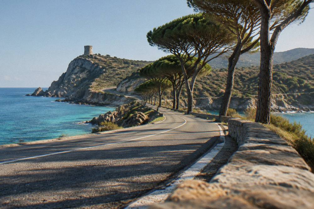
A compact car is the sensible default for Corsican roads, which are frequently narrow with tight bends, while the interior routes to the Col de Bavella, the Restonica and the Désert des Agriates tracks favour higher clearance, and automatic transmission is worth considering because mountain sections involve constant gear changes. The choice of vehicle is a road-type decision, not a comfort decision.
The site's partner booking tools cover standard hire categories across the island, including Bastia listings, and the practical pages on Corsica cost and budget frame the trade-offs. Two Corsica-specific points come straight from the geography: the west coast road through the Calanques de Piana and around the Golfe de Porto rewards a smaller car, and the Désert des Agriates beaches at Saleccia and Lotu are reached by boat shuttle from Saint-Florent, by 4x4 track from Casta or on foot, per the tourist board's page, so a standard rental is not the tool for that particular beach.
For the Agriates, the guided jeep option exists precisely because the track defeats ordinary cars. The tour from Calvi to Lotu and Saleccia runs as a small-group jeep day, listed on the site's Saleccia beach and Lotu beach pages.
What Rules Apply To Driving In Corsica In Summer?
From 15 June to 30 September it is forbidden to light a fire or smoke in forests, maquis, garrigue and massifs, and the daily fire-risk map is published at 18:00 for the next day, with access to some massifs restricted from mid-June to mid-September on high-risk days. There are no GR20 departures from Calenzana after 11:00 under the municipal order. Those rules shape where a rental car can park and which valleys close on red days.
The rule comes from the Parc naturel régional de Corse's own GR20 page, which covers both walkers and drivers on the massif tracks. The UK FCDO notes a high wildfire risk in France from April to October, and the US State Department lists France at Level 2, Exercise Increased Caution, per its travel advisory. Neither changes a rental plan by itself; both mean the fire map deserves a place in the bookmarks. The full index of guides sits on Corsica Travel Guide.
| Rule | Detail |
|---|---|
| Fire and smoking ban | 15 June to 30 September, forests, maquis, garrigue and massifs |
| Fire-risk map | Updated at 18:00 for the next day |
| Massif access | Can be restricted from mid-June to mid-September on high-risk days |
| GR20 Calenzana start | No departures after 11:00 (municipal order) |
| Wild camping | Banned across Corsica, including the GR20 |
Which One-Week Loops Work With A Rental Car In Corsica?
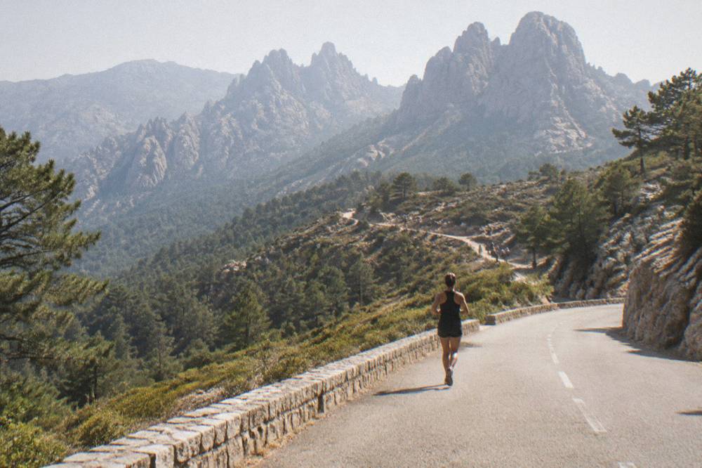
A one-week rental loop splits naturally into three shapes: a west-coast loop from Ajaccio through the Golfe de Porto, the Calanques de Piana and up to Calvi; a south loop through Sartène, Bonifacio, Porto-Vecchio and the Alta Rocca; and a north loop taking Cap Corse, Saint-Florent and the Balagne. The site's itinerary pages carry the day-by-day detail, and the road times above govern what fits in a day.
The five-day and one-week itineraries on Corsica in one week and Corsica in 5 days spell out overnight stops. From a rental standpoint, three anchors matter. First, Scandola is visited by boat only, with no landing in the integral reserve, so the car's job is to reach Porto, Sagone, Cargèse or Calvi, not the reserve itself; the Scandola boat tour guide covers the departures. Second, the beaches of the Désert des Agriates reward the boat shuttle from Saint-Florent rather than the track. Third, Bonifacio's cliffs and the Îles Lavezzi are a boat-trip town with paid parking logic of its own; see Bonifacio boat tour.
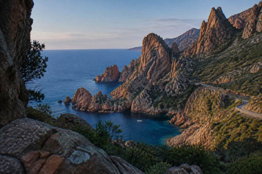
Straight-line distances help sequence the south loop: Sartène about 39 km from Ajaccio, Bonifacio about 69 km, Porto-Vecchio about 58 km, Propriano about 31 km. The Aiguilles de Bavella, about 43 km as the crow flies, sit inland of Porto-Vecchio and pair naturally with a 4x4 or a long day of bends.
When Is A Boat Trip Better Than The Car In Corsica?
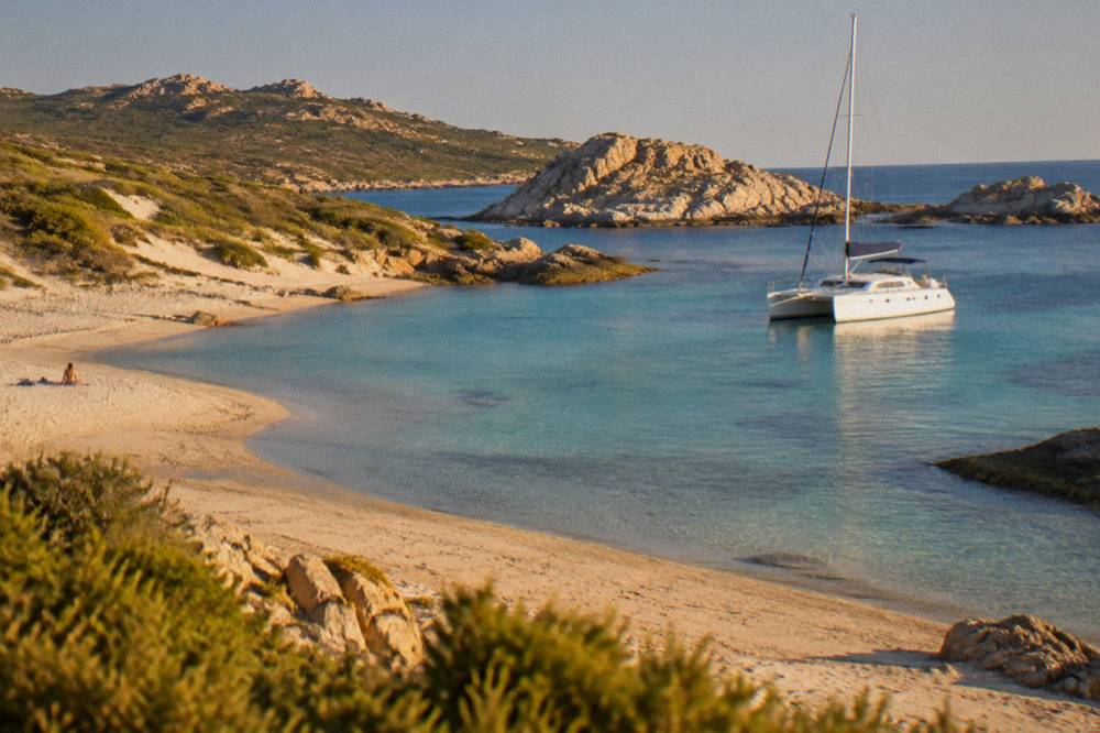
Scandola, Girolata, the Îles Lavezzi and the Îles Sanguinaires are boat-only or boat-first destinations: the Scandola land area is closed to the public and visits are by boat only, Girolata is reached by sea or on foot, and the Sanguinaires gulf is a short cruise from Ajaccio, so on those days the rental car simply waits at the port. The island's coast, more than 1,000 km of it, is partly a maritime road network.
The site's cruise pages, from Sanguinaires boat trip from Ajaccio to Porto-Vecchio boat trips, list the departures port by port. The pattern for a rental week is simple: drive the interior, sail the protected corners. Scandola's rules, daytime anchoring outside the integral reserve with anchors up at sunset, and no recreational line or spear fishing, come from the reserve's own access conditions, and boat operators handle all of that for passengers.
What Are The Alternatives To A Rental Car In Corsica?
The alternatives are the Chemins de fer de la Corse on three lines, Ajaccio to Bastia via Corte, Ponte-Leccia to Calvi and the Balagne coastal line from Calvi to L'Île-Rousse, plus boat shuttles on the coast, guided 4x4 and jeep days into the interior, and canyon tours with transport from set meeting points. For a single-base holiday built around one town and its boat trips, the alternatives are not a compromise.
The site's tour of the Corsican train page covers the rail lines and their scenery. Ferry travel to the island is on flights to Corsica and the ferry pages; the operators are Corsica Linea, La Méridionale, Moby and Corsica Ferries, with the short Sardinia link from Santa Teresa Gallura to Bonifacio taking about 50 to 60 minutes, reported as a range by aggregator data.
Guided days substitute directly for hard drives. The canyon tour in the Richiusa canyon at Bocognano and the turtle park at A Cupulatta near Sagone both work as car-free outings, and the canyoning page on Corsica canyoning and adventure sets out the options. For the plateau country behind Porto-Vecchio, the guided e-bike ride on the Plateau du Coscione takes the engine question off the table entirely.
How Does Weather Affect A Corsica Road Trip?
Corsica has a hot dry summer and a mild wet winter, with snow only on the high mountains, and the Météo-France 1991-2020 station normals for Ajaccio put July rainfall at 8.6 mm and November at 111.8 mm, so summer drives are mostly a heat and fire-risk question while November to March is when mountain passes and interior roads deserve the most caution. The fire map, not the rain gauge, is the summer constraint.
| Month (Ajaccio normals, Météo-France 1991-2020) | Mean daily high | Mean daily low | Rain |
|---|---|---|---|
| January | 14.0 °C | 4.7 °C | 54.1 mm |
| April | 18.5 °C | 8.3 °C | 53.1 mm |
| July | 28.6 °C | 17.7 °C | 8.6 mm |
| August | 29.2 °C | 18.1 °C | 15.8 mm |
| October | 22.8 °C | 12.6 °C | 85.7 mm |
| November | 18.3 °C | 9.0 °C | 111.8 mm |
The full month-by-month picture, including the Bastia station normals, sits on Corsica weather by month, and the seasonal trade-offs on best time to visit Corsica. For a road trip, October and November carry the most rain at both stations, and the interior climbs enough that winter planning belongs to the high routes, where Inforoutes Corse lists pass accessibility levels live.
What Safety Numbers Should A Driver Save In Corsica?
The numbers to save are 112 for all EU emergencies, 15 for medical, 17 for police, 18 for fire, 114 by SMS or app for deaf or speech-impaired callers, and 196 for sea rescue on VHF channel 16, with the PGHM mountain rescue unit in Ajaccio on 04 95 24 24 00. All of these come from the French service-public portal and the official directory.
On the road itself, the standing advice from the sources is narrow roads, live pass status through Inforoutes Corse, and the summer fire rules. The site's Corsica safety page collects the fuller picture, including beach supervision: Ajaccio ran 7 lifeguard posts from 1 July to the end of August 2026, and Haute-Corse beaches are supervised by volunteer firefighters about 1 July to 31 August, reported by local sources.
| Number | Use |
|---|---|
| 112 | European emergency number |
| 15 | SAMU medical emergencies |
| 17 | Police |
| 18 | Fire brigade |
| 114 | Emergency SMS or app |
| 196 | Sea rescue, VHF channel 16 |
| PGHM Ajaccio 04 95 24 24 00 | Mountain rescue |
Common Questions About Corsica Car Rental
Do You Need A Car In Corsica?
Not always: the Chemins de fer de la Corse link Ajaccio, Bastia, Corte and Calvi, boat trips cover the protected coast, and a single-base holiday can work car-free. A car becomes the practical tool for loops taking in the Golfe de Porto, Filitosa, the Alta Rocca and Cap Corse. The full answer is on the site's dedicated page.
Which Corsica Airport Is Best For Car Rental?
All four airports, Ajaccio Napoléon Bonaparte (AJA), Bastia Poretta (BIA), Figari Sud Corse (FSC) and Calvi Sainte-Catherine (CLY), carry rental capacity. Ajaccio and Bastia serve the widest choice of routes; Figari suits Bonifacio and Porto-Vecchio; Calvi suits the Balagne.
Can You Drive To Scandola?
No. The Scandola land area is closed to the public and visits are by boat only, with no landing in the integral reserve. A car gets you to a departure port such as Porto, Sagone, Cargèse or Calvi; the reserve itself is a boat trip.
Can You Drive To Saleccia And Lotu Beaches?
The Désert des Agriates beaches are reached by boat shuttle from Saint-Florent, by 4x4 track from Casta, or on foot, per the tourist board's page. A standard rental car is not the right tool for the track, and a guided jeep tour from Calvi exists as an alternative.
Are Corsican Roads Difficult?
The mountain roads are narrow and winding, and no straight-line distance converts to a drive time. The published road times to Corte, 1 hour from Bastia and 2 h 45 from Bonifacio, give the scale. Inforoutes Corse publishes live pass accessibility so conditions can be checked before setting out.
Is It Safe To Drive In Corsica In Summer?
Summer driving is governed by fire-season rules: from 15 June to 30 September fires and smoking are banned in forests, maquis and massifs, and some massifs can close on high-risk days. The UK FCDO notes a high wildfire risk in France from April to October. Emergency numbers are 112 and, for the mountains, the PGHM Ajaccio on 04 95 24 24 00.
The pattern that emerges from every source on this page is consistent: rent the car for the interior and the loops, park it for the protected coast, and let the fire map and Inforoutes Corse set the pace between them.