Driving In Corsica
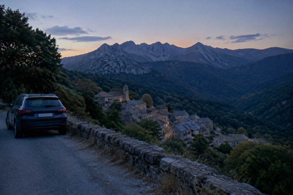
Corsica is 8,722 km2 of mountain roads, more than 1,000 km of coastline and a rail network that touches only part of the island, so a car shapes almost every itinerary.
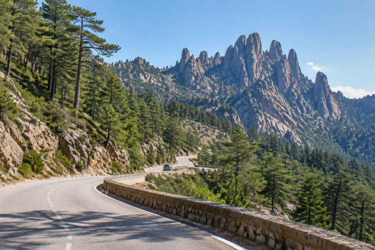
You can drive in Corsica on standard French rules, but the roads are narrow, mountainous and slow: the only crossing times worth trusting are the published ones, and the interior massifs carry summer fire restrictions.
Corsica packs 8,722 km2, more than 1,000 km of coastline and a summit of 2,706 m at Monte Cinto into the fourth-largest island in the Mediterranean, and its road network reflects that vertical geography. The Collectivité de Corse counts 360 communes, many of them strung along valley roads or perched above the sea, and the island's 365,636 residents (INSEE provisional estimate, 1 January 2026) share those roads with a heavy summer flow of visitors and their cars. Driving here follows standard French rules, and the payoffs are real, but the pace is slower than the map suggests and a handful of seasonal rules shape when and where you can go. This guide from the Corsica Travel Guide sets out what the published sources say about the roads, the times, the restrictions and the alternatives.
What Are The Roads In Corsica Like To Drive?
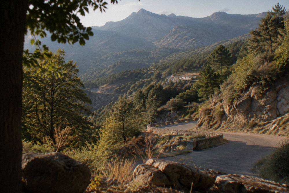
Corsica's roads are narrow, mountainous and much slower than their distance suggests, with the main routes linking the coastal towns and countless small roads climbing into the interior. Inforoutes Corse publishes live road conditions and accessibility levels for the principal mountain passes, which tells you how central real-time status is to route planning here. No straight-line distance between two Corsican towns should ever be read as a drive time.
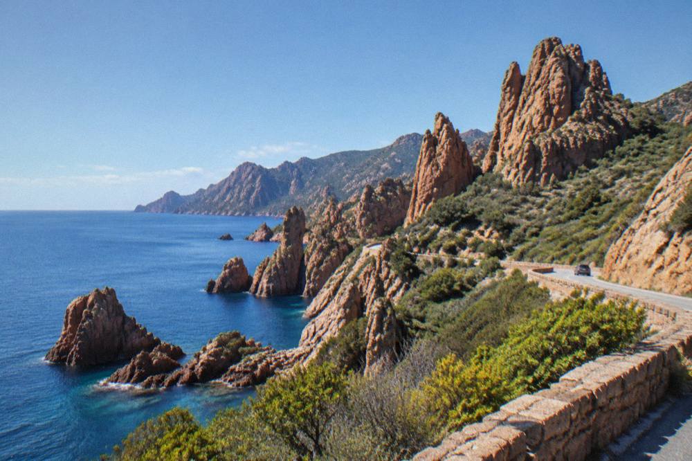
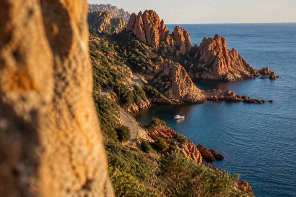
The island's geography is the reason. A mountainous interior runs the length of Corsica, with Monte Cinto at 2,706 m and the main towns sitting on the coast: Ajaccio, the capital, with 76,320 residents, Bastia with 46,867, and the smaller ports of Bonifacio, Porto-Vecchio, Calvi, L'Île-Rousse, Propriano and Saint-Florent. Roads that cross the interior have to climb, turn and descend, and roads that follow the coast, such as the route through the Calanques de Piana, are cut into cliff faces.
Inforoutes Corse, run by the territorial authority, grades the accessibility of the main cols and publishes live closures and works. That service exists because conditions change: storms close sections of mountain road, and in the fire season access to whole massifs can be restricted by prefectural order. Checking the pass status before a day of driving in the mountains is standard practice on this island, not an optional extra.
How Long Does Driving To Corte From Each Corsican Town Take?
Corte, the island's old capital in the interior, sits one hour by road from Bastia, one and a half hours from Ajaccio, one and a half hours from Calvi, two hours from Porto-Vecchio, two hours forty-five from Bonifacio and two hours forty-five from Propriano, per the Musée de la Corse practical page, which publishes these times for visitors reaching the citadel.
The ratio between straight-line distance and road time in the mountains is steep, and it holds across the island. Anyone planning a loop should budget by published road times where they exist and by generous margins everywhere else.
| From | Road time to Corte |
|---|---|
| Bastia | 1 h 00 |
| Ajaccio | 1 h 30 |
| Calvi | 1 h 30 |
| Porto-Vecchio | 2 h 00 |
| Bonifacio | 2 h 45 |
| Propriano | 2 h 45 |
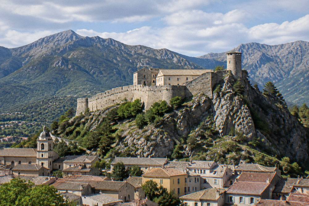
Corte itself rewards the drive. The Citadelle de Corte houses the Musée de la Corse, open 1 May to 31 October daily 10:00 to 19:00 (closed 1 May) and 1 November to 30 April 10:00 to 17:00 except Sundays, Mondays, holidays and 24 December, with a single EUR 5.50 ticket covering both museum and citadel. From Corte the Tavignano and Restonica valleys push further inland, and the Restonica valley guide covers what waits up that road.
Where Do You Pick Up A Rental Car In Corsica?
Rental desks cluster at Corsica's four airports, Ajaccio Napoléon Bonaparte (AJA), Bastia Poretta (BIA), Figari Sud Corse (FSC) and Calvi Sainte-Catherine (CLY), and at the main ferry ports of Ajaccio, Bastia, Bonifacio, L'Île-Rousse, Propriano and Porto-Vecchio, so the arrival point usually decides the start of the itinerary.
More than 8.5 million passengers, excluding cruise passengers, passed through Corsica's ports and airports in 2025 according to the ORTC and DREAL annual report published 30 May 2026, and a large share of those arrivals continue their journey by road. Ajaccio and Bastia are the two biggest gateways by population and traffic, Figari serves the far south near Bonifacio and Porto-Vecchio, and Calvi serves the Balagne. The Corsica airports guide and the Corsica car rental guide carry the detail on desks and pickup.
If the plan involves crossing to Sardinia or arriving by sea, the ferry to Corsica guide lists the ports and operators: Corsica Linea and La Méridionale from Marseille, Corsica Ferries from Toulon, Nice and Italy, Moby from Livorno, Genoa and Santa Teresa Gallura, with the short Sardinia link to Bonifacio taking roughly 50 to 60 minutes. A car booked from the port of arrival works the same way as one booked from an airport desk.
How Do Straight-Line Distances Translate Into Corsican Road Trips?
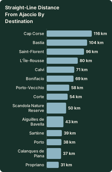
The published straight-line distances from Ajaccio are about 38 km to Porto, 37 km to the Calanques de Piana, 69 km to Bonifacio, 58 km to Porto-Vecchio, 71 km to Calvi, 104 km to Bastia and 116 km to Cap Corse, all measured as the crow flies and none of them a road distance, so treat every figure below as geography, not as a schedule.
The table gives the full set of measured points. What it shows is the island's shape: Corsica's main towns sit on a coastal ring with the interior in the middle, and the classic road trip follows that ring with occasional plunges inland to Corte, the Niolu or the Aiguilles de Bavella, which lies about 43 km from Ajaccio as the crow flies.
| Destination | Straight-line distance from Ajaccio |
|---|---|
| Propriano | about 31 km |
| Calanques de Piana | about 37 km |
| Porto | about 38 km |
| Sartène | about 39 km |
| Aiguilles de Bavella | about 43 km |
| Corte | about 54 km |
| Porto-Vecchio | about 58 km |
| Bonifacio | about 69 km |
| Calvi | about 71 km |
| L'Île-Rousse | about 80 km |
| Saint-Florent | about 96 km |
| Bastia | about 104 km |
| Cap Corse | about 116 km |
| Scandola Nature Reserve | about 50 km |
Two implications follow. First, a single-base holiday in Ajaccio or Bastia still leaves long days for the far ends of the island, since the far south and Cap Corse both sit beyond 100 km of straight-line distance. Second, the big itineraries, covered in the Corsica road trip guide and the Corsica map guide, are usually built as a ring rather than as day trips, precisely because the mountain roads stretch every kilometre.
What Fire-Season Rules Affect Driving And Access In Corsica?
From 15 June to 30 September it is forbidden to light a fire or smoke in Corsica's forests, maquis and massifs, and the prefecture's fire-risk map, updated at 18:00 for the next day, can restrict access to certain massifs from mid-June to mid-September, sometimes closing them entirely by prefectural order on the most severe days.
The UK Foreign Office likewise notes a high wildfire risk in France from April to October. A drive planned into a forest massif in high summer should be checked against the daily risk map the evening before.
The GR20 illustrates the pattern in its own rules: no departures from Calenzana, the northern start, after 11:00 under a municipal order tied to fire risk. Drivers heading to trailheads in the season should expect the same logic applied to the access roads. The fire rules, the refuge booking system and the trail lengths are all covered in the Corsica GR20 guide.
| Rule | Period | Scope |
|---|---|---|
| No fires or smoking in forests, maquis and massifs | 15 June to 30 September | Island-wide |
| Daily fire-risk map | updated 18:00 for the next day | Prefecture systems |
| Massif access restrictions | mid-June to mid-September | Marked massifs, can close fully |
| No GR20 departures from Calenzana after 11:00 | high-risk periods | Municipal order |
Can You Drive To Saleccia And Lotu In The Désert Des Agriates?
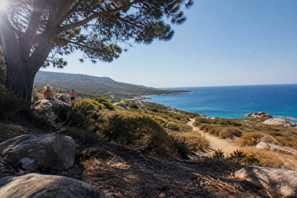
The beaches of the Désert des Agriates, Saleccia and Lotu among them, are reached by boat shuttle from Saint-Florent from about April to October, weather permitting, by 4x4 track from Casta, or on foot, as the official tourism page for the area states, so an ordinary rental car on an ordinary road does not get you there directly.
This is the clearest case in Corsica where the driving question changes shape. The Agriates is a protected coastal wilderness between Saint-Florent and the Plage d'Ostriconi, and its beaches are the reward for taking one of the three access options seriously. The boat shuttle from Saint-Florent port is the simplest; the 4x4 track from Casta is a rough, authorised route that suits vehicles and drivers prepared for it; on foot is a commitment. The Saleccia beach guide, the Lotu beach guide and the Désert des Agriates guide cover each option.
Do You Need A Car In Corsica At All?
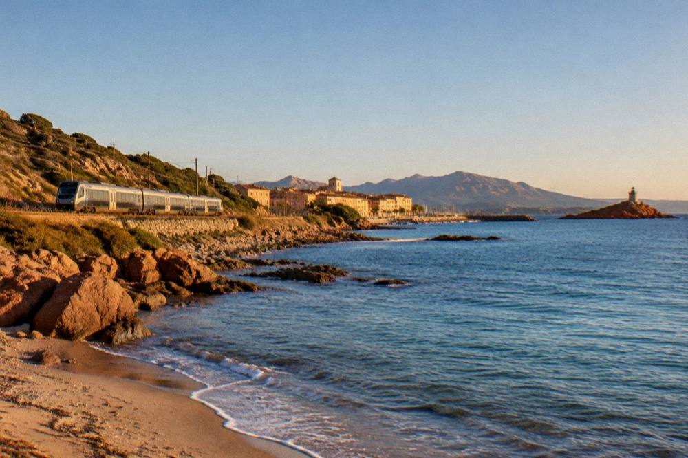
A car is the flexible choice for most of Corsica, but it is not the only one: the Chemins de fer de la Corse run an Ajaccio to Bastia line via Corte, a Ponte-Leccia to Calvi line and the Balagne coastal line between Calvi and L'Île-Rousse, ferries serve seven ports, and boat trips, jeep tours and guided day trips cover the headline sights for travellers who would rather not drive.
The rail network is genuinely useful for the axes it covers, and the getting around Corsica guide and the tour of the Corsican train guide cover it in detail. It does not reach Bonifacio, Porto-Vecchio, the Calanques de Piana or the Agriates. For those, the choice is a car, a boat, or an organised trip, and this site's Ajaccio city tour, Scandola boat tour and Bonifacio boat tour pages describe the boat-based alternatives.
| Gateway | Type | Serves |
|---|---|---|
| Ajaccio (AJA) | Airport and ferry port | Capital, west coast |
| Bastia (BIA) | Airport and ferry port | North-east, Cap Corse |
| Figari Sud Corse (FSC) | Airport | Bonifacio, Porto-Vecchio, far south |
| Calvi Sainte-Catherine (CLY) | Airport | Balagne, L'Île-Rousse |
| L'Île-Rousse | Ferry port | Balagne |
| Propriano and Porto-Vecchio | Ferry ports | Valinco, south-east coast |
| Bonifacio | Ferry port | Far south, Sardinia link |
The seasonal logic also plays a part. The best time to visit Corsica guide and the Corsica weather by month guide carry the Météo-France station normals: Ajaccio averages a July mean daily high of 28.6 °C with 8.6 mm of rain, while November averages 111.8 mm. Mountain roads and massif access behave differently across those months.
What Rules And Emergency Numbers Apply To Driving In Corsica?
Corsica applies standard French road rules, and the emergency numbers are 112 for all EU emergencies, 15 for medical, 17 for police, 18 for fire, 114 by SMS or app for deaf and speech-impaired callers and 196 for sea rescue, with the PGHM mountain rescue base in Ajaccio reachable on 04 95 24 24 00 outside a 112 call.
The currency is the euro, and restaurant pricing in France carries the service charge by law, with menus stating "prix service compris" and any extra tip optional, per the DGCCRF consumer guidance. None of that changes at the wheel, but it settles the practical background of a road trip: fill up, park legally, keep the fire rules in mind in summer and save the numbers.
| Number | Service |
|---|---|
| 112 | EU-wide emergency |
| 15 | SAMU medical |
| 17 | Police |
| 18 | Fire |
| 114 | Emergency by SMS or app |
| 196 | Sea rescue (VHF channel 16 at sea) |
| 04 95 24 24 00 | PGHM Ajaccio mountain rescue |
For travellers weighing the general risk picture, the Corsica safety guide covers the standing advisories, and the Corsica travel tips guide collects the small practical details. The US State Department lists France at Level 2, Exercise Increased Caution, as reported on its advisory page, which applies to the whole country.
What Are The Classic Drives In Corsica?
The published highlights cluster on the coastal ring and the interior crossing: the road through the Calanques de Piana on the west coast, the Golfe de Porto with its UNESCO-listed stretch, the crossing to Corte in the middle of the island, the Aiguilles de Bavella in the south and Cap Corse's peninsula road in the north, each covered by a dedicated guide on this site.
The west coast is the headline. The Calanques de Piana lie about 37 km from Ajaccio as the crow flies, inside the UNESCO property "Gulf of Porto: Calanche of Piana, Gulf of Girolata, Scandola Reserve" inscribed in 1983, and the road between Porto and Piana threads the red rock. The Calanques de Piana guide, the Golfe de Porto guide and the Scandola nature reserve guide describe what the drive connects; Scandola itself is visited by boat only, per the reserve's rules.
The south pairs the Aiguilles de Bavella, about 43 km from Ajaccio as the crow flies, with Bonifacio's cliffs, and the Aiguilles de Bavella guide and the Bonifacio citadel and cliffs guide cover both. Cap Corse, the northern peninsula about 116 km from Ajaccio as the crow flies, has its own page, as do Nonza and Centuri on its shores. What none of these pages can do is promise you a drive time: the mountain roads set their own pace.
Is Parking And Access Regulated At The Famous Natural Sites?
At Scandola the land area is closed to the public and visits are by boat only, with no landing in the integral reserve and anchors lifted at sunset where daytime anchoring is allowed, while at the Bouches de Bonifacio Nature Reserve the Îles Lavezzi are managed under reserve rules, and the Désert des Agriates runs its boat-shuttle and 4x4 access as described above, so the car's job usually ends at a port or a car park rather than at the sight itself.
That pattern repeats across the island's flagship nature sites and it is worth building into the itinerary rather than discovering at the wheel. The boat-based sights, Scandola, Girolata, the Îles Lavezzi and the Îles Sanguinaires off Ajaccio, all have dedicated guides on this site explaining the departure points and the cruise options. The drive delivers you to the embarkation point, and the sea does the rest.
For the inland sights the car works directly. Filitosa, the prehistoric site inland from Sollacaro, is open 1 April to 2 November from 09:00 with admission at EUR 9 for adults, EUR 7 reduced and EUR 28 for a family of two adults and two children aged 6 to 17. Maison Bonaparte in Ajaccio, on Rue Saint-Charles 200 m from the bus station and ferry terminal and served by bus 8 from the airport, charges EUR 10 full price and is closed on Mondays. The Filitosa guide and the Maison Bonaparte guide carry the hours.
Common Questions About Driving In Corsica
Is Driving In Corsica Difficult?
The roads are narrow and mountainous, and drive times run long relative to straight-line distances: Corte is an hour and a half by road from Ajaccio despite lying about 54 km away as the crow flies. Inforoutes Corse publishes live road conditions and pass accessibility, and the fire-risk map can restrict massif access from mid-June to mid-September.
Do You Need A Car In Corsica?
Not strictly. The Chemins de fer de Corse link Ajaccio, Bastia via Corte, Calvi and L'Île-Rousse, ferries serve seven ports, and boat trips and guided day trips cover sights such as Scandola, the Îles Lavezzi and the Désert des Agriates beaches. A car is the flexible option for the coastal ring and the interior villages.
Can You Drive To Saleccia And Lotu Beaches?
Only by the authorised 4x4 track from Casta. The official tourism page for the Désert des Agriates lists three accesses: boat shuttle from Saint-Florent from about April to October, weather permitting, the 4x4 track from Casta, or arrival on foot. A guided jeep tour is the alternative that leaves the track to a driver who knows it.
What Is The Speed Limit In Corsica?
Standard French road rules apply. Corsican limits beyond the general French framework are not detailed here, so follow the posted signage, which accounts for the narrow roads and village crossings.
Are Mountain Passes In Corsica Ever Closed?
Yes. Inforoutes Corse grades accessibility levels for the principal cols and publishes live closures and works, storms close sections from time to time, and in the fire season, with no fires or smoking allowed in forests, maquis and massifs from 15 June to 30 September, some massifs can close entirely by prefectural order on severe days. Check the pass status before driving into the interior.
Where Do You Rent A Car In Corsica?
At the four airports, Ajaccio Napoléon Bonaparte, Bastia Poretta, Figari Sud Corse and Calvi Sainte-Catherine, and at the ferry ports of Ajaccio, Bastia, Bonifacio, L'Île-Rousse, Propriano and Porto-Vecchio. The Corsica car rental guide on this site covers the practical detail.
Driving in Corsica rewards patience more than pace: the island's 8,722 km2 hold coast, massif and valley in close proximity, the published road times to Corte show how the mountains stretch a kilometre, and the daily road and fire-risk services exist precisely because conditions move. Plan the ring, book the car at the gateway that suits it, and let the boat shuttles and guided trips handle the places the roads deliberately leave alone.