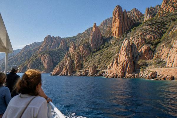
Corsica Photography
Corsica packs 8,722 km2 of granite coast, maquis and 2,706 m peaks into one island, and that range is what makes Corsica photography so varied. This guide sets out the locations, the seasonal light, the boat access rules and the practical limits a shoot on the island needs to respect.
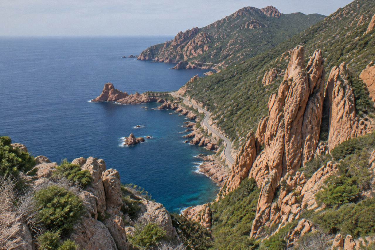
The strongest Corsica photography subjects are the red Calanques de Piana, the boat-only Scandola Reserve, the Bonifacio cliffs, the Désert des Agriates beaches and the high interior around the Restonica and the Aiguilles de Bavella, with the PNRC refuges and fire rules shaping summer access.
Corsica is a French Mediterranean island of 8,722 km2 with more than 1,000 km of coastline and an interior that rises to Monte Cinto at 2,706 m, and that vertical range is the whole story of Corsica photography. The same island day can hold granite cliffs over deep water, a Genoese-built citadel town, a prehistoric standing-stone site and a snow-striped summit. The Parc naturel régional de Corse, created in 1972, covers 4,484 km2 of it, and one stretch of the west coast, the "Gulf of Porto: Calanche of Piana, Gulf of Girolata, Scandola Reserve", has been UNESCO World Heritage since 1983. Access rules, guarded-refuge seasons and summer fire regulations shape when and how a photographer can work here, and this guide lays all of that out, location by location.
What Makes Corsica Photography So Distinctive?
Corsica photography stands apart because the island combines a 1,000 km granite shoreline with a mountain chain that reaches 2,706 m at Monte Cinto, all inside 8,722 km2, so sea, maquis and high peaks sit within a single day's drive of each other, and a UNESCO property covering the Calanche of Piana, the Gulf of Girolata and the Scandola Reserve protects one of the most photographed coastlines in the Mediterranean.
The island holds 360 communes spread across Corse-du-Sud and Haute-Corse, and the Collectivité de Corse has governed it as a single territorial authority since 1 January 2018. For a photographer that means two distinct working environments. The coast delivers the calanques, the beach crescents of the Désert des Agriates and the cliff towns. The interior, from Corte to the Niolu and the Aiguilles de Bavella, is the inland part, and it behaves like alpine country, with its own seasons, its own rules and its own light.
The UNESCO property is the anchor. Inscribed in 1983 under natural criteria, it spans 11,800 ha and includes the Scandola Nature Reserve, created by ministerial order on 9 December 1975 as the first nature reserve in Corsica, with 919 ha of land, 1,000 ha of sea and a 70 ha integral reserve. Scandola's land area is closed to the public and visits are by boat only, which is why almost every strong image of the reserve comes from the water. The reserve is also credited with saving the osprey in Corsica, and renewed quiet zones around the birds are part of current management, so drone-free, distance-respecting photography is not optional courtesy, it is the frame the rules set.
Where Are The Best Photography Locations In Corsica?
The locations that define a Corsica photography trip are the Calanques de Piana and the Scandola Reserve on the west coast, the Bonifacio cliffs and the Îles Lavezzi in the far south, the Désert des Agriates beaches of Saleccia and Lotu, the Calvi and Bastia citadels, the historic core of Ajaccio, the Restonica valley and the Aiguilles de Bavella in the mountains, and the prehistoric site of Filitosa inland of the Valinco.
Each of these answers a different photographic problem, and the practical details differ sharply between them.
The Golfe de Porto block is the classic. Piana's red granite calanques are reachable by road and by sea, Girolata is reachable on foot or by boat, and Scandola only by sea. A cruise leaving Porto or Cargèse covers all three in one loop, and an afternoon option such as the Scandola and coves of Piana cruise with a Girolata stop ties the whole stretch together. The Calanques de Piana guide covers the land side, and Girolata the hamlet itself.
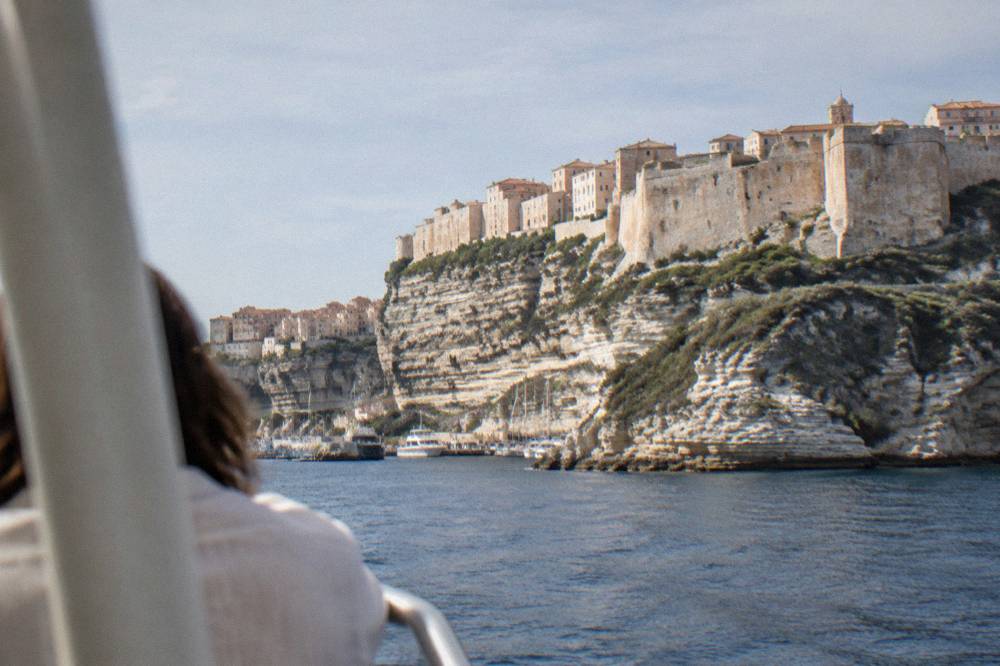
Bonifacio gives the island its most theatrical town setting, a citadel above limestone cliffs facing Sardinia, and the Bonifacio citadel and cliffs page details it. The Escalier du Roi d'Aragon, 189 steps cut down the cliff, gives a view the reservation site describes as a 180-degree sweep toward Sardinia; children receive a diploma at the top, and closed-toe flat shoes are required. In the south-east, Palombaggia, Santa Giulia and Rondinara are the beach subjects, and the Îles Sanguinaires off Ajaccio close out the gulf picture at sunset.
The interior works differently. The Restonica valley runs up from Corte, the old capital, where the citadel houses the Musée de la Corse. The Aiguilles de Bavella are the granite spires of the south, and the Forêt d'Aïtone and Gorges de Spelunca sit between the coast road and the peaks. Filitosa, open 1 April to 2 November, adds standing stones and menhir-statues to the portfolio; entry is EUR 9 for adults, EUR 7 reduced and EUR 28 for a family of two adults and two children aged 6 to 17, free under 6.
A location set this spread out rewards a base plan. The pairing of subjects and bases is the cleanest way to cut wasted driving on narrow mountain roads, and the table below gives the working combination.
How Do You Plan A Photography Trip Around Corsica?
A photography trip around Corsica works best as a two-base or three-base plan, one base on the west or south coast for the Golfe de Porto, Bonifacio and the beaches, and one inland or in the Balagne for Corte, the Restonica and the hilltop villages, with arrival chosen between the four airports of Ajaccio, Bastia, Figari and Calvi and ferries running year-round from Marseille, Toulon and Nice.
Arrival shapes everything. The island has four airports, Ajaccio Napoléon Bonaparte (AJA), Bastia Poretta (BIA), Figari Sud Corse (FSC) and Calvi Sainte-Catherine (CLY), and the Corsica airports guide covers them all. Corsica Linea and La Méridionale sail from Marseille year-round, Corsica Ferries from Toulon, Nice, Livorno and Savona, and Moby from Livorno, Genoa and Santa Teresa Gallura in Sardinia; the ferry to Corsica guide lays out the routes. Reported crossing ranges run from about 50 to 60 minutes on the Santa Teresa Gallura to Bonifacio hop to roughly 12 to 13 hours on the overnight Marseille sailings.
Once on the island, driving is the realistic way to move between shoot locations, and the driving in Corsica and Corsica car rental pages cover what that involves. Inforoutes Corse publishes live road conditions and accessibility levels for the main mountain passes, which matters for any high-interior shoot after storms. Road times into Corte, the natural pivot of the island, are fixed enough to plan around:
| From | Drive time to Corte |
|---|---|
| Bastia | 1 h |
| Ajaccio | 1 h 30 |
| Calvi | 1 h 30 |
| Porto-Vecchio | 2 h |
| Bonifacio | 2 h 45 |
| Propriano | 2 h 45 |
For the timing itself, the ready-made frameworks in Corsica in 5 days, Corsica in 10 days and the Corsica road trip pages can be re-cut around light rather than lunch. A west-coast base near Porto or Piana covers the UNESCO property, a south base near Bonifacio or Porto-Vecchio covers the cliffs and beaches, and Corte covers the interior. Where to sleep is covered in where to stay in Corsica, and the budget side in Corsica cost and budget.
The strongest single afternoon on the west coast is the Scandola loop by boat, because the reserve's land area is closed and the water is the only camera position. The afternoon cruise with a Girolata stop is the related pick for this page, it can be reserved through Check availability, and free cancellation makes it a safe early booking to lock in.
What Light And Weather Should Photographers Expect In Corsica?
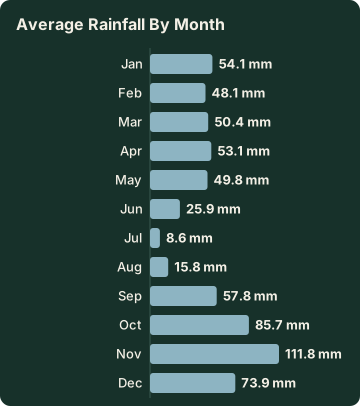
Corsica has a hot dry summer and a mild wet winter, with Météo-France 1991-2020 station normals for Ajaccio showing July averaging 8.6 mm of rain and a 28.6 °C mean daily high, November carrying 111.8 mm of rain, and sunshine peaking at an average 12.1 hours a day in July, while snow holds only on the high mountains, so summer light is abundant and hard and autumn and spring light is softer with a real rain risk.
The station normals give the planning grid. Ajaccio, at Campo dell'Oro:
| Month | Mean high °C | Mean low °C | Rain mm | Sunshine h/day |
|---|---|---|---|---|
| Jan | 14.0 | 4.7 | 54.1 | 4.4 |
| Feb | 14.2 | 4.3 | 48.1 | 5.5 |
| Mar | 16.0 | 5.9 | 50.4 | 6.8 |
| Apr | 18.5 | 8.3 | 53.1 | 7.7 |
| May | 22.1 | 11.8 | 49.8 | 9.3 |
| Jun | 25.9 | 15.4 | 25.9 | 11.1 |
| Jul | 28.6 | 17.7 | 8.6 | 12.1 |
| Aug | 29.2 | 18.1 | 15.8 | 11.1 |
| Sep | 26.1 | 15.4 | 57.8 | 8.7 |
| Oct | 22.8 | 12.6 | 85.7 | 6.7 |
| Nov | 18.3 | 9.0 | 111.8 | 4.7 |
| Dec | 15.1 | 5.8 | 73.9 | 4.0 |
Bastia, on the east side of the island, runs slightly warmer in summer highs and wetter in the autumn months. The Bastia normals put October at 126.5 mm of rain and November at 134.3 mm, against Ajaccio's 85.7 mm and 111.8 mm, and August shows a 29.8 °C mean daily high there. What the tables say to a photographer is simple: the June to August window gives long, reliable, hard light with short shadows and a real heat constraint in the middle of the day, while April, May, September and October trade some reliability for softer angles and fewer hours of daylight. Sunrise and sunset times come from the live feed on the Corsica weather by month page, and the broader trade-offs are in best time to visit Corsica.
| Month | Bastia mean high °C | Bastia rain mm | Ajaccio mean high °C | Ajaccio rain mm |
|---|---|---|---|---|
| Apr | 18.3 | 71.6 | 18.5 | 53.1 |
| Jun | 26.4 | 38.8 | 25.9 | 25.9 |
| Aug | 29.8 | 21.1 | 29.2 | 15.8 |
| Sep | 26.0 | 74.5 | 26.1 | 57.8 |
| Oct | 22.0 | 126.5 | 22.8 | 85.7 |
| Nov | 17.7 | 134.3 | 18.3 | 111.8 |
One seasonal constraint sits outside the climate table. From 15 June to 30 September it is forbidden to light a fire or smoke in forests, maquis and massifs, and the UK FCDO notes a high wildfire risk in France from April to October. The daily massif access map is updated at 18:00 for the next day, and from mid-June to mid-September some massifs can be restricted or closed outright. A summer interior shoot needs that check the evening before.
Which Boat Trips Give The Best Coastal Photos In Corsica?
The boat trips that matter for Corsica photography are the Scandola and Calanques de Piana cruises out of Porto, Cargèse, Sagone, Ota, Ajaccio and Calvi, the Lavezzi and cliff cruises out of Bonifacio and Porto-Vecchio, the Agriates catamarans out of L'Île-Rousse and the Sanguinaires trips out of Ajaccio, because Scandola is reachable only by boat and several of the finest coastal frames in Corsica simply do not exist from land.
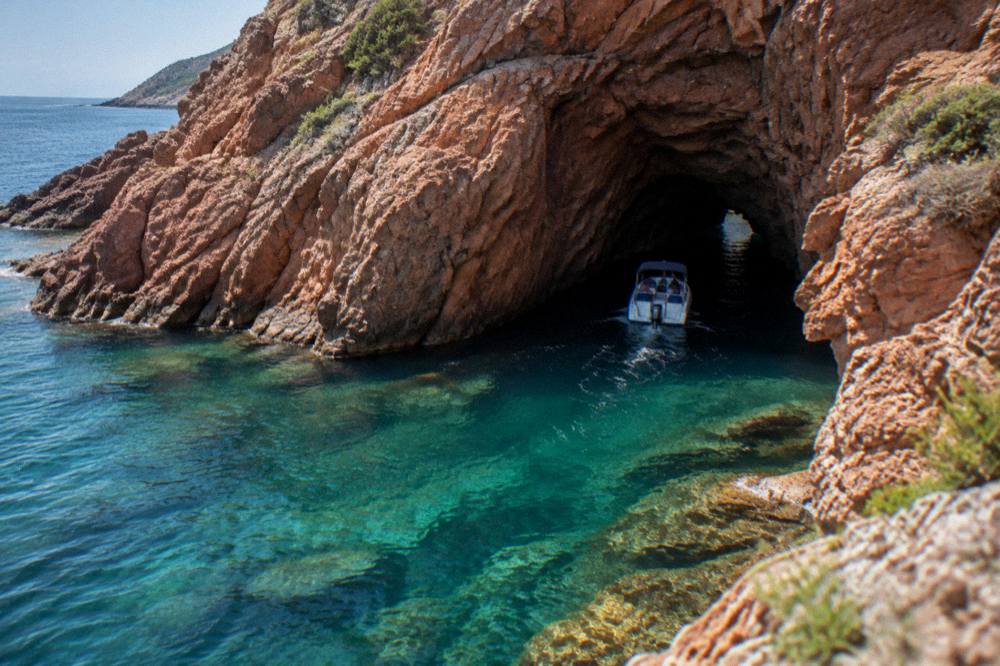
Scandola first, because the rule makes the choice. The reserve's terrestrial part is closed to the public, anchoring is allowed by day only outside the integral reserve and the Gargalu channel, anchors must be lifted at sunset, and recreational line fishing and spearfishing are prohibited. Voluntary labelling of boat operators, a QR-code tracking trial for pleasure boats and more controls at sea are the current measures, with quotas and licences to be consolidated in a regulatory framework being finalised, and no year attached to that. The practical read: go with a licensed cruise operator and photograph from the deck. The rest of the planning pages sit on Corsica Travel Guide.
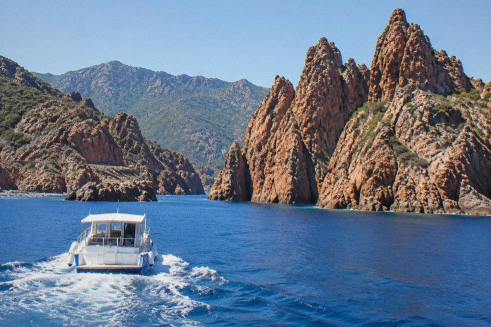
The Porto-based cruises, the semi-rigid and small-group trips from Ajaccio, the Cargèse runs with a Girolata stop and the Calvi to Scandola crossing all cover the reserve, while the Bonifacio side covers the cliffs and the Îles Lavezzi inside the Bouches de Bonifacio Nature Reserve. Swimming stops appear on several of them, and aperitif service on others. Since no landing is permitted in the Scandola integral reserve, the boat is the tripod.
| Cruise area | Ports of departure | What the camera gets |
|---|---|---|
| Scandola and Calanques de Piana | Porto, Ota, Cargèse, Sagone, Ajaccio, Calvi | Red granite, sea caves, Girolata hamlet |
| Bonifacio cliffs and Îles Lavezzi | Bonifacio, Porto-Vecchio | Limestone cliffs, islets, turquoise water |
| Îles Sanguinaires | Ajaccio, Porticcio | Islands and lighthouse at sunset |
| Désert des Agriates coast | L'Île-Rousse, Saint-Florent | Saleccia and Lotu beaches from the water |
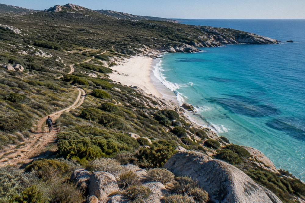
For the Agriates, the land alternatives matter. The beaches of Saleccia and Lotu are reached by boat shuttle from Saint-Florent, by 4x4 track from Casta, or on foot, with shuttles generally running from about April to October, weather permitting. Photographically that means two distinct frames exist: the long sand arcs from the water on a catamaran, and the track approach by jeep from the Calvi side, which is exactly what the guided jeep tours to Lotu and Saleccia cover.
How Do You Photograph The Corsican Mountain Interior?
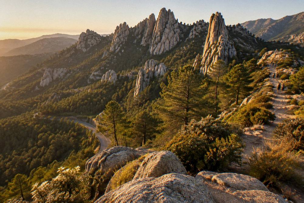
The Corsican interior is photographed around Corte and its citadel, the Gorges de la Restonica, the Aiguilles de Bavella, the Forêt d'Aïtone, the plateau country of the Alta Rocca and the GR20 ridge line, with about 15 stages of 4 to 8.5 hours across 180 km, refuges guarded from 16 May to 4 October and online booking mandatory for every bunk and bivouac pitch.
Corte is the pivot. It is the old capital of the island and it sits inland, and its citadel museum ticket, EUR 5.50 full, EUR 4 reduced and EUR 3 for over-65s and young people, covers both the Musée de la Corse and the citadel itself, with citadel access closing one hour before the museum. From Corte the Restonica climbs toward the high granite, and its road times and access are covered in the Restonica valley guide.
The GR20, Fra li Monti, is the high route: 180 km north to south, about fifteen stages of 4 to 8.5 hours, starting from Calenzana in the north, with no departures from Calenzana after 11:00 under a municipal fire-risk order. The 2026 refuge season runs 16 May to 4 October inclusive, and booking is online only, for bunks and bivouac pitches alike. The PNRC rates are EUR 20 per person for a refuge bunk, EUR 12 for a bivouac pitch with your own tent, EUR 27 for a one-person rented tent and EUR 39 for a two-person rented tent; every PNRC rental tent sleeps two with a 3 cm mat per person, and you bring the sleeping bag. Dogs are not allowed inside refuges or rented tents.
| PNRC option (2026) | Rate per person |
|---|---|
| Refuge bunk (bat-flanc) | EUR 20 |
| Bivouac pitch, own tent | EUR 12 |
| Rented tent, 1 person (pitch + tent) | EUR 27 |
| Rented tent, 2 persons (2 pitches + tent) | EUR 39 |
Wild camping is banned across Corsica, including on the GR20, and bivouac is allowed only in the marked areas at the refuges, so the mountain photography workflow is a hut-to-hut one. The old Cirque de la Solitude section has been off the route since a fatal rockfall in 2015 and a variant replaces it. For anyone weighing the whole undertaking, is the GR20 hard and the Corsica GR20 guide break the stages down, and the long alternatives matter too: Mare a Mare Nord runs 139 km, 161 km with the variant, Mare a Mare Centre 84 km from Ghisonaccia to Porticcio, Mare a Mare Sud 73 km to Propriano, Mare e Monti Nord 121 km and Mare e Monti Sud 66 km.
| Trail | Length | Days | Total climb |
|---|---|---|---|
| GR20 (Fra li Monti) | 180 km | about 15 stages | not stated |
| Mare a Mare Nord | 139 km (161 km with variant) | 8 to 12 | 5,900 m |
| Mare a Mare Centre | 84 km | 6 to 7 | 3,900 m |
| Mare a Mare Sud | 73 km | 5 | 3,200 m |
| Mare e Monti Nord | 121 km | 10 | 6,100 m |
| Mare e Monti Sud | 66 km | 5 | 2,700 m |
Which Towns And Streets Are Worth A Photography Morning In Corsica?
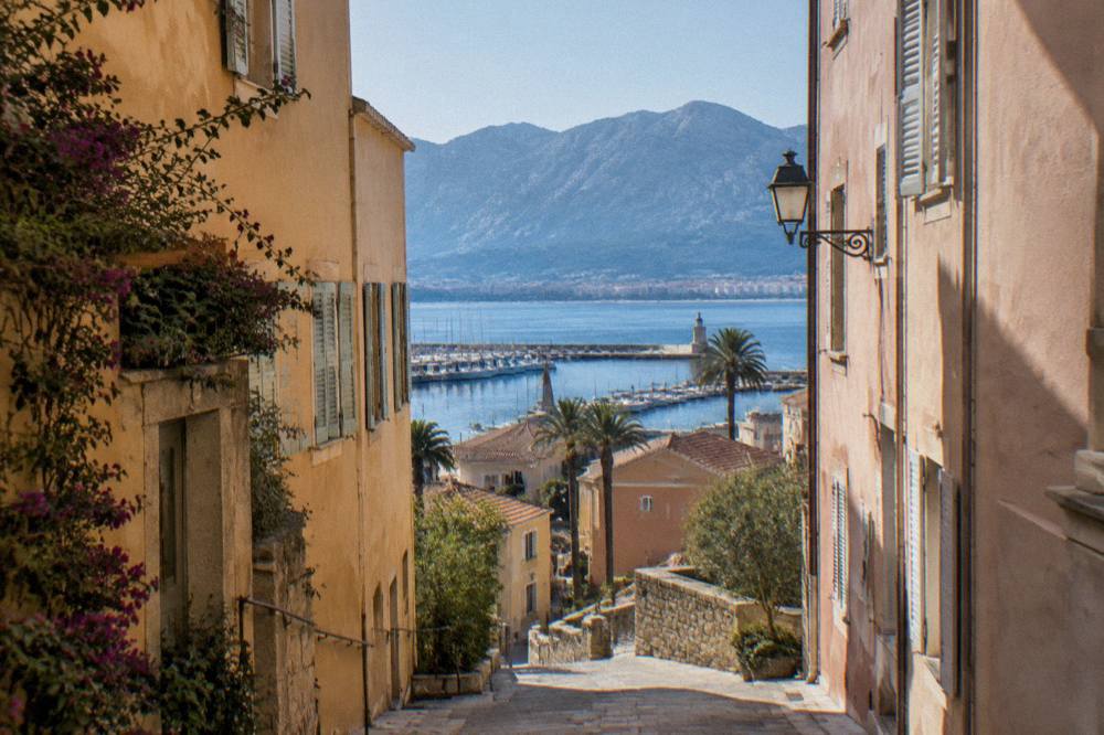
The towns that reward a photography morning are Ajaccio with Maison Bonaparte and the Palais Fesch, Bastia with its old harbour and the Palais des Gouverneurs, Bonifacio's citadel core, Calvi and L'Île-Rousse on the Balagne coast, the hilltop villages of the interior and Sartène inland of the Valinco, with museum opening days and admission prices fixed and checkable in advance.
Ajaccio, the capital and Napoleon's birthplace, has 76,320 residents, and its two museums set the schedule. Maison Bonaparte on Rue Saint-Charles, 200 m from the bus station and ferry terminal, is open every day except Monday; it charges EUR 10 full price, EUR 8 for non-EU residents aged 18 to 25 and large families, and is free for EU residents under 26, with hours shifting by season, 10:30 to 12:30 and 13:15 to 16:30 from October to March, 10:00 to 12:30 and 13:15 to 17:30 from April to June, and continuous 10:00 to 17:30 from July to September. The Palais Fesch charges EUR 10 full price, EUR 6 for over-65s and is free up to 18, open daily 09:00 to 17:00. The city pages for Ajaccio, Bastia, Bonifacio, Porto-Vecchio and Calvi and the Balagne carry the fuller detail.
| Museum or site | Admission | Opening pattern |
|---|---|---|
| Maison Bonaparte, Ajaccio | EUR 10 full, EUR 8 non-EU 18-25 and large families, free EU under 26 | Closed Monday |
| Palais Fesch, Ajaccio | EUR 10 full, EUR 6 over 65, free up to 18 | Daily 09:00-17:00 |
| Musée de la Corse and citadel, Corte | EUR 5.50 full, EUR 4 reduced, EUR 3 over 65s and young people | Daily 1 May-31 Oct 10:00-19:00, reduced off-season |
| Filitosa | EUR 9 adults, EUR 7 reduced, EUR 28 family, free under 6 | 1 April to 2 November |
| Escalier du Roi d'Aragon, Bonifacio | about EUR 5 | 189 steps, closed shoes required |
Bastia, the second town with 46,867 residents, keeps its old harbour and the Musée de Bastia in the Palais des Gouverneurs, running a high-season 10:00 to 18:30 schedule and a split low-season one, closed Sundays and Mondays off-season. Beyond the big towns, the hill villages of the Balagne and the interior are half-day subjects in their own right, and a guided day trip to the old hilltop villages from the Calvi side is one options for reaching them without route-finding on mountain roads. In Ajaccio itself, a small-group history walk from Genoa to Napoleon gives the town core with a guide who knows the lanes, and it pairs naturally with a food tour morning in the same streets.
What Practical Rules And Safety Points Apply To Photography In Corsica?
Photography in Corsica runs under French emergency numbers 112, 15, 17, 18, 114 and 196 at sea, mountain rescue through the PGHM in Ajaccio on 04 95 24 24 00, a fire and smoking ban in forests and massifs from 15 June to 30 September, a daily massif access map updated at 18:00, banned wild camping everywhere on the island and boat-only access to the Scandola Reserve, so the rules shape the shoot, not the other way round.
The emergency set is fixed: 112 as the European number, 15 for medical, 17 for police, 18 for fire, 114 by SMS or app, and 196 for sea rescue on VHF channel 16. The PGHM in Ajaccio answers on 04 95 24 24 00, and in a genuine emergency the instruction is 112 or 17 first. For coastal work the lifeguard picture matters in summer: Ajaccio operated seven lifeguard posts on its main beaches from 1 July to the end of August 2026, and Haute-Corse beaches are supervised by volunteer firefighters over roughly the same window. The full risk picture is in Corsica safety.
Access rules do more work than any filter. Wild camping is banned island-wide, bivouac is confined to refuge areas on the GR20 with a reservation, no landing is allowed in the Scandola integral reserve, no GR20 stage starts from Calenzana after 11:00, and massifs can shut on red fire-risk days between mid-June and mid-September. None of this stops a planned shoot; all of it punishes an unplanned one. The remaining practicalities, currency in euros, plugs, arrival logistics and packing, are collected in Corsica travel tips, and the full island layout is on the Corsica map page.
A few last planning notes close out this guide. The Collectivité de Corse runs Corsican-language programmes, including immersion schools, so island signage frequently carries Corsican place names alongside French ones, and photographing that dual signage is one of the small genuine details of a Corsica set. More than 8.5 million passengers, excluding cruise passengers, passed through the island's ports and airports in 2025, which is why the pressure on the flagship locations in July and August is a planning fact rather than a guess, and why May, June, September and October carry the same light with fewer arrivals. Pick the coast or the interior for each day, check the access map the evening before, book the refuge or the boat ahead, and let the island's rules set the schedule.
Common Questions About Corsica Photography
Can You Photograph The Scandola Reserve From Land?
No. The terrestrial part of the Scandola Nature Reserve is closed to the public and visits are by boat only, with no landing permitted in the integral reserve, so every Scandola photograph is taken from the water on a licensed cruise.
When Can You Photograph The GR20 Refuges?
The PNRC refuges on the GR20 are guarded from 16 May to 4 October inclusive, and booking a bunk at EUR 20 per person or a bivouac pitch at EUR 12 is mandatory and online only.
Which Months Give The Most Light For Corsica Photography?
Per the Météo-France 1991-2020 station normals for Ajaccio, July averages 12 h 6 min of sunshine a day and 8.6 mm of rain, while November averages 4 h 42 min of sunshine a day and carries 111.8 mm of rain, so summer delivers the hours and the shoulder months the softer light.
Can You Fly A Drone Over Corsican Beaches And Reserves?
Nature reserves such as Scandola and the Bouches de Bonifacio carry their own protected-area restrictions, so check the current prefectural and reserve rules before flying anywhere on the coast.
Do You Need A Boat To Photograph Saleccia And Lotu?
Not necessarily. The Désert des Agriates beaches are reached by boat shuttle from Saint-Florent, generally April to October weather permitting, by 4x4 track from Casta, or on foot, so both a water frame and a land frame are possible.
Are Corsican Museums Open On Mondays?
Maison Bonaparte in Ajaccio is closed on Mondays, the Musée de la Corse in Corte is closed Sundays and Mondays in the low season, and the Palais Fesch is open daily from 09:00 to 17:00, so Monday is the day to plan around for museum interiors.