Figari Airport
Figari Sud Corse is the airport that puts you in the far south of Corsica, close to Bonifacio, Porto-Vecchio and the beaches of the extreme south of the island.
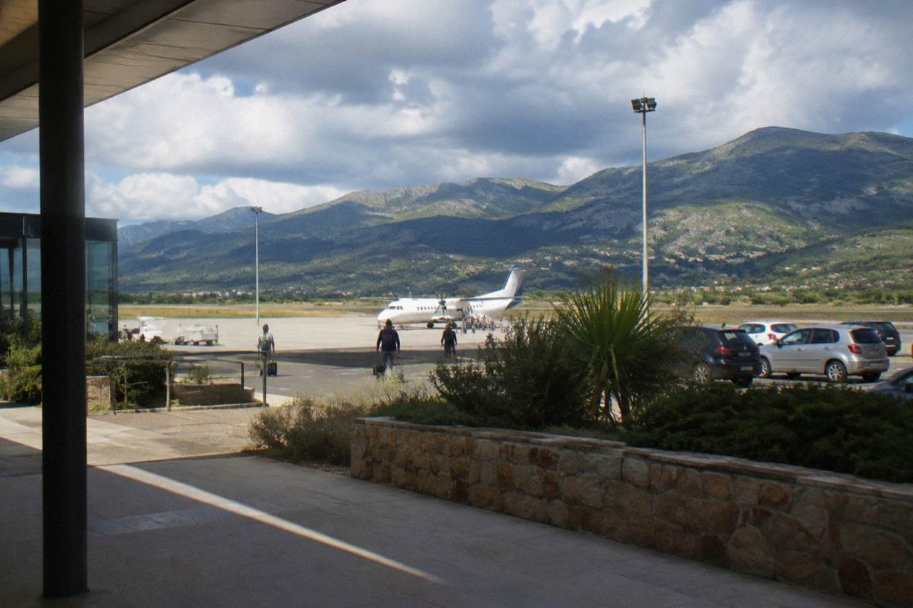
Figari Sud Corse (FSC) is one of Corsica's four airports and serves the island's far south, with Bonifacio and Porto-Vecchio the nearest major towns and ferry connections onward to Sardinia from Bonifacio.
Corsica, the French Mediterranean island of 8,722 km2 with more than 1,000 km of coastline, has four airports, and Figari Sud Corse (FSC) is the one that serves the far south of the island. The airport sits in the Corse-du-Sud interior, inland of the coast, roughly between Bonifacio to the southeast and Porto-Vecchio to the northeast, which makes it the natural entry point for travellers whose plans centre on the extreme south of the island: the Bonifacio citadel and cliffs, the Îles Lavezzi, Palombaggia and Santa Giulia, and the plateaus and forests of the Alta Rocca. This page covers what the sources say about the airport, how to move on from it, and how to build a trip around it, with ferry, road and sight information the site works from.
Corsica's transport picture is unusual for an island of its size. Alongside the four airports, seven towns carry ferry services (Ajaccio, Bastia, Bonifacio, L'Île-Rousse, Propriano and Porto-Vecchio), and a small rail network, the Chemins de fer de la Corse, links Ajaccio to Bastia via Corte with branch lines towards Calvi and the Balagne coast. More than 8.5 million passengers, excluding cruise passengers, passed through the island's ports and airports in 2025, according to the ORTC and DREAL de Corse annual report published 30 May 2026. Figari's role in that flow is the southern one: it collects the traffic headed for the strip of coast between Propriano and Bonifacio and the crossing point to Sardinia.
Where Is Figari Airport In Corsica?
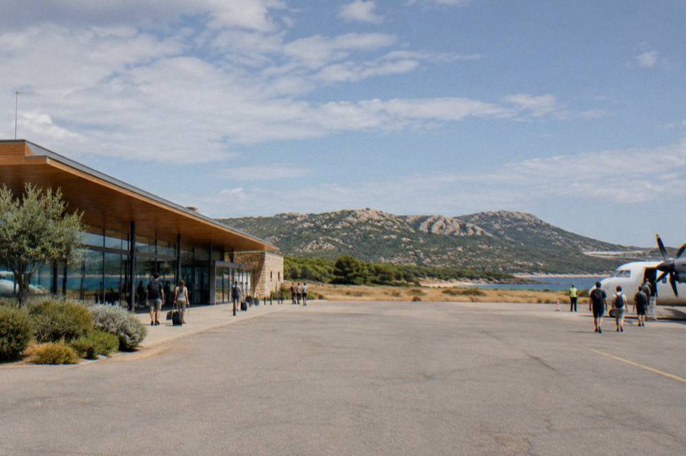
Figari Sud Corse (FSC) is one of the four airports of Corsica, alongside Ajaccio Napoléon Bonaparte (AJA), Bastia Poretta (BIA) and Calvi Sainte-Catherine (CLY), and it serves the far south of the island, in the department of Corse-du-Sud, inland between Bonifacio on the south coast and Porto-Vecchio on the southeast coast. The airport is named after Figari, the commune where it sits.
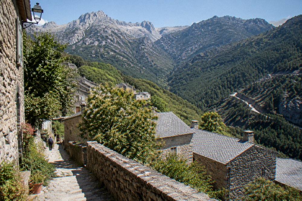
The south of Corsica that Figari serves is a compact region with a real range inside a short radius. Bonifacio, on its limestone cliffs above the Strait of Bonifacio, holds the citadel, the Escalier du Roi d'Aragon with its 189 steps cut down the cliff, and the boat departures for the Îles Lavezzi. Porto-Vecchio carries the old town and the beach corridor of Palombaggia and Santa Giulia. Inland to the northwest, the Alta Rocca rises towards the Aiguilles de Bavella and the plateaus around Cuscionu, and Propriano, on the Golfe de Valinco, is both a resort and a ferry port. Sartène sits between the two coasts, and the prehistoric site of Filitosa lies west of the airport area near Sollacaro.
For orientation, the site's wider guides cover each of these bases: Bonifacio, Porto-Vecchio, Sartène and the Valinco and Alta Rocca and Zonza. The airport's position, inland on the plain rather than on the coast, means every onward journey starts with a road drive through maquis-covered country, and the road network of the south is described in the section on getting around below.
Which Airlines Serve Figari Sud Corse?
Figari Sud Corse (FSC) is one of four airports serving Corsica, alongside Ajaccio Napoléon Bonaparte (AJA), Bastia Poretta (BIA) and Calvi Sainte-Catherine (CLY), but the text does not name the specific airlines that serve it. Its traffic is strongly shaped by the holiday season in the far south, which concentrates demand into the warm months.
What can be said with certainty is the island-level picture. Corsica is served by four airports: Ajaccio Napoléon Bonaparte (AJA), Bastia Poretta (BIA), Figari Sud Corse (FSC) and Calvi Sainte-Catherine (CLY). Ajaccio, the capital, recorded 76,320 residents in the census population published 27 August 2026, and Bastia, the second town, 46,867, and the two northern and western airports together carry the bulk of the island's scheduled traffic. Figari's traffic is strongly shaped by the holiday season in the south: the beaches of Palombaggia and Santa Giulia, the bonifacien cliffs and the Sardinia crossing all concentrate demand into the warm months.
The climate helps explain that seasonality. The Météo-France 1991-2020 station normals for Ajaccio show a hot dry summer and a mild wet winter: July averages 8.6 mm of rain and August a mean daily high of 29.2 °C, while November carries 111.8 mm of rain and December a mean daily high of 15.1 C. The site's Corsica weather by month guide carries the full tables. Anyone booking flights into Figari for the summer should also note the island-wide fire rule: from 15 June to 30 September it is forbidden to light a fire or smoke in forests, maquis and massifs, and access to some massifs can be restricted when the fire-risk map, updated each day at 18:00 for the next day, runs high.
For the practical comparison of the island's four gateways, the table the site builds its data on is below, and Corsica airports expands each one.
| Airport | IATA code | Base town | Area served |
|---|---|---|---|
| Figari Sud Corse | FSC | Figari, Corse-du-Sud | Far south: Bonifacio, Porto-Vecchio, Valinco, Alta Rocca |
| Ajaccio Napoléon Bonaparte | AJA | Ajaccio | West coast and capital region |
| Bastia Poretta | BIA | Bastia | Northeast, Cap Corse, Castagniccia |
| Calvi Sainte-Catherine | CLY | Calvi | Balagne and northwest coast |
How Do You Get From Figari Airport To Bonifacio And Porto-Vecchio?
Onward travel from Figari is by road: hire car, taxi or bus, with Bonifacio and Porto-Vecchio the two main towns within reach of the airport, and no rail line in the far south, since the reported Chemins de fer de la Corse network runs Ajaccio to Bastia via Corte, Ponte-Leccia to Calvi, and the Balagne coastal line Calvi to L'Île-Rousse, none of which reaches the island's southern tip.
No taxi fare, bus timetable or drive time is stated here, because no such details are given for these routes.
Driving is the mode the island's geography favours. Corsica is a mountainous island, 8,722 km2 with Monte Cinto at 2,706 m, and the roads of the south run through hills and along the coast on routes where conditions change with the terrain. Inforoutes Corse publishes live road conditions and accessibility levels for the main mountain passes, reported by the Collectivité de Corse's road information service, and checking it before a drive in the interior or over the passes is the standing advice on every page of this site. The driving in Corsica and Corsica car rental guides cover the detail, and getting around Corsica sets out the wider options, train, bus and boat included.
The rule that matters when driving anywhere on the island in summer is the fire rule quoted above, 15 June to 30 September, no fires or smoking in forests, maquis and massifs, with daily massif access levels published from mid-June to mid-September. The same rule sits behind one of the GR20's oddities: no departures from Calenzana after 11:00, under a municipal order linked to fire risk. A driver in the south is unlikely to meet that particular rule, but the same logic of daytime restrictions in the massifs applies across the island's forest roads on red days.
For a sense of how the island's road distances work at the regional level, one anchor exists: road times to Corte, the old capital in the interior, are given by the Musée de la Corse's practical page as 1 hour from Bastia, 1 hour 30 from Ajaccio, 1 hour 30 from Calvi, 2 hours from Porto-Vecchio, 2 hours 45 from Bonifacio and 2 hours 45 from Propriano. Those figures give a fair picture of how the south connects to the centre: Porto-Vecchio is closer to Corte than Bonifacio is, and both are among the longer regional drives on the island.
| Route to Corte (Musée de la Corse practical page) | Road time |
|---|---|
| From Bastia | 1 h |
| From Ajaccio | 1 h 30 |
| From Calvi | 1 h 30 |
| From Porto-Vecchio | 2 h |
| From Bonifacio | 2 h 45 |
| From Propriano | 2 h 45 |
Can You Arrive At Figari Airport And Leave By Ferry?
Yes, and the far south is one of the best-connected corners of Corsica for it: Bonifacio, Porto-Vecchio and Propriano all sit on the island's ferry port list, and Moby and Ichnusa Lines sail the short Santa Teresa Gallura to Bonifacio crossing from Sardinia, about 50 to 60 minutes reported, while Corsica Linea and La Méridionale connect Marseille to the island's ports and Corsica Ferries sails from Toulon, Nice and the Italian ports.
The port facts are these. Corsica Linea sails Marseille to L'Île-Rousse, Bastia, Propriano and Ajaccio. La Méridionale sails Marseille to Ajaccio and Marseille to Porto-Vecchio. Moby sails Livorno to Bastia, Genoa to Bastia and Santa Teresa Gallura to Bonifacio, and Moby and Ichnusa Lines keep the Santa Teresa Gallura to Bonifacio route under a public service renewal reported in October 2026. Corsica Ferries, reported by the aggregator and operator pages, sails from Toulon and Nice to Ajaccio, Bastia, L'Île-Rousse, Porto-Vecchio and Propriano, and from Livorno and Savona to Bastia. Crossings from the mainland run long: about 12 to 13 hours from Marseille, mostly overnight, 10 to 13 hours from Toulon, and 7.5 to 10 hours from Nice, all reported as ranges by the ferry aggregator ferrygogo.fr, while the Sardinia link is under an hour.
That Sardinia crossing is the one that matters most to a Figari arrival. Bonifacio is the port, Santa Teresa Gallura the Sardinian side, and the Corsica Sardinia ferry guide covers the route in detail, with ferry to Corsica and Nice to Corsica ferry covering the mainland links. A day trip to Sardinia from Bonifacio is a realistic plan with a Figari base, and the Sardinia day trip from Bonifacio guide walks it through.
| Ferry port | Mainland or island links (verified or reported) |
|---|---|
| Bonifacio | Santa Teresa Gallura (Moby, Ichnusa Lines), about 50 to 60 min |
| Porto-Vecchio | Marseille (La Méridionale), Toulon and Nice (Corsica Ferries) |
| Propriano | Marseille (Corsica Linea), Toulon (Corsica Ferries) |
| Ajaccio | Marseille (Corsica Linea, La Méridionale), Toulon and Nice (Corsica Ferries) |
| Bastia | Marseille, Livorno, Savona, Genoa (Corsica Linea, Corsica Ferries, Moby) |
| L'Île-Rousse | Marseille (Corsica Linea), Toulon and Nice (Corsica Ferries) |
| Calvi | Listed among the island's ferry ports |
What Is There To Do Near Figari In South Corsica?
The far south around Figari holds the Bonifacio citadel and cliffs with the Escalier du Roi d'Aragon (189 steps, about EUR 5 reported, closed shoes required), the prehistoric site of Filitosa (EUR 9 adults, open 1 April to 2 November), the beaches of Palombaggia, Santa Giulia and Rondinara, the boat trips to the Îles Lavezzi, and the 73 km Mare a Mare Sud trail ending in Propriano.
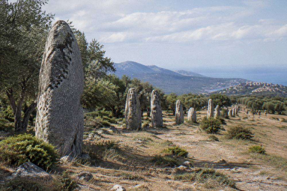
Filitosa is the region's flagship inland sight. The prehistoric site near Sollacaro is open 1 April to 2 November, from 09:00 to about an hour before sunset with the museum open 09:00 to 19:00, and the site's own page advises allowing about an hour and a half. Prices are EUR 9 for adults aged 18 and over, EUR 7 reduced for ages 6 to 17 and disabled visitors, EUR 28 for a family of two adults and two children aged 6 to 17, and free for under-6s. The Filitosa guide covers what the site holds.
In Bonifacio, the Escalier du Roi d'Aragon cuts 189 steps down the cliff face, with a 180-degree view over the strait towards Sardinia, and children receive a diploma at the top, per the Bonifacio reservation page. The fee is reported at about EUR 5 for adults with EUR 2 for ages 6 to 11, hours vary by month, and closed-toe flat shoes are required. Boat trips from the town cover the cliffs and the Îles Lavezzi inside the Bouches de Bonifacio Nature Reserve, managed by the OEC, and the site's guides cover the Bonifacio citadel and cliffs, the Lavezzi islands and the Bonifacio boat tour options.
The beaches run east and west from Figari's corner of the island. Palombaggia, Santa Giulia and Rondinara line the coast north of Bonifacio towards Porto-Vecchio, each with its own guide: Palombaggia, Santa Giulia and Rondinara. Further west, Plage de Roccapina sits on the wild south coast with its own guide. For hikers, the Mare a Mare Sud is 73 km over 5 days, ending in Propriano with 3,200 m of climbing, and the Mare e Monti Sud is 66 km over 5 days, also ending in Propriano with 2,700 m of climbing, both from the PNRC brochure. The full set of the island's long trails is in the table below, and hiking in Corsica expands on all of them.
| Long trail (PNRC brochure) | Length | Days | Total climb |
|---|---|---|---|
| GR20 (Fra li Monti) | 180 km | about 15 stages of 4 to 8.5 h | not stated |
| Mare e Monti Nord | 121 km | 10 | 6,100 m |
| Mare a Mare Nord | 139 km (161 km with variant) | 8 to 12 | 5,900 m |
| Mare a Mare Centre | 84 km | 6 to 7 | 3,900 m |
| Mare a Mare Sud | 73 km | 5 | 3,200 m |
| Mare e Monti Sud | 66 km | 5 | 2,700 m |
For travellers who want a guided day rather than self-driving, the far south offers a 4x4 tour of the Ospedale forest and the Aiguilles de Bavella from Porto-Vecchio and a Cuscionu plateau and Alta Rocca 4x4 day, and the Cap Corse and Désert des Agriates half-day trip makes a strong pairing if the trip extends north.
Where Should You Stay When Flying Into Figari?
The main bases within reach of Figari are Bonifacio, inside or below the clifftop citadel town; Porto-Vecchio, the old town and beach corridor of the southeast; the quieter Valinco around Propriano and Sartène; and the Alta Rocca villages inland towards the Aiguilles de Bavella, with the choice trading beach proximity against access to the interior trails.
Bonifacio suits a first visit built around the cliffs, the boat trips and the Sardinia crossing, and the how many days do you need in Bonifacio planning pages cover pacing. Porto-Vecchio suits a beach-and-evenings trip, with Palombaggia and Santa Giulia on the doorstep and the Porto-Vecchio old town guide covering the town itself. Propriano and the Valinco give a calmer base with a ferry port of their own, and Sartène sits inland between the coasts. The interior option, Zonza and the Alta Rocca, puts the Bavella needles, the Cuscionu plateau and the southern trailheads closest, at the cost of a drive to the beaches.
Accommodation types across the island are covered in the site's where to stay in Corsica guide, with luxury hotels in Corsica and Corsica villas and vacation rentals for the higher end, and Corsica camping for the budget and family angle. One rule shapes any camping plan: wild camping is banned across Corsica, per the GR20 and park regulations, with bivouac tolerated only in the marked areas near PNRC refuges, with reservation. Campsites and their booked pitches are the legal option everywhere else.
What Does The Weather Do Around Figari?
The far south of Corsica shares the island's pattern, a hot dry summer and a mild wet winter: at Ajaccio, July averages 8.6 mm of rain with a mean daily high of 28.6 °C, August averages a mean daily high of 29.2 °C, and November carries 111.8 mm of rain, while at Bastia November carries 134.3 mm and July 13.8 mm.
The monthly detail matters for flight and activity planning. Spring at Ajaccio shows 49.8 mm of rain in May with a mean daily high of 22.1 °C, June drops to 25.9 mm with 25.9 °C, and the autumn rises begins in September at 57.8 mm and climbs to 85.7 mm in October. Sunshine averages 12.1 hours a day in July at Ajaccio against 4.0 in December. Snow falls only on the high mountains, and the interior massifs, not the Figari plain, are where winter conditions concentrate. The full monthly tables for both stations are on Corsica weather by month, and the planning trade-offs are drawn together in best time to visit Corsica.
| Month (Ajaccio, Météo-France normals 1991-2020) | Mean daily high | Rain |
|---|---|---|
| April | 18.5 °C | 53.1 mm |
| May | 22.1 °C | 49.8 mm |
| June | 25.9 °C | 25.9 mm |
| July | 28.6 °C | 8.6 mm |
| August | 29.2 °C | 15.8 mm |
| September | 26.1 °C | 57.8 mm |
| October | 22.8 °C | 85.7 mm |
| November | 18.3 °C | 111.8 mm |
Is Figari The Right Corsican Airport For Your Trip?
Figari Sud Corse is the right gateway when the trip centres on the far south, Bonifacio, Porto-Vecchio, the Valinco, the Alta Rocca or a Corsica-and-Sardinia combination using the Bonifacio crossing, while Ajaccio, Bastia or Calvi serve the west coast, the northeast and the Balagne better, and the choice is best made by matching the airport to the first night's base rather than to the island as a whole.
A south-centred trip built on a Figari arrival can run from the Bonifacio cliffs and the Îles Lavezzi boats, through the beaches of the southeast, to the Filitosa and Cucuruzzu prehistoric sites, the Restonica and Spelunca gorges further afield, and the Bavella massif on the long arm of the drive north. The site's itinerary guides frame the options: Corsica in 3 days, Corsica in 5 days, Corsica in one week and the longer Corsica in 10 days and Corsica in 14 days plans, plus the Corsica south itinerary for exactly this corner of the island.
For the return leg, the pairing logic works in both directions. A traveller can fly into Figari, spend the trip in the south, and ferry out from Bonifacio to Sardinia or from Porto-Vecchio or Propriano to Marseille, or arrive the opposite way. The flights to Corsica guide covers the air side across all four airports, and the Corsica airports hub compares them gate by gate, with the individual pages for Ajaccio airport, Bastia airport and Calvi airport alongside this one.
What Should You Know Before Landing At Figari?
The practical essentials for a Figari arrival are the euro as currency, emergency numbers 112, 15, 17, 18, 114 and 196 for sea rescue with PGHM Ajaccio on 04 95 24 24 00 for mountain rescue, service included in restaurant prices by law with tipping optional, and the 15 June to 30 September fire ban in forests, maquis and massifs.
The safety picture for the island is straightforward. The UK FCDO notes a high risk of wildfires in France from April to October, and the US State Department lists France at Level 2, Exercise Increased Caution. At sea, supervised beaches run in summer: Ajaccio operated 7 lifeguard posts from 1 July to the end of August 2026, and Haute-Corse's beaches are supervised by volunteer firefighters about 1 July to 31 August. The Corsica safety guide carries the detail, and Corsica travel tips collects the small rules, tipping, plugs, language notes, that smooth a trip.
Budgeting helps too, and the Corsica cost and budget guide sets out what the figures allow. Sight admission across the south is modest and fixed: Filitosa at EUR 9, the Escalier du Roi d'Aragon at about EUR 5 reported, and, for a trip that reaches the interior, the Musée de la Corse and citadel at Corte on one EUR 5.50 ticket. Booked tours and their prices render on this and every page of the site, and the wider island catalogue sits at Corsica Travel Guide's things to do in Corsica hub.
| Practical item | Figure |
|---|---|
| Currency | Euro (EUR) |
| General emergency | 112 |
| Medical (SAMU) | 15 |
| Police | 17 |
| Fire | 18 |
| SMS or app for deaf or speech-impaired users | 114 |
| Sea rescue | 196 (VHF channel 16 at sea) |
| Mountain rescue, PGHM Ajaccio | 04 95 24 24 00 |
| Fire ban, forests and massifs | 15 June to 30 September |
Common Questions About Figari Airport
Where Is Figari Airport In Corsica?
Figari Sud Corse (FSC) sits in the commune of Figari in Corse-du-Sud, inland between Bonifacio and Porto-Vecchio, and serves the far south of the island.
What Is The IATA Code For Figari Airport?
The IATA code is FSC. The island's other airports are Ajaccio Napoléon Bonaparte (AJA), Bastia Poretta (BIA) and Calvi Sainte-Catherine (CLY).
Which Airlines Fly To Figari Sud Corse?
The operators reported at Corsica's airports include Air Corsica, Air France, easyJet and Volotea. The facts available carry no route map or flight schedule for FSC itself, so specific routes are best confirmed with the operators before booking.
Can You Take A Ferry From Figari Airport To Sardinia?
Not from the airport directly, but Bonifacio, the nearest ferry port, is linked to Santa Teresa Gallura in Sardinia by Moby and Ichnusa Lines, a crossing reported at about 50 to 60 minutes.
Is There A Train From Figari Airport?
No. The Chemins de fer de la Corse network, runs Ajaccio to Bastia via Corte, Ponte-Leccia to Calvi, and the Balagne coastal line Calvi to L'Île-Rousse, and none of it reaches the far south, so onward travel from Figari is by road.
What Is Close To Figari Airport?
Bonifacio with its citadel, cliffs and the 189-step Escalier du Roi d'Aragon, Porto-Vecchio with the beaches of Palombaggia and Santa Giulia, the prehistoric site of Filitosa (open 1 April to 2 November), and the trails and massifs of the Alta Rocca.